Common Wood

Wood, Forest in Somerset Somerset West and Taunton

England

Common Wood

Bridge over the River Barle at Dulverton
Bridge over the River Barle at Dulverton Credit: David Martin

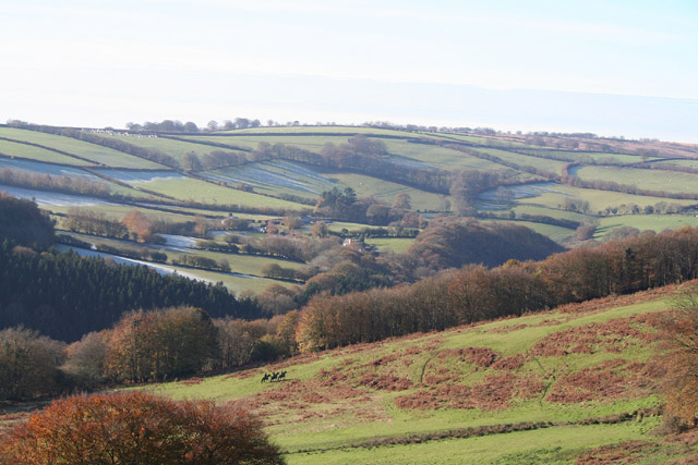
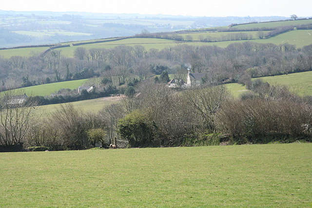
Common Wood is a charming forest located in Somerset, England, known for its stunning natural beauty and diverse ecosystem. Spread over a vast area, it serves as a popular recreational spot for locals and tourists alike, offering a peaceful escape from the hustle and bustle of city life.

The wood is predominantly characterized by its dense population of deciduous trees, such as oak, beech, and birch, which create a picturesque landscape throughout the year. In spring, the forest comes alive with a vibrant display of blossoming wildflowers, while in autumn, the trees transform into a kaleidoscope of fiery reds, oranges, and yellows.

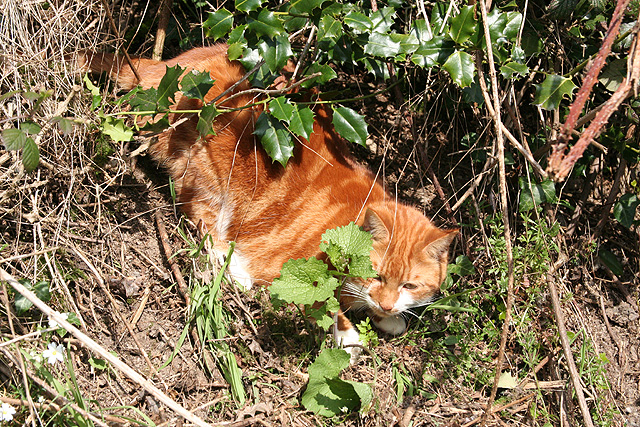
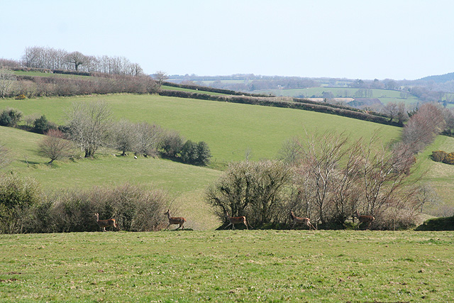
The woodland is home to a rich variety of wildlife, making it a haven for nature lovers and birdwatchers. Visitors may spot an array of bird species, including woodpeckers, thrushes, and owls. Mammals such as deer, badgers, and foxes are also known to roam the forest, adding to its enchanting atmosphere.

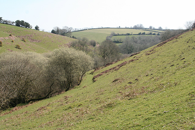
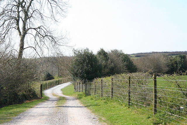
Several well-marked trails wind their way through the wood, offering visitors the opportunity to explore its hidden gems. Whether on foot or by bicycle, these paths provide a chance to immerse oneself in the tranquil surroundings and discover the wood's unique features, such as ancient trees and bubbling streams.

Common Wood is easily accessible, with ample parking facilities and well-maintained amenities for visitors. The forest's peaceful ambiance, combined with its natural beauty and abundant wildlife, makes it an idyllic destination for outdoor enthusiasts and those seeking a peaceful retreat in the heart of Somerset.

If you have any feedback on the listing, please let us know in the comments section below.
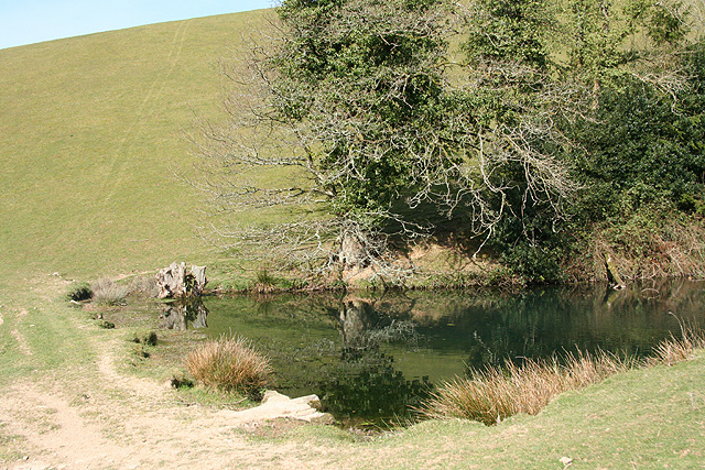
Common Wood Images

Images are sourced within 2km of 51.035667/-3.5783338 or Grid Reference SS8927. Thanks to Geograph Open Source API. All images are credited.

Bridge over the River Barle at Dulverton
High Street, Dulverton
Bridge over the River Barle at Dulverton
Barle Bridge, Dulverton A Grade II Listed bridge over the River Barle. Mediaeval in origin, repaired 1624, subsequently widened 1819 by J Stone, repaired 1866 and 1952-3. Five arches in random rubble. Also a Scheduled Ancient Monument.
Barle Bridge, Dulverton
A Grade II Listed bridge over the River Barle. Mediaeval in origin, repaired 1624, subsequently widened 1819 by J Stone, repaired 1866 and 1952-3. Five arches in random rubble. Also a Scheduled Ancient Monument.
Brushford: Knowle Farm
Dulverton: Draydon Wood Beyond the wood lies the Barle valley and on the hill above is Hinham Farm, its north-facing fields still partly covered in frost. Three riders from the Devon & Somerset hunt can be seen
Dulverton: Draydon Wood
Beyond the wood lies the Barle valley and on the hill above is Hinham Farm, its north-facing fields still partly covered in frost. Three riders from the Devon & Somerset hunt can be seen
Brushford: Venn Looking north from the lane between West Knowle and Hawkwell Cross
Brushford: Venn
Looking north from the lane between West Knowle and Hawkwell Cross
Brushford: Bere A farm in remote country between East Anstey and Dulverton, seen from its entrance gate. The track leading to the farm and on to Broomball Cross is also a public bridleway. Looking north west
Brushford: Bere
A farm in remote country between East Anstey and Dulverton, seen from its entrance gate. The track leading to the farm and on to Broomball Cross is also a public bridleway. Looking north west
Brushford: between Nightcott and Upcott Looking south from the Brushford – Nightcott lane
Brushford: between Nightcott and Upcott
Looking south from the Brushford – Nightcott lane
Dulverton: footbridge over stream On the public footpath between Dulverton and Waddicombe, looking east
Dulverton: footbridge over stream
On the public footpath between Dulverton and Waddicombe, looking east
Dulverton: below Chilcott Looking east in the direction of Lower Chilcott Wood, in a hidden valley, with pussy willow by a stream
Dulverton: below Chilcott
Looking east in the direction of Lower Chilcott Wood, in a hidden valley, with pussy willow by a stream
Dulverton: by Lower Chilcott A cat enjoying Easter sunshine
Dulverton: by Lower Chilcott
A cat enjoying Easter sunshine
Dulverton: Higher Chilcott Farm Home of Pine Lodge Riding Holidays. Looking north east. See <span class="nowrap"><a title="http://www.pinelodge.countryside-inter.net/introductionframe.htm" rel="nofollow ugc noopener" href="http://www.pinelodge.countryside-inter.net/introductionframe.htm">Link</a><img style="margin-left:2px;" alt="External link" title="External link - shift click to open in new window" src="https://s1.geograph.org.uk/img/external.png" width="10" height="10"/></span>
Dulverton: Higher Chilcott Farm
Home of Pine Lodge Riding Holidays. Looking north east. See LinkExternal link
Dulverton: track to Cawkett Looking south west
Dulverton: track to Cawkett
Looking south west
Dulverton: five hinds Near Chilcott Cross, looking east
Dulverton: five hinds
Near Chilcott Cross, looking east
Dulverton: by Chilcott Cross Looking north east towards a barn
Dulverton: by Chilcott Cross
Looking north east towards a barn
Dulverton: towards Higher Chilcott Looking south west. Higher Chilcott - beyond the square - has smoke rising from a chimney and Lower Chilcott is to the left of this farm
Dulverton: towards Higher Chilcott
Looking south west. Higher Chilcott - beyond the square - has smoke rising from a chimney and Lower Chilcott is to the left of this farm
Dulverton: pond By the footpath from Dulverton to Waddicombe, and clearly man made, with a dam height of 12 feet or more. Looking west
Dulverton: pond
By the footpath from Dulverton to Waddicombe, and clearly man made, with a dam height of 12 feet or more. Looking west
Show me another place!

Common Wood is located at Grid Ref: SS8927 (Lat: 51.035667, Lng: -3.5783338)

Administrative County: Somerset

District: Somerset West and Taunton

Police Authority: Avon and Somerset

What 3 Words

///parent.adjusting.major. Near Dulverton, Somerset

Related Wikis

Northmoor, Dulverton

Northmoor is an historic estate in the parish of Dulverton in Somerset, England. The Victorian mansion house known as Northmoor House is set amongst steep...

Oldberry Castle

Oldberry Castle (sometimes called Oldbury Castle) is an Iron Age hill fort north west of Dulverton, Somerset, England. It lies approximately 0.5 miles...

Barle Bridge

Barle Bridge is a five span stone arch bridge over the River Barle in Dulverton within the English county of Somerset, which is medieval in origin. It...

Combe, Dulverton

Combe is a historic estate in Somerset, England, situated between the town of Dulverton and the village of Brushford. == Descent == === Taunton Priory... ===

Dulverton Town Hall

Dulverton Town Hall is a municipal building in Fore Street in Dulverton, Somerset, England. The building, which is the meeting place of Dulverton Town...

Church of All Saints, Dulverton

The Anglican Church of All Saints in Dulverton, Somerset, England was built in the 15th century and largely rebuilt in the 1850s. It is a Grade II* listed...

Dulverton

Dulverton is a town and civil parish in west Somerset, England, near the border with Devon. The town had a population of 1,408 at the 2011 Census. The...

Mounsey Castle

Mounsey Castle is an Iron Age irregular triangular earthwork of 1.75 hectares (4.3 acres) north west of Dulverton, Somerset, England. It has been scheduled...

Nearby Amenities

Located within 500m of 51.035667,-3.5783338
The data included in this document is from www.openstreetmap.org. The data is made available under ODbL.

Have you been to Common Wood?

Leave your review of Common Wood below (or comments, questions and feedback).