Ashcombe Plantation

Wood, Forest in Somerset Somerset West and Taunton

England

Ashcombe Plantation

Stone Lane and a postbox by the gate
Stone Lane and a postbox by the gate Credit: David Smith

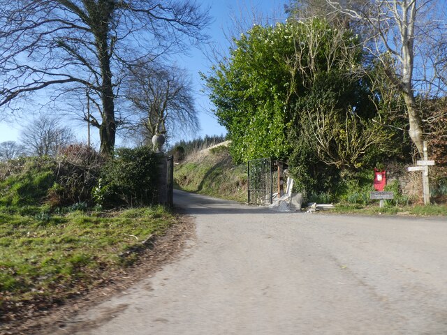
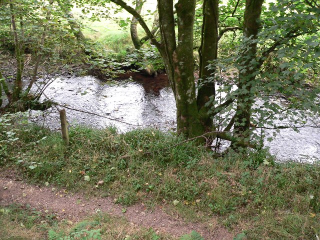
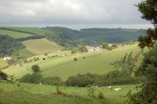
Ashcombe Plantation is a picturesque woodland area located in Somerset, England. Nestled amidst the rolling hills and countryside, this serene plantation covers a vast expanse of approximately 400 acres. It is known for its diverse range of tree species, making it a haven for nature enthusiasts and wildlife alike.

The forest is primarily composed of deciduous trees such as oak, beech, and ash, which create a stunning canopy overhead. These trees provide a rich habitat for a variety of bird species, including woodpeckers, owls, and thrushes. Additionally, the plantation is home to an abundance of wildlife, including deer, foxes, badgers, and rabbits.

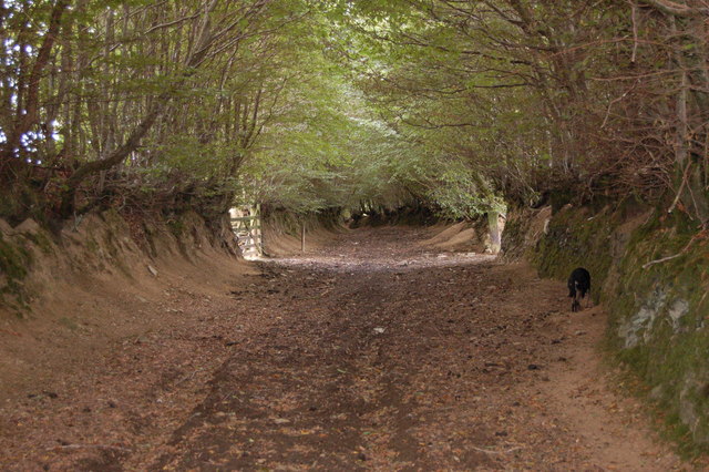
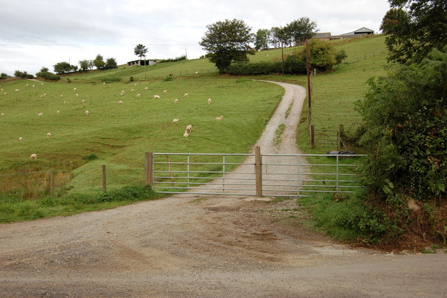
Ashcombe Plantation boasts several well-maintained walking trails that wind their way through the enchanting woodland. These trails offer visitors the opportunity to immerse themselves in nature and appreciate the tranquility of the surroundings. The plantation also features picnic areas, allowing visitors to relax and enjoy a meal amidst the beauty of the forest.

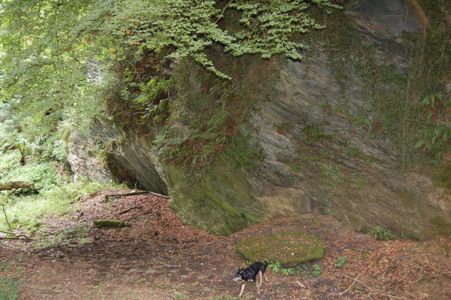
Furthermore, Ashcombe Plantation is not only a place of natural beauty but also holds historical significance. The plantation has been carefully preserved over the years, showcasing remnants of ancient earthworks and stone structures dating back centuries. These historical features provide a glimpse into the past and add an air of intrigue to the woodland.

Overall, Ashcombe Plantation in Somerset is a true gem for those seeking a peaceful retreat in nature. With its diverse range of tree species, abundant wildlife, and historical significance, it offers a unique and captivating experience for visitors of all ages.

If you have any feedback on the listing, please let us know in the comments section below.

Ashcombe Plantation Images

Images are sourced within 2km of 51.127748/-3.5966059 or Grid Reference SS8837. Thanks to Geograph Open Source API. All images are credited.

Stone Lane and a postbox by the gate
Road fork at Langdon's Way
Hedge and ditch by B3224 Land around this road has been reclaimed from marshland, so the ditch is probably a reminder of that
Hedge and ditch by B3224
Land around this road has been reclaimed from marshland, so the ditch is probably a reminder of that
Hegebank by B3224
Hegebank by B3224
River Exe at Nethercote Taken on south side of the river.
River Exe at Nethercote
Taken on south side of the river.
The River Exe below Road Castle The young river twists through steep-sided valleys in this part of Exmoor.
The River Exe below Road Castle
The young river twists through steep-sided valleys in this part of Exmoor.
Bridleway to Codsend This part of the route marked as (Holloway Lane) slopes gently down hill all the way to Codsend. It tends to get very boggy in the winter months.
Bridleway to Codsend
This part of the route marked as (Holloway Lane) slopes gently down hill all the way to Codsend. It tends to get very boggy in the winter months.
Round this bend to Codsend This is a small farming community at the end of a single road. The photograph shows the last few metres of bridleway/farm road before the start of the road.
Round this bend to Codsend
This is a small farming community at the end of a single road. The photograph shows the last few metres of bridleway/farm road before the start of the road.
Very wide Bridleway off Thorne Lane Approx 200 years ago, this route (Pinn Lane) was used by horse drawn wagons carrying stone from Pinn Quarry at its western end to build many of the local farms and houses.
Very wide Bridleway off Thorne Lane
Approx 200 years ago, this route (Pinn Lane) was used by horse drawn wagons carrying stone from Pinn Quarry at its western end to build many of the local farms and houses.
Disused Quarry This quarry is so overgrown that people passing by on the bridleway near the top corner would only notice trees growing down a steep slope. At a lower level, cattle and sheep are free to wander over overgrown spoil heaps and into the quarry basin.
Disused Quarry
This quarry is so overgrown that people passing by on the bridleway near the top corner would only notice trees growing down a steep slope. At a lower level, cattle and sheep are free to wander over overgrown spoil heaps and into the quarry basin.
Torre Farm surrounded by fields of sheep. Taken from the start of Ison Lane bridleway
Torre Farm surrounded by fields of sheep.
Taken from the start of Ison Lane bridleway
Track up to Torre Farm from Oldrey Lane The track swings to the left then in a large semicircle round the contour of the hill to finish at the farm buildings near the top right.
Track up to Torre Farm from Oldrey Lane
The track swings to the left then in a large semicircle round the contour of the hill to finish at the farm buildings near the top right.
Bridleway through newly planted woodland. Although the slopes were cleared for planting, a wide selection of new hardwood trees (oak, ash, sycamore, birch, and rowan) is in fierce competition with the local bracken.
Bridleway through newly planted woodland.
Although the slopes were cleared for planting, a wide selection of new hardwood trees (oak, ash, sycamore, birch, and rowan) is in fierce competition with the local bracken.
Bridge over River Exe at Larcombe Foot. This Bridge (in need of repair) now provides access to 2 bridleways 1 footpath and a private road. The photograph was taken from a spot which could have been a ford.
Bridge over River Exe at Larcombe Foot.
This Bridge (in need of repair) now provides access to 2 bridleways 1 footpath and a private road. The photograph was taken from a spot which could have been a ford.
Entrance to Bridleway from B3224 At this point the surface of the bridleway has been worn down to an outcrop of soft sedimentary rock known locally as "shelit".
Entrance to Bridleway from B3224
At this point the surface of the bridleway has been worn down to an outcrop of soft sedimentary rock known locally as "shelit".
Heather and Gorse on Kitnor Heath This view was taken from the grass covered bridleway which was not in the shot.
Heather and Gorse on Kitnor Heath
This view was taken from the grass covered bridleway which was not in the shot.
Electrically operated gates to Bridleway at Stone Cross Extra high level switches have been provided for Horse riders on both sides of these gates. A sensor on the righthand gate post close the gates after the horse passes through. This is also the entrance to Stone Farm.
Electrically operated gates to Bridleway at Stone Cross
Extra high level switches have been provided for Horse riders on both sides of these gates. A sensor on the righthand gate post close the gates after the horse passes through. This is also the entrance to Stone Farm.
Cutthorne valley A view of Cutthorne valley, site of a post medieval field gutter system listed as archaeologically important. The property has been occupied and farmed since Saxon times and was the home of Johannes de Cotehorne in 1327.( Lay Subsidy records)
Cutthorne valley
A view of Cutthorne valley, site of a post medieval field gutter system listed as archaeologically important. The property has been occupied and farmed since Saxon times and was the home of Johannes de Cotehorne in 1327.( Lay Subsidy records)
Show me another place!

Ashcombe Plantation is located at Grid Ref: SS8837 (Lat: 51.127748, Lng: -3.5966059)

Administrative County: Somerset

District: Somerset West and Taunton

Police Authority: Avon and Somerset

What 3 Words

///scream.defends.presenter. Near Porlock, Somerset

Nearby Locations

Ashcombe Plantation

Related Wikis

Road Castle

Road Castle is an Iron Age bank and ditch in the West Somerset district of Somerset, England. The hill fort is situated approximately 2 miles (3.2 km)...

Church of St Mary Magdelene, Exford

The Anglican Church of St Mary Magdelene in Exford, Somerset, England was built in the 15th century. It is a Grade II* listed building. == History == Nothing...

Exford, Somerset

Exford is a rural village at the centre of Exmoor National Park, 7 miles (11 km) north-west of Dulverton, and 10 miles (16 km) south-west of Minehead,...

Exmoor

Exmoor is loosely defined as an area of hilly open moorland in west Somerset and north Devon in South West England. It is named after the River Exe, the...

Related Videos

Walking The Coleridge Way | 51 miles In The Footsteps Of Poetry

The Coleridge Way runs for 51 miles from Nether Stowey on the edge of the Quantock Hills AONB, to Lynmouth on the coast of ...

Epic Exmoor: Hiking, Wild Swimming and The South West Coast Path #greenspaces #wellbeing

This hike begins at the free County Gate carpark (EX35 6NQ) in the incredible Exmoor National Park. From here we follow the ...

Beautiful walk in Exmoor National Park! #walking #nationalparks

A walk through the Lorna Doone Valley in Exmoor National Park, from National Trust cafe The Buttery and along the East Lyn ...

Dartmoor National Park | A Walk Around Lydford Gorge

Featuring Whitelady Waterfall, Tunnel Falls, and Devil's Cauldron and more, this classic 3 mile circular walk in Dartmoor National ...

Have you been to Ashcombe Plantation?

Leave your review of Ashcombe Plantation below (or comments, questions and feedback).