Taylor's Copse

Wood, Forest in Devon Mid Devon

England

Taylor's Copse

Cruwys Morchard: near Hill Farm Farmland with trees
Cruwys Morchard: near Hill Farm Credit: Martin Bodman

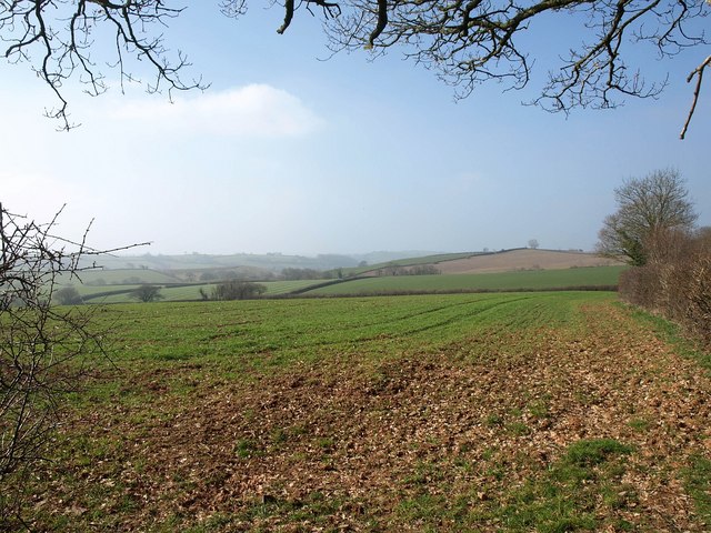
Taylor's Copse is a picturesque woodland located in Devon, a county in southwestern England. Situated near the village of Newton Abbot, the copse covers an area of approximately 20 hectares. It is a well-known destination for nature enthusiasts and offers a tranquil escape from the hustle and bustle of urban life.

The copse is primarily composed of native broadleaf trees such as oak, beech, and ash, which create a dense and diverse canopy. This rich variety of tree species allows for a thriving understory of ferns, wildflowers, and mosses. The forest floor is carpeted with a layer of decaying leaves, providing a nutrient-rich habitat for a plethora of wildlife.

Taylor's Copse is home to a wide range of fauna, including mammals like deer, foxes, and badgers. Birdwatchers will be delighted to spot various species such as woodpeckers, owls, and thrushes. The copse also provides a habitat for amphibians and reptiles, such as frogs, newts, and slow worms.

Visitors can enjoy a peaceful stroll along the well-maintained footpaths that wind through the copse, offering opportunities to embrace the beauty of nature. The area is also popular for picnics and family outings, with designated picnic spots scattered throughout the woodland.

Taylor's Copse is a haven for biodiversity, offering a glimpse into the natural wonders of Devon. Its serene atmosphere, rich flora and fauna, and well-preserved trails make it a perfect destination for nature lovers and those seeking respite in the heart of the English countryside.

If you have any feedback on the listing, please let us know in the comments section below.

Taylor's Copse Images

Images are sourced within 2km of 50.867236/-3.6125996 or Grid Reference SS8608. Thanks to Geograph Open Source API. All images are credited.

Cruwys Morchard: near Hill Farm Farmland with trees
Cruwys Morchard: near Hill Farm
Farmland with trees
Poughill: near Riggledown Looking south east
Poughill: near Riggledown
Looking south east
Cruwys Morchard: towards Pennymoor Near Eastland, looking north-north-east
Cruwys Morchard: towards Pennymoor
Near Eastland, looking north-north-east
View near Westway Looking across the valley of the Holly Water from the no through road from Way Village to the farms at Claw, across a field of grass. The wood heading up the far side valley is Collard's Copse.
View near Westway
Looking across the valley of the Holly Water from the no through road from Way Village to the farms at Claw, across a field of grass. The wood heading up the far side valley is Collard's Copse.
Lane from Cheriton Mill Cross The lane crosses Holly Water at the depth measuring scale, and then curves towards Rookbeare Farm.
Lane from Cheriton Mill Cross
The lane crosses Holly Water at the depth measuring scale, and then curves towards Rookbeare Farm.
Fences and meadow by Holly Water Taken from the lane east of Cheriton Mill Cross. The stream runs, to the left, past the line of trees.
Fences and meadow by Holly Water
Taken from the lane east of Cheriton Mill Cross. The stream runs, to the left, past the line of trees.
Coddiford Cross A T-junction just north of a bridge across Wilson's Water. The right turn climbs a ridge to Redyeates Cross; ahead leads up the Holly Water valley.
Coddiford Cross
A T-junction just north of a bridge across Wilson's Water. The right turn climbs a ridge to Redyeates Cross; ahead leads up the Holly Water valley.
Bridge over Wilson's Water The bridge is shown from the other direction in <a href="https://www.geograph.org.uk/photo/1942450">SS8607 : Bridge over a stream south of Leys Cross</a>. The further line of trees above the hedge to the left is along the turning to the right in <a href="https://www.geograph.org.uk/photo/2318008">SS8607 : Coddiford Cross</a>, about 60 metres along the road.
Bridge over Wilson's Water
The bridge is shown from the other direction in SS8607 : Bridge over a stream south of Leys Cross. The further line of trees above the hedge to the left is along the turning to the right in SS8607 : Coddiford Cross, about 60 metres along the road.
By Wilson's Water A strong suspicion of a river terrace on the left. The bridge shown in <a href="https://www.geograph.org.uk/photo/2318082">SS8607 : Bridge over Wilson's Water</a> is just to the right, and the stream is heading downstream among the trees; at the end of this long meadow it will meet Holly Water.
By Wilson's Water
A strong suspicion of a river terrace on the left. The bridge shown in SS8607 : Bridge over Wilson's Water is just to the right, and the stream is heading downstream among the trees; at the end of this long meadow it will meet Holly Water.
Towards Coddiford Coddiford Farm is on the left; the rest of the hamlet, beyond, is in <a href="https://www.geograph.org.uk/gridref/SS8707">SS8707</a>. The oak tree is on Coddiford Lane.
Towards Coddiford
Coddiford Farm is on the left; the rest of the hamlet, beyond, is in SS8707. The oak tree is on Coddiford Lane.
Coddiford Lane A bend in the lane close to the spot where <a href="https://www.geograph.org.uk/photo/2318116">SS8707 : Towards Coddiford</a>. The oak on the left appears in both images.
Coddiford Lane
A bend in the lane close to the spot where SS8707 : Towards Coddiford. The oak on the left appears in both images.
Coddiford Lane A view around the bend shown in <a href="https://www.geograph.org.uk/photo/2318135">SS8707 : Coddiford Lane</a>. The farm buildings at Coddiford are in <a href="https://www.geograph.org.uk/gridref/SS8707">SS8707</a>.
Coddiford Lane
A view around the bend shown in SS8707 : Coddiford Lane. The farm buildings at Coddiford are in SS8707.
Approaching Upham The lane from Redyeates Cross approaches the hamlet of Upham. To the left of the bungalow is Court Place.
Approaching Upham
The lane from Redyeates Cross approaches the hamlet of Upham. To the left of the bungalow is Court Place.
Track and path near Upham The track is shown looking in the other direction in <a href="https://www.geograph.org.uk/photo/232573">SS8708 : Cheriton Fitzpaine: footpath near Upham</a>. Actually the footpath (Cheriton Fitzpaine Footpath 9) runs in the field at the side, as indicated by the stile on the left.
Track and path near Upham
The track is shown looking in the other direction in SS8708 : Cheriton Fitzpaine: footpath near Upham. Actually the footpath (Cheriton Fitzpaine Footpath 9) runs in the field at the side, as indicated by the stile on the left.
Stile near Upham The stile, on Cheriton Fitzpaine Footpath 9, can be seen on the left of <a href="https://www.geograph.org.uk/photo/2318194">SS8708 : Track and path near Upham</a>.
Stile near Upham
The stile, on Cheriton Fitzpaine Footpath 9, can be seen on the left of SS8708 : Track and path near Upham.
Field west of Upham The view ahead from the stile shown in <a href="https://www.geograph.org.uk/photo/2318194">SS8708 : Track and path near Upham</a>, across mid-Devon farmland.
Field west of Upham
The view ahead from the stile shown in SS8708 : Track and path near Upham, across mid-Devon farmland.
Stile near Upham An uphill struggle to get over this stile above the track shown in <a href="https://www.geograph.org.uk/photo/232573">SS8708 : Cheriton Fitzpaine: footpath near Upham</a> and onto Cheriton Fitzpaine Footpath 9 northwards.
Stile near Upham
An uphill struggle to get over this stile above the track shown in SS8708 : Cheriton Fitzpaine: footpath near Upham and onto Cheriton Fitzpaine Footpath 9 northwards.
Farms at Upham A view from Cheriton Fitzpaine Footpath 9. Upham Farm is the nearer farm, East Upham is beyond.
Farms at Upham
A view from Cheriton Fitzpaine Footpath 9. Upham Farm is the nearer farm, East Upham is beyond.
Show me another place!

Taylor's Copse is located at Grid Ref: SS8608 (Lat: 50.867236, Lng: -3.6125996)

Administrative County: Devon

District: Mid Devon

Police Authority: Devon and Cornwall

What 3 Words

///crispy.discusses.pound. Near Witheridge, Devon

Related Wikis

Poughill, Devon

Poughill (pronounced "po-il") is a village and civil parish in Devon, England. It lies 5 miles (8 km) north of Crediton. In 2011, the parish had a population...

Cheriton Fitzpaine

Cheriton Fitzpaine is a village in Devon, England, located 4 miles (7 km) north-east of Crediton. The population of the parish in the 2011 Census was 556...
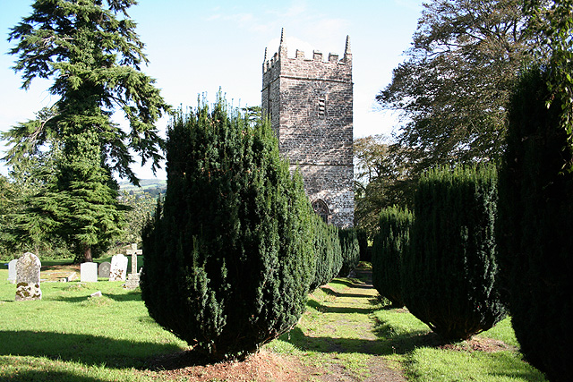
Stockleigh English

Stockleigh English is a village and civil parish in Devon, England. It has a 15th-century church, Saint Mary the Virgin, which was restored 1878–83.Stockleigh...

Cruwys Morchard

Cruwys Morchard is an ecclesiastical and civil parish in the Mid Devon district of the county of Devon in England. It is located about four to five miles...

Nearby Amenities

Located within 500m of 50.867236,-3.6125996
Ford: yes
Lat/Long: 50.8699663/-3.608471
Barrier: height_restrictor
Lat/Long: 50.8649049/-3.6107369
The data included in this document is from www.openstreetmap.org. The data is made available under ODbL.

Have you been to Taylor's Copse?

Leave your review of Taylor's Copse below (or comments, questions and feedback).