Berry Castle Wood

Wood, Forest in Somerset Somerset West and Taunton

England

Berry Castle Wood

Flock of Sheep on Exmoor A flock of sheep returned to a field after sorting lambs from ewes on a farm on Exmoor.
Flock of Sheep on Exmoor Credit: Kevin Pearson

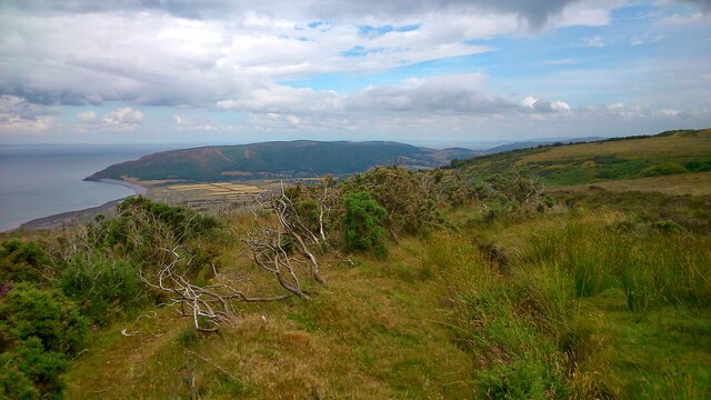
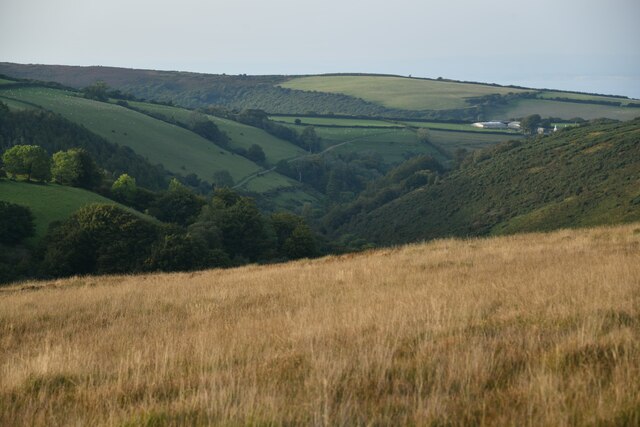
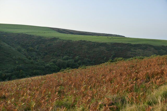
Berry Castle Wood is a picturesque woodland located in Somerset, England. Covering an area of approximately 50 acres, it is nestled in the heart of the county, near the village of Berry Castle. The wood is known for its natural beauty, diverse wildlife, and historical significance.

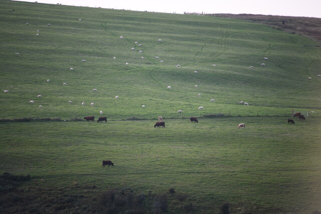
The woodland is predominantly made up of deciduous trees, including oak, beech, and ash, which create a stunning canopy overhead. The forest floor is adorned with a rich carpet of wildflowers, ferns, and mosses, adding to its enchanting atmosphere. The wood is also home to a variety of bird species, such as woodpeckers, robins, and owls, making it a haven for birdwatchers and nature enthusiasts alike.

One of the main attractions of Berry Castle Wood is its historical significance. The wood is named after the nearby Berry Castle, an Iron Age hillfort that dates back over 2,000 years. The hillfort's earthworks and ramparts are still visible today, providing a glimpse into the area's ancient past. Exploring the wood, visitors can stumble upon remnants of the fort, such as ditches and banks, adding an element of mystery and intrigue.

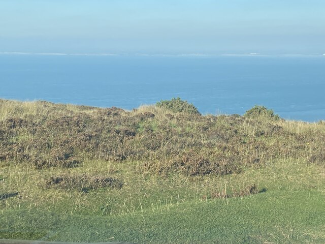
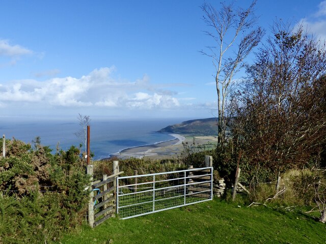
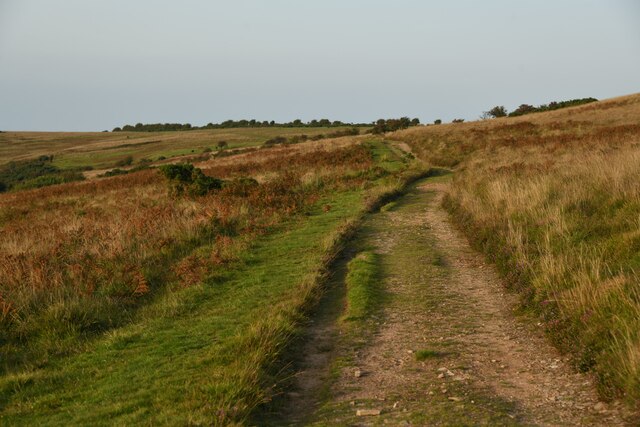
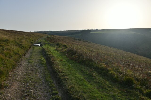
The wood offers a range of recreational activities for visitors to enjoy. There are several walking trails that wind through the woodland, allowing visitors to soak in the tranquil surroundings. Picnic areas are scattered throughout the wood, providing the perfect spot to relax and enjoy a packed lunch. In addition, the wood is popular with photographers, who are drawn to the natural beauty and unique lighting conditions found within the forest.

Overall, Berry Castle Wood is a charming and captivating woodland that offers visitors a chance to connect with nature, explore history, and enjoy a peaceful retreat in the heart of Somerset.

If you have any feedback on the listing, please let us know in the comments section below.

Berry Castle Wood Images

Images are sourced within 2km of 51.193248/-3.6352349 or Grid Reference SS8545. Thanks to Geograph Open Source API. All images are credited.

Flock of Sheep on Exmoor A flock of sheep returned to a field after sorting lambs from ewes on a farm on Exmoor.
Flock of Sheep on Exmoor
A flock of sheep returned to a field after sorting lambs from ewes on a farm on Exmoor.
View from Exmoor near Porlock A view from Exmoor close to the Whitstone Post, looking north west over the Bristol Channel.
View from Exmoor near Porlock
A view from Exmoor close to the Whitstone Post, looking north west over the Bristol Channel.
View north from car park on the A349 Rough ground. But further afield lies the Bristol Channel and the coast of South Wales.
View north from car park on the A349
Rough ground. But further afield lies the Bristol Channel and the coast of South Wales.
Distant Bossington Beach Bossington Beach is viewed from a field gate on New Road, just above Porlock. New Road is a toll road which is accessed at Pittcombe Head on the A39 and offers a more gentle descent into Porlock, rather than using the steep A39 Porlock Hill road. The fee was £3.00 for a car (one way). The road crosses moor and farm land which gradually gives way to a pretty wooded valley.
Distant Bossington Beach
Bossington Beach is viewed from a field gate on New Road, just above Porlock. New Road is a toll road which is accessed at Pittcombe Head on the A39 and offers a more gentle descent into Porlock, rather than using the steep A39 Porlock Hill road. The fee was £3.00 for a car (one way). The road crosses moor and farm land which gradually gives way to a pretty wooded valley.
Ordnance Survey Cut Mark This OS cut mark can be found on the stone SE side of the road. It marks a point 343.645m above mean sea level.
Ordnance Survey Cut Mark
This OS cut mark can be found on the stone SE side of the road. It marks a point 343.645m above mean sea level.
Ordnance Survey Cut Mark This OS cut mark can be found on the west parapet of the bridge. It marks a point 407.445m above mean sea level.
Ordnance Survey Cut Mark
This OS cut mark can be found on the west parapet of the bridge. It marks a point 407.445m above mean sea level.
Ordnance Survey Rivet This OS rivet can be found on the south stone of the Whitstones. It marks a point 400.877m above mean sea level.
Ordnance Survey Rivet
This OS rivet can be found on the south stone of the Whitstones. It marks a point 400.877m above mean sea level.
Luccombe : Exmoor Scenery Looking to fields on the hillsides of Exmoor.
Luccombe : Exmoor Scenery
Looking to fields on the hillsides of Exmoor.
Luccombe : Exmoor Scenery The view above Nutscale Reservoir, which is down in the valley.
Luccombe : Exmoor Scenery
The view above Nutscale Reservoir, which is down in the valley.
Luccombe : Exmoor Scenery A track heads across Exmoor
Luccombe : Exmoor Scenery
A track heads across Exmoor
Luccombe : Exmoor Scenery Looking along a track heading above Nutscale Reservoir which eventually heads down into the valley.
Luccombe : Exmoor Scenery
Looking along a track heading above Nutscale Reservoir which eventually heads down into the valley.
Luccombe : Exmoor Scenery Looking across the moors above Nutscale Reservoir.
Luccombe : Exmoor Scenery
Looking across the moors above Nutscale Reservoir.
Luccombe : Track A track heading across Exmoor.
Luccombe : Track
A track heading across Exmoor.
Luccombe : Grassy Field A grassy field on Exmoor.
Luccombe : Grassy Field
A grassy field on Exmoor.
Exmoor : Road A road heads over Exmoor.
Exmoor : Road
A road heads over Exmoor.
Exmoor : Road A road heading over Exmoor.
Exmoor : Road
A road heading over Exmoor.
Luccombe : Road A road heading down the hill.
Luccombe : Road
A road heading down the hill.
Porlock : Gate A gate along the footpath over Exmoor.
Porlock : Gate
A gate along the footpath over Exmoor.
Show me another place!

Berry Castle Wood is located at Grid Ref: SS8545 (Lat: 51.193248, Lng: -3.6352349)

Administrative County: Somerset

District: Somerset West and Taunton

Police Authority: Avon and Somerset

What 3 Words

///emailed.loaning.guardian. Near Porlock, Somerset

Related Wikis

Berry Castle, Somerset

Berry Castle (sometimes known as Berry Camp) is an early Roman (possible Iron Age) hillslope enclosure in the West Somerset district of Somerset, England...

Porlock Stone Circle

Porlock Stone Circle is a stone circle located on Exmoor, near the village of Porlock in the south-western English county of Somerset. The Porlock ring...

Nutscale Reservoir

Nutscale Reservoir is a reservoir located in Exmoor in north west Somerset, England. It supplies the town of Minehead and nearby Porlock and Porlock Weir...

Stoke Pero Church

Stoke Pero Church in Stoke Pero, Somerset, England was built in the 13th century. It is a Grade II* listed building. Standing 1,013 feet (309 meters) above...

Porlock Hill

Porlock Hill is a road west of Porlock, Somerset. It is part of the A39, connecting Porlock to Lynmouth and Barnstaple in Devon and is the steepest A-road...
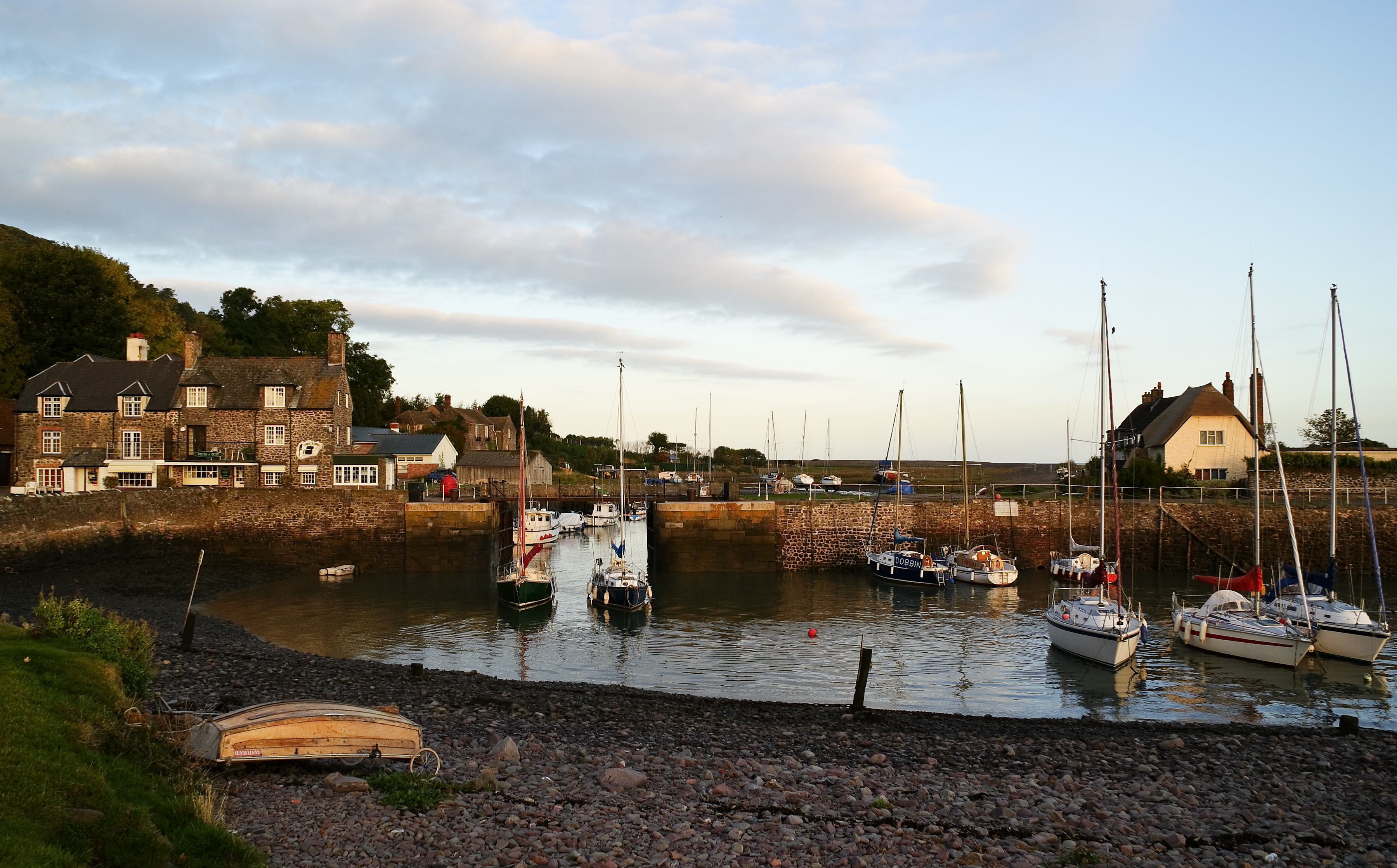
Porlock Weir

Porlock Weir is a harbour settlement approximately 1.5 miles (2.4 km) west of the inland village of Porlock, Somerset, England. "Porlock" comes from the...

Hawkcombe Woods

Hawkcombe Woods is a national nature reserve near Porlock on Exmoor, Somerset, England.The 101 hectares (250 acres) woodlands are notable for their lichens...

Porlock

Porlock is a coastal village in Somerset, England, 5 miles (8 km) west of Minehead. At the 2011 census, the village had a population of 1,440.In 2017,...

Nearby Amenities

Located within 500m of 51.193248,-3.6352349
Berry Castle Wood
Place: locality
Lat/Long: 51.1930565/-3.6355877
West Lucott Wood
Place: locality
Lat/Long: 51.1921374/-3.6317056
The data included in this document is from www.openstreetmap.org. The data is made available under ODbL.

Have you been to Berry Castle Wood?

Leave your review of Berry Castle Wood below (or comments, questions and feedback).