Anick

Settlement in Northumberland

England

Anick

Benchmark on NW parapet of A6079 railway bridge Ordnance Survey cut mark benchmark levelled at 40.610m above Newlyn Datum verified 1961
Benchmark on NW parapet of A6079 railway bridge Credit: Roger Templeman

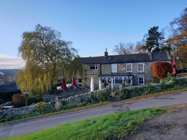
Anick is a small village located in the county of Northumberland, in the northeast of England. Situated approximately four miles north of the market town of Hexham, Anick is surrounded by picturesque countryside and offers a tranquil and rural setting.

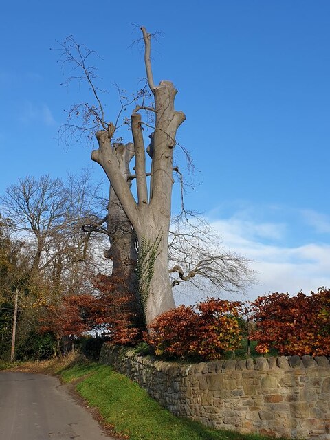
The village is known for its charming and traditional architecture, with many of the houses dating back to the 18th and 19th centuries. The local community takes pride in preserving the village's historic character, creating a welcoming and idyllic atmosphere for residents and visitors alike.

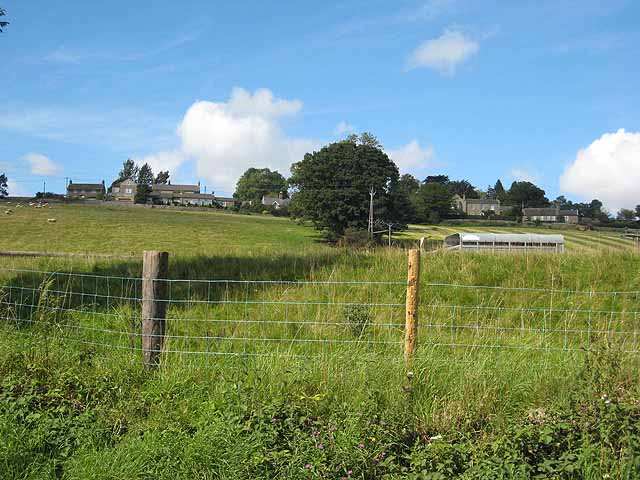
Anick's location provides easy access to the stunning Northumberland National Park, which is just a short drive away. The park offers breathtaking scenery with rolling hills, moorland, and forests, making it a popular destination for outdoor enthusiasts. There are also several walking and cycling routes that start or pass through Anick, allowing visitors to explore the surrounding countryside at their leisure.

Despite its small size, Anick has a strong sense of community, with a village hall that hosts various events and activities throughout the year. The village also benefits from its proximity to Hexham, where residents can find a wider range of amenities, including shops, supermarkets, schools, and healthcare facilities.

In summary, Anick is a delightful village in Northumberland that offers a peaceful and picturesque setting, with easy access to the natural beauty of the Northumberland National Park. Its historic architecture and strong sense of community make it an attractive place to live or visit for those seeking a rural retreat.

If you have any feedback on the listing, please let us know in the comments section below.

Anick Images

Images are sourced within 2km of 54.98401/-2.072159 or Grid Reference NY9565. Thanks to Geograph Open Source API. All images are credited.

Benchmark on NW parapet of A6079 railway bridge Ordnance Survey cut mark benchmark levelled at 40.610m above Newlyn Datum verified 1961
Benchmark on NW parapet of A6079 railway bridge
Ordnance Survey cut mark benchmark levelled at 40.610m above Newlyn Datum verified 1961
Bridge taking A6079 over railway line NW of Hexham Station There is an Ordnance Survey benchmark <a href="https://www.geograph.org.uk/photo/6941663">NY9364 : Benchmark on NW parapet of A6079 railway bridge</a> at the base of the parapet pier on the left hand side of the bridge
Bridge taking A6079 over railway line NW of Hexham Station
There is an Ordnance Survey benchmark NY9364 : Benchmark on NW parapet of A6079 railway bridge at the base of the parapet pier on the left hand side of the bridge
Construction site on SW side of railway NW of Hexham Station
Matfen bus approaching A6079 bridge over railway NW of Hexham Station
Class 156 diesel multiple unit at Hexham Station forming the 1612 to Carlisle
A view to the east from Hexham railway station Some sections of the line between Newcastle and Carlisle retain their mechanical semaphore signalling, as here at Hexham. The 1896 signal box stands on a gantry above the track and is Grade II listed.
A view to the east from Hexham railway station
Some sections of the line between Newcastle and Carlisle retain their mechanical semaphore signalling, as here at Hexham. The 1896 signal box stands on a gantry above the track and is Grade II listed.
A freight train approaching Hexham station Hauling a short train of container flats. Framed by the A6079 Rotary Way road bridge. The left-hand span of the bridge once accommodated tracks into a small goods yard, which stood next to the station.
A freight train approaching Hexham station
Hauling a short train of container flats. Framed by the A6079 Rotary Way road bridge. The left-hand span of the bridge once accommodated tracks into a small goods yard, which stood next to the station.
Wentworth Leisure Centre, Hexham
Roadworks on the A69, Bridge End
"The Rat" at Anick Despite its unpromising name, this pub has a very good reputation. Spectacularly site on a steep hillside overlooking Tynedale. For the present, closed on Sundays, as here.
"The Rat" at Anick
Despite its unpromising name, this pub has a very good reputation. Spectacularly site on a steep hillside overlooking Tynedale. For the present, closed on Sundays, as here.
Lopped trees at Anick
Eggers works The cloud of steam emanating from the Egger factory (manufacturers of posh chipboard) is the first thing the traveller is likely to see on approaching Hexham. Seen here to best advantage from Halfmile Wood. The village of Oakwood <a href="https://www.geograph.org.uk/gridref/NY9565">NY9565</a> can be seen on the far side of Tynedale.
Eggers works
The cloud of steam emanating from the Egger factory (manufacturers of posh chipboard) is the first thing the traveller is likely to see on approaching Hexham. Seen here to best advantage from Halfmile Wood. The village of Oakwood NY9565 can be seen on the far side of Tynedale.
Rickerby's yard, Hexham Agricultural machinery dealers.
Rickerby's yard, Hexham
Agricultural machinery dealers.
Old milestone by the former A69 The milestone, which is Grade II listed <span class="nowrap"><a title="https://historicengland.org.uk/listing/the-list/list-entry/1044819?section=official-list-entry" rel="nofollow ugc noopener" href="https://historicengland.org.uk/listing/the-list/list-entry/1044819?section=official-list-entry">Link</a><img style="margin-left:2px;" alt="External link" title="External link - shift click to open in new window" src="https://s1.geograph.org.uk/img/external.png" width="10" height="10"/></span> has gained a fair amount of moss in the 20 years since <a href="https://www.geograph.org.uk/photo/6044026">NY9365 : Old Milestone by the former A69, The Hermitage, Acomb Parish</a> was taken. See also <a href="https://www.geograph.org.uk/photo/7143846">NY9365 : Lane east of The Hermitage</a> and <a href="https://www.geograph.org.uk/photo/7143863">NY9365 : Lane east of The Hermitage (2)</a>.
Old milestone by the former A69
The milestone, which is Grade II listed LinkExternal link has gained a fair amount of moss in the 20 years since NY9365 : Old Milestone by the former A69, The Hermitage, Acomb Parish was taken. See also NY9365 : Lane east of The Hermitage and NY9365 : Lane east of The Hermitage (2).
Old milestone by the former A69 (2) See <a href="https://www.geograph.org.uk/photo/7143833">NY9365 : Old milestone by the former A69</a>.
Old milestone by the former A69 (2)
Coppice near The Hermitage Shows the location of the <a href="https://www.geograph.org.uk/photo/7143833">NY9365 : Old milestone by the former A69</a>.
Coppice near The Hermitage
Shows the location of the NY9365 : Old milestone by the former A69.
Coppice near The Hermitage (2) Shows the location of the <a href="https://www.geograph.org.uk/photo/7143833">NY9365 : Old milestone by the former A69</a>. It's just possible to see, through the fence (upper left), part of the former A69.
Coppice near The Hermitage (2)
Shows the location of the NY9365 : Old milestone by the former A69. It's just possible to see, through the fence (upper left), part of the former A69.
Coppice near The Hermitage (3) The <a href="https://www.geograph.org.uk/photo/7143833">NY9365 : Old milestone by the former A69</a> is hidden in the undergrowth (centre).
Coppice near The Hermitage (3)
The NY9365 : Old milestone by the former A69 is hidden in the undergrowth (centre).
Show me another place!

Anick is located at Grid Ref: NY9565 (Lat: 54.98401, Lng: -2.072159)

Unitary Authority: Northumberland

Police Authority: Northumbria

What 3 Words

///ends.skin.idealist. Near Acomb, Northumberland

Nearby Locations

Oakwood Anick

Related Wikis

Anick

Anick ( AY-nik) is a village and former civil parish, now in the parish of Sandhoe, in Northumberland, England, situated to the north of Hexham. In 1881...
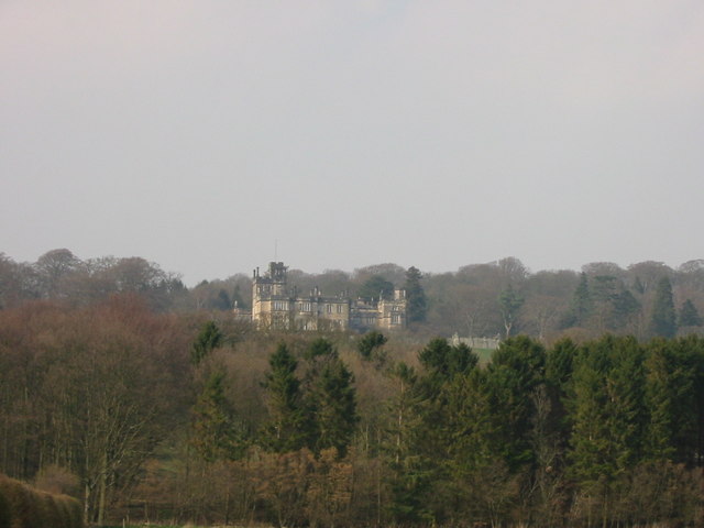
Beaufront Castle

Beaufront Castle is a privately owned 19th-century country house near Hexham, Northumberland, England. It is a Grade I listed building.A pele tower was...

Sandhoe Hall

Sandhoe Hall, also once known as Sandhoe House, is a 19th-century country house situated at Sandhoe, Northumberland. It is a Grade II listed building.The...
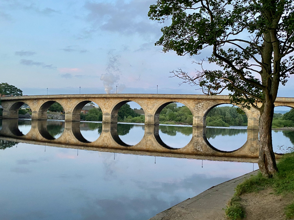
Hexham Bridge

Hexham Bridge is a road bridge in Northumberland, England linking Hexham with the North Tyne valley. It lies north of the town of Hexham and is the main...

Sandhoe

Sandhoe is a hamlet and civil parish in Northumberland, England. It lies about 3 kilometres (2 mi) northwest of Corbridge and 3 kilometres south of Hadrian...

Hexham Rowing Club

Hexham Rowing Club is a rowing club on the River Tyne, based at Tyne Green boathouse, Nr Hexham Bridge, Hexham, Northumberland. Rowers aged 12 and upwards...

Queen Elizabeth High School Rowing Club

Queen Elizabeth High School Rowing Club is a rowing club on the River Tyne, based at Tyne Green boathouse, Nr Hexham Bridge, Hexham, Northumberland....

Hexham railway station

Hexham is a railway station on the Tyne Valley Line, which runs between Newcastle and Carlisle via Hexham. The station, situated 22 miles 22 chains (22...

Nearby Amenities

Located within 500m of 54.98401,-2.072159
Anick
Is In: UK, England, Northumberland, Tynevale
Is In Country Code: GB
Is In County: Northumberland
Place: hamlet
Source: NPE
Wikidata: Q4764506
Lat/Long: 54.9845108/-2.0728548
Post Box
Drive Through: no
Operator: Royal Mail
Operator Wikidata: Q638098
Post Box Type: wall
Royal Cypher: EIIR
Royal Cypher Wikidata: Q33102113
Lat/Long: 54.984981/-2.0767627
Bus Stop
Oakwood, opp The Nook
Bus: yes
Departures Board: timetable
Public Transport: platform
Shelter: yes
Lat/Long: 54.9853773/-2.077039
Power: pole
Lat/Long: 54.9869511/-2.0667457
Power: pole
Lat/Long: 54.9861339/-2.0665258
Power: pole
Lat/Long: 54.984825/-2.0682558
Power: pole
Lat/Long: 54.9841786/-2.0690819
Power: pole
Lat/Long: 54.9828373/-2.0708414
Power: pole
Lat/Long: 54.9821555/-2.0717105
Material: wood
Power: pole
Lat/Long: 54.9818261/-2.0722228
Addr Housenumber: 1
Lat/Long: 54.9859368/-2.0776923
The data included in this document is from www.openstreetmap.org. The data is made available under ODbL.

Have you been to Anick?

Leave your review of Anick below (or comments, questions and feedback).