Court Close Plantation

Wood, Forest in Devon North Devon

England

Court Close Plantation

Lay By at Rackenfrord Northbound on the A361 North Devon Link Road.
Lay By at Rackenfrord Credit: Anthony Vosper

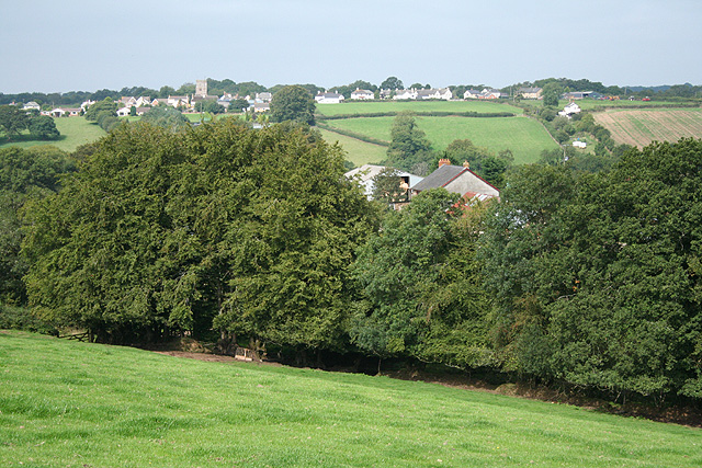
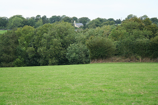
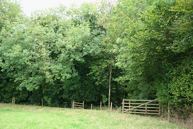
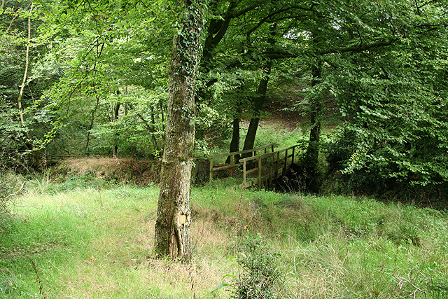
Court Close Plantation is a picturesque woodland located in Devon, England. Covering an area of approximately 50 acres, it is nestled in the beautiful countryside of the county. The plantation is well-known for its diverse range of tree species, making it a haven for nature enthusiasts and hikers.

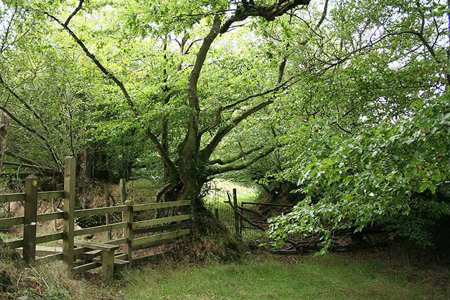
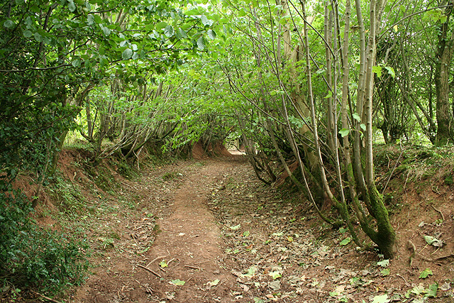
The woodland is primarily composed of deciduous trees, such as oak, beech, and birch. These majestic trees provide a dense canopy that offers shelter and a tranquil atmosphere to visitors. The forest floor is adorned with a variety of wildflowers and ferns, adding to the enchanting ambiance.

Court Close Plantation is home to a rich array of wildlife, including deer, squirrels, and a plethora of bird species. Nature lovers often flock to this woodland to catch a glimpse of these creatures in their natural habitat. The plantation also plays a vital role in conserving local biodiversity and providing a safe haven for endangered species.

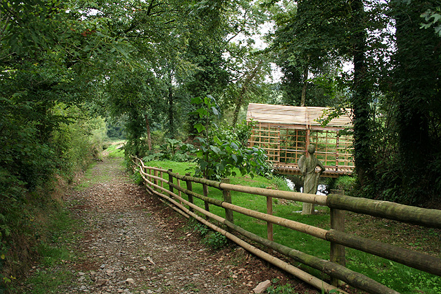
For those seeking outdoor activities, Court Close Plantation offers a network of well-maintained walking trails that wind through the woodland. These paths provide a delightful opportunity to explore the plantation's natural beauty and immerse oneself in its peaceful surroundings. Additionally, the plantation boasts several picnic areas, allowing visitors to relax and enjoy the serenity of the woodland.

Court Close Plantation is a truly captivating destination for anyone seeking a retreat into nature. Its breathtaking scenery, diverse flora and fauna, and well-designed trails make it an ideal spot for both leisurely strolls and immersive wildlife experiences.

If you have any feedback on the listing, please let us know in the comments section below.

Court Close Plantation Images

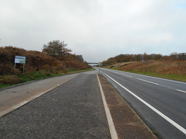
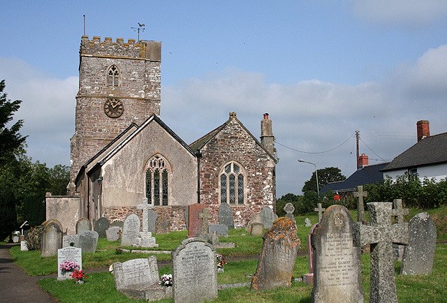
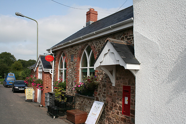
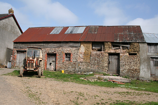
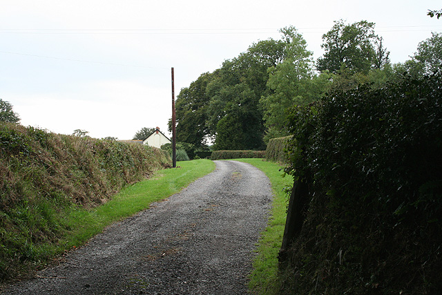
Images are sourced within 2km of 50.960268/-3.6404397 or Grid Reference SS8419. Thanks to Geograph Open Source API. All images are credited.

Lay By at Rackenfrord Northbound on the A361 North Devon Link Road.
Lay By at Rackenfrord
Northbound on the A361 North Devon Link Road.
Rackenford : Grassy Field & Cattle Cattle grazing in a field.
Rackenford : Grassy Field & Cattle
Cattle grazing in a field.
Rackenford: All Saints church The building was closed to visitors in September 2006 while conservation and repair work was undertaken by a specialist masonry firm. The nearby 12th century Stag Inn predates the church. Looking west-north-west
Rackenford: All Saints church
The building was closed to visitors in September 2006 while conservation and repair work was undertaken by a specialist masonry firm. The nearby 12th century Stag Inn predates the church. Looking west-north-west
Rackenford: Post Office Originally one of three schools built in the village and dating from 1848, the structure was converted to a shop and Post Office in 2003. Looking north west
Rackenford: Post Office
Originally one of three schools built in the village and dating from 1848, the structure was converted to a shop and Post Office in 2003. Looking north west
Rackenford: crossing the Little Dart A footbridge on the path between the village and Lower Bulworthy. Looking north west
Rackenford: crossing the Little Dart
A footbridge on the path between the village and Lower Bulworthy. Looking north west
Rackenford: Lower Bulworthy Barn of stone, cob, brick, wood and corrugated iron, fronted by a David Brown tractor. Looking north-north-west from a public footpath. Bulworthy was a Domesday estate
Rackenford: Lower Bulworthy
Barn of stone, cob, brick, wood and corrugated iron, fronted by a David Brown tractor. Looking north-north-west from a public footpath. Bulworthy was a Domesday estate
Rackenford: towards the village Above Lower Bulworthy and bearing west-north-west towards the village
Rackenford: towards the village
Above Lower Bulworthy and bearing west-north-west towards the village
Rackenford: between Lower Bulworthy and Tidderson Moor On a public footpath looking south-south-east
Rackenford: between Lower Bulworthy and Tidderson Moor
On a public footpath looking south-south-east
Rackenford: near Rackenford Cross Looking west-north-west. Locals keep a look-out for the Tiverton Staghounds
Rackenford: near Rackenford Cross
Looking west-north-west. Locals keep a look-out for the Tiverton Staghounds
Rackenford: war memorial At Rackenford Cross. Looking north. The men slain in the First World War are commemorated together with a lone individual in the Second World War
Rackenford: war memorial
At Rackenford Cross. Looking north. The men slain in the First World War are commemorated together with a lone individual in the Second World War
Rackenford: a green lane Looking south-south-east on an old way from West Backstone to Rackenford village
Rackenford: a green lane
Looking south-south-east on an old way from West Backstone to Rackenford village
Rackenford: towards West Backstone On a public footpath, crossing a field, looking west-north-west
Rackenford: towards West Backstone
On a public footpath, crossing a field, looking west-north-west
Rackenford: wooded valley On a public footpath to West Backstone, looking north west
Rackenford: wooded valley
On a public footpath to West Backstone, looking north west
Rackenford: by West Backstone A public footpath to Rackenford village runs by the farmhouse and then past this statue of Fortuna, erected by the farm’s owner after his estate was narrowly spared from foot-and-mouth in 2001. Fortuna holds a cornucopia in her left arm; her right hand on a tiller. Backstone was an extant estate at Domesday; East Backstone once stood adjacent to West Backstone farm. Looking east-north-east
Rackenford: by West Backstone
A public footpath to Rackenford village runs by the farmhouse and then past this statue of Fortuna, erected by the farm’s owner after his estate was narrowly spared from foot-and-mouth in 2001. Fortuna holds a cornucopia in her left arm; her right hand on a tiller. Backstone was an extant estate at Domesday; East Backstone once stood adjacent to West Backstone farm. Looking east-north-east
Rackenford: approaching a stream Public footpath to Rackenford village, looking east-south-east
Rackenford: approaching a stream
Public footpath to Rackenford village, looking east-south-east
Rackenford: entrance to West Nutcott Looking west-south-west
Rackenford: entrance to West Nutcott
Looking west-south-west
Rackenford: Rackenford Manor A rare glimpse through the gateway of this private residence. Earlier known as Cruwyshaye, it stands on the site of an older manor house. Looking south-south-west
Rackenford: Rackenford Manor
A rare glimpse through the gateway of this private residence. Earlier known as Cruwyshaye, it stands on the site of an older manor house. Looking south-south-west
Rackenford: old toll house The house stands by the junction of the Tiverton – South Molton road, the B3221, with the route from Creacombe. Nearby the Two Moors Way runs north as a green lane. Looking east-north-east
Rackenford: old toll house
The house stands by the junction of the Tiverton – South Molton road, the B3221, with the route from Creacombe. Nearby the Two Moors Way runs north as a green lane. Looking east-north-east
Show me another place!

Court Close Plantation is located at Grid Ref: SS8419 (Lat: 50.960268, Lng: -3.6404397)

Administrative County: Devon

District: North Devon

Police Authority: Devon and Cornwall

What 3 Words

///releasing.rebirth.invoices. Near Witheridge, Devon

Related Wikis

Rackenford

Rackenford is a village and civil parish in North Devon, England. It is roughly located 7.31 miles North West of Tiverton and 20 miles South East of Barnstaple...

Rackenford and Knowstone Moors

Rackenford and Knowstone Moors is a nature reserve of the Devon Wildlife Trust, situated about 8 miles (13 km) north-west of Tiverton, in Devon, England...

Batsworthy

Batsworthy is a village in Devon, England. == References ==

Creacombe

Creacombe is a small village and former civil parish, now in the parish of Rackenford, in the North Devon district of Devon, England. Its nearest town...

Nearby Amenities

Located within 500m of 50.960268,-3.6404397
Knowstone Cross
Place: locality
Lat/Long: 50.9628986/-3.6398726
Barrier: yes
Lat/Long: 50.9621616/-3.6443314
Post Box
Operator: Royal Mail
Post Box Type: wall
Ref: EX16 104
Royal Cypher: GR
Royal Cypher Wikidata: Q33102273
Lat/Long: 50.9631528/-3.6451556
Power: pole
Source: bing
Lat/Long: 50.9631277/-3.6400995
Power: pole
Source: bing
Transformer: distribution
Lat/Long: 50.9636782/-3.6448265
Power: pole
Source: bing
Lat/Long: 50.9636782/-3.6435538
Power: pole
Source: bing
Transformer: distribution
Lat/Long: 50.9636802/-3.6423031
Power: pole
Source: bing
Lat/Long: 50.9626534/-3.639282
Power: pole
Source: bing
Lat/Long: 50.9577305/-3.6361143
Power: pole
Source: bing
Lat/Long: 50.9583566/-3.636924
Power: pole
Source: bing
Transformer: distribution
Lat/Long: 50.9585609/-3.6396191
Power: pole
Source: bing
Lat/Long: 50.9618151/-3.639104
Power: pole
Source: bing
Lat/Long: 50.9609837/-3.6389197
Power: pole
Source: bing
Lat/Long: 50.9601375/-3.6387275
Power: pole
Source: bing
Lat/Long: 50.9584597/-3.6383495
Power: pole
Source: bing
Lat/Long: 50.9593031/-3.6385448
Power: pole
Source: bing
Lat/Long: 50.9569437/-3.6358371
The data included in this document is from www.openstreetmap.org. The data is made available under ODbL.

Have you been to Court Close Plantation?

Leave your review of Court Close Plantation below (or comments, questions and feedback).