Guinea Close Copse

Wood, Forest in Devon North Devon

England

Guinea Close Copse

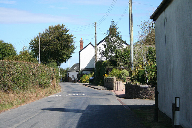
Knowstone: St Peter’s church Looking north west
Knowstone: St Peter’s church Credit: Martin Bodman

Guinea Close Copse is a charming woodland located in Devon, a county in southwest England. This picturesque copse is nestled in the heart of the countryside, offering visitors a tranquil and serene environment to explore and unwind.

Covering an area of approximately 10 acres, Guinea Close Copse is primarily composed of deciduous trees, including oak, beech, and ash. These trees create a dense and vibrant canopy, providing shade and shelter for a diverse range of wildlife. The forest floor is carpeted with a rich variety of wildflowers, such as bluebells and primroses, which bloom in the spring and add a burst of color to the woodland.

The copse is crisscrossed by several well-maintained footpaths, allowing visitors to easily navigate and discover the hidden gems within. These paths wind through the trees, leading to open clearings and secluded glades, perfect for picnicking or simply enjoying the peaceful surroundings. The copse is also home to a small stream that meanders through the woodland, adding to its natural beauty.

Nature enthusiasts will delight in the copse's abundant wildlife. The area is teeming with birdlife, including woodpeckers, owls, and various songbirds. Squirrels can be spotted darting between the trees, while deer and foxes are occasionally sighted in the early morning or at dusk.

Guinea Close Copse offers a welcome escape from the hustle and bustle of everyday life. Whether you are a nature lover seeking solitude or a family looking for an outdoor adventure, this enchanting woodland is sure to captivate and inspire.

If you have any feedback on the listing, please let us know in the comments section below.

Guinea Close Copse Images

Images are sourced within 2km of 51.002657/-3.6465242 or Grid Reference SS8423. Thanks to Geograph Open Source API. All images are credited.

Knowstone: St Peter’s church Looking north west
Knowstone: St Peter’s church
Looking north west
Knowstone: The Mason’s Arms Looking east-north-east. The building is reputed to date from the 13th century
Knowstone: The Mason’s Arms
Looking east-north-east. The building is reputed to date from the 13th century
Knowstone: Roachill Looking north east past the entrance to Roachill Farm. Beyond the second pole stands the Old Smithy
Knowstone: Roachill
Looking north east past the entrance to Roachill Farm. Beyond the second pole stands the Old Smithy
Knowstone: barns at Wiston Seen from the lane between Swineham Moor and Wiston Cross. Looking east-north-east
Knowstone: barns at Wiston
Seen from the lane between Swineham Moor and Wiston Cross. Looking east-north-east
Knowstone: Shapcott Barton Seen from the public footpath to East Knowstone. Looking north
Knowstone: Shapcott Barton
Seen from the public footpath to East Knowstone. Looking north
Knowstone: public footpath By the entrance to Shapcott Barton and a little overgrown. Looking west
Knowstone: public footpath
By the entrance to Shapcott Barton and a little overgrown. Looking west
East Anstey: Jubilee Inn A 20th century inn by the B3227 Taunton - Bampton - South Molton road, an early 19th century turnpike, now pleasantly quiet after much of its traffic has transferred to the North Devon Link Road. Looking east-north-east
East Anstey: Jubilee Inn
A 20th century inn by the B3227 Taunton - Bampton - South Molton road, an early 19th century turnpike, now pleasantly quiet after much of its traffic has transferred to the North Devon Link Road. Looking east-north-east
East Anstey: by Yanhey Moor Woodland by the entrance to Higher Radnidge Farm and Radnidge House. Looking south-south-east
East Anstey: by Yanhey Moor
Woodland by the entrance to Higher Radnidge Farm and Radnidge House. Looking south-south-east
East Anstey: Smallacombe Moors Looking south east towards Blackerton
East Anstey: Smallacombe Moors
Looking south east towards Blackerton
West Anstey: saw mill By the Two Moors Way. An old tractor adapted to split logs and also to cut them, using a circular saw. Looking east-north-east on the road leading to Yeo Mill
West Anstey: saw mill
By the Two Moors Way. An old tractor adapted to split logs and also to cut them, using a circular saw. Looking east-north-east on the road leading to Yeo Mill
East Anstey: by Smallacombe Farm On the road to Oldways End, looking east-south-east. The entrance to Smallacombe Farm is on the right by the trees
East Anstey: by Smallacombe Farm
On the road to Oldways End, looking east-south-east. The entrance to Smallacombe Farm is on the right by the trees
East Anstey: by Smallacombe Moors Looking west-south-west
East Anstey: by Smallacombe Moors
Looking west-south-west
East Anstey: woodland near Whiteford Cross Seen from a lay-by on the B3227 Bampton – South Molton road. Looking south-south-west
East Anstey: woodland near Whiteford Cross
Seen from a lay-by on the B3227 Bampton – South Molton road. Looking south-south-west
East Anstey: approaching Whiteford Cross On the B3227 Bampton – South Molton road, looking west-north-west
East Anstey: approaching Whiteford Cross
On the B3227 Bampton – South Molton road, looking west-north-west
Knowstone: by New Barn Moor On the lane from Wiston Cross to Whitefield Cross, looking north-north-west
Knowstone: by New Barn Moor
On the lane from Wiston Cross to Whitefield Cross, looking north-north-west
Knowstone: the Two Moors Way Approaching Knowstone village, looking north-north-west
Knowstone: the Two Moors Way
Approaching Knowstone village, looking north-north-west
Knowstone: The Masons Arms An inn reputedly dating from the 13th century and now providing good food. Looking east-north-east
Knowstone: The Masons Arms
An inn reputedly dating from the 13th century and now providing good food. Looking east-north-east
Knowstone: towards Luckett In the valley of the Crooked Oak, looking north-north-west. Only the foreground is in the square
Knowstone: towards Luckett
In the valley of the Crooked Oak, looking north-north-west. Only the foreground is in the square
Show me another place!

Guinea Close Copse is located at Grid Ref: SS8423 (Lat: 51.002657, Lng: -3.6465242)

Administrative County: Devon

District: North Devon

Police Authority: Devon and Cornwall

What 3 Words

///series.snows.zest. Near Dulverton, Somerset

Related Wikis

Roachill

Roachill is a hamlet in the civil parish of Knowstone in the North Devon district of Devon, England. Its nearest town is Tiverton, which lies approximately...

Knowstone

Knowstone is a village and civil parish situated in the North Devon district of Devon, England, halfway between the Mid Devon town of Tiverton, Devon and...

East Anstey

East Anstey is a village and civil parish in the North Devon district of Devon, England. The parish is located in an area which has been designated as...

Oldways End

Oldways End is a hamlet in the civil parish of East Anstey in the North Devon district of Devon, England. Its nearest town is Tiverton, which lies approximately...

Have you been to Guinea Close Copse?

Leave your review of Guinea Close Copse below (or comments, questions and feedback).