Angram

Settlement in Yorkshire Richmondshire

England

Angram

The Pennine Way near Rukin Wood
The Pennine Way near Rukin Wood Credit: Dave Kelly

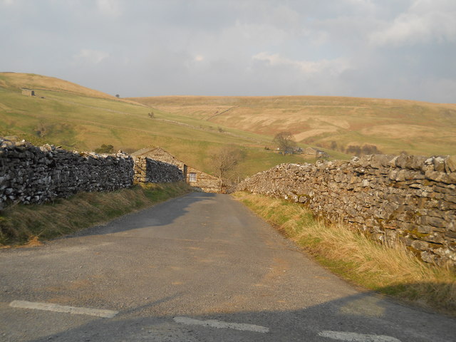
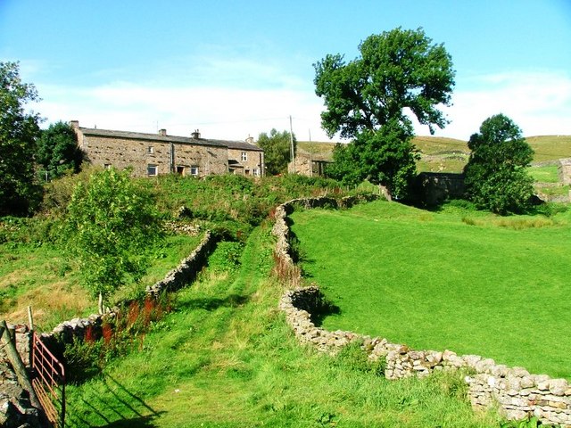
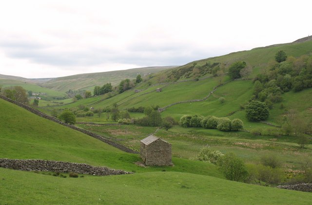
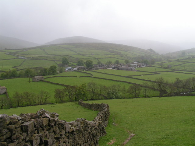
Angram is a small village located in the county of Yorkshire, England. Situated in the stunning countryside, it is part of the district of Richmondshire and lies within the Yorkshire Dales National Park. Angram is characterized by its picturesque setting, surrounded by rolling hills, lush green fields, and charming stone cottages.

The village itself is home to a tight-knit community, with a population of around 100 residents. Despite its small size, Angram boasts a rich history dating back centuries. The village is mentioned in the Domesday Book of 1086, highlighting its long-standing presence in the region.

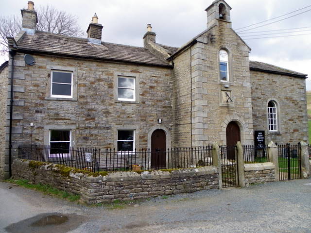
One of the notable landmarks in Angram is the Saint James Church, a beautiful medieval building that stands as a testament to the village's historical significance. The church's architecture and stained glass windows are admired by visitors and locals alike.

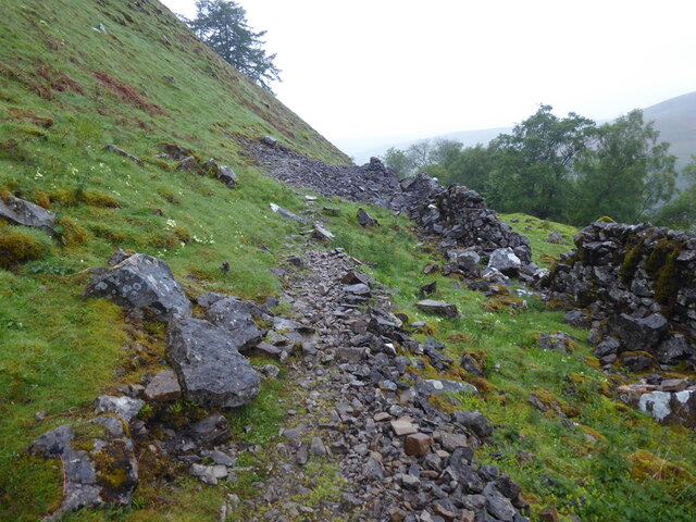
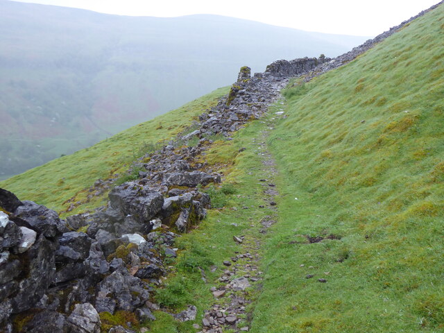
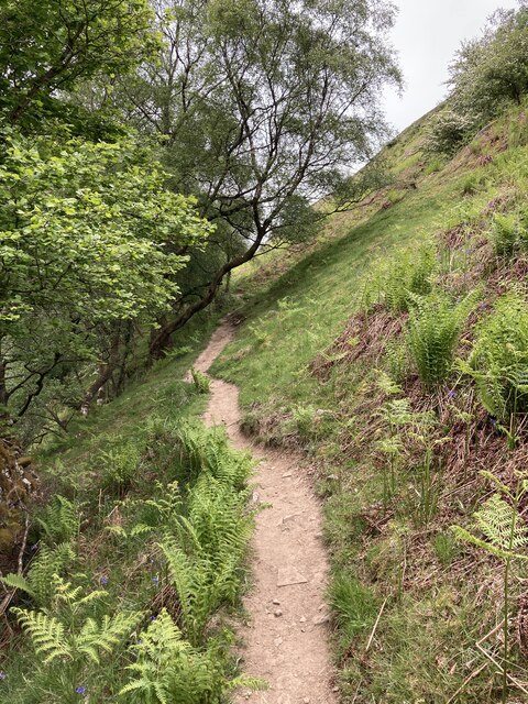
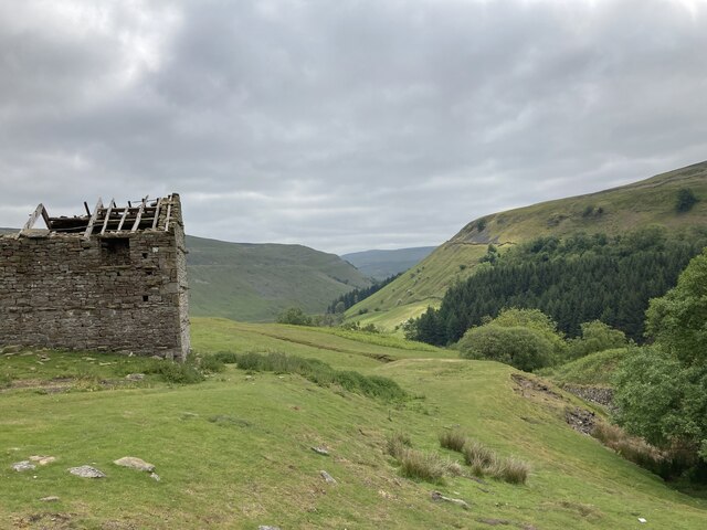
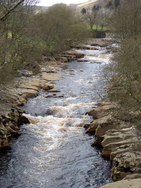
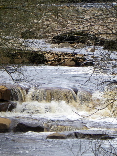
Angram offers a tranquil and idyllic escape from the hustle and bustle of city life. The surrounding countryside provides ample opportunities for outdoor activities such as hiking, cycling, and fishing. The village is also a popular destination for nature lovers, with its diverse range of flora and fauna.

Although Angram is a peaceful retreat, it is not entirely isolated. Nearby towns and villages offer amenities such as shops, schools, and healthcare facilities, ensuring that residents have access to essential services.

Overall, Angram is a charming village that showcases the natural beauty and rich heritage of the Yorkshire region. Its serene atmosphere and close-knit community make it a truly special place to visit or call home.

If you have any feedback on the listing, please let us know in the comments section below.
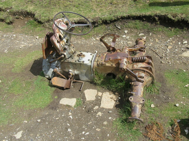
Angram Images

Images are sourced within 2km of 54.393294/-2.173228 or Grid Reference SD8899. Thanks to Geograph Open Source API. All images are credited.

The Pennine Way near Rukin Wood
The Pennine Way above Rukin Wood
Ruined barn above West Wood
Remains of tractor The rusting remains of a tractor.
Remains of tractor
The rusting remains of a tractor.
Road to Keld village
River Swale from Park Bridge The River Swale is the northernmost tributary of the Yorkshire Ouse with its headwaters located in the eastern Yorkshire Dales, from where it flows in an easterly direction towards Richmond.
River Swale from Park Bridge
The River Swale is the northernmost tributary of the Yorkshire Ouse with its headwaters located in the eastern Yorkshire Dales, from where it flows in an easterly direction towards Richmond.
River Swale from Park Bridge The name Swale in Old English means 'swilling and fast flowing'. It certainly is when viewed from Park Bridge.
River Swale from Park Bridge
The name Swale in Old English means 'swilling and fast flowing'. It certainly is when viewed from Park Bridge.
Methodist Chapel, Keld The chapel dates from 1841 and is a sad sight now that it is boarded up.
Methodist Chapel, Keld
The chapel dates from 1841 and is a sad sight now that it is boarded up.
Date stone, Keld Methodist Chapel For a wider view of the chapel <a href="https://www.geograph.org.uk/photo/2403594">NY8900 : Methodist Chapel, Keld</a>
Date stone, Keld Methodist Chapel
For a wider view of the chapel NY8900 : Methodist Chapel, Keld
Village scene, Keld A K6 telephone box stands beside the narrow road that passes the main part of the village.

In 1935, the Post Office commissioned a new kiosk from Sir Giles Gilbert Scott to celebrate the Jubilee of King George V.  The K6 Jubilee Kiosk, as it is known, was similar to the K2 box, being made of cast iron and painted red but was 25% lighter in weight.  By the end of the 1930s there were 20,000 K6 telephone boxes in use all over the UK.
Village scene, Keld
A K6 telephone box stands beside the narrow road that passes the main part of the village. In 1935, the Post Office commissioned a new kiosk from Sir Giles Gilbert Scott to celebrate the Jubilee of King George V. The K6 Jubilee Kiosk, as it is known, was similar to the K2 box, being made of cast iron and painted red but was 25% lighter in weight. By the end of the 1930s there were 20,000 K6 telephone boxes in use all over the UK.
Village scene, Keld The former institute stands on the right and former manse, which is now the United Reformed Church stands at the bottom of the lane.
Village scene, Keld
The former institute stands on the right and former manse, which is now the United Reformed Church stands at the bottom of the lane.
United Reformed Church, Keld The building is the former manse and is dated 1860.
United Reformed Church, Keld
The building is the former manse and is dated 1860.
Date stone, Keld Chapel The date stone is on the United Reformed Church <a href="https://www.geograph.org.uk/photo/2403691">NY8901 : United Reformed Church, Keld</a>
Date stone, Keld Chapel
The date stone is on the United Reformed Church NY8901 : United Reformed Church, Keld
Sundial, Keld Chapel The sundial is on the United Reformed Church <a href="https://www.geograph.org.uk/photo/2403691">NY8901 : United Reformed Church, Keld</a>

Sundials or sun clocks are considered to be the oldest known device for the measurement of time and one of the most ancient scientific instruments.
The oldest known true sundial was built around 1500BC in Egypt. Shaped like a letter 'L' the length of the shadow cast by the vertical leg along the horizontal leg indicated the time. The Romans perfected the horizontal sundial we know today and invented portable travelling versions.
Sundial, Keld Chapel
The sundial is on the United Reformed Church NY8901 : United Reformed Church, Keld Sundials or sun clocks are considered to be the oldest known device for the measurement of time and one of the most ancient scientific instruments. The oldest known true sundial was built around 1500BC in Egypt. Shaped like a letter 'L' the length of the shadow cast by the vertical leg along the horizontal leg indicated the time. The Romans perfected the horizontal sundial we know today and invented portable travelling versions.
Bench Mark, Keld Chapel The bench mark is to be found on the south face of the building.  For a view of the building <a href="https://www.geograph.org.uk/photo/2403691">NY8901 : United Reformed Church, Keld</a> and for further information on the bench mark and others in the area <span class="nowrap"><a title="http://www.bench-marks.org.uk/bm37903" rel="nofollow ugc noopener" href="http://www.bench-marks.org.uk/bm37903">Link</a><img style="margin-left:2px;" alt="External link" title="External link - shift click to open in new window" src="https://s1.geograph.org.uk/img/external.png" width="10" height="10"/></span>
Bench Mark, Keld Chapel
The bench mark is to be found on the south face of the building. For a view of the building NY8901 : United Reformed Church, Keld and for further information on the bench mark and others in the area LinkExternal link
Bellcote, Old School The stone bellcote on the old school in Keld is inscribed with the name W. Metcalfe and the date 1847.

The Metcalfe family originated in Swaledale and Wensleydale and are now scattered the world over.
Bellcote, Old School
The stone bellcote on the old school in Keld is inscribed with the name W. Metcalfe and the date 1847. The Metcalfe family originated in Swaledale and Wensleydale and are now scattered the world over.
War Memorial, Keld The war memorial remembers those of the village who lost their lives during the Great War (1914-1918).

The names on the memorial are:  

Richard Alderson
Thomas Clarkson
Wm Waller Hutchinson
Robert Rukin

We will remember them.
War Memorial, Keld
The war memorial remembers those of the village who lost their lives during the Great War (1914-1918). The names on the memorial are: Richard Alderson Thomas Clarkson Wm Waller Hutchinson Robert Rukin We will remember them.
Show me another place!

Angram is located at Grid Ref: SD8899 (Lat: 54.393294, Lng: -2.173228)

Division: North Riding

Administrative County: North Yorkshire

District: Richmondshire

Police Authority: North Yorkshire

What 3 Words

///stars.regress.envoy. Near Kirkby Stephen, Cumbria

Nearby Locations

Angram Pasture Angram

Related Wikis

Angram, Richmondshire

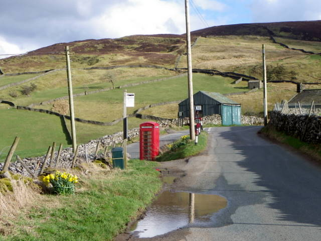
Angram is a hamlet in the Yorkshire Dales in the Richmondshire district of North Yorkshire, England. It is situated near to Keld to the north and Thwaite...

Angram Bottoms

Angram Bottoms (grid reference SD891999) is a 9.8 hectares (24 acres) biological Site of Special Scientific Interest (SSSI) near to the village of Angram...

Kisdon

Kisdon, also called Kisdon Hill, is a fell situated in upper Swaledale in the Yorkshire Dales National Park in North Yorkshire, England. == Geography... ==

Catrake Force

Catrake Force is a waterfall on the River Swale in North Yorkshire, England. It is not visible from the road but is accessible via a campsite in Keld....

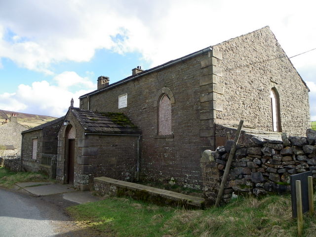
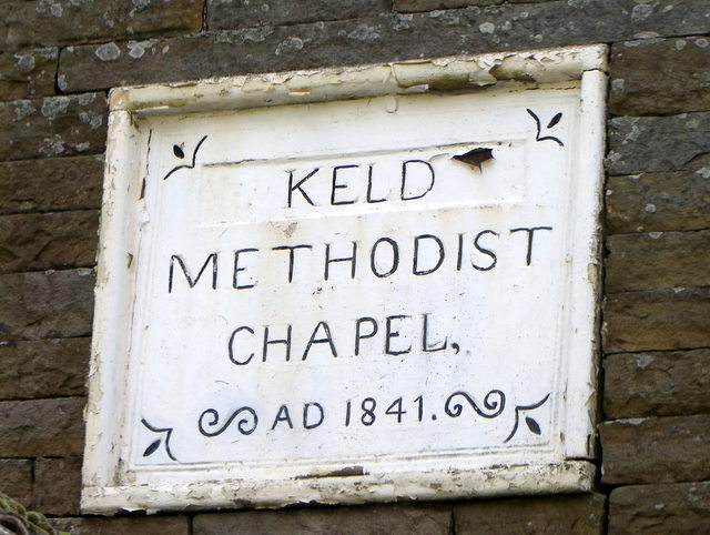
Keld, North Yorkshire

Keld is a village in the English county of North Yorkshire. It is in Swaledale, and the Yorkshire Dales National Park. The name derives from the Viking...

Kisdon Force

Kisdon Force is a series of waterfalls on the River Swale in Swaledale, England. The falls are situated within the Yorkshire Dales National Park in the...

East Gill Force

East Gill Force is a waterfall in Swaledale, 330 yards (300 m) east of the hamlet of Keld, in the Yorkshire Dales National Park, North Yorkshire, England...

Thwaite, North Yorkshire

Thwaite is a small village in the Yorkshire Dales, North Yorkshire, England. It is in Swaledale and is part the district of Richmondshire and the civil...

Nearby Amenities

Located within 500m of 54.393294,-2.173228
Angram
Place: hamlet
Wikidata: Q4763918
Wikipedia: en:Angram, Richmondshire
Lat/Long: 54.3932754/-2.1743
Barrier: stile
Lat/Long: 54.3963259/-2.1713606
Barrier: entrance
Lat/Long: 54.3930274/-2.169773
Telephone
Booth: K6
Covered: booth
Listed Status: Grade II
Source: survey
Wikidata: Q26604430
Lat/Long: 54.3934354/-2.1745558
Post Box
Post Box Type: lamp
Source: survey
Lat/Long: 54.3934244/-2.1745587
Power: pole
Lat/Long: 54.3896707/-2.1710767
Power: pole
Lat/Long: 54.3903384/-2.1710458
Power: pole
Lat/Long: 54.391221/-2.1710004
Power: pole
Lat/Long: 54.3921672/-2.1709592
Power: pole
Lat/Long: 54.3931383/-2.170934
Power: pole
Lat/Long: 54.3966866/-2.1690099
Power: pole
Lat/Long: 54.395782/-2.1695021
Power: pole
Lat/Long: 54.3948978/-2.1699782
Power: pole
Lat/Long: 54.39403/-2.1704502
Barrier: entrance
Lat/Long: 54.3944243/-2.1706903
Power: pole
Lat/Long: 54.3970211/-2.1702276
Power: pole
Lat/Long: 54.3966807/-2.1715929
Power: pole
Lat/Long: 54.3973272/-2.1721253
Power: pole
Lat/Long: 54.3966081/-2.1726577
Power: pole
Lat/Long: 54.396359/-2.1728495
Power: pole
Lat/Long: 54.3959413/-2.1731593
Power: pole
Lat/Long: 54.3969649/-2.1723935
The data included in this document is from www.openstreetmap.org. The data is made available under ODbL.

Have you been to Angram?

Leave your review of Angram below (or comments, questions and feedback).