Angram Pasture

Downs, Moorland in Yorkshire Richmondshire

England

Angram Pasture

Road to Keld village
Road to Keld village Credit: David Brown

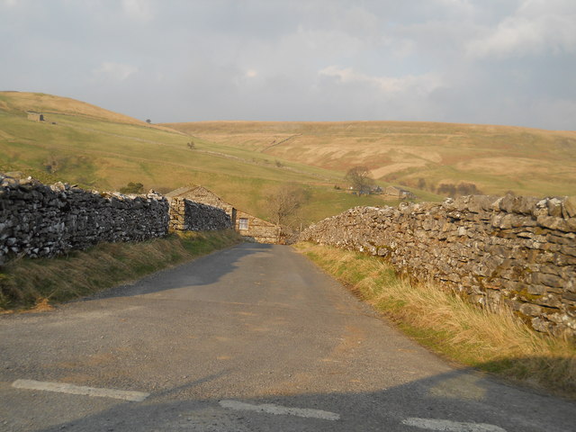
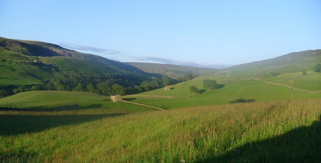
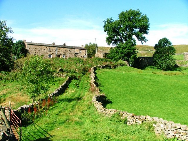
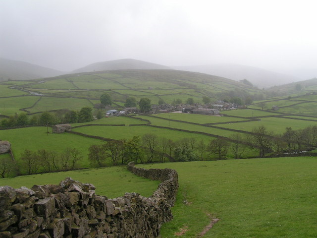
Angram Pasture is a picturesque and expansive area located in the county of Yorkshire, England. Situated amidst the stunning landscapes of the Yorkshire Downs and Moorland, it spans over vast hectares of rolling hills, lush green meadows, and rugged terrain. This idyllic pasture is a haven for nature enthusiasts, hikers, and those seeking tranquility in the heart of Yorkshire.

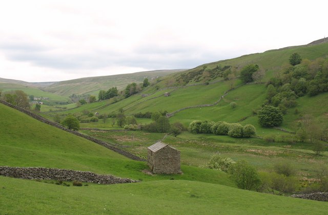
The dominant feature of Angram Pasture is its diverse flora and fauna. The meadows are adorned with vibrant wildflowers, creating a colorful tapestry that stretches as far as the eye can see. The area is also home to a wide range of wildlife, including deer, rabbits, and various species of birds, making it a popular spot for birdwatching and wildlife photography.

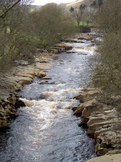
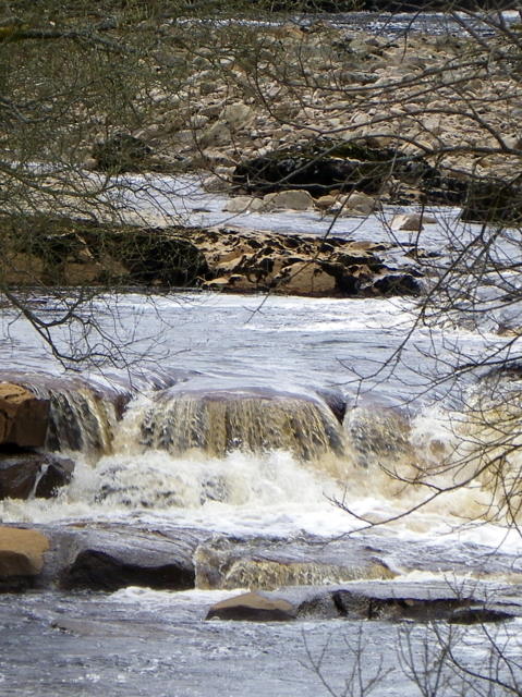
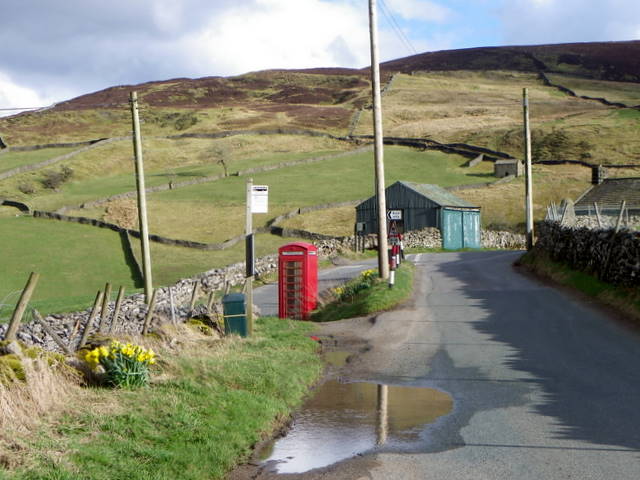
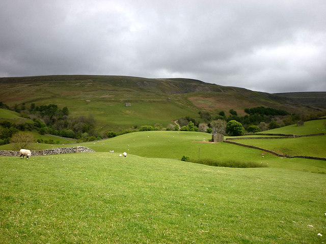
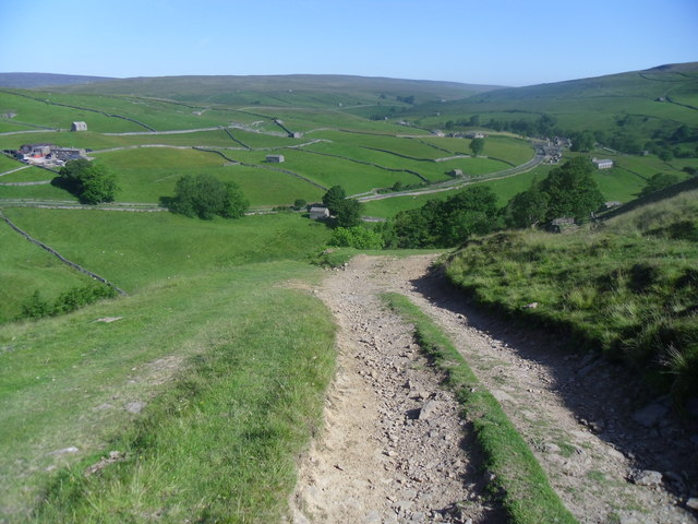
The landscape of Angram Pasture is characterized by its undulating hills and valleys, offering breathtaking panoramic views of the surrounding moorland and distant peaks. The rugged terrain provides ample opportunities for hiking and exploring, with numerous footpaths and trails crisscrossing the area. Along these trails, visitors can discover hidden streams, cascading waterfalls, and ancient stone formations, adding to the allure and mystique of the pasture.

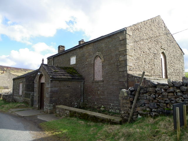
Angram Pasture is not only a natural wonder but also holds historical significance. The area is dotted with ancient archaeological sites, including Bronze Age burial mounds and remnants of medieval settlements, serving as a testament to the rich heritage of Yorkshire.

Whether it's the enchanting beauty of the wildflowers, the serenity of the moorland, or the allure of its historical past, Angram Pasture is a captivating destination that offers a unique and unforgettable experience for all who venture into its embrace.

If you have any feedback on the listing, please let us know in the comments section below.

Angram Pasture Images

Images are sourced within 2km of 54.392676/-2.1829703 or Grid Reference SD8899. Thanks to Geograph Open Source API. All images are credited.

Road to Keld village
River Swale from Park Bridge The River Swale is the northernmost tributary of the Yorkshire Ouse with its headwaters located in the eastern Yorkshire Dales, from where it flows in an easterly direction towards Richmond.
River Swale from Park Bridge
The River Swale is the northernmost tributary of the Yorkshire Ouse with its headwaters located in the eastern Yorkshire Dales, from where it flows in an easterly direction towards Richmond.
River Swale from Park Bridge The name Swale in Old English means 'swilling and fast flowing'. It certainly is when viewed from Park Bridge.
River Swale from Park Bridge
The name Swale in Old English means 'swilling and fast flowing'. It certainly is when viewed from Park Bridge.
Methodist Chapel, Keld The chapel dates from 1841 and is a sad sight now that it is boarded up.
Methodist Chapel, Keld
The chapel dates from 1841 and is a sad sight now that it is boarded up.
Date stone, Keld Methodist Chapel For a wider view of the chapel <a href="https://www.geograph.org.uk/photo/2403594">NY8900 : Methodist Chapel, Keld</a>
Date stone, Keld Methodist Chapel
For a wider view of the chapel NY8900 : Methodist Chapel, Keld
Village scene, Keld A K6 telephone box stands beside the narrow road that passes the main part of the village.

In 1935, the Post Office commissioned a new kiosk from Sir Giles Gilbert Scott to celebrate the Jubilee of King George V.  The K6 Jubilee Kiosk, as it is known, was similar to the K2 box, being made of cast iron and painted red but was 25% lighter in weight.  By the end of the 1930s there were 20,000 K6 telephone boxes in use all over the UK.
Village scene, Keld
A K6 telephone box stands beside the narrow road that passes the main part of the village. In 1935, the Post Office commissioned a new kiosk from Sir Giles Gilbert Scott to celebrate the Jubilee of King George V. The K6 Jubilee Kiosk, as it is known, was similar to the K2 box, being made of cast iron and painted red but was 25% lighter in weight. By the end of the 1930s there were 20,000 K6 telephone boxes in use all over the UK.
Village scene, Keld The former institute stands on the right and former manse, which is now the United Reformed Church stands at the bottom of the lane.
Village scene, Keld
The former institute stands on the right and former manse, which is now the United Reformed Church stands at the bottom of the lane.
United Reformed Church, Keld The building is the former manse and is dated 1860.
United Reformed Church, Keld
The building is the former manse and is dated 1860.
Date stone, Keld Chapel The date stone is on the United Reformed Church <a href="https://www.geograph.org.uk/photo/2403691">NY8901 : United Reformed Church, Keld</a>
Date stone, Keld Chapel
The date stone is on the United Reformed Church NY8901 : United Reformed Church, Keld
Sundial, Keld Chapel The sundial is on the United Reformed Church <a href="https://www.geograph.org.uk/photo/2403691">NY8901 : United Reformed Church, Keld</a>

Sundials or sun clocks are considered to be the oldest known device for the measurement of time and one of the most ancient scientific instruments.
The oldest known true sundial was built around 1500BC in Egypt. Shaped like a letter 'L' the length of the shadow cast by the vertical leg along the horizontal leg indicated the time. The Romans perfected the horizontal sundial we know today and invented portable travelling versions.
Sundial, Keld Chapel
The sundial is on the United Reformed Church NY8901 : United Reformed Church, Keld Sundials or sun clocks are considered to be the oldest known device for the measurement of time and one of the most ancient scientific instruments. The oldest known true sundial was built around 1500BC in Egypt. Shaped like a letter 'L' the length of the shadow cast by the vertical leg along the horizontal leg indicated the time. The Romans perfected the horizontal sundial we know today and invented portable travelling versions.
Bench Mark, Keld Chapel The bench mark is to be found on the south face of the building.  For a view of the building <a href="https://www.geograph.org.uk/photo/2403691">NY8901 : United Reformed Church, Keld</a> and for further information on the bench mark and others in the area <span class="nowrap"><a title="http://www.bench-marks.org.uk/bm37903" rel="nofollow ugc noopener" href="http://www.bench-marks.org.uk/bm37903">Link</a><img style="margin-left:2px;" alt="External link" title="External link - shift click to open in new window" src="https://s1.geograph.org.uk/img/external.png" width="10" height="10"/></span>
Bench Mark, Keld Chapel
The bench mark is to be found on the south face of the building. For a view of the building NY8901 : United Reformed Church, Keld and for further information on the bench mark and others in the area LinkExternal link
Bellcote, Old School The stone bellcote on the old school in Keld is inscribed with the name W. Metcalfe and the date 1847.

The Metcalfe family originated in Swaledale and Wensleydale and are now scattered the world over.
Bellcote, Old School
The stone bellcote on the old school in Keld is inscribed with the name W. Metcalfe and the date 1847. The Metcalfe family originated in Swaledale and Wensleydale and are now scattered the world over.
War Memorial, Keld The war memorial remembers those of the village who lost their lives during the Great War (1914-1918).

The names on the memorial are:  

Richard Alderson
Thomas Clarkson
Wm Waller Hutchinson
Robert Rukin

We will remember them.
War Memorial, Keld
The war memorial remembers those of the village who lost their lives during the Great War (1914-1918). The names on the memorial are: Richard Alderson Thomas Clarkson Wm Waller Hutchinson Robert Rukin We will remember them.
Aygill near Angram The small green hill resembles a Norman motte but is more likely to be simply a glacial deposit of boulder clay.
Aygill near Angram
The small green hill resembles a Norman motte but is more likely to be simply a glacial deposit of boulder clay.
Sheep pasture near Keld The quintessential upper Swaledale scene of green pastures, field barns and sheep happily caught in a brief patch of sun. The River Swale runs in a wooded gorge beyond with Beldi Hill above, the scene of much lead mining, once a mainstay of the local economy.
Sheep pasture near Keld
The quintessential upper Swaledale scene of green pastures, field barns and sheep happily caught in a brief patch of sun. The River Swale runs in a wooded gorge beyond with Beldi Hill above, the scene of much lead mining, once a mainstay of the local economy.
Recently harvested grass fields near Keld The black plastic bales of silage are in the valley of the Skeb Skeugh stream. Keld village in the middle distance sits above the wooded course of the upper Swale.
Recently harvested grass fields near Keld
The black plastic bales of silage are in the valley of the Skeb Skeugh stream. Keld village in the middle distance sits above the wooded course of the upper Swale.
Meadows and barns near Keld. Swaledale countryside.
Meadows and barns near Keld.
Swaledale countryside.
Corpse road. Leading back to Keld.
Corpse road.
Leading back to Keld.
Show me another place!

Angram Pasture is located at Grid Ref: SD8899 (Lat: 54.392676, Lng: -2.1829703)

Division: North Riding

Administrative County: North Yorkshire

District: Richmondshire

Police Authority: North Yorkshire

What 3 Words

///agenda.bottled.decoded. Near Kirkby Stephen, Cumbria

Nearby Locations

Angram Angram Pasture

Related Wikis

Angram, Richmondshire

Angram is a hamlet in the Yorkshire Dales in the Richmondshire district of North Yorkshire, England. It is situated near to Keld to the north and Thwaite...

Angram Bottoms

Angram Bottoms (grid reference SD891999) is a 9.8 hectares (24 acres) biological Site of Special Scientific Interest (SSSI) near to the village of Angram...

Catrake Force

Catrake Force is a waterfall on the River Swale in North Yorkshire, England. It is not visible from the road but is accessible via a campsite in Keld....

Kisdon

Kisdon, also called Kisdon Hill, is a fell situated in upper Swaledale in the Yorkshire Dales National Park in North Yorkshire, England. == Geography... ==

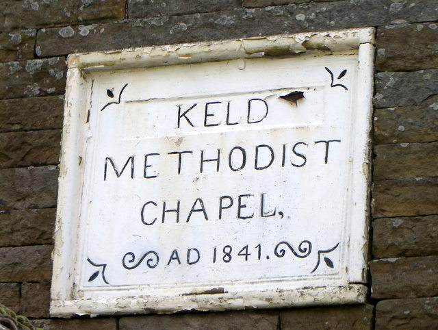
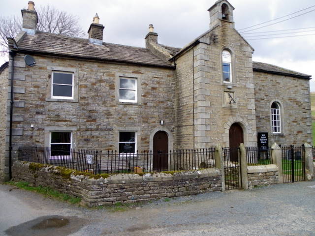
Keld, North Yorkshire

Keld is a village in the English county of North Yorkshire. It is in Swaledale, and the Yorkshire Dales National Park. The name derives from the Viking...

Wain Wath Force

Wain Wath Force is a waterfall on the River Swale in the Yorkshire Dales National Park, North Yorkshire, England. The falls are at grid reference NY883015...

Thwaite, North Yorkshire

Thwaite is a small village in the Yorkshire Dales, North Yorkshire, England. It is in Swaledale and is part the district of Richmondshire and the civil...

East Gill Force

East Gill Force is a waterfall in Swaledale, 330 yards (300 m) east of the hamlet of Keld, in the Yorkshire Dales National Park, North Yorkshire, England...

Nearby Amenities

Located within 500m of 54.392676,-2.1829703
The data included in this document is from www.openstreetmap.org. The data is made available under ODbL.

Have you been to Angram Pasture?

Leave your review of Angram Pasture below (or comments, questions and feedback).