Churchill

Settlement in Devon / Dorset East Devon

England

Churchill

All Saints Road, Smallridge A village of houses and cottages to the north of Axminster.
All Saints Road, Smallridge Credit: Jonathan Billinger

Churchill is a small village located on the border of Devon and Dorset, in the southwestern part of England. Situated in the beautiful countryside, Churchill offers a peaceful and idyllic setting for residents and visitors alike. The village is surrounded by rolling hills, lush green fields, and picturesque woodlands, making it a popular destination for nature lovers and hikers.

Despite its small size, Churchill boasts a rich history that dates back centuries. The village is home to several historical landmarks, including a medieval church that stands as a testament to the area's past. Visitors can also explore the remnants of an ancient hill fort that once served as a defensive structure in times gone by.

In addition to its historical significance, Churchill is known for its charming and quaint atmosphere. The village is dotted with traditional thatched-roof cottages, adding to its timeless appeal. There is a sense of community in Churchill, with a local pub serving as a gathering place for residents and visitors alike.

For those seeking outdoor activities, Churchill offers ample opportunities. The surrounding countryside is ideal for hiking, cycling, and horseback riding, with numerous trails and scenic routes to explore. Additionally, the nearby coast provides opportunities for beach walks, water sports, and fishing.

Churchill, Devon/Dorset, is a hidden gem nestled in the heart of the English countryside. With its natural beauty, historical significance, and tranquil ambiance, it offers a perfect escape from the hustle and bustle of modern life.

If you have any feedback on the listing, please let us know in the comments section below.
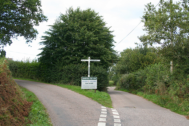
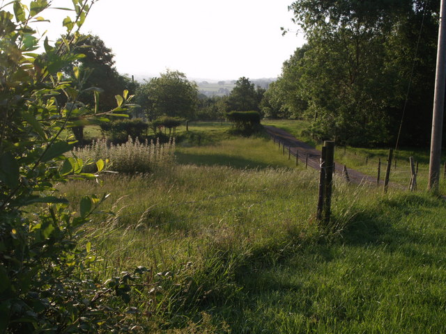
Churchill Images

Images are sourced within 2km of 50.81231/-2.998518 or Grid Reference ST2901. Thanks to Geograph Open Source API. All images are credited.

All Saints Road, Smallridge A village of houses and cottages to the north of Axminster.
All Saints Road, Smallridge
A village of houses and cottages to the north of Axminster.
Unnamed stream, Smallridge A lovely September afternoon to be on the footbridge here.
Unnamed stream, Smallridge
A lovely September afternoon to be on the footbridge here.
Converted Chapel, Smallridge Designed to resemble Noah's Ark, a very early Methodist Chapel dating to 1796 which was closed in 2002 and is now a comfortable holiday let.
Converted Chapel, Smallridge
Designed to resemble Noah's Ark, a very early Methodist Chapel dating to 1796 which was closed in 2002 and is now a comfortable holiday let.
Houses in Smallridge
Churchill Farm
Churchill Farm
Houses in Goldsmiths Lane
Weir above Weycroft Mill
Chardstock: Churchill Farm Seen from the public footpath at Churchill Lane; the field is accessed up a steep flight of steps from the lane
Chardstock: Churchill Farm
Seen from the public footpath at Churchill Lane; the field is accessed up a steep flight of steps from the lane
Chardstock: Birchill Cross Also known as The Triangle. Looking north
Chardstock: Birchill Cross
Also known as The Triangle. Looking north
Power lines Parallel with Greatwood Lane, west of Weycroft.
Power lines
Parallel with Greatwood Lane, west of Weycroft.
Back gardens of Smallridge
Field near Waggs Plot The A358 is behind the trees on the right, and the freshly-cut field is seen from a gateway close to where the lane called Waggs Plot joins the main road.
Field near Waggs Plot
The A358 is behind the trees on the right, and the freshly-cut field is seen from a gateway close to where the lane called Waggs Plot joins the main road.
Fordwater Farm An L-shaped farmhouse, seen from All Saints Footpath 49 as it crosses a meadow beside the River Kit.
Fordwater Farm
An L-shaped farmhouse, seen from All Saints Footpath 49 as it crosses a meadow beside the River Kit.
A358 at Waggs Plot The main road from Chard to Axminster passes the lane to Waggs Plot.
A358 at Waggs Plot
The main road from Chard to Axminster passes the lane to Waggs Plot.
Colston Farm A barn at the farm, a few yards of the A358 at Colston Cross. Across the field are houses at Waggs Plot.
Colston Farm
A barn at the farm, a few yards of the A358 at Colston Cross. Across the field are houses at Waggs Plot.
Drive to Gregham Farm Past nettles and grass in the early morning sun, the farm track leaves the A358.
Drive to Gregham Farm
Past nettles and grass in the early morning sun, the farm track leaves the A358.
South Common Lane Seen from its junction with the A358. The house is Mellstock, doubtless named by a Hardy fan.
South Common Lane
Seen from its junction with the A358. The house is Mellstock, doubtless named by a Hardy fan.
Field near Fordwater Farm A field beside the A358. In the distance is Greghams Farm.
Field near Fordwater Farm
A field beside the A358. In the distance is Greghams Farm.
Show me another place!

Churchill is located at Grid Ref: ST2901 (Lat: 50.81231, Lng: -2.998518)

Administrative County: Devon

District: East Devon

Police Authority: Devon and Cornwall

What 3 Words

///juggles.earl.fortified. Near Axminster, Devon

Related Wikis

Alston, East Devon

Alston is a hamlet in Devon, England. == References ==

Smallridge

Smallridge is a large hamlet in All Saints parish in the East Devon district of Devon, England. The hamlet is situated about 1 mile north of the town of...

All Saints, Devon

All Saints is a civil parish in East Devon, Devon, England. It has a population of 498 according to the 2001 census. The parish includes the hamlets...

Membury Castle

Membury Castle is an Iron Age hillfort situated above the village of Membury in Devon. The fort occupies a commanding hilltop position some 204 metres...
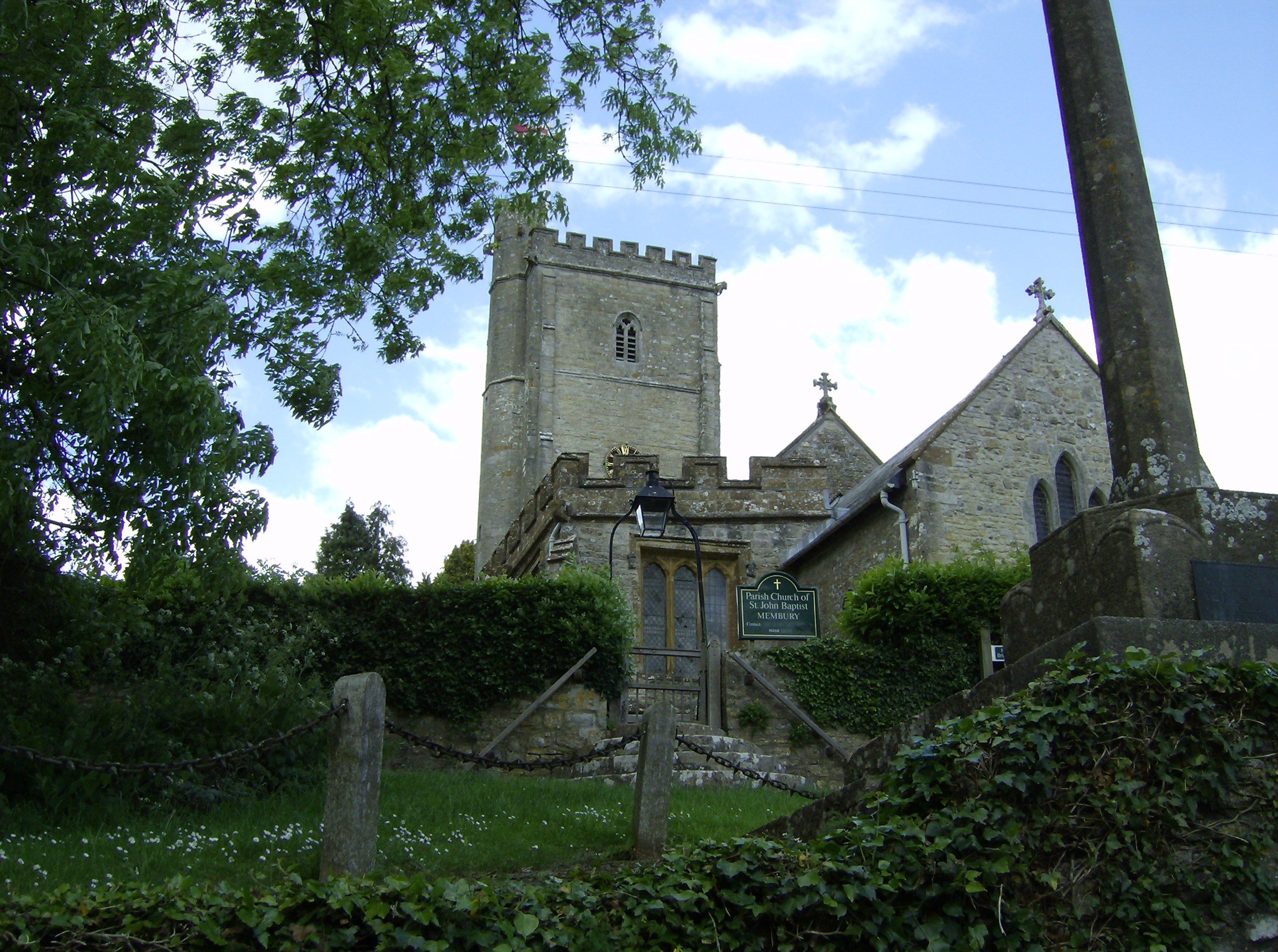
Membury, Devon

Membury is a village three miles north west of Axminster in East Devon district. The population at the 2011 Census was 501.The village has a 13th-century...

Axminster Town A.F.C.

Axminster Town Association Football Club is a football club based in Axminster, Devon, England. They are currently members of the South West Peninsula...

Tytherleigh

Tytherleigh is a village in the civil parish of Chardstock in Devon, England (historically in Dorset), close to the borders with Dorset and Somerset on...

Blackwater River (River Axe)

The Blackwater River is a 10-kilometre (6.2 mi) long river in the counties of Dorset and Devon, in the south-west of England. It rises to the north of...

Related Videos

Piaggio Ape Driver Controls Tutorial

Hello everyone. Welcome to the Tukxi Piaggio Apé channel. In this video, I'm happy to present the Piaggio Ape driver controls ...

Axminster Charity Skatepark - Christmas Edit #christmas #skate

Subscribe to this channel ‎@axminstercharityskatepark A Christmas holiday video edit from the senior members of The ...

Axminster Skatepark - Golden Hour # #axminster #charity #skatepark #rollerblading #skateboarding

Subscribe to this channel ‎@axminstercharityskatepark A Christmas holiday video edit from the senior members of The ...

Nearby Amenities

Located within 500m of 50.81231,-2.998518
Churchill
Created By: Potlatch 0.10f
Place: hamlet
Wikidata: Q64825099
Lat/Long: 50.8122057/-2.9970524
Cranborne Cross
Junction: yes
Lat/Long: 50.8157591/-3.0018328
Cloverhayes Farm
Place: locality
Source: survey;OS
Lat/Long: 50.8086475/-2.9973267
Generator Method: photovoltaic
Generator Output Electricity: yes
Generator Source: solar
Generator Type: solar_photovoltaic_panel
Location: roof
Power: generator
Source: Bing
Lat/Long: 50.8132956/-3.0015126
Power: pole
Source: bing
Transformer: distribution
Lat/Long: 50.812522/-2.997378
Power: pole
Source: bing
Lat/Long: 50.8119144/-2.9957163
Power: pole
Source: bing
Lat/Long: 50.8115144/-2.9946113
Power: pole
Source: bing
Lat/Long: 50.8110907/-2.9934794
Power: pole
Source: bing
Lat/Long: 50.8103246/-2.9924735
Power: pole
Source: bing
Transformer: distribution
Lat/Long: 50.8121957/-2.9993212
Power: pole
Source: bing
Lat/Long: 50.8112364/-2.9994875
Power: pole
Source: bing
Lat/Long: 50.8101721/-2.9996726
Power: pole
Source: bing
Lat/Long: 50.8085179/-2.9995117
Power: pole
Source: bing
Lat/Long: 50.8094755/-2.9997933
Power: pole
Source: bing
Transformer: distribution
Lat/Long: 50.8082365/-3.000555
The data included in this document is from www.openstreetmap.org. The data is made available under ODbL.

Have you been to Churchill?

Leave your review of Churchill below (or comments, questions and feedback).