Sharpham Wood

Wood, Forest in Devon South Hams

England

Sharpham Wood

Ruin, Fleet Mill The disintegration of the building must be fairly recent, as the current satellite map I am using shows its roof intact.
Ruin, Fleet Mill Credit: Derek Harper

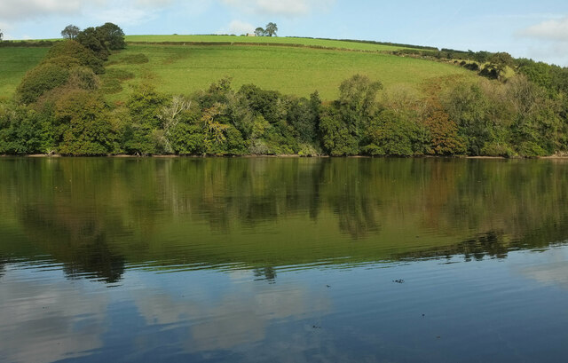
Sharpham Wood is a beautiful woodland located in Devon, England. It covers an area of approximately 80 acres and is situated near the village of Ashprington, just a few miles away from the town of Totnes. The wood is part of the larger Sharpham Estate and is a popular destination for both locals and visitors alike.

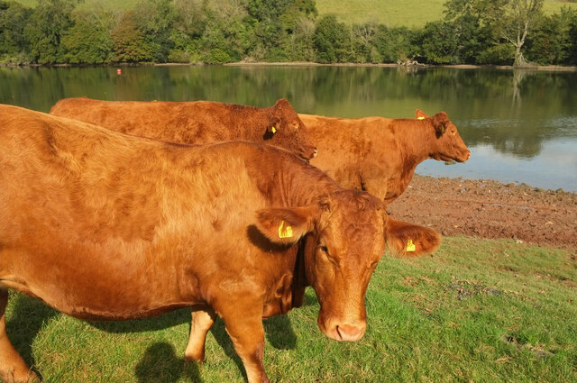
The wood features a diverse range of tree species, including oak, beech, ash, and chestnut, creating a rich and vibrant ecosystem. It is home to a variety of wildlife, including deer, badgers, foxes, and numerous bird species. Birdwatchers often visit Sharpham Wood to catch a glimpse of the rare and elusive species that inhabit the area.

There are several well-marked walking trails that wind their way through the wood, allowing visitors to explore and enjoy the peaceful surroundings. The trails are suitable for all levels of fitness and offer stunning views of the surrounding countryside.

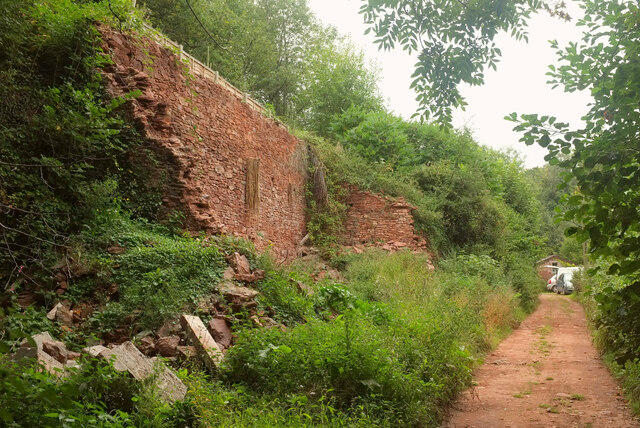
In addition to its natural beauty, Sharpham Wood also has historical significance. It was once part of a medieval deer park and remnants of ancient boundaries and walls can still be seen throughout the woodland.

The wood is managed by the Sharpham Trust, a charitable organization that aims to promote environmental conservation and education. They offer various events and activities throughout the year, including guided walks, wildlife workshops, and educational programs for schools.

Overall, Sharpham Wood is a picturesque and tranquil woodland that offers a wonderful opportunity to immerse oneself in nature and learn about the rich history and biodiversity of the area.

If you have any feedback on the listing, please let us know in the comments section below.

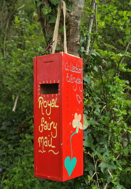
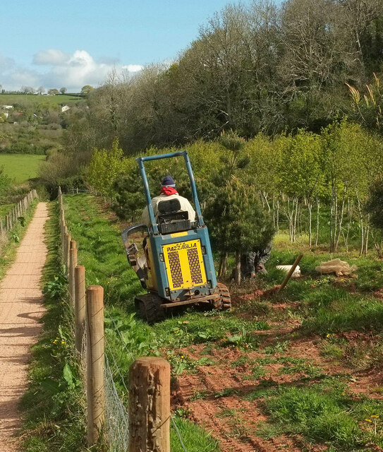
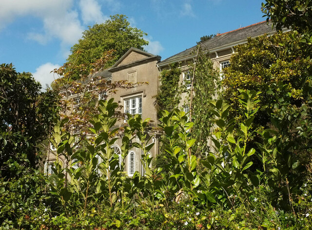
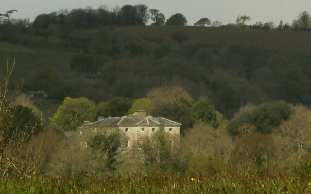
Sharpham Wood Images

Images are sourced within 2km of 50.404513/-3.6490469 or Grid Reference SX8257. Thanks to Geograph Open Source API. All images are credited.

Ruin, Fleet Mill The disintegration of the building must be fairly recent, as the current satellite map I am using shows its roof intact.
Ruin, Fleet Mill
The disintegration of the building must be fairly recent, as the current satellite map I am using shows its roof intact.
Postbox, Tuckenhay Elizabeth II postbox TQ9 63 is shown in more context at <a href="https://www.geograph.org.uk/photo/6820508">SX8155 : Coronation Cross, Tuckenhay</a>.
Postbox, Tuckenhay
Elizabeth II postbox TQ9 63 is shown in more context at SX8155 : Coronation Cross, Tuckenhay.
Lane, Tuckenhay Dropping from the mill buildings to Coronation Cross.
Lane, Tuckenhay
Dropping from the mill buildings to Coronation Cross.
Houses at Ashprington from near Tideford Looking more to the right than <a href="https://www.geograph.org.uk/photo/6816464">SX8157 : Ashprington from near Tideford</a>; the church is on the left. The houses are on Church Close.
Houses at Ashprington from near Tideford
Looking more to the right than SX8157 : Ashprington from near Tideford; the church is on the left. The houses are on Church Close.
Across Bow Creek From Cornworthy footpath 1a, which runs along the southern foreshore.
Across Bow Creek
From Cornworthy footpath 1a, which runs along the southern foreshore.
Cattle by Bow Creek These fine beasts are grazing along the line of Cornworthy footpath 1 and I am trying to distract them as a rather nervous member of our party passes. Probably among the most placid cattle I have ever encountered.
Cattle by Bow Creek
These fine beasts are grazing along the line of Cornworthy footpath 1 and I am trying to distract them as a rather nervous member of our party passes. Probably among the most placid cattle I have ever encountered.
Boats, Bow Creek Colourful rowing craft pass each other, seen from Cornworthy footpath 1.
Boats, Bow Creek
Colourful rowing craft pass each other, seen from Cornworthy footpath 1.
Tower, St Peter's Church, Cornworthy The tower at the west end of the slate building, listed grade I and described at <span class="nowrap"><a title="https://historicengland.org.uk/listing/the-list/list-entry/1291647" rel="nofollow ugc noopener" href="https://historicengland.org.uk/listing/the-list/list-entry/1291647">Link</a><img style="margin-left:2px;" alt="External link" title="External link - shift click to open in new window" src="https://s1.geograph.org.uk/img/external.png" width="10" height="10"/></span> .
Tower, St Peter's Church, Cornworthy
The tower at the west end of the slate building, listed grade I and described at LinkExternal link .
Pebble, Hoyle Copse One of several attractive little features in the woodland.
Pebble, Hoyle Copse
One of several attractive little features in the woodland.
Woodland ornament, Hoyle Copse One of several charming miniature items in the wood. Doors are a frequent theme in such ventures.
Woodland ornament, Hoyle Copse
One of several charming miniature items in the wood. Doors are a frequent theme in such ventures.
Woodland ornament, Hoyle Copse Not far from <a href="https://www.geograph.org.uk/photo/6832242">SX8457 : Miniature house, Hoyle Copse</a>.
Woodland ornament, Hoyle Copse
Your amazing, Hoyle Copse Well, a pleasing message, although a shame about the grammar - or is there a word missing? "Your amazing freckles", perhaps?
Your amazing, Hoyle Copse
Well, a pleasing message, although a shame about the grammar - or is there a word missing? "Your amazing freckles", perhaps?
Miniature door, Hoyle Copse As I said at <a href="https://www.geograph.org.uk/photo/7001868">SX8457 : Woodland ornament, Hoyle Copse</a>, doors are a frequent theme in woodland ornamentation.
Miniature door, Hoyle Copse
As I said at SX8457 : Woodland ornament, Hoyle Copse, doors are a frequent theme in woodland ornamentation.
Royal fairy mailbox, Hoyle Copse "Collection everyday".
Royal fairy mailbox, Hoyle Copse
"Collection everyday".
Nursery work, New Wood Trees To be honest, I can't recall nearly six months afterwards whether they were planting or lifting a tree, but I think perhaps the latter. The footpath is Stoke Gabriel 7. Hoyle Copse is in the background.
Nursery work, New Wood Trees
To be honest, I can't recall nearly six months afterwards whether they were planting or lifting a tree, but I think perhaps the latter. The footpath is Stoke Gabriel 7. Hoyle Copse is in the background.
Stoke Gabriel House The grade II listed house <span class="nowrap"><a title="https://historicengland.org.uk/listing/the-list/list-entry/1147601" rel="nofollow ugc noopener" href="https://historicengland.org.uk/listing/the-list/list-entry/1147601">Link</a><img style="margin-left:2px;" alt="External link" title="External link - shift click to open in new window" src="https://s1.geograph.org.uk/img/external.png" width="10" height="10"/></span> is not easily photographed. although the link provides a good image. This glimpse is from Duncannon Lane. "Large detached house in garden. Built in 1798 for Rear Admiral Thomas Hicks ... Centre breaks forward with pediment ...".
Stoke Gabriel House
The grade II listed house LinkExternal link is not easily photographed. although the link provides a good image. This glimpse is from Duncannon Lane. "Large detached house in garden. Built in 1798 for Rear Admiral Thomas Hicks ... Centre breaks forward with pediment ...".
Sharpham House from Stoke Gabriel The grade I listed house, seen here across the Dart from two kilometres away, is more clearly shown at <a title="https://www.geograph.org.uk/search.php?i=144315938" href="https://www.geograph.org.uk/search.php?i=144315938">Link</a> .
Sharpham House from Stoke Gabriel
The grade I listed house, seen here across the Dart from two kilometres away, is more clearly shown at Link .
Walkers near Stoke Gabriel Looking left from <a href="https://www.geograph.org.uk/photo/7002347">SX8257 : Sharpham House from Stoke Gabriel</a> along Stoke Gabriel Footpath 3.
Walkers near Stoke Gabriel
Looking left from SX8257 : Sharpham House from Stoke Gabriel along Stoke Gabriel Footpath 3.
Show me another place!

Sharpham Wood is located at Grid Ref: SX8257 (Lat: 50.404513, Lng: -3.6490469)

Administrative County: Devon

District: South Hams

Police Authority: Devon and Cornwall

What 3 Words

///storeroom.sharpened.newest. Near Stoke Gabriel, Devon

Related Wikis

Sharpham, Ashprington

Sharpham is an historic estate in the parish of Ashprington, Devon. The Georgian mansion house, known as Sharpham House, overlooks the River Dart and is...

Ashprington

Ashprington is a village and civil parish in the South Hams district of Devon, England. The village is not far from the River Dart, but high above it...
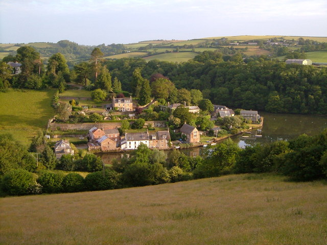
Tuckenhay

Tuckenhay is a hamlet in the South Hams in Devon, England, 2.5 miles (4.0 km) south of Totnes. It lies on the south bank of Bow Creek, the estuary of...

Cornworthy

Cornworthy is a village and civil parish in the South Hams, Devon, England. The hamlet of East Cornworthy lies due east of the village at grid reference...
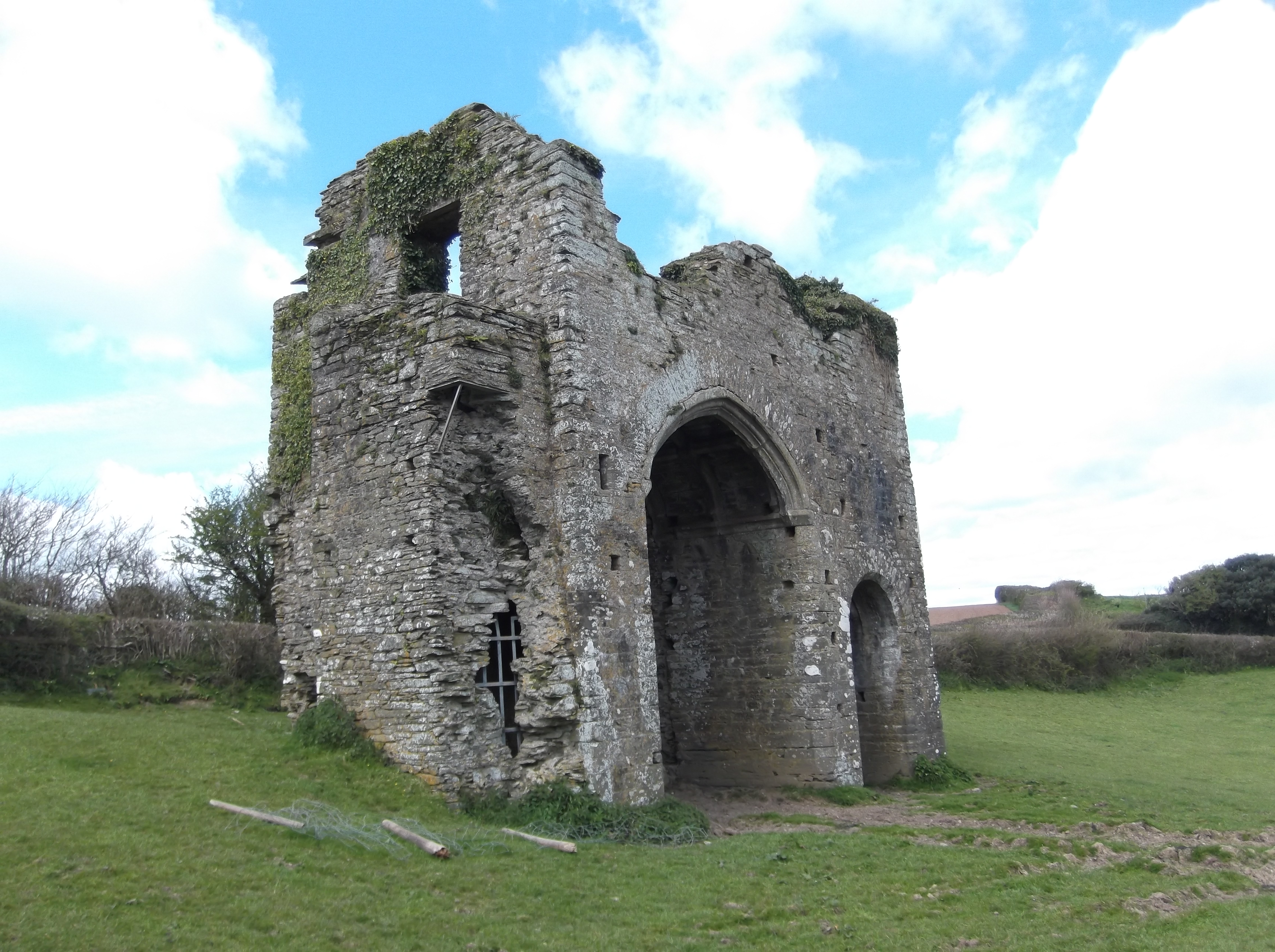
Cornworthy Priory

Cornworthy Priory was a priory in Devon, England. It was founded in the early thirteenth century, for Augustinian nuns, and existed until 1536. At the...
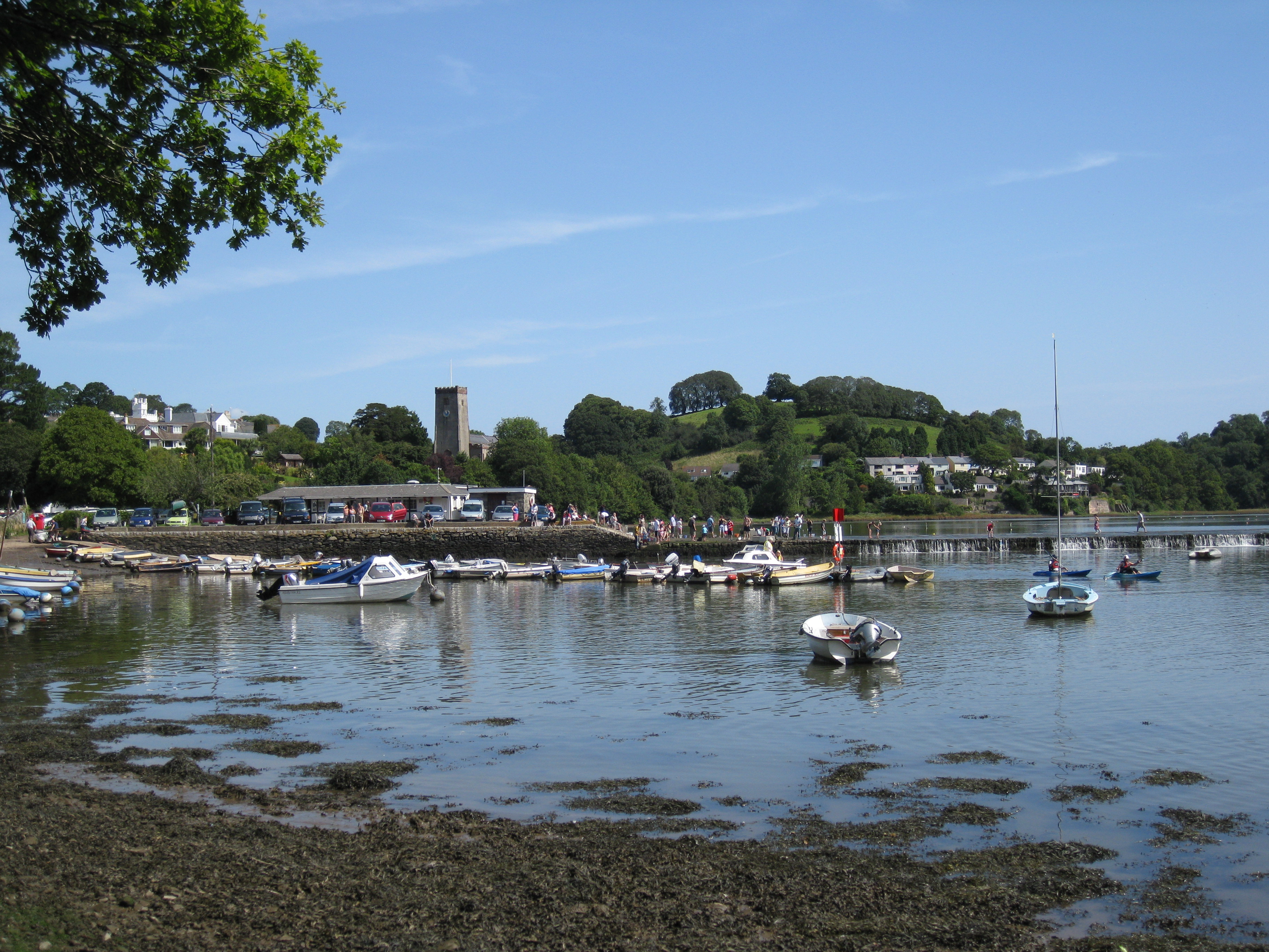
Stoke Gabriel

Stoke Gabriel is a village and parish in Devon, England, situated on a creek of the River Dart. The village is a popular tourist destination in the South...

Aish, Stoke Gabriel

Aish is a hamlet in the English county of Devon, near the village of Stoke Gabriel. Aish House is a Grade II listed 19th century house on the south side...

Stoke Gabriel & Torbay Police F.C.

Stoke Gabriel & Torbay Police Football Club is a football club based in Stoke Gabriel, Devon, established in the early 1900s as Stoke Gabriel AFC. In June...

Related Videos

Higher Well Farm Camping & Holiday Park An honest review

Looking for an honest review of Higher Well Farm Holiday Park? Look no further! This video provides an in-depth look at the ...

Devon Tourism Awards - Spring Party 2023

Watch highlights of the Devon Tourism Award Spring Party. Winners and sponsors gathered at Sandridge Barton - home of ...

A Wander from Cornworthy to Tuckenhay

Come and join me exploring a new wood, a beautiful creek and an old Manorial Gateway.

Nearby Amenities

Located within 500m of 50.404513,-3.6490469
Source: PGS
Lat/Long: 50.4036039/-3.6429616
Source: PGS
Lat/Long: 50.403824/-3.6444066
Source: PGS
Lat/Long: 50.4042747/-3.6461441
Source: PGS
Lat/Long: 50.4044672/-3.6471274
Source: PGS
Lat/Long: 50.4046954/-3.6478824
Source: PGS
Lat/Long: 50.4049831/-3.6483947
Source: PGS
Lat/Long: 50.4060015/-3.6493233
Source: PGS
Lat/Long: 50.406979/-3.6493385
Source: PGS
Lat/Long: 50.4071109/-3.6491799
Source: PGS
Lat/Long: 50.4078157/-3.6487574
Source: PGS
Lat/Long: 50.4080276/-3.6484835
Source: PGS
Lat/Long: 50.4083482/-3.647618
Source: PGS
Lat/Long: 50.4085551/-3.6464663
Source: PGS
Lat/Long: 50.4075199/-3.6446894
Source: PGS
Lat/Long: 50.4073265/-3.6450027
Source: PGS
Lat/Long: 50.4071305/-3.6453454
Source: PGS
Lat/Long: 50.4070205/-3.6456764
Source: PGS
Lat/Long: 50.4068419/-3.6468291
Source: PGS
Lat/Long: 50.4061997/-3.6475404
Source: PGS
Lat/Long: 50.4062139/-3.6473776
Source: PGS
Lat/Long: 50.4059371/-3.6464803
Source: PGS
Lat/Long: 50.4058005/-3.6456715
Source: PGS
Lat/Long: 50.4055542/-3.6441112
Source: PGS
Lat/Long: 50.4055507/-3.6435201
Source: PGS
Lat/Long: 50.4056728/-3.6428511
Source: PGS
Lat/Long: 50.4040155/-3.6453068
Source: PGS
Lat/Long: 50.4053078/-3.648791
The data included in this document is from www.openstreetmap.org. The data is made available under ODbL.

Have you been to Sharpham Wood?

Leave your review of Sharpham Wood below (or comments, questions and feedback).