Hill Copse

Wood, Forest in Devon Teignbridge

England

Hill Copse

View near Bilsdon Trig Point
View near Bilsdon Trig Point Credit: thejackrustles

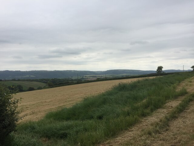
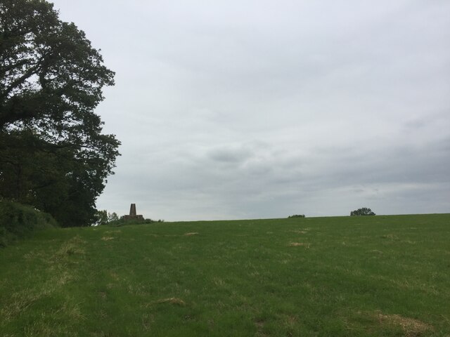
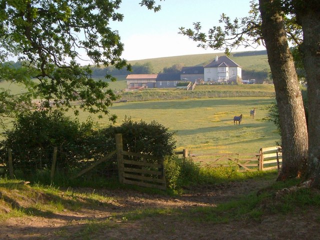
Hill Copse, located in Devon, England, is a picturesque woodland area that spans approximately 100 acres. Situated near the village of Newton Abbot, this forest is a popular destination for nature enthusiasts and outdoor adventurers alike.

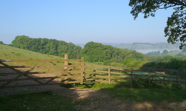
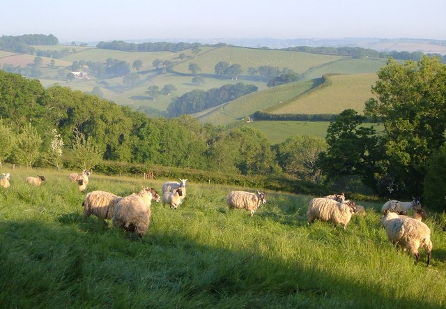
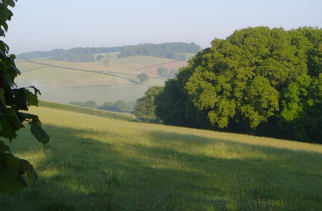
The copse is predominantly composed of native broadleaf trees, including oak, beech, and birch, which create a diverse and vibrant ecosystem. The lush undergrowth is home to a variety of flora, such as bluebells, wild garlic, and ferns, adding to the beauty of the landscape throughout the seasons.

Traversing Hill Copse, visitors can explore a network of well-maintained trails, providing opportunities for peaceful walks and hikes. The pathways wind through the forest, offering glimpses of wildlife like deer, foxes, and a rich variety of bird species. The copse is also known for its birdwatching opportunities, attracting enthusiasts eager to spot species such as woodpeckers, owls, and warblers.

In addition to its natural beauty, Hill Copse provides recreational amenities for visitors. There are picnic areas scattered throughout the woodland, allowing families and friends to enjoy a meal amidst the tranquility of nature. Furthermore, designated camping spots are available, enabling overnight stays for those seeking a more immersive experience.

Hill Copse is a cherished natural treasure in Devon, offering a serene and rejuvenating environment for those seeking a break from the hustle and bustle of everyday life. With its diverse flora and fauna, well-maintained trails, and recreational facilities, it serves as a haven for outdoor enthusiasts and nature lovers alike.

If you have any feedback on the listing, please let us know in the comments section below.
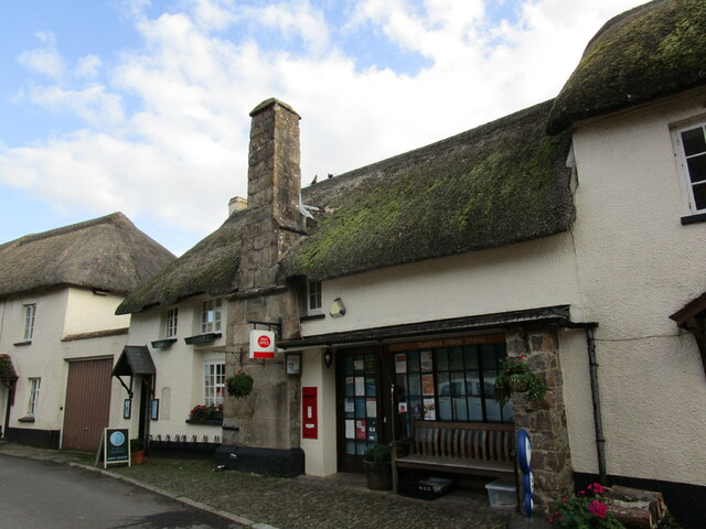
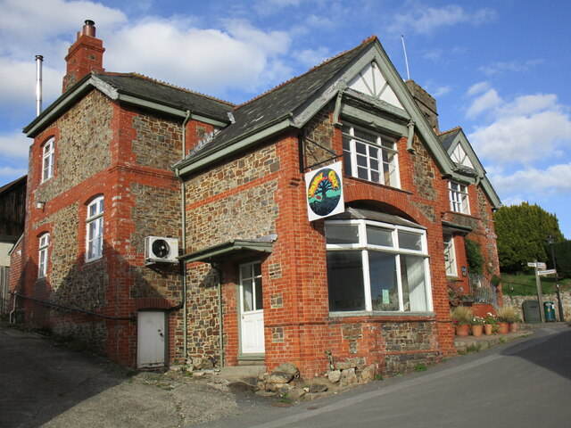
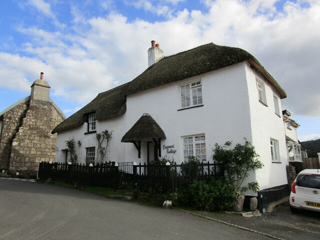
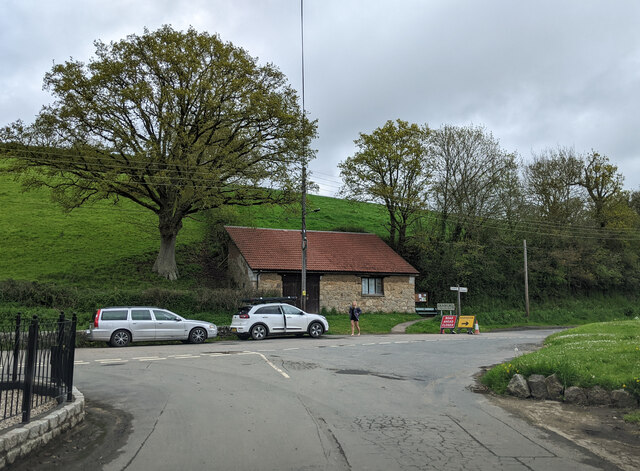
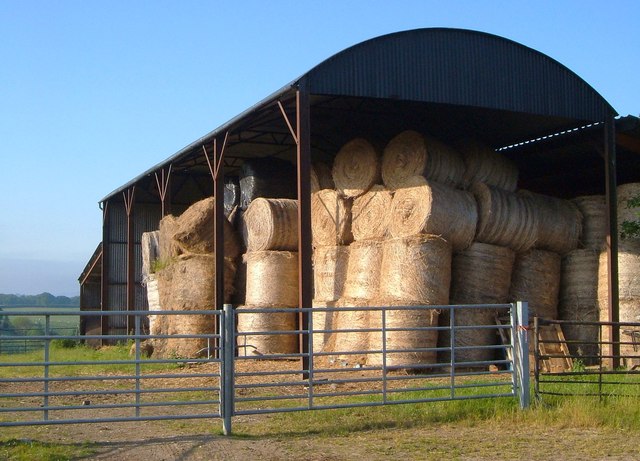
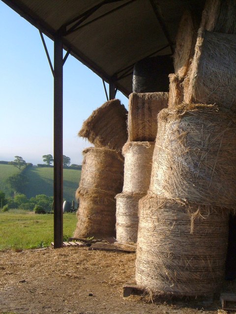
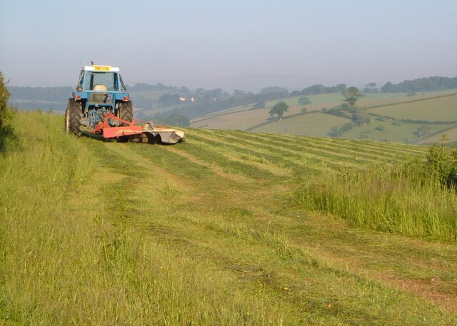
Hill Copse Images

Images are sourced within 2km of 50.700728/-3.6755185 or Grid Reference SX8190. Thanks to Geograph Open Source API. All images are credited.

View near Bilsdon Trig Point
Bilsdon Trig Point on a high plinth
Cottages, Dunsford Date from the early nineteenth century <span class="nowrap"><a title="https://historicengland.org.uk/listing/the-list/list-entry/1215490?section=official-list-entry" rel="nofollow ugc noopener" href="https://historicengland.org.uk/listing/the-list/list-entry/1215490?section=official-list-entry">Link</a><img style="margin-left:2px;" alt="External link" title="External link - shift click to open in new window" src="https://s1.geograph.org.uk/img/external.png" width="10" height="10"/></span>
Cottages, Dunsford
Date from the early nineteenth century LinkExternal link
Telephone Kiosk, Dunsford K6 telephone kiosk with working telephone <span class="nowrap"><a title="https://historicengland.org.uk/listing/the-list/list-entry/1228634?section=official-list-entry" rel="nofollow ugc noopener" href="https://historicengland.org.uk/listing/the-list/list-entry/1228634?section=official-list-entry">Link</a><img style="margin-left:2px;" alt="External link" title="External link - shift click to open in new window" src="https://s1.geograph.org.uk/img/external.png" width="10" height="10"/></span>
Telephone Kiosk, Dunsford
K6 telephone kiosk with working telephone LinkExternal link
Post Office, Dunsford The building probably dates from the late sixteenth century <span class="nowrap"><a title="https://historicengland.org.uk/listing/the-list/list-entry/1215127?section=official-list-entry" rel="nofollow ugc noopener" href="https://historicengland.org.uk/listing/the-list/list-entry/1215127?section=official-list-entry">Link</a><img style="margin-left:2px;" alt="External link" title="External link - shift click to open in new window" src="https://s1.geograph.org.uk/img/external.png" width="10" height="10"/></span>
Post Office, Dunsford
The building probably dates from the late sixteenth century LinkExternal link
The Royal Oak, Dunsford
Dymond Cottage, Dunsford Dymond Cottage probably dates from the eighteenth century <span class="nowrap"><a title="https://historicengland.org.uk/listing/the-list/list-entry/1214828?section=official-list-entry" rel="nofollow ugc noopener" href="https://historicengland.org.uk/listing/the-list/list-entry/1214828?section=official-list-entry">Link</a><img style="margin-left:2px;" alt="External link" title="External link - shift click to open in new window" src="https://s1.geograph.org.uk/img/external.png" width="10" height="10"/></span> The adjacent cottage (on the left) is of similar date <span class="nowrap"><a title="https://historicengland.org.uk/listing/the-list/list-entry/1214827?section=official-list-entry" rel="nofollow ugc noopener" href="https://historicengland.org.uk/listing/the-list/list-entry/1214827?section=official-list-entry">Link</a><img style="margin-left:2px;" alt="External link" title="External link - shift click to open in new window" src="https://s1.geograph.org.uk/img/external.png" width="10" height="10"/></span>
Dymond Cottage, Dunsford
Dymond Cottage probably dates from the eighteenth century LinkExternal link The adjacent cottage (on the left) is of similar date LinkExternal link
On the west side of Dunsford, there's been a road closed
Ford, South Zeal Another view of the ford shown in <a href="https://www.geograph.org.uk/photo/1986755">SX8190 : Ford, South Zeal</a>, looking up the Reedy Brook past the footbridge.
Ford, South Zeal
Another view of the ford shown in SX8190 : Ford, South Zeal, looking up the Reedy Brook past the footbridge.
Wisteria, South Zeal A magnificent display of purple and white wisteria at the crossroads shown in <a href="https://www.geograph.org.uk/photo/182368">SX8190 : Lockhouse Farm, Dunsford</a> - you can just see it on the right of that photo.
Wisteria, South Zeal
A magnificent display of purple and white wisteria at the crossroads shown in SX8190 : Lockhouse Farm, Dunsford - you can just see it on the right of that photo.
Lane to Kelland Corner The lane from South Zeal drops towards the lane junction and the buildings at Foxcote Farm. Ahead, the Lilly Brook valley is full of mist.
Lane to Kelland Corner
The lane from South Zeal drops towards the lane junction and the buildings at Foxcote Farm. Ahead, the Lilly Brook valley is full of mist.
Goatlake Farm A view of <a href="https://www.geograph.org.uk/photo/1986641">SX8291 : Goatlake Farm</a> from beneath oak trees by the lane from Kelland Corner.
Goatlake Farm
A view of SX8291 : Goatlake Farm from beneath oak trees by the lane from Kelland Corner.
Gate, fence and field above Scuttishill Plantation From the same spot as <a href="https://www.geograph.org.uk/photo/2620574">SX8291 : Goatlake Farm</a>, looking to the left, with Scuttishill Plantation on the slopes of a side valley above Reedy Brook.
Gate, fence and field above Scuttishill Plantation
From the same spot as SX8291 : Goatlake Farm, looking to the left, with Scuttishill Plantation on the slopes of a side valley above Reedy Brook.
Sheep near Halstow A young wood - an orchard, perhaps - is in the next field on the left. Beyond is Oxenpark Plantation. In the background is the valley of the Ducks Brook, with the farm of Aller, in <a href="https://www.geograph.org.uk/gridref/SX8192">SX8192</a>.
Sheep near Halstow
A young wood - an orchard, perhaps - is in the next field on the left. Beyond is Oxenpark Plantation. In the background is the valley of the Ducks Brook, with the farm of Aller, in SX8192.
Corner of Oxenpark Plantation A view from the lane shown in <a href="https://www.geograph.org.uk/photo/185344">SX8192 : Lane near Halstow, Tedburn St Mary</a>, with the Ducks Brook valley in the background. Mists drifts like smoke.
Corner of Oxenpark Plantation
A view from the lane shown in SX8192 : Lane near Halstow, Tedburn St Mary, with the Ducks Brook valley in the background. Mists drifts like smoke.
Barn near Halstow Boasting numerous bales of straw. This is beside the lane shown in <a href="https://www.geograph.org.uk/photo/185344">SX8192 : Lane near Halstow, Tedburn St Mary</a>.
Barn near Halstow
Boasting numerous bales of straw. This is beside the lane shown in SX8192 : Lane near Halstow, Tedburn St Mary.
Bales in a barn Another view of the bales shown in <a href="https://www.geograph.org.uk/photo/2621001">SX8191 : Barn near Halstow</a>.
Bales in a barn
Another view of the bales shown in SX8191 : Barn near Halstow.
Mowing near Halstow A tractor cuts the grass in a field on the other side of the lane from <a href="https://www.geograph.org.uk/photo/2621001">SX8191 : Barn near Halstow</a>.
Mowing near Halstow
A tractor cuts the grass in a field on the other side of the lane from SX8191 : Barn near Halstow.
Show me another place!

Hill Copse is located at Grid Ref: SX8190 (Lat: 50.700728, Lng: -3.6755185)

Administrative County: Devon

District: Teignbridge

Police Authority: Devon and Cornwall

What 3 Words

///flickers.hours.pushing. Near Moretonhampstead, Devon

Related Wikis

Dunsford

Dunsford is a village in Devon, England, just inside the Dartmoor National Park. The place-name 'Dunsford' is first attested in the Domesday Book of 1086...

Dunsford Halt railway station

Dunsford Halt was a railway station serving Dunsford, a small village in Devon, England, on the Teign Valley Line between the towns of Newton Abbot and...

Great Fulford

Great Fulford is an historic estate in the parish of Dunsford, Devon. The grade I listed manor house, known as Great Fulford House, is about 9 miles west...

West Country English

West Country English is a group of English language varieties and accents used by much of the native population of South West England, the area sometimes...

Devon

Devon (/ˈdɛvən/ DEV-ən, historically also known as Devonshire /-ʃɪər, -ʃər/ -⁠sheer, -⁠shər) is a ceremonial county in South West England. It is bordered...

Holcombe Burnell

Holcombe Burnell is a civil parish in the Teignbridge district, in Devon, England, the church of which is about 4 miles west of Exeter City centre. There...

Tedburn St Mary

Tedburn St Mary is a village and civil parish in the Teignbridge district of Devon, England, approximately 8 miles west of Exeter. It has a population...

Longdown railway station

Longdown was a railway station serving Longdown, a small village in Devon, England located on the Teign Valley Line between the towns of Newton Abbot and...

Nearby Amenities

Located within 500m of 50.700728,-3.6755185
Incline: 20%
Lat/Long: 50.6989382/-3.6724101
Brook
Place: hamlet
Lat/Long: 50.7025566/-3.6766862
Ford: yes
Lat/Long: 50.6977609/-3.6744195
Generator Method: photovoltaic
Generator Output Electricity: yes
Generator Source: solar
Generator Type: solar_photovoltaic_panel
Location: roof
Power: generator
Lat/Long: 50.7022406/-3.6707747
Generator Method: photovoltaic
Generator Output Electricity: yes
Generator Source: solar
Generator Type: solar_photovoltaic_panel
Location: roof
Power: generator
Lat/Long: 50.6974125/-3.6750059
Power: pole
Source: bing
Lat/Long: 50.7038774/-3.678077
Power: pole
Source: bing
Lat/Long: 50.7043148/-3.679052
Power: pole
Source: bing
Transformer: distribution
Lat/Long: 50.7024428/-3.6773944
Power: pole
Source: bing
Lat/Long: 50.7032038/-3.6778584
Power: pole
Source: bing
Lat/Long: 50.7034026/-3.6771664
Power: pole
Source: bing
Lat/Long: 50.7037067/-3.6761177
Power: pole
Source: bing
Lat/Long: 50.7040838/-3.6748356
Power: pole
Source: bing
Transformer: distribution
Lat/Long: 50.7028403/-3.6700706
Power: pole
Source: bing
Lat/Long: 50.7040413/-3.6710188
Power: pole
Source: bing
Lat/Long: 50.7036489/-3.670426
Power: pole
Source: bing
Lat/Long: 50.7044609/-3.6716357
Power: pole
Source: bing
Lat/Long: 50.7032378/-3.6702302
Power: pole
Source: bing
Lat/Long: 50.7044575/-3.6735642
The data included in this document is from www.openstreetmap.org. The data is made available under ODbL.

Have you been to Hill Copse?

Leave your review of Hill Copse below (or comments, questions and feedback).