Old Plantation

Wood, Forest in Devon North Devon

England

Old Plantation

Witheridge: towards Monkey Moor Near Pilliven, looking east-north-east in the direction of Down Cross on the lane from Witheridge
Witheridge: towards Monkey Moor Credit: Martin Bodman

Old Plantation, Devon, also known as Wood or Forest, is a historic and picturesque village located in the county of Devon, England. Situated amidst the stunning landscapes of the Dartmoor National Park, it offers a tranquil and idyllic setting for residents and visitors alike.

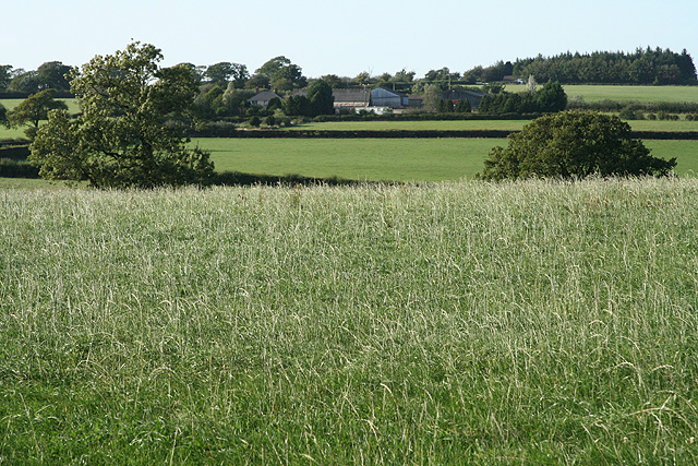
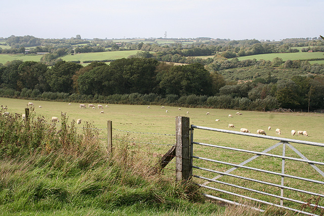
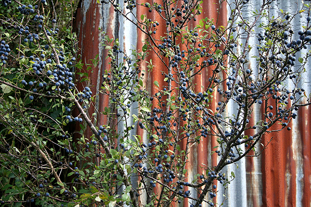
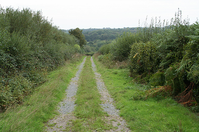
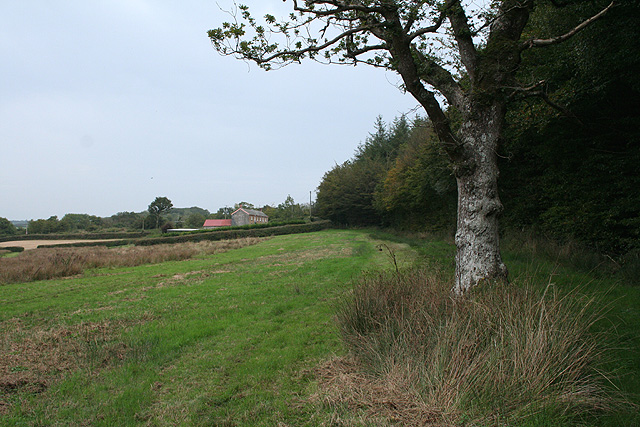
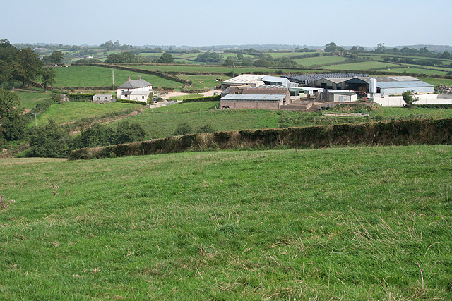
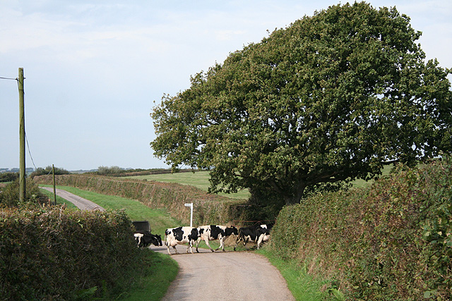
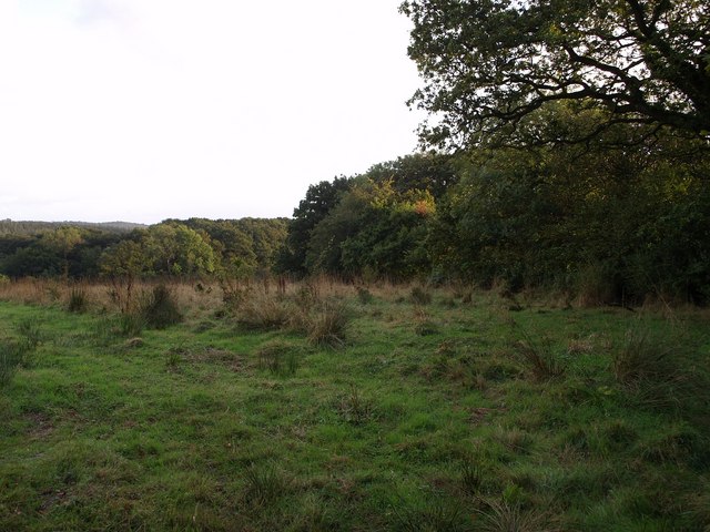
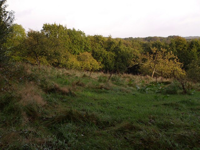
The village is renowned for its lush greenery and dense forests, making it a haven for nature enthusiasts and hikers. The sprawling woodlands surrounding Old Plantation are home to a diverse range of flora and fauna, including ancient oak trees, vibrant wildflowers, and various species of birds and mammals.

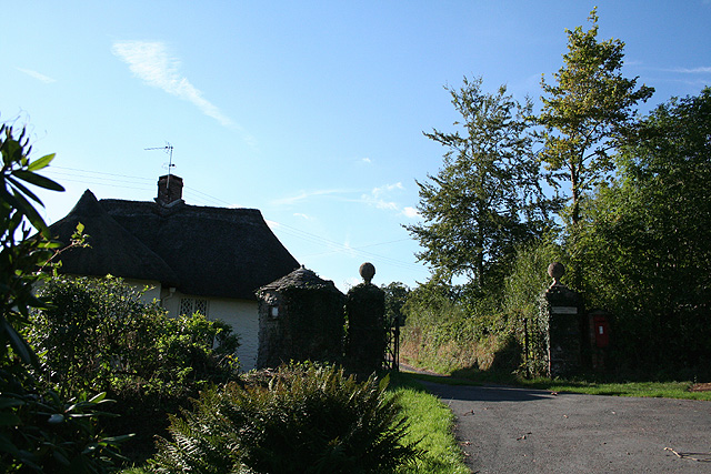
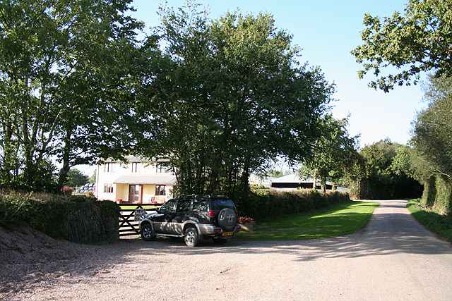
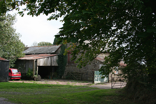
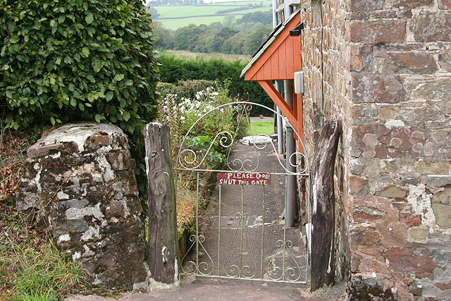
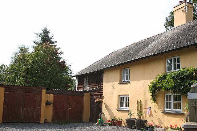
Dating back centuries, the village has a rich history and is dotted with charming old cottages and buildings, giving it a quaint and timeless atmosphere. The local community takes pride in preserving the village's heritage, and many of the buildings have been lovingly restored to their former glory.

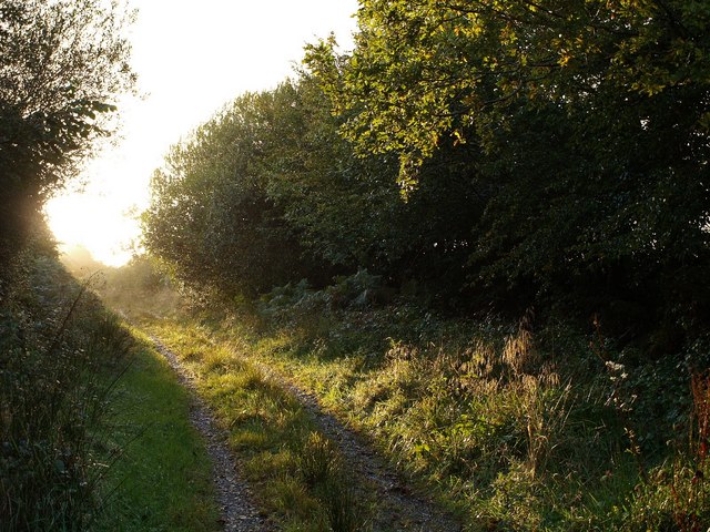
Old Plantation also offers a range of recreational activities for visitors. The nearby river provides opportunities for fishing and boating, while the surrounding hills and moors are perfect for hiking, cycling, and horse riding. The village is also a popular destination for birdwatching, with several designated spots offering a chance to observe rare and migratory species.

In terms of amenities, Old Plantation boasts a small but vibrant community center, a post office, and a handful of quaint shops and cafes. The village also hosts an annual summer fair that attracts both locals and tourists, showcasing local crafts, produce, and traditional entertainment.

Overall, Old Plantation, Devon is a hidden gem that combines natural beauty, historical charm, and a strong sense of community, making it a beloved destination for those seeking a peaceful escape in the heart of the countryside.

If you have any feedback on the listing, please let us know in the comments section below.

Old Plantation Images

Images are sourced within 2km of 50.939636/-3.6872961 or Grid Reference SS8116. Thanks to Geograph Open Source API. All images are credited.

Witheridge: towards Monkey Moor Near Pilliven, looking east-north-east in the direction of Down Cross on the lane from Witheridge
Witheridge: towards Monkey Moor
Near Pilliven, looking east-north-east in the direction of Down Cross on the lane from Witheridge
Witheridge: entrance to Bradford Tracy Looking north west by an entrance lodge to the estate
Witheridge: entrance to Bradford Tracy
Looking north west by an entrance lodge to the estate
Witheridge: above Leat Farm Looking north east
Witheridge: above Leat Farm
Looking north east
Witheridge: New Hole Farm Looking north-north-west. This farm has been built since the 1976 Ordnance Survey Pathfinder map for Tiverton was published. By the road to Bradford Mill and Bradford Tracy
Witheridge: New Hole Farm
Looking north-north-west. This farm has been built since the 1976 Ordnance Survey Pathfinder map for Tiverton was published. By the road to Bradford Mill and Bradford Tracy
Witheridge: towards Broadridge Farm Looking north-north-west
Witheridge: towards Broadridge Farm
Looking north-north-west
Creacombe: Creacombe Parsonage Farm The farm offers bread and breakfast for visitors and there is a camp site. Looking south east
Creacombe: Creacombe Parsonage Farm
The farm offers bread and breakfast for visitors and there is a camp site. Looking south east
Creacombe: near Great Longland Plantation Looking west-north-west towards the Sturcombe River valley. Ash Moor, beyond the square, is on the horizon
Creacombe: near Great Longland Plantation
Looking west-north-west towards the Sturcombe River valley. Ash Moor, beyond the square, is on the horizon
Creacombe: Blackthorn bush with sloes At Creacombe Parsonage Farm. Looking east-south-east
Creacombe: Blackthorn bush with sloes
At Creacombe Parsonage Farm. Looking east-south-east
Creacombe: on Creacombe Moor Looking west-north-west towards farms at Wellhayes and Bulkworthy, both beyond the square
Creacombe: on Creacombe Moor
Looking west-north-west towards farms at Wellhayes and Bulkworthy, both beyond the square
Creacombe: near Crowdhole Looking west-south-west along an access track heading towards Monkey Moor.
Creacombe: near Crowdhole
Looking west-south-west along an access track heading towards Monkey Moor.
Witheridge: Two Moors Way Looking east-north-east towards Bradford Moor House
Witheridge: Two Moors Way
Looking east-north-east towards Bradford Moor House
Witheridge: Bradford Moor House Looking west by the gate
Witheridge: Bradford Moor House
Looking west by the gate
Witheridge: towards North Coombe Looking east by the road from Crowdhole Cross to Bradford Barton
Witheridge: towards North Coombe
Looking east by the road from Crowdhole Cross to Bradford Barton
Creacombe: herd at Crowdhole Cross Looking north-north-west on the lane to Creacombemoor Cross; a left turn leads to Ditchett Cross
Creacombe: herd at Crowdhole Cross
Looking north-north-west on the lane to Creacombemoor Cross; a left turn leads to Ditchett Cross
Witheridge: Bradford Mill This ceased to be a working watermill in the 1930s. The watermill has since become part of a private residence, seen here from the adjoining road. Henry Blackford was miller in the period 1893 - 1906 and William Roberts was listed as miller in 1926; he may well have been the last of the line. Looking south west
Witheridge: Bradford Mill
This ceased to be a working watermill in the 1930s. The watermill has since become part of a private residence, seen here from the adjoining road. Henry Blackford was miller in the period 1893 - 1906 and William Roberts was listed as miller in 1926; he may well have been the last of the line. Looking south west
Field by Grendon Lane North Grendon Plantation is on the right. Taken from Grendon Lane, a green lane across the Sturcombe River valley.
Field by Grendon Lane
North Grendon Plantation is on the right. Taken from Grendon Lane, a green lane across the Sturcombe River valley.
Orchard at North Grendon An orchard beside the farm buildings at North Grendon, which no longer seem to be inhabited.
Orchard at North Grendon
An orchard beside the farm buildings at North Grendon, which no longer seem to be inhabited.
Grendon Lane A rather damp lane brightens up in some evening sunshine. This long track leads from the nearest public road at Crowdhole for almost a kilometre to reach North Grendon.
Grendon Lane
A rather damp lane brightens up in some evening sunshine. This long track leads from the nearest public road at Crowdhole for almost a kilometre to reach North Grendon.
Show me another place!

Old Plantation is located at Grid Ref: SS8116 (Lat: 50.939636, Lng: -3.6872961)

Administrative County: Devon

District: North Devon

Police Authority: Devon and Cornwall

What 3 Words

///rivers.irritate.knees. Near Witheridge, Devon

Related Wikis

Batsworthy

Batsworthy is a village in Devon, England. == References ==

Witheridge

Witheridge is a village and civil parish in the North Devon district of Devon, England. In 2001 the population of the parish was 1162, reducing slightly...

Witheridge F.C.

Witheridge Football Club is a football club based in the Devon village of Witheridge. They are currently members of the Devon & Exeter League Division...

Creacombe

Creacombe is a small village and former civil parish, now in the parish of Rackenford, in the North Devon district of Devon, England. Its nearest town...

Rackenford

Rackenford is a village and civil parish in North Devon, England. It is roughly located 7.31 miles North West of Tiverton and 20 miles South East of Barnstaple...

Nomansland, Devon

Nomansland is a hamlet in Devon, England, with a population of about 150. It is eight miles west of Tiverton. It is so named because it was at one time...

Drayford

Drayford is a village in the English county of Devon, approximately 15 miles north west of Exeter. == External links == Media related to Drayford at Wikimedia...

East Worlington

East Worlington is a civil parish and hamlet in the North Devon administrative area, in the English county of Devon, England.In 2001, the village had 241...

Nearby Amenities

Located within 500m of 50.939636,-3.6872961
The data included in this document is from www.openstreetmap.org. The data is made available under ODbL.

Have you been to Old Plantation?

Leave your review of Old Plantation below (or comments, questions and feedback).