Great Copse
Wood, Forest in Devon Teignbridge
England
Great Copse

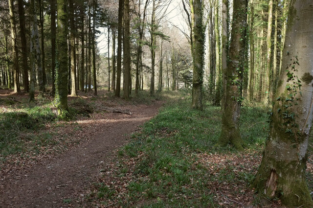
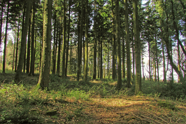
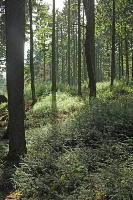
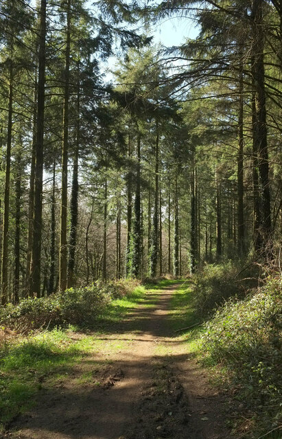
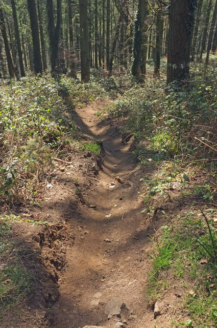
Great Copse is a picturesque wood located in the county of Devon, England. Situated in the southwest region of the country, it covers an area of approximately 100 acres and is a popular destination for nature enthusiasts and outdoor adventurers. The copse is characterized by its dense, lush foliage and towering trees, creating a serene and tranquil atmosphere.
The wood is home to a diverse range of flora and fauna, with an abundance of native species thriving within its boundaries. Oak, beech, and ash trees dominate the landscape, providing a rich habitat for various wildlife including squirrels, rabbits, and a variety of bird species.
Visitors to Great Copse can explore its many walking trails and pathways, which wind their way through the wood, offering delightful views of the surrounding countryside. The copse is also intersected by a small stream, adding to its natural beauty and providing a refreshing spot for a picnic or a moment of relaxation.
The wood has been carefully managed to preserve its natural beauty and ecological integrity. Local conservation efforts have ensured that the copse remains a haven for wildlife and a cherished natural resource for the community. It is a designated Site of Special Scientific Interest (SSSI), recognizing its importance in terms of biodiversity and ecological significance.
Great Copse offers a wonderful opportunity for nature lovers to immerse themselves in the serene beauty of Devon's woodlands, providing a peaceful retreat from the hustle and bustle of modern life.
If you have any feedback on the listing, please let us know in the comments section below.
Great Copse Images
Images are sourced within 2km of 50.625916/-3.6763919 or Grid Reference SX8182. Thanks to Geograph Open Source API. All images are credited.


Great Copse is located at Grid Ref: SX8182 (Lat: 50.625916, Lng: -3.6763919)
Administrative County: Devon
District: Teignbridge
Police Authority: Devon and Cornwall
What 3 Words
///advice.keen.turntable. Near Bovey Tracey, Devon
Nearby Locations
Related Wikis
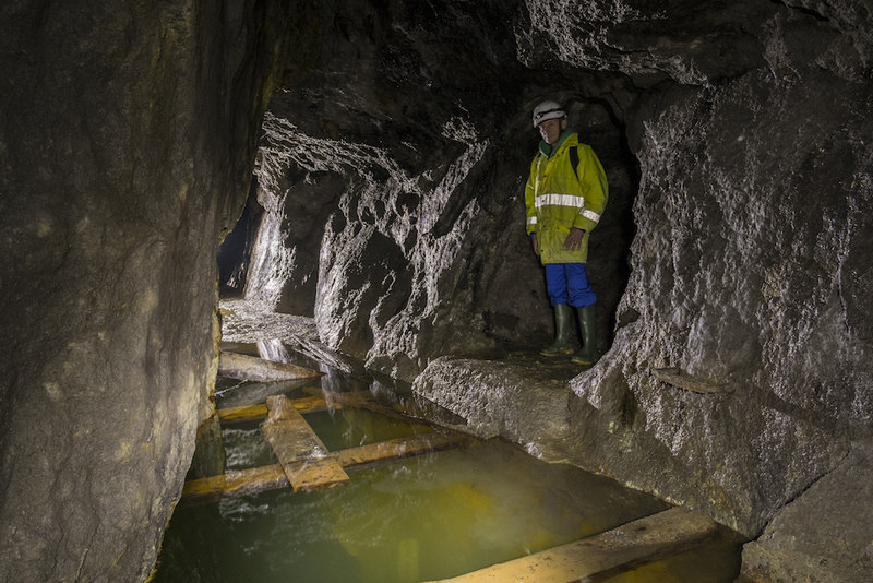
Great Rock Mine
Great Rock Mine is a disused micaceous haematite mine about 3 km north of the town of Bovey Tracey in Devon, England. It was worked from the nineteenth...
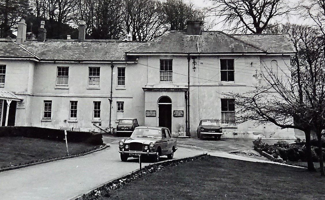
Hawkmoor Hospital
Hawkmoor Hospital, originally known as Hawkmoor County Sanatorium, was a specialist hospital near Bovey Tracey in Devon, England, founded in 1913 as a...

Canonteign Falls
Canonteign Falls is a waterfall in the historic tything of Canonteign in the Teign Valley and Dartmoor National Park near Chudleigh, South Devon, England...
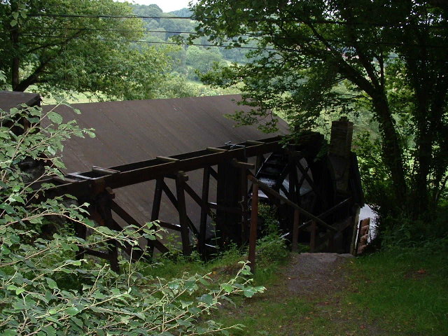
Kelly Mine, Devon
Kelly Mine is a disused metalliferous mine situated on the eastern flank of Dartmoor near the village of Lustleigh in Devon, England. It was intermittently...

Hennock
Hennock is a village and civil parish about 3 miles west north west of Chudleigh, in the Teignbridge district, in the county of Devon, England. In 2011...

Lustleigh railway station
Lustleigh station was on the Moretonhampstead and South Devon Railway serving the village of Lustleigh, Devon, England. Lustleigh was the penultimate station...

Pullabrook Halt railway station
Pullabrook Halt was a railway station opened in 1931 by the Great Western Railway to serve the hamlet of Pullabrook that lies between Bovey Tracey and...
Church of St John the Baptist, Lustleigh
The Church of St John the Baptist is the Church of England parish church of the village of Lustleigh, Devon, located in the centre of the village. ��2...
Nearby Amenities
Located within 500m of 50.625916,-3.6763919Have you been to Great Copse?
Leave your review of Great Copse below (or comments, questions and feedback).