Church Houses

Settlement in Yorkshire Ryedale

England

Church Houses

Near Hazel House Looking SE from the footpath that goes between Hazel House and Church Houses.
Near Hazel House Credit: T Eyre

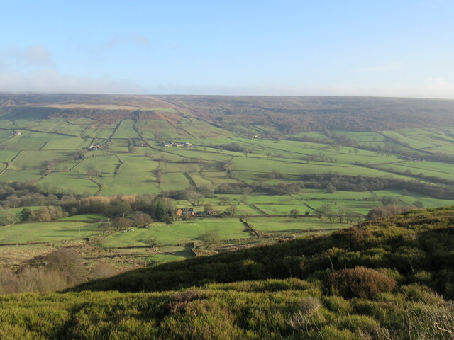
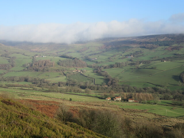
Church Houses is a small village located in the Yorkshire Dales National Park, in North Yorkshire, England. Situated approximately 10 miles north of the market town of Skipton, the village is nestled within the picturesque countryside of the Yorkshire Dales, offering stunning views and a tranquil atmosphere.

The village gets its name from the cluster of houses that surround the local church, St. Michael and All Angels. This charming church dates back to the 12th century and is a prominent feature of the village. Its architecture showcases a mix of medieval and Victorian styles, with a beautiful churchyard that adds to the overall allure of the area.

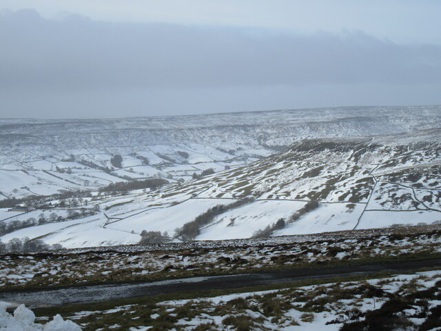
Church Houses is a popular destination for outdoor enthusiasts, as it provides easy access to a variety of walking and cycling routes that traverse the surrounding hills and valleys. The village serves as a perfect base for exploring the Yorkshire Dales, with many scenic trails leading to nearby attractions such as Malham Cove and Gordale Scar.

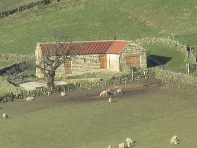
Although Church Houses is predominantly a residential area, there are a few amenities available to visitors. These include a local pub that offers traditional pub food and a warm atmosphere, as well as a tea room where visitors can enjoy a cup of tea and homemade baked goods. Accommodation options in the village are limited but include bed and breakfasts and holiday cottages.

Overall, Church Houses offers a peaceful retreat, away from the hustle and bustle of city life, and provides a gateway to some of the most stunning natural landscapes in Yorkshire.

If you have any feedback on the listing, please let us know in the comments section below.

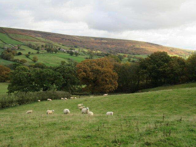
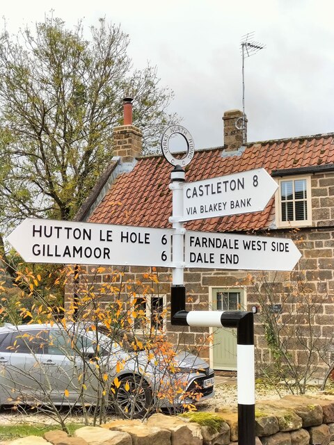
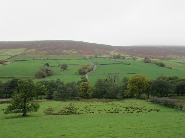
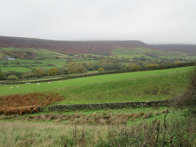
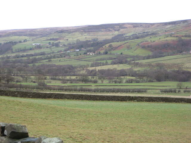
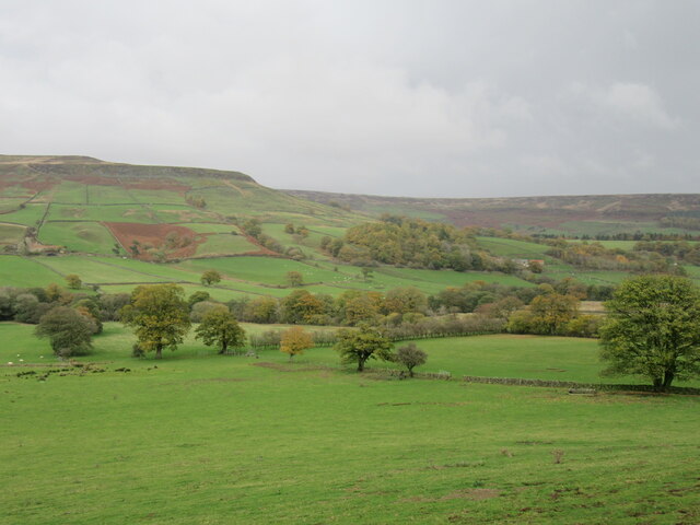
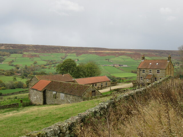
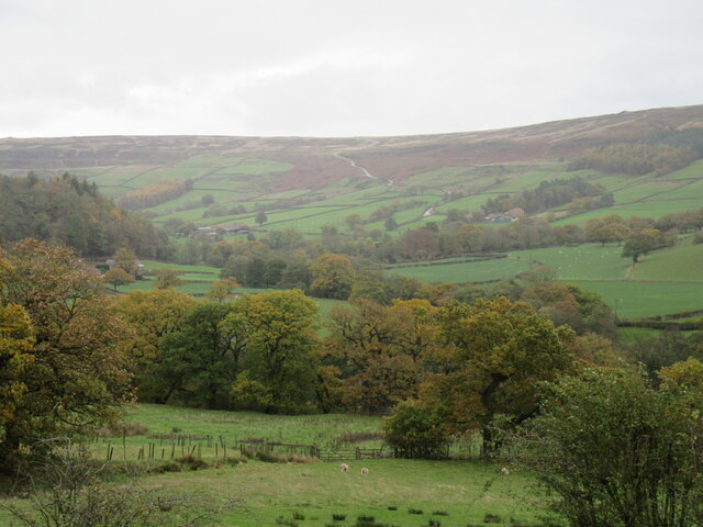
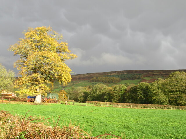
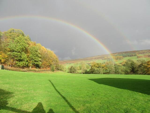
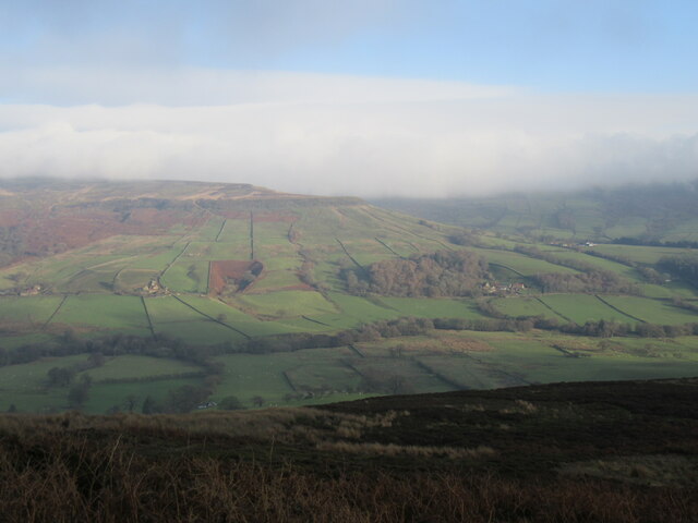
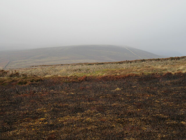
Church Houses Images

Images are sourced within 2km of 54.368688/-0.97113393 or Grid Reference SE6697. Thanks to Geograph Open Source API. All images are credited.

Near Hazel House Looking SE from the footpath that goes between Hazel House and Church Houses.
Near Hazel House
Looking SE from the footpath that goes between Hazel House and Church Houses.
New Direction Sign – Signpost at Church Houses Located at Church Houses on the south side of the T junction of Daleside Road, Red Way and Meckeridge Drive, Farndale East parish. 3 arms and annulus finial.

Milestone Society National ID: YN_SE6697
New Direction Sign – Signpost at Church Houses
Located at Church Houses on the south side of the T junction of Daleside Road, Red Way and Meckeridge Drive, Farndale East parish. 3 arms and annulus finial. Milestone Society National ID: YN_SE6697
Near Church Houses Looking west from Daleside Road.
Near Church Houses
Looking west from Daleside Road.
Near Hollins Farm Looking NW from Daleside Road.
Near Hollins Farm
Looking NW from Daleside Road.
Near Monket House Looking NE from Daleside Road.
Near Monket House
Looking NE from Daleside Road.
Near Broom Hill Looking east across Farndale.
Near Broom Hill
Looking east across Farndale.
Monket House At the part of the Daleside Road with the best views.
Monket House
At the part of the Daleside Road with the best views.
Looking towards Blakey Bank Looking NE towards Church Houses and Blakey Bank.
Looking towards Blakey Bank
Looking NE towards Church Houses and Blakey Bank.
Just outside Church Houses Looking NE.
Just outside Church Houses
Looking NE.
Double rainbow A double rainbow at Church Houses.
Double rainbow
A double rainbow at Church Houses.
Out of the low cloud Farndale appearing out of the low cloud.
Out of the low cloud
Farndale appearing out of the low cloud.
Horn Ridge Horn Ridge in the low cloud.
Horn Ridge
Horn Ridge in the low cloud.
Horn Ridge view Looking east across Farndale.
Horn Ridge view
Looking east across Farndale.
Horn Ridge view 2 Looking NE into Farndale.
Horn Ridge view 2
Looking NE into Farndale.
Road at top of Blakey Bank
High Barn A full-zoom view of High Barn, which has been re-built since 2015.

<a title="https://www.geograph.org.uk/photo/6052185" href="https://www.geograph.org.uk/photo/6052185">Link</a>
High Barn
A full-zoom view of High Barn, which has been re-built since 2015. Link
High Blakey Moor Looking south from the old railway line.
High Blakey Moor
Looking south from the old railway line.
The top of Blakey Bank Looking west into Farndale.
The top of Blakey Bank
Looking west into Farndale.
Show me another place!

Church Houses is located at Grid Ref: SE6697 (Lat: 54.368688, Lng: -0.97113393)

Division: North Riding

Administrative County: North Yorkshire

District: Ryedale

Police Authority: North Yorkshire

What 3 Words

///recliner.cracking.shirt. Near Bilsdale, North Yorkshire

Nearby Locations

Farndale Church Houses

Related Wikis

Farndale Local Nature Reserve

Farndale Local Nature Reserve is a Local Nature Reserve (LNR) in the valley of Farndale, North Yorkshire, England. It is located within the North York...

Lion Inn

The Lion Inn is a public house at Blakey Ridge, near Kirkbymoorside, in North Yorkshire, England. The building was completed between 1553 and 1558 (dates...

Farndale

Farndale is a valley and community in North Yorkshire, England, which is known for the daffodils which flower each spring along a 7-mile (11 km) stretch...

Ironstone mining in Rosedale

The Ironstone mining in Rosedale, was a major mining concern, in Rosedale, North Yorkshire, England. It flourished in the 19th century and ceased in the...

Nearby Amenities

Located within 500m of 54.368688,-0.97113393
Church Houses
Place: hamlet
Lat/Long: 54.3687713/-0.9707152
Cafe
Daffy Caffy
Addr City: York
Addr Postcode: YO62 7LF
Addr Suburb: Church Houses
Lat/Long: 54.3646858/-0.9732999
Pub
Feversham Arms
Addr City: York
Addr Postcode: YO62 7LF
Addr Suburb: Church Houses
Website: https://fevershamarmsinn.co.uk/
Lat/Long: 54.368659/-0.9709691
Hiking: yes
Information: guidepost
Tourism: information
Lat/Long: 54.3656432/-0.9728031
Post Box
Collection Times: Mo-Fr 16:15; Sa 10:30
Post Box Type: wall
Ref: YO62 273
Royal Cypher: VR
Royal Cypher Wikidata: Q33102356
Lat/Long: 54.3687899/-0.9708038
Give Way
Direction: backward
Lat/Long: 54.3687099/-0.9711504
Telephone
Booth: K6
Covered: booth
Lat/Long: 54.3686211/-0.9711234
Give Way
Direction: forward
Lat/Long: 54.3689129/-0.9704791
Give Way
Direction: backward
Lat/Long: 54.3684564/-0.9712356
Farndale Cottages
Addr Postcode: YO62 7LF
Tourism: guest_house
Lat/Long: 54.3690263/-0.9707563
High Mill
Place: locality
Lat/Long: 54.3645514/-0.9730984
Passing Place
Lat/Long: 54.3678682/-0.9643399
Information: board
Tourism: information
Lat/Long: 54.3688554/-0.9681225
Passing Place
Lat/Long: 54.3680545/-0.972722
Passing Place
Lat/Long: 54.3677868/-0.9752378
Passing Place
Lat/Long: 54.3675516/-0.977324
Passing Place
Lat/Long: 54.3699682/-0.9697931
Passing Place
Lat/Long: 54.3703528/-0.9682869
Defibrillator
Defibrillator Location: outside Feversham Arms, Church Houses, Farndale - next to red phone box
Emergency: defibrillator
Indoor: no
Lat/Long: 54.3686414/-0.9711262
The data included in this document is from www.openstreetmap.org. The data is made available under ODbL.

Have you been to Church Houses?

Leave your review of Church Houses below (or comments, questions and feedback).