Farndale

Valley in Yorkshire Ryedale

England

Farndale

View from the chapel Looking west across Farndale from the old chapel.
View from the chapel Credit: T Eyre

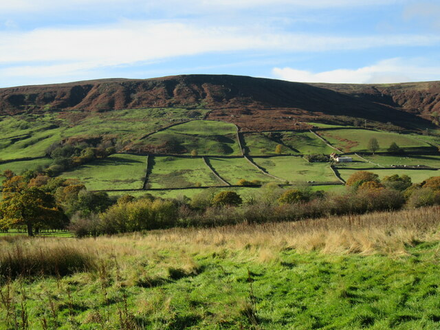
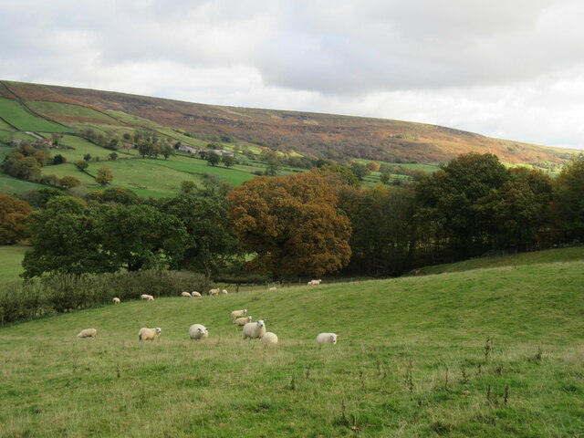
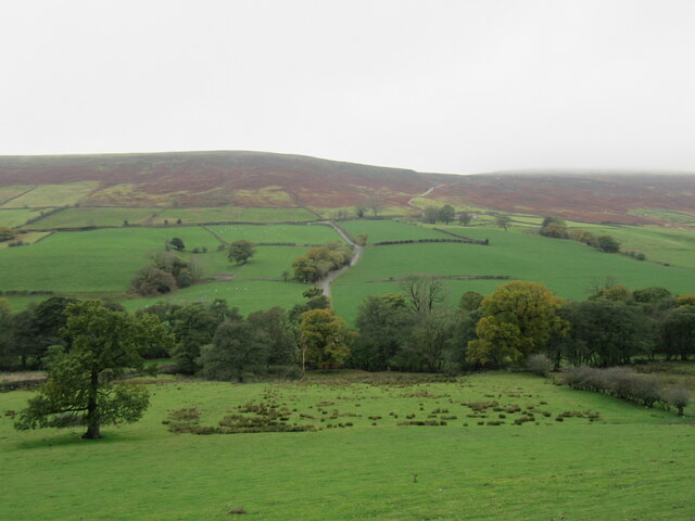
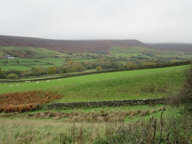
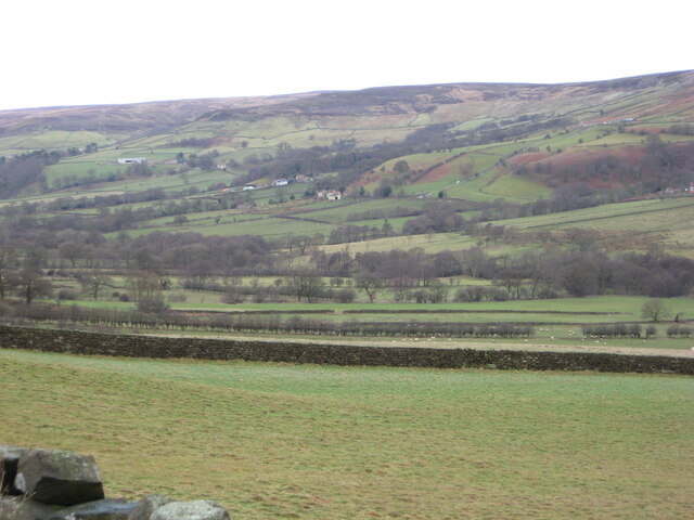
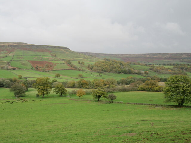
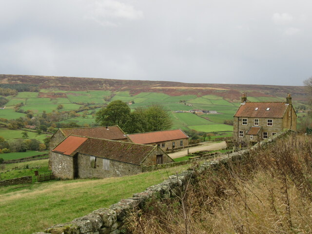
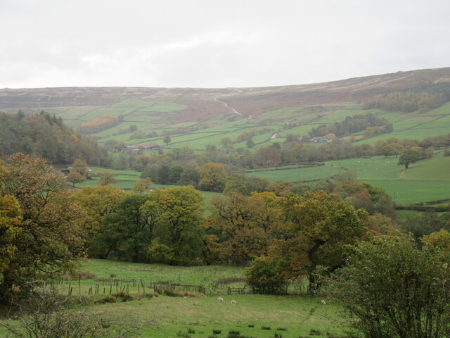
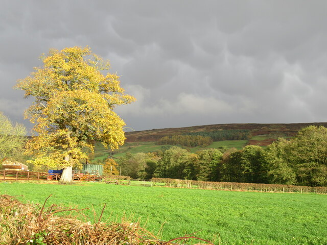
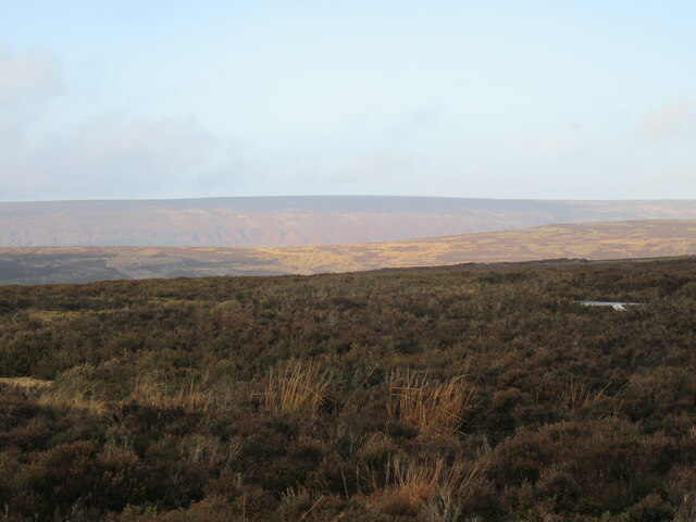
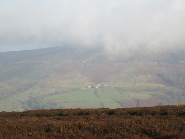
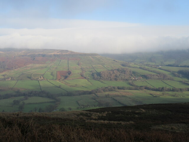
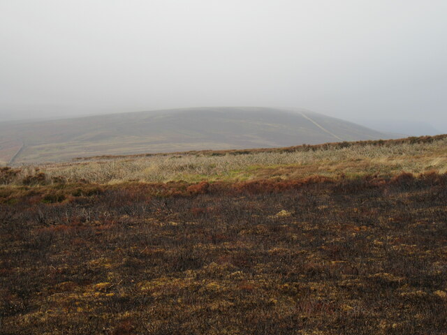
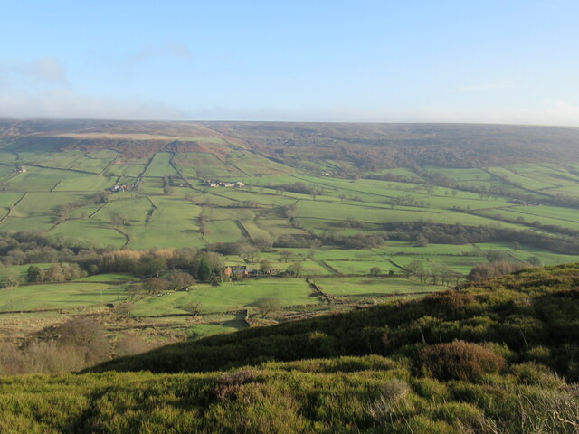
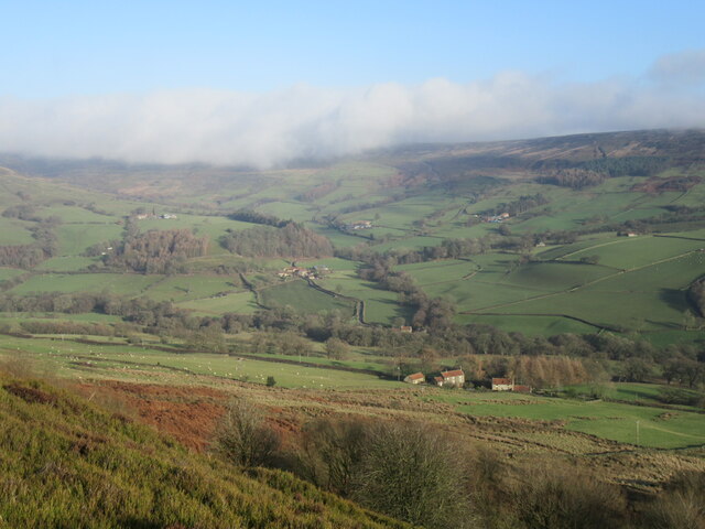
Farndale is a picturesque valley located in the North York Moors National Park in Yorkshire, England. Situated approximately 40 miles northeast of York, this charming rural area is known for its stunning natural beauty and tranquil atmosphere.

The valley is formed by the River Dove, which meanders through the rolling hills and lush meadows, creating a serene and idyllic setting. Farndale is particularly renowned for its vibrant display of wild daffodils that bloom along the riverbanks during the spring months, attracting numerous visitors from near and far.

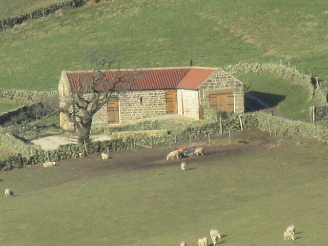
The valley is home to several small hamlets and farms, with a population of around 200 people. The communities in Farndale are close-knit and maintain a strong sense of rural heritage and tradition. The residents of the valley are known for their welcoming nature and their commitment to preserving the natural environment.

The landscape of Farndale offers ample opportunities for outdoor activities such as hiking, cycling, and birdwatching. There are numerous walking trails that traverse the valley, allowing visitors to explore its abundant flora and fauna. The valley is also a popular spot for fishing enthusiasts, as the River Dove is known for its abundance of brown trout.

Farndale is famous for its annual Daffodil Festival, held in March, which celebrates the blooming of the daffodils. The festival attracts a large number of tourists who come to witness the vibrant spectacle and take part in various events and activities.

In conclusion, Farndale is a charming and scenic valley in Yorkshire, offering a peaceful retreat for nature lovers and those seeking a rural escape. Its natural beauty, friendly communities, and cultural events make it a delightful destination for visitors of all ages.

If you have any feedback on the listing, please let us know in the comments section below.

Farndale Images

Images are sourced within 2km of 54.367026/-0.98390439 or Grid Reference SE6697. Thanks to Geograph Open Source API. All images are credited.

View from the chapel Looking west across Farndale from the old chapel.
View from the chapel
Looking west across Farndale from the old chapel.
Near Hazel House Looking SE from the footpath that goes between Hazel House and Church Houses.
Near Hazel House
Looking SE from the footpath that goes between Hazel House and Church Houses.
New Direction Sign – Signpost at Church Houses Located at Church Houses on the south side of the T junction of Daleside Road, Red Way and Meckeridge Drive, Farndale East parish. 3 arms and annulus finial.

Milestone Society National ID: YN_SE6697
New Direction Sign – Signpost at Church Houses
Located at Church Houses on the south side of the T junction of Daleside Road, Red Way and Meckeridge Drive, Farndale East parish. 3 arms and annulus finial. Milestone Society National ID: YN_SE6697
Near Church Houses Looking west from Daleside Road.
Near Church Houses
Looking west from Daleside Road.
Near Hollins Farm Looking NW from Daleside Road.
Near Hollins Farm
Looking NW from Daleside Road.
Near Monket House Looking NE from Daleside Road.
Near Monket House
Looking NE from Daleside Road.
Near Broom Hill Looking east across Farndale.
Near Broom Hill
Looking east across Farndale.
Monket House At the part of the Daleside Road with the best views.
Monket House
At the part of the Daleside Road with the best views.
Looking towards Blakey Bank Looking NE towards Church Houses and Blakey Bank.
Looking towards Blakey Bank
Looking NE towards Church Houses and Blakey Bank.
Just outside Church Houses Looking NE.
Just outside Church Houses
Looking NE.
Double rainbow A double rainbow at Church Houses.
Double rainbow
A double rainbow at Church Houses.
Golden Heights Looking across to Shaw Ridge from Westside Road.
Golden Heights
Looking across to Shaw Ridge from Westside Road.
Hill Houses Looking across Farndale towards Hill Houses.
Hill Houses
Looking across Farndale towards Hill Houses.
Out of the low cloud Farndale appearing out of the low cloud.
Out of the low cloud
Farndale appearing out of the low cloud.
Horn Ridge Horn Ridge in the low cloud.
Horn Ridge
Horn Ridge in the low cloud.
Horn Ridge view Looking east across Farndale.
Horn Ridge view
Looking east across Farndale.
Horn Ridge view 2 Looking NE into Farndale.
Horn Ridge view 2
Looking NE into Farndale.
High Barn A full-zoom view of High Barn, which has been re-built since 2015.

<a title="https://www.geograph.org.uk/photo/6052185" href="https://www.geograph.org.uk/photo/6052185">Link</a>
High Barn
A full-zoom view of High Barn, which has been re-built since 2015. Link
Show me another place!

Farndale is located at Grid Ref: SE6697 (Lat: 54.367026, Lng: -0.98390439)

Division: North Riding

Administrative County: North Yorkshire

District: Ryedale

Police Authority: North Yorkshire

What 3 Words

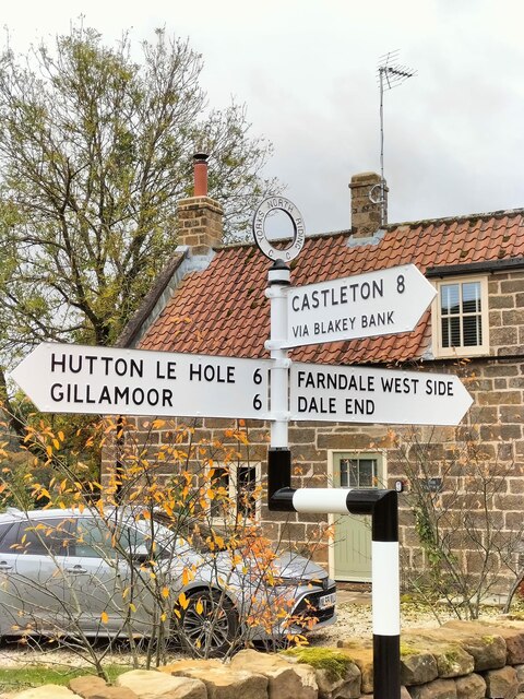
///hacksaw.ripen.reporting. Near Bilsdale, North Yorkshire

Nearby Locations

Farndale Church Houses

Related Wikis

Farndale Local Nature Reserve

Farndale Local Nature Reserve is a Local Nature Reserve (LNR) in the valley of Farndale, North Yorkshire, England. It is located within the North York...

Farndale

Farndale is a valley and community in North Yorkshire, England, which is known for the daffodils which flower each spring along a 7-mile (11 km) stretch...

Lion Inn

The Lion Inn is a public house at Blakey Ridge, near Kirkbymoorside, in North Yorkshire, England. The building was completed between 1553 and 1558 (dates...

Ironstone mining in Rosedale

The Ironstone mining in Rosedale, was a major mining concern, in Rosedale, North Yorkshire, England. It flourished in the 19th century and ceased in the...

Nearby Amenities

Located within 500m of 54.367026,-0.98390439
Barrier: stile
Lat/Long: 54.3645302/-0.9799839
Bench
Lat/Long: 54.3644574/-0.9798402
Direction West: Bransdale
Guide Type: destination
Information: guidepost
Tourism: information
Lat/Long: 54.3662831/-0.9851721
Monket House
Place: farm
Lat/Long: 54.3664585/-0.9848274
Passing Place
Lat/Long: 54.3675516/-0.977324
Passing Place
Lat/Long: 54.3669353/-0.9794799
Passing Place
Lat/Long: 54.3665791/-0.9811118
The data included in this document is from www.openstreetmap.org. The data is made available under ODbL.

Have you been to Farndale?

Leave your review of Farndale below (or comments, questions and feedback).