Longpark Copse

Wood, Forest in Devon Teignbridge

England

Longpark Copse

The Valley by Haswell Brake A woodland plantation covers the western slope of the valley.
The Valley by Haswell Brake Credit: Tony Atkin

Longpark Copse is a picturesque woodland located in Devon, a county in South West England. Nestled amidst the rolling hills and lush countryside, this copse offers a tranquil retreat for nature enthusiasts and outdoor adventurers alike.

Covering an area of approximately 20 acres, Longpark Copse is primarily composed of broadleaf trees, including oak, beech, and ash. The dense canopy of foliage provides a haven for a diverse range of flora and fauna, making it a haven for wildlife. Visitors can expect to encounter a variety of bird species, such as woodpeckers and tits, as well as small mammals like squirrels and rabbits.

The copse is crisscrossed by a network of well-maintained footpaths, allowing visitors to explore its natural beauty at their own pace. The pathways wind through the woodland, leading to open clearings and peaceful glades, where one can rest and appreciate the serenity of the surroundings. There are also several benches strategically placed throughout the copse, providing ideal spots for contemplation or a picnic with family and friends.

Longpark Copse is open to the public year-round, with no admission fee. It is a popular destination for nature walks, photography, and simply immersing oneself in the tranquility of the natural world. The copse is easily accessible by car, with a small parking area located nearby.

Overall, Longpark Copse offers a slice of untouched nature in the heart of Devon. Its scenic beauty and peaceful ambiance make it an ideal destination for those seeking respite from the hustle and bustle of everyday life.

If you have any feedback on the listing, please let us know in the comments section below.

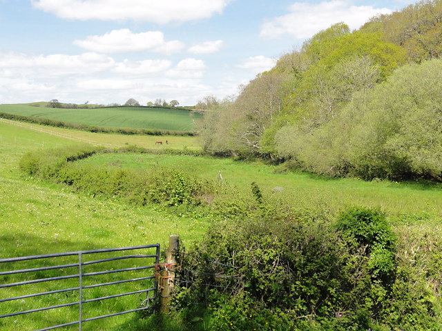
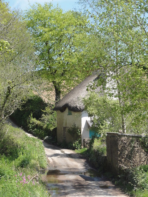
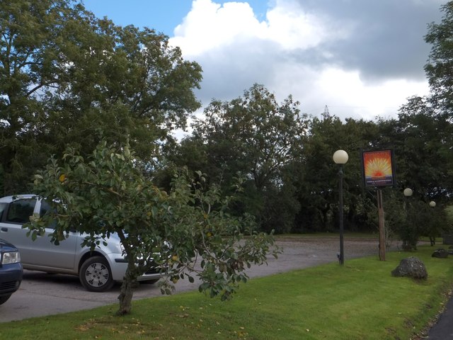
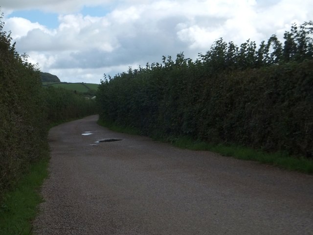
Longpark Copse Images

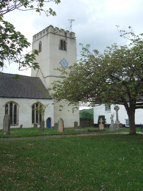
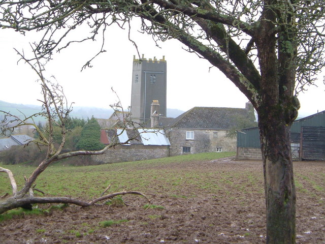
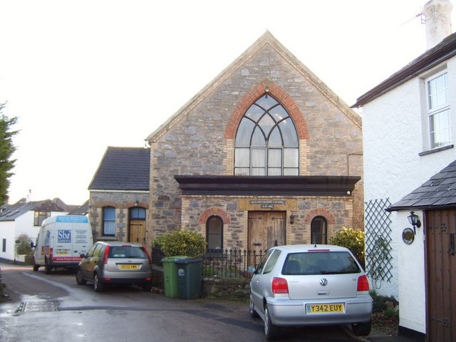
Images are sourced within 2km of 50.51042/-3.7079378 or Grid Reference SX7869. Thanks to Geograph Open Source API. All images are credited.

The Valley by Haswell Brake A woodland plantation covers the western slope of the valley.
The Valley by Haswell Brake
A woodland plantation covers the western slope of the valley.
The Cottage in the Valley Bottom near Haswell Springtime comes to the cottage.
The Cottage in the Valley Bottom near Haswell
Springtime comes to the cottage.
Farm Track near Haswell
Solitary tree by the road near Wickeridge The tree is on a bend in the road, close to Wickeridge Lodge
Solitary tree by the road near Wickeridge
The tree is on a bend in the road, close to Wickeridge Lodge
Car park and sign of the Rising Sun inn
Farmland at Bovey Cross and its signpost The styles of writing on the fingers of the signpost distinguish between the minor road going left to right and the even-more-minor road ahead.
Farmland at Bovey Cross and its signpost
The styles of writing on the fingers of the signpost distinguish between the minor road going left to right and the even-more-minor road ahead.
From Bovey Cross, looking towards Denbury A minor road, with the woods at Yeatt on the skyline.
From Bovey Cross, looking towards Denbury
A minor road, with the woods at Yeatt on the skyline.
Purcombe Cross road junction
A damaged signpost at Blakewell Cross The OS map calls this Blackwell Cross.  One arm of the signpost is completely missing, and a second has been cut off
A damaged signpost at Blakewell Cross
The OS map calls this Blackwell Cross. One arm of the signpost is completely missing, and a second has been cut off
Minor road south of Blakewell Cross Just to the south of the junction, there is a lone tree in the hedge.
Minor road south of Blakewell Cross
Just to the south of the junction, there is a lone tree in the hedge.
Woodland at Lake Cross A path into the woods is marked as "Pedestrians only"
Woodland at Lake Cross
A path into the woods is marked as "Pedestrians only"
Almost a tunnel of greenery at Waytown The crossroads at Waytown is surrounded by woodland.  This is the road to Broadhempston
Almost a tunnel of greenery at Waytown
The crossroads at Waytown is surrounded by woodland. This is the road to Broadhempston
Meadow near Wayesford From a green lane / route with public access to Beaston, with trees along a tributary of the Hems.
Meadow near Wayesford
From a green lane / route with public access to Beaston, with trees along a tributary of the Hems.
Cottage near Halswell The C17 thatched Wayseford is described at <span class="nowrap"><a title="http://list.english-heritage.org.uk/resultsingle.aspx?uid=1164270&searchtype=mapsearch" rel="nofollow ugc noopener" href="http://list.english-heritage.org.uk/resultsingle.aspx?uid=1164270&searchtype=mapsearch">Link</a><img style="margin-left:2px;" alt="External link" title="External link - shift click to open in new window" src="https://s1.geograph.org.uk/img/external.png" width="10" height="10"/></span> and also shown in <a href="https://www.geograph.org.uk/photo/1072123">SX7867 : Cottage near Halswell</a>. It may have been a cider-house. View from the same gateway as <a href="https://www.geograph.org.uk/photo/3778157">SX7867 : Meadow near Wayesford</a>.
Cottage near Halswell
The C17 thatched Wayseford is described at LinkExternal link and also shown in SX7867 : Cottage near Halswell. It may have been a cider-house. View from the same gateway as SX7867 : Meadow near Wayesford.
Oak near Wayesford A route with public access passes beneath this oak as it approaches a bridge over a tributary of the Hems.
Oak near Wayesford
A route with public access passes beneath this oak as it approaches a bridge over a tributary of the Hems.
Alders near Wayesford Seen from beneath the oak shown in <a href="https://www.geograph.org.uk/photo/3778182">SX7867 : Oak near Wayesford</a>, this clump of alders is where the green lane crosses a tributary of the Hems.
Alders near Wayesford
Seen from beneath the oak shown in SX7867 : Oak near Wayesford, this clump of alders is where the green lane crosses a tributary of the Hems.
Marshy land near Halswell From the green lane shown in <a href="https://www.geograph.org.uk/photo/3778203">SX7867 : Alders near Wayesford</a>. Beyond the marshy valley of a tributary of the Hems, and beyond the ploughed field in the middle distance, is the actual Hems valley, with green fields on the hill beyond.
Marshy land near Halswell
From the green lane shown in SX7867 : Alders near Wayesford. Beyond the marshy valley of a tributary of the Hems, and beyond the ploughed field in the middle distance, is the actual Hems valley, with green fields on the hill beyond.
Green lane near Halswell This route with public access follows the valley of a tributary of the River Hems.
Green lane near Halswell
This route with public access follows the valley of a tributary of the River Hems.
Show me another place!

Longpark Copse is located at Grid Ref: SX7869 (Lat: 50.51042, Lng: -3.7079378)

Administrative County: Devon

District: Teignbridge

Police Authority: Devon and Cornwall

What 3 Words

///supposed.bypasses.froze. Near Ashburton, Devon

Nearby Locations

Kiln Copse Longpark Copse

Related Wikis

Denbury and Torbryan

Denbury and Torbryan is a civil parish in Teignbridge, Devon, England. It includes the villages of Denbury and Torbryan. As of 2019, it has a population...

Woodland, Devon

Woodland is a small hamlet and civil parish in Teignbridge, Devon, England. Its nearest town is Ashburton. == References ==

Bickington

Bickington is a village and civil parish in the Teignbridge district of Devon, England, on the east edge of the Dartmoor National Park. At the 2001 census...

West Ogwell Church

West Ogwell Church in Ogwell, Devon, England was built in the 13th century. It is recorded in the National Heritage List for England as a designated Grade...

Nearby Amenities

Located within 500m of 50.51042,-3.7079378
Woodland
Is In: Devon, England, UK
Place: hamlet
Lat/Long: 50.5070816/-3.7061767
Design: barrel
Power: tower
Lat/Long: 50.5137788/-3.7045009
Design: barrel
Power: tower
Lat/Long: 50.5117259/-3.7072835
Design: barrel
Power: tower
Lat/Long: 50.5093823/-3.7104231
Design: barrel
Power: tower
Lat/Long: 50.5067131/-3.711431
Pub
Rising Sun
Wikidata: Q80476658
Lat/Long: 50.514781/-3.7081876
Restaurant
Lat/Long: 50.5147776/-3.7080749
Generator Method: photovoltaic
Generator Output Electricity: yes
Generator Source: solar
Generator Type: solar_photovoltaic_panel
Location: roof
Power: generator
Lat/Long: 50.5139382/-3.7122524
Generator Method: photovoltaic
Generator Output Electricity: yes
Generator Source: solar
Generator Type: solar_photovoltaic_panel
Location: roof
Power: generator
Lat/Long: 50.5139207/-3.7123168
The data included in this document is from www.openstreetmap.org. The data is made available under ODbL.

Have you been to Longpark Copse?

Leave your review of Longpark Copse below (or comments, questions and feedback).