East Plantation

Wood, Forest in Somerset Somerset West and Taunton

England

East Plantation

Twitchen : Countryside Scenery Looking across the grassy fields.
Twitchen : Countryside Scenery Credit: Lewis Clarke

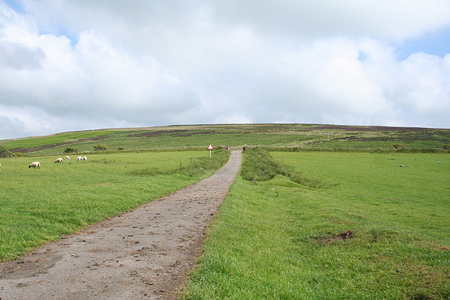
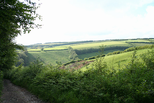
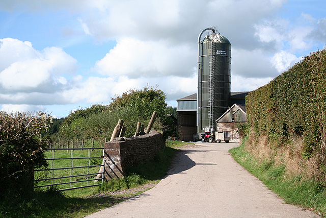
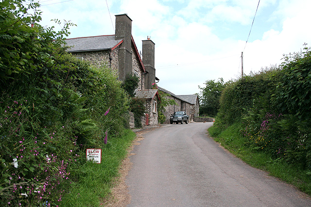
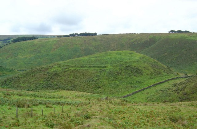
East Plantation, Somerset (Wood, Forest) is a picturesque rural area located in the county of Somerset, England. Nestled amidst the rolling hills and lush green landscapes, it is renowned for its abundant woodlands and captivating forests. Covering an extensive area, East Plantation is a haven for nature enthusiasts and offers a tranquil escape from the hustle and bustle of city life.

The woodlands of East Plantation boast a diverse range of tree species, including oak, beech, ash, and birch, creating a rich and vibrant tapestry of colors throughout the seasons. The forested areas are home to a variety of wildlife, from deer and foxes to birds of prey and smaller mammals. Nature lovers can explore the numerous walking trails and enjoy the symphony of birdsong that fills the air.

The enchanting beauty of East Plantation is further enhanced by the presence of babbling brooks and small streams that meander through the woodlands. These water features not only add to the aesthetic appeal but also provide a valuable habitat for aquatic fauna and flora.

In addition to its natural splendor, East Plantation offers a range of outdoor activities for visitors. From hiking and cycling to picnicking and camping, there is something for everyone to enjoy. The area is also popular for birdwatching and photography, as it provides ample opportunities to capture stunning shots of the local wildlife and landscapes.

Overall, East Plantation, Somerset (Wood, Forest) is a captivating destination that showcases the beauty of the English countryside. Its woodlands and forests provide a sanctuary for both nature lovers and those seeking a peaceful retreat in the heart of nature.

If you have any feedback on the listing, please let us know in the comments section below.

East Plantation Images

Images are sourced within 2km of 51.090208/-3.7392666 or Grid Reference SS7833. Thanks to Geograph Open Source API. All images are credited.

Twitchen : Countryside Scenery Looking across the grassy fields.
Twitchen : Countryside Scenery
Looking across the grassy fields.
North Molton: towards the Mole valley Near Darlick Moors, looking west-south-west
North Molton: towards the Mole valley
Near Darlick Moors, looking west-south-west
North Molton: near Long Holcombe Cross Looking south-east over sheep country; by the lane from North Radworthy
North Molton: near Long Holcombe Cross
Looking south-east over sheep country; by the lane from North Radworthy
Twitchen: near Twitchen Ball Corner Looking south west below the North Molton Ridge
Twitchen: near Twitchen Ball Corner
Looking south west below the North Molton Ridge
Four Miles to Everywhere! Just inside of the Devon-Somerset Border, this signpost appears to be four miles from everywhere!  Another one slightly further up contains the location of where I came from, but as that was more than four miles away doesn't really count...
Four Miles to Everywhere!
Just inside of the Devon-Somerset Border, this signpost appears to be four miles from everywhere! Another one slightly further up contains the location of where I came from, but as that was more than four miles away doesn't really count...
Exmoor: Sportman’s Inn One of the most westerly pubs in Somerset, virtually on the border with Devon near Sandyway Cross. Looking north
Exmoor: Sportman’s Inn
One of the most westerly pubs in Somerset, virtually on the border with Devon near Sandyway Cross. Looking north
North Molton: towards Darlick Moor Looking south near the headwaters of the river Mole
North Molton: towards Darlick Moor
Looking south near the headwaters of the river Mole
North Molton: by Longstone Wells Looking north-north-west with Fyldon Common in the distance, on the horizon
North Molton: by Longstone Wells
Looking north-north-west with Fyldon Common in the distance, on the horizon
North Molton: gated lane Looking south east: the lane leads to moorland on North Molton Ridge
North Molton: gated lane
Looking south east: the lane leads to moorland on North Molton Ridge
North Molton: moorland lane Between gates on the lane heading over North Molton Ridge. Looking south east
North Molton: moorland lane
Between gates on the lane heading over North Molton Ridge. Looking south east
North Molton: towards Longstone Wells Looking west-north-west towards the farm
North Molton: towards Longstone Wells
Looking west-north-west towards the farm
North Molton: on North Molton Ridge Looking south-south-west
North Molton: on North Molton Ridge
Looking south-south-west
North Molton: by Darlick Corner Looking west-south-west with North Molton Ridge to the left
North Molton: by Darlick Corner
Looking west-south-west with North Molton Ridge to the left
Exmoor: bridleway to Horsen Looking north west on a track some way above Sherdon Bridge
Exmoor: bridleway to Horsen
Looking north west on a track some way above Sherdon Bridge
Twitchen: at Mudgate Cross Looking north-north-east above the Litton Water
Twitchen: at Mudgate Cross
Looking north-north-east above the Litton Water
Exmoor: on Horsen Hill By the bridleway linking Sherdon Farm and Horsen Farm. The building surrounded by trees over on the left is Wintershead Farm
Exmoor: on Horsen Hill
By the bridleway linking Sherdon Farm and Horsen Farm. The building surrounded by trees over on the left is Wintershead Farm
View south from Exmoor An old hedgerow is marked by windswept trees.
View south from Exmoor
An old hedgerow is marked by windswept trees.
Moorland at Long Holcombe The vegetation here is mainly sedge, and the surface is rather boggy.
Moorland at Long Holcombe
The vegetation here is mainly sedge, and the surface is rather boggy.
Show me another place!

East Plantation is located at Grid Ref: SS7833 (Lat: 51.090208, Lng: -3.7392666)

Administrative County: Somerset

District: Somerset West and Taunton

Police Authority: Avon and Somerset

What 3 Words

///vibe.sleepy.rebel. Near South Molton, Devon

Related Wikis

Twitchen, Devon

Twitchen is a village and civil parish in Devon, England, located within the North Devon local authority area. Historically it formed part of South Molton...

North Radworthy

North Radworthy is a hamlet and historic estate in the civil parish and former manor of North Molton, in the North Devon district of the county of Devon...

South Radworthy

South Radworthy is a hamlet in the civil parish of North Molton, in the North Devon District of the county of Devon, England. It is about three miles to...

Cow Castle

Cow Castle is an Iron Age hillfort 5.75 kilometres (4 mi) West South West of Exford, Somerset, England within the Exmoor National Park. It is a Scheduled...
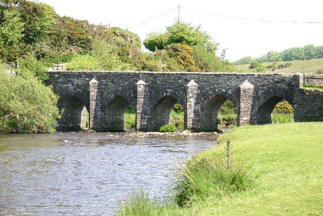
Landacre Bridge

Landacre Bridge carries Landacre Lane across the River Barle near Withypool on Exmoor in the English county of Somerset. It has been designated as a scheduled...

Wheal Eliza Mine

Wheal Eliza Mine was an unsuccessful copper and iron mine on the River Barle near Simonsbath on Exmoor in the English county of Somerset. The first mining...

Bickingcott

Bickingcott is a village in Devon, England. == External links == Media related to Bickingcott at Wikimedia Commons

Bentwitchen

Bentwitchen is a hamlet in Devon, England. == References ==

Have you been to East Plantation?

Leave your review of East Plantation below (or comments, questions and feedback).