Church End

Settlement in Cambridgeshire South Cambridgeshire

England

Church End

St Mary’s Church, Over A Grade I listed building with C13th origins but mainly early C14th, see: <span class="nowrap"><a title="https://britishlistedbuildings.co.uk/101317811-church-of-st-mary-over" rel="nofollow ugc noopener" href="https://britishlistedbuildings.co.uk/101317811-church-of-st-mary-over">Link</a><img style="margin-left:2px;" alt="External link" title="External link - shift click to open in new window" src="https://s1.geograph.org.uk/img/external.png" width="10" height="10"/></span> .
Photo taken during the 2021 sponsored cycle ride in aid of Cambridgeshire Historic Churches Trust (<span class="nowrap"><a title="https://camhct.uk/" rel="nofollow ugc noopener" href="https://camhct.uk/">Link</a><img style="margin-left:2px;" alt="External link" title="External link - shift click to open in new window" src="https://s1.geograph.org.uk/img/external.png" width="10" height="10"/></span> ). Next stop: <a href="https://www.geograph.org.uk/photo/6963611">TL3669 : St Andrew's Church, Swavesey</a>.
St Mary’s Church, Over Credit: Martin Tester

Church End is a small village located in the county of Cambridgeshire, England. Situated approximately 7 miles west of the city of Cambridge, Church End is a picturesque and tranquil settlement with a population of around 300 residents.

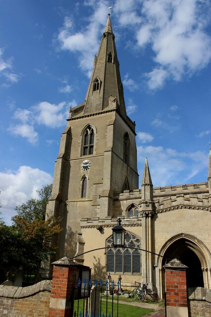
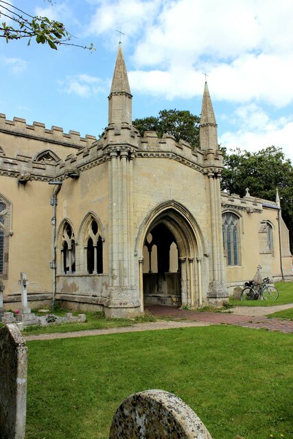
The village derives its name from the presence of the parish church, which dates back to the 12th century and serves as a prominent landmark in the area. The church, dedicated to St. Mary, is an architectural gem with its distinctive Norman tower and beautifully preserved medieval features.

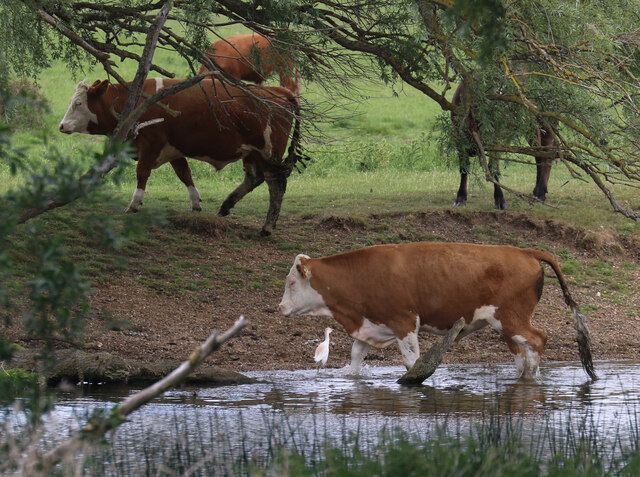
Surrounded by lush green fields and rolling countryside, Church End offers a serene and idyllic setting. The village itself is characterized by a collection of charming cottages, many of which are constructed using traditional local materials such as timber and thatch. These buildings contribute to the village's strong sense of heritage and create a quaint and inviting atmosphere.

Although small in size, Church End boasts a strong sense of community. The village organizes various social events throughout the year, including fairs, festivals, and charity fundraisers, providing residents with opportunities to come together and foster a sense of belonging.

For amenities, Church End provides a community hall, a local pub, and a primary school, ensuring that basic needs are met within the village itself. Residents also benefit from its proximity to Cambridge, where they can access a wider range of services and opportunities.

In summary, Church End, Cambridgeshire, is a charming and close-knit village that offers a peaceful and traditional English countryside experience. Its rich history, natural beauty, and strong community spirit make it an appealing place to live or visit.

If you have any feedback on the listing, please let us know in the comments section below.
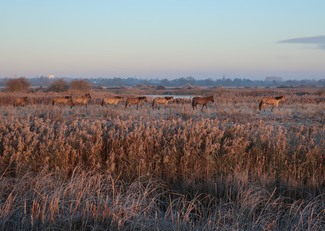
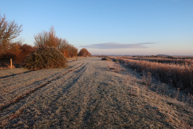
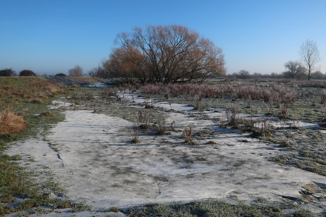
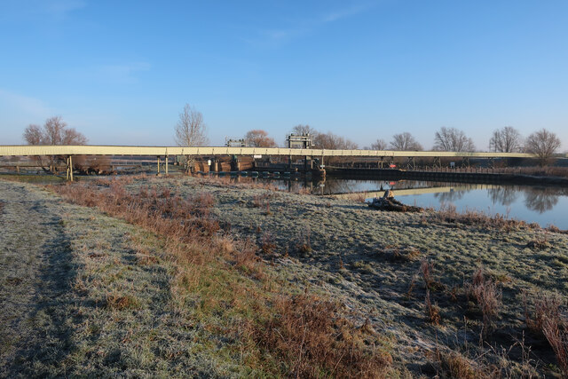
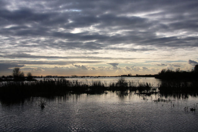
Church End Images

Images are sourced within 2km of 52.317722/0.012516 or Grid Reference TL3770. Thanks to Geograph Open Source API. All images are credited.

St Mary’s Church, Over A Grade I listed building with C13th origins but mainly early C14th, see: <span class="nowrap"><a title="https://britishlistedbuildings.co.uk/101317811-church-of-st-mary-over" rel="nofollow ugc noopener" href="https://britishlistedbuildings.co.uk/101317811-church-of-st-mary-over">Link</a><img style="margin-left:2px;" alt="External link" title="External link - shift click to open in new window" src="https://s1.geograph.org.uk/img/external.png" width="10" height="10"/></span> .
Photo taken during the 2021 sponsored cycle ride in aid of Cambridgeshire Historic Churches Trust (<span class="nowrap"><a title="https://camhct.uk/" rel="nofollow ugc noopener" href="https://camhct.uk/">Link</a><img style="margin-left:2px;" alt="External link" title="External link - shift click to open in new window" src="https://s1.geograph.org.uk/img/external.png" width="10" height="10"/></span> ). Next stop: <a href="https://www.geograph.org.uk/photo/6963611">TL3669 : St Andrew's Church, Swavesey</a>.
St Mary’s Church, Over
A Grade I listed building with C13th origins but mainly early C14th, see: LinkExternal link . Photo taken during the 2021 sponsored cycle ride in aid of Cambridgeshire Historic Churches Trust (LinkExternal link ). Next stop: TL3669 : St Andrew's Church, Swavesey.
The porch of St Mary's Church, Over A Grade I listed building with C13th origins but mainly early C14th, see: <span class="nowrap"><a title="https://britishlistedbuildings.co.uk/101317811-church-of-st-mary-over" rel="nofollow ugc noopener" href="https://britishlistedbuildings.co.uk/101317811-church-of-st-mary-over">Link</a><img style="margin-left:2px;" alt="External link" title="External link - shift click to open in new window" src="https://s1.geograph.org.uk/img/external.png" width="10" height="10"/></span> . The porch is remarkably large & ornate. 
Photo taken during the 2021 sponsored cycle ride in aid of Cambridgeshire Historic Churches Trust (<span class="nowrap"><a title="https://camhct.uk/" rel="nofollow ugc noopener" href="https://camhct.uk/">Link</a><img style="margin-left:2px;" alt="External link" title="External link - shift click to open in new window" src="https://s1.geograph.org.uk/img/external.png" width="10" height="10"/></span> ). Next stop: <a href="https://www.geograph.org.uk/photo/6963611">TL3669 : St Andrew's Church, Swavesey</a>.
The porch of St Mary's Church, Over
A Grade I listed building with C13th origins but mainly early C14th, see: LinkExternal link . The porch is remarkably large & ornate. Photo taken during the 2021 sponsored cycle ride in aid of Cambridgeshire Historic Churches Trust (LinkExternal link ). Next stop: TL3669 : St Andrew's Church, Swavesey.
Fields by Middle Way
Middle Way
Middle Way
Middle Way
Middle Way
White-legged Damselfly (Platycnemis pennipes) Present in small numbers at the northern edge of Fen Drayton Lakes RSPB reserve.
White-legged Damselfly (Platycnemis pennipes)
Present in small numbers at the northern edge of Fen Drayton Lakes RSPB reserve.
Cattle by the Great Ouse With a Cattle Egret in attendance, as is now unremarkable. Just three years ago it would have been quite a notable bird sighting.
Cattle by the Great Ouse
With a Cattle Egret in attendance, as is now unremarkable. Just three years ago it would have been quite a notable bird sighting.
Building plot by Station Road Infill development in Over.
Building plot by Station Road
Infill development in Over.
Konik Ponies at Ouse Fen A relatively recent addition to the reserve. Coming out of the reedbed for a daily check.
Konik Ponies at Ouse Fen
A relatively recent addition to the reserve. Coming out of the reedbed for a daily check.
Cuckoo Fen North Cell 2 in Ouse Fen RSPB, where a gravel quarry is being gradually turned in a reedbed reserve.
Cuckoo Fen North
Cell 2 in Ouse Fen RSPB, where a gravel quarry is being gradually turned in a reedbed reserve.
Path in Ouse Fen
Path in Ouse Fen
Spiregrass Square, Over
Ouse Fen Bank A byway, but with a request for motor vehicles not to use it.
Ouse Fen Bank
A byway, but with a request for motor vehicles not to use it.
New cattle sheds, Chain Farm
Cuckoo Drove Along the southern edge of Ouse Fen.
Cuckoo Drove
Along the southern edge of Ouse Fen.
The frozen washlands of Cambridgeshire Frozen pools between the river and the raised river bank. See <a href="https://www.geograph.org.uk/photo/6745643">TL3672 : Bank of the Great Ouse</a> for a wetter view.
The frozen washlands of Cambridgeshire
Frozen pools between the river and the raised river bank. See TL3672 : Bank of the Great Ouse for a wetter view.
Overcote Road
Overcote Road
Conveyor belt over the Great Ouse at Brownshill Staunch Carrying sand and gravel from the quarry to the processing plant, see <a href="https://www.geograph.org.uk/photo/7387989">TL3873 : Hanson Aggregates Needingworth Quarry</a> and <a href="https://www.geograph.org.uk/photo/7359821">TL3672 : Conveyor belt into Hanson site</a>
Conveyor belt over the Great Ouse at Brownshill Staunch
Carrying sand and gravel from the quarry to the processing plant, see TL3873 : Hanson Aggregates Needingworth Quarry and TL3672 : Conveyor belt into Hanson site
Show me another place!

Church End is located at Grid Ref: TL3770 (Lat: 52.317722, Lng: 0.012516)

Administrative County: Cambridgeshire

District: South Cambridgeshire

Police Authority: Cambridgeshire

What 3 Words

///tentacles.rather.front. Near Over, Cambridgeshire

Nearby Locations

Church End Over

Related Wikis

Over, Cambridgeshire

Over is a large village near the River Great Ouse in the English county of Cambridgeshire, just east of the prime meridian. The parish covers an area of...

Mare Fen

Mare Fen is a 16.3 hectare Local Nature Reserve north of Swavesey in Cambridgeshire, England. It is owned by Cambridgeshire County Council, and was formerly...

Swavesey Priory

Swavesey Priory was a medieval monastic house in the village of Swavesey, Cambridgeshire, England. A church existed in Swavesey at the time of the Norman...

Swavesey railway station

Swavesey railway station was a station in Swavesey, Cambridgeshire on the line between Cambridge and St Ives which was closed for passenger services in...

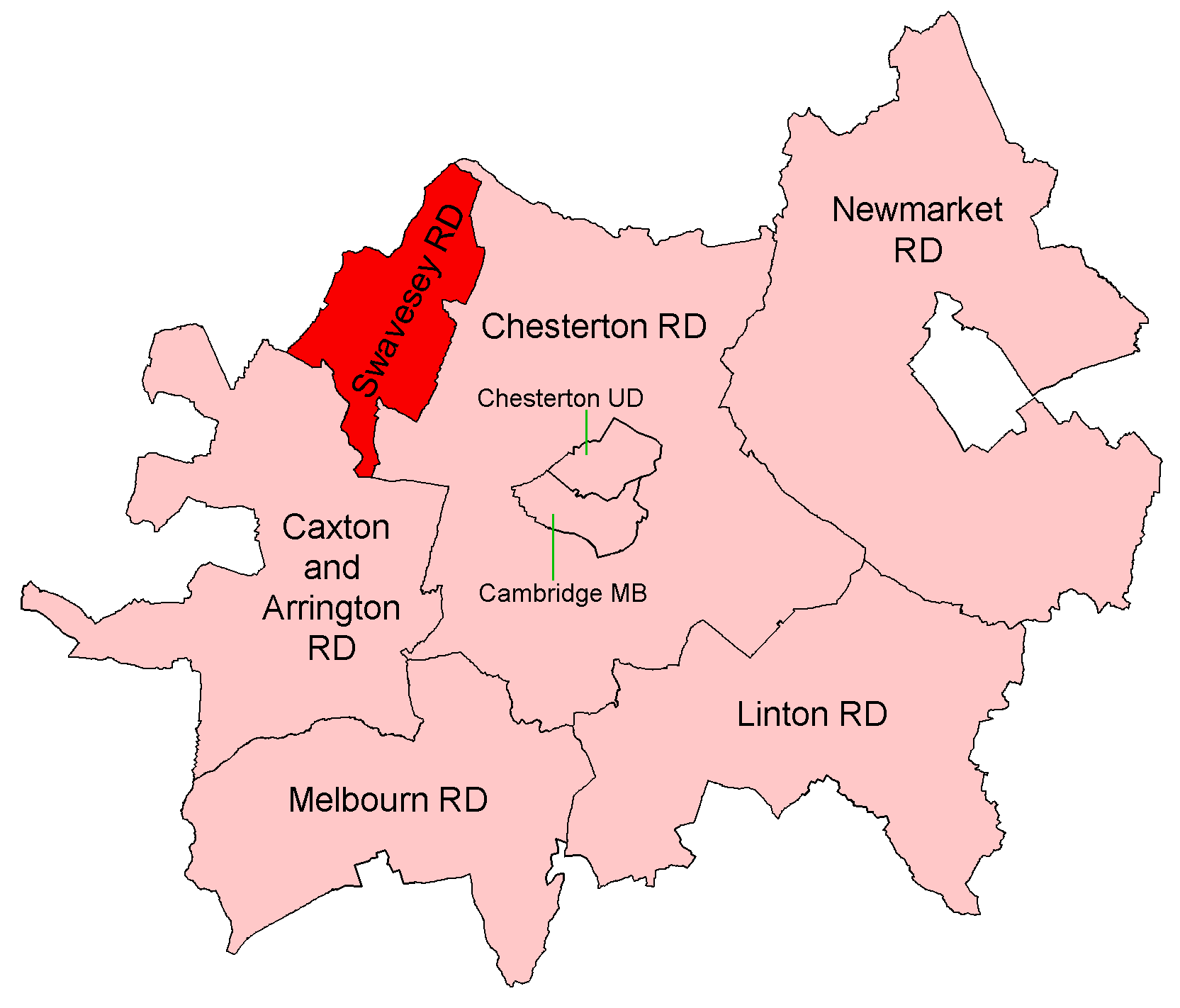
Swavesey Rural District

Swavesey was a rural district in Cambridgeshire, England, from 1894 to 1934. It was formed under the Local Government Act 1894 from the part of the St...

Cambridgeshire

Cambridgeshire (abbreviated Cambs.) is a ceremonial county in the East of England and East Anglia. It is bordered by Lincolnshire to the north, Norfolk...

List of Sites of Special Scientific Interest in Cambridgeshire

Cambridgeshire is a county in eastern England, with an area of 339,746 hectares (1,312 sq mi) and a population as of mid-2015 of 841,218. It is crossed...

List of local nature reserves in Cambridgeshire

Cambridgeshire is a county in eastern England, with an area of 1,308 square miles (3,390 km2) and a population as of 2011 of 708,719. It is crossed by...

Nearby Amenities

Located within 500m of 52.317722,0.012516
Traffic Calming: table
Lat/Long: 52.314935/0.0089134
Over
Is In: Cambridgeshire, England, UK
Place: village
Population: 2790
Source Name: local knowledge
Source Population: http://www.scambs.gov.uk/CommunityandLiving/VillageServicesAndAmenities/
Wikidata: Q5002826
Lat/Long: 52.3152187/0.0170499
Townhall
Over Town Hall
Lat/Long: 52.3177103/0.0133941
Crossing
Bicycle: yes
Crossing: unmarked
Crossing Island: no
Foot: yes
Kerb: flush
Tactile Paving: yes
Lat/Long: 52.3149573/0.0088557
Chain Farm
Landuse: farm
Note Retag: CS #48756035
Lat/Long: 52.3211171/0.015119
Bus Stop
The Doles
Bus: yes
Naptan AtcoCode: 0500SOVER001
Naptan Bearing: NE
Naptan BusStopType: CUS
Naptan CommonName: The Doles
Naptan Indicator: opp
Naptan Landmark: The Doles
Naptan NaptanCode: cmbgampt
Naptan Street: Station Road
Naptan Verified: no
Public Transport: platform
Source: naptan_import
Lat/Long: 52.3156337/0.0096463
Bus Stop
The Doles
Bus: yes
Naptan AtcoCode: 0500SOVER003
Naptan Bearing: SW
Naptan CommonName: The Doles
Naptan Indicator: near
Naptan Landmark: The Doles
Naptan NaptanCode: cmbgamta
Naptan Street: Station Road
Naptan Verified: no
Public Transport: platform
Source: naptan_import
Lat/Long: 52.3156055/0.0097183
Bus Stop
Randalls Lane
Bus: yes
Naptan AtcoCode: 0500SOVER006
Naptan Bearing: E
Naptan CommonName: Randalls Lane
Naptan Indicator: near
Naptan Landmark: Randalls Lane
Naptan NaptanCode: cmbgamtj
Naptan Street: High Street
Naptan Verified: no
Public Transport: platform
Source: naptan_import
Lat/Long: 52.3166271/0.0167781
Bus Stop
Overcote Road
Bus: yes
Naptan AtcoCode: 0500SOVER014
Naptan Bearing: NW
Naptan CommonName: Overcote Road
Naptan Indicator: opp
Naptan Landmark: Overcote Road
Naptan NaptanCode: cmbgamwm
Naptan Street: High Street
Naptan Verified: no
Public Transport: platform
Source: naptan_import
Lat/Long: 52.3172382/0.0141648
Bus Stop
Willingham Road
Bus: yes
Naptan AtcoCode: 0500SOVER017
Naptan Bearing: NE
Naptan BusStopType: CUS
Naptan CommonName: Willingham Road
Naptan Indicator: opp
Naptan Landmark: Willingham Road
Naptan NaptanCode: cmbgapad
Naptan ShortCommonName: Willingham Road
Naptan Street: Long Furlong
Naptan Verified: no
Public Transport: platform
Source: naptan_import
Lat/Long: 52.315583/0.0189461
Bus Stop
Randalls Lane
Bus: yes
Naptan AtcoCode: 0500SOVER018
Naptan Bearing: W
Naptan BusStopType: CUS
Naptan CommonName: Randalls Lane
Naptan Indicator: opp
Naptan Landmark: Randalls Lane
Naptan NaptanCode: cmbgapag
Naptan Street: High Street
Naptan Verified: no
Public Transport: platform
Source: naptan_import
Lat/Long: 52.3165822/0.0167761
Bus Stop
Overcote Road
Bus: yes
Naptan AtcoCode: 0500SOVER019
Naptan Bearing: SE
Naptan BusStopType: CUS
Naptan CommonName: Overcote Road
Naptan Crossing: Overcote Road
Naptan Indicator: near
Naptan Landmark: Overcote Road
Naptan NaptanCode: cmbgjpdg
Naptan Street: High Street
Naptan Verified: no
Public Transport: platform
Source: naptan_import
Lat/Long: 52.3173388/0.0140667
Post Box
Brand: Royal Mail
Brand Wikidata: Q638098
Collection Times: Mo-Fr 09:00; Sa 07:00
Operator: Royal Mail
Operator Wikidata: Q638098
Post Box Type: wall
Ref: CB24 447D
Royal Cypher: VR
Royal Cypher Wikidata: Q33102356
Lat/Long: 52.3180298/0.0128615
Post Box
Brand: Royal Mail
Brand Wikidata: Q638098
Collection Times: Mo-Fr 16:15; Sa 10:45
Operator: Royal Mail
Operator Wikidata: Q638098
Post Box Type: pillar
Ref: CB24 448
Royal Cypher: EIIR
Royal Cypher Wikidata: Q33102113
Lat/Long: 52.3166423/0.0166483
Ponders Travel
Addr City: Over
Addr Housename: The Gallery
Addr Housenumber: 25
Addr Postcode: CB24 5NB
Addr Street: High Street
Opening Hours: Mo-Fr 09:00-17:30; Sa 09:00-17:00
Phone: +44 1954 232802
Shop: travel_agency
Website: https://www.ponderstravel.co.uk/
Lat/Long: 52.3165062/0.0172317
Images Hair & Beauty
Shop: hairdresser
Lat/Long: 52.3164904/0.0163161
Traffic Calming: table
Lat/Long: 52.3157687/0.0190966
Traffic Calming: table
Lat/Long: 52.3160359/0.0192187
Traffic Calming: table
Lat/Long: 52.3160029/0.0190314
Traffic Calming: choker
Lat/Long: 52.3168973/0.0110979
Traffic Calming: table
Lat/Long: 52.3158432/0.0099252
Traffic Calming: table
Lat/Long: 52.3157277/0.0099426
Traffic Calming: table
Lat/Long: 52.3157022/0.0097615
Priority: backward
Traffic Calming: choker
Lat/Long: 52.3145621/0.0085091
Barrier: cycle_barrier
Lat/Long: 52.3166341/0.0175533
Post Office
Over Mobile Post Office Service
Opening Hours: Mo,Th 09:30-12:30; Fr 15:00-16:00
Po Id: 125490
Ref Pol Id: 110053
Source: https://www.postoffice.co.uk/branch-finder/7142307/over-mobile-service
Lat/Long: 52.3145427/0.011103
Bench
Backrest: yes
Inscription: The gift of a native of this Parish August 11 1904.
Material: wood
Openbenches Id: 25477
Seats: 5
Lat/Long: 52.3180968/0.0130143
Parking
Fee: no
Lat/Long: 52.3180381/0.0129067
Bench
Backrest: yes
Material: wood
Seats: 4
Lat/Long: 52.3178815/0.0119541
Defibrillator
Defibrillator Location: Outside NE corner Over Community Centre building,
Emergency: defibrillator
Indoor: no
Ref GB The Circuit: 2BAF3F53-2D54-4A7C-882E-AD3600C396A5
Lat/Long: 52.3144642/0.0116156
Barrier: entrance
Lat/Long: 52.3179737/0.0127669
Advertising: board
Inscription: Presented to the village of Over by Royal Air Force, Oakington To commemorate our long association 1st July 1940 10th March 1975
Lat/Long: 52.3166539/0.0166297
Barrier: cycle_barrier
Lat/Long: 52.3165267/0.0166835
Crossing
Crossing: unmarked
Crossing Island: no
Kerb: flush
Tactile Paving: yes
Lat/Long: 52.315788/0.019119
Crossing
Crossing: unmarked
Crossing Island: no
Kerb: flush
Tactile Paving: yes
Lat/Long: 52.3159962/0.0190434
Crossing
Crossing: unmarked
Crossing Island: no
Kerb: flush
Tactile Paving: yes
Lat/Long: 52.3160243/0.0192043
Entrance: yes
Lat/Long: 52.3137156/0.014854
Entrance: yes
Lat/Long: 52.3136972/0.0148252
Entrance: yes
Lat/Long: 52.3136732/0.0147469
Entrance: yes
Lat/Long: 52.313618/0.0146595
Entrance: yes
Lat/Long: 52.3133991/0.0142869
Entrance: yes
Lat/Long: 52.3134315/0.0143378
Entrance: yes
Lat/Long: 52.3134645/0.0143897
Entrance: yes
Lat/Long: 52.3134881/0.0144663
Entrance: yes
Lat/Long: 52.3135662/0.0139952
Entrance: yes
Lat/Long: 52.3136012/0.0140475
Addr City: Cambridge
Addr Housenumber: 6
Addr Postcode: CB24 5QA
Addr Street: Asplins Close
Addr Village: Over
Entrance: yes
Lat/Long: 52.3138461/0.0144721
Addr City: Cambridge
Addr Housenumber: 8
Addr Postcode: CB24 5QA
Addr Street: Asplins Close
Addr Village: Over
Entrance: yes
Lat/Long: 52.31383/0.0144487
Addr City: Cambridge
Addr Housenumber: 10
Addr Postcode: CB24 5QA
Addr Street: Asplins Close
Addr Village: Over
Entrance: yes
Lat/Long: 52.3137979/0.0144018
Addr City: Cambridge
Addr Housenumber: 12
Addr Postcode: CB24 5QA
Addr Street: Asplins Close
Addr Village: Over
Entrance: yes
Lat/Long: 52.3137818/0.0143784
Addr City: Cambridge
Addr Housenumber: 2
Addr Postcode: CB24 5QA
Addr Street: Asplins Close
Addr Village: Over
Entrance: yes
Lat/Long: 52.3139029/0.0145298
Addr City: Cambridge
Addr Housenumber: 4
Addr Postcode: CB24 5QA
Addr Street: Asplins Close
Addr Village: Over
Entrance: yes
Lat/Long: 52.3138863/0.0145057
Entrance: yes
Lat/Long: 52.3139588/0.0132981
Entrance: yes
Lat/Long: 52.313927/0.013354
Entrance: yes
Lat/Long: 52.3138953/0.01341
Entrance: yes
Lat/Long: 52.3138495/0.0134944
Entrance: yes
Lat/Long: 52.3138429/0.0135852
Entrance: yes
Lat/Long: 52.3138121/0.0136399
Entrance: yes
Lat/Long: 52.3137811/0.0136951
Entrance: yes
Lat/Long: 52.3137182/0.0137331
Entrance: yes
Lat/Long: 52.3136955/0.0137741
Entrance: yes
Lat/Long: 52.3142419/0.0129648
Entrance: yes
Lat/Long: 52.3141902/0.0129087
Entrance: yes
Lat/Long: 52.3141385/0.0128525
Entrance: yes
Lat/Long: 52.3147945/0.0116673
Entrance: yes
Lat/Long: 52.314743/0.0116112
Entrance: yes
Lat/Long: 52.3146935/0.0118786
Entrance: yes
Lat/Long: 52.3146377/0.0118177
Entrance: yes
Lat/Long: 52.3145117/0.0121085
Entrance: yes
Lat/Long: 52.3144792/0.0121882
Entrance: yes
Lat/Long: 52.3143924/0.0125051
Entrance: yes
Lat/Long: 52.3143428/0.012451
Cafe
Cuisine: cake
Opening Hours: Sa[1] 10:00-12:00
Outdoor Seating: no
Lat/Long: 52.3163567/0.0146361
The data included in this document is from www.openstreetmap.org. The data is made available under ODbL.

Have you been to Church End?

Leave your review of Church End below (or comments, questions and feedback).