Church End

Settlement in Cambridgeshire South Cambridgeshire

England

Church End

St Mary’s Church, Over A Grade I listed building with C13th origins but mainly early C14th, see: <span class="nowrap"><a title="https://britishlistedbuildings.co.uk/101317811-church-of-st-mary-over" rel="nofollow ugc noopener" href="https://britishlistedbuildings.co.uk/101317811-church-of-st-mary-over">Link</a><img style="margin-left:2px;" alt="External link" title="External link - shift click to open in new window" src="https://s1.geograph.org.uk/img/external.png" width="10" height="10"/></span> .
Photo taken during the 2021 sponsored cycle ride in aid of Cambridgeshire Historic Churches Trust (<span class="nowrap"><a title="https://camhct.uk/" rel="nofollow ugc noopener" href="https://camhct.uk/">Link</a><img style="margin-left:2px;" alt="External link" title="External link - shift click to open in new window" src="https://s1.geograph.org.uk/img/external.png" width="10" height="10"/></span> ). Next stop: <a href="https://www.geograph.org.uk/photo/6963611">TL3669 : St Andrew's Church, Swavesey</a>.
St Mary’s Church, Over Credit: Martin Tester

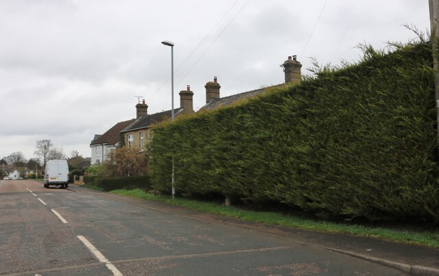
Church End is a small village located in the county of Cambridgeshire, England. Situated just over six miles west of the historic city of Cambridge, it is home to a tight-knit community of residents. The village is surrounded by picturesque countryside, offering residents a peaceful and idyllic setting.

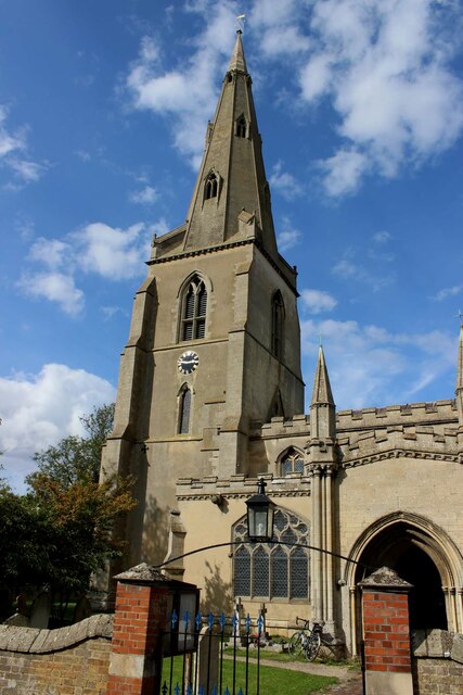
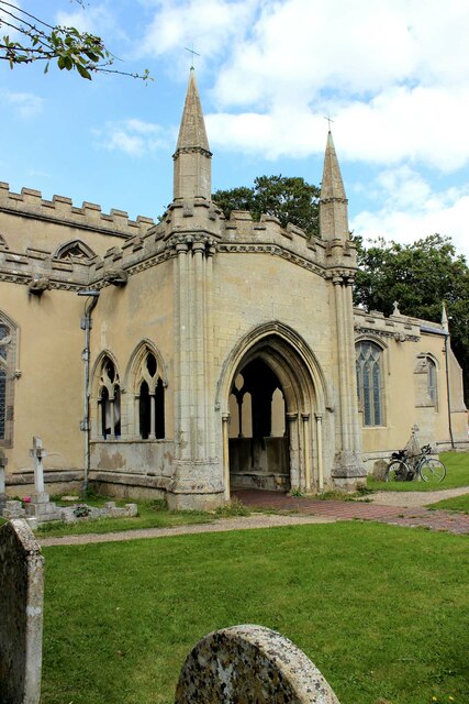
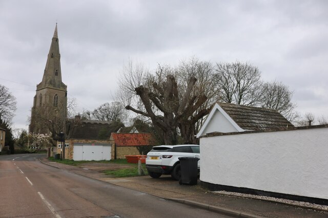
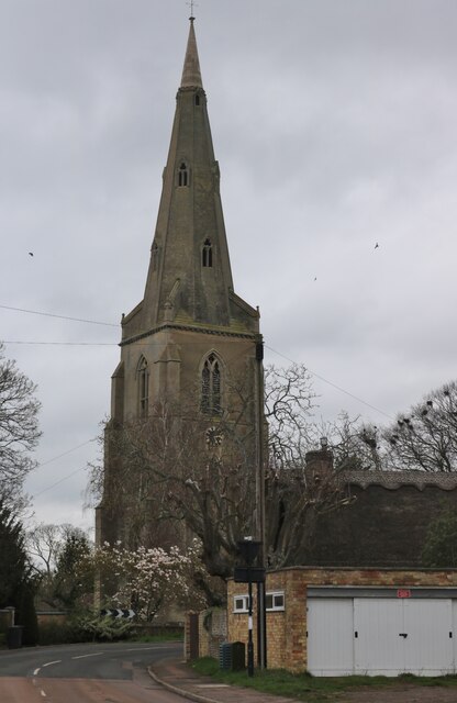
As its name suggests, Church End is centered around its beautiful parish church, St. Mary the Virgin. Dating back to the 12th century, the church serves as a significant landmark and cultural hub for the village. Its stunning architecture and rich history attract visitors from both near and far.

The village itself boasts a charming and traditional character, with a range of period properties and thatched cottages lining its quaint streets. The local pub, The Crown Inn, provides a warm and welcoming atmosphere for residents and visitors alike, offering a place to gather and socialize.

Despite its small size, Church End offers a range of amenities to cater to the needs of its community. These include a primary school, a village hall, and a local shop providing essential goods. The village also benefits from excellent transport links, with regular bus services connecting it to nearby towns and cities.

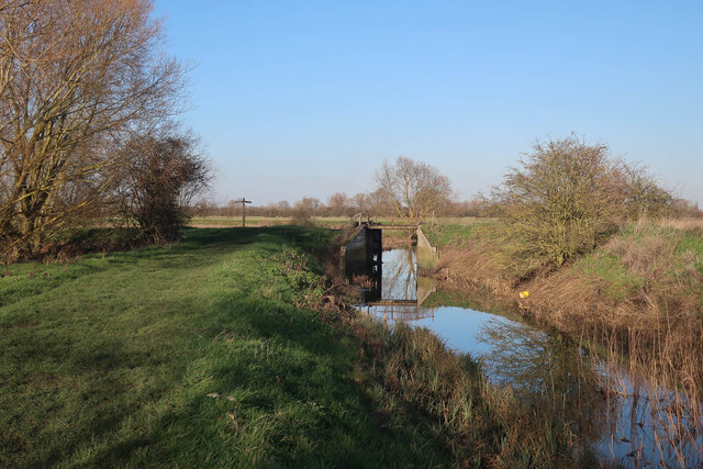
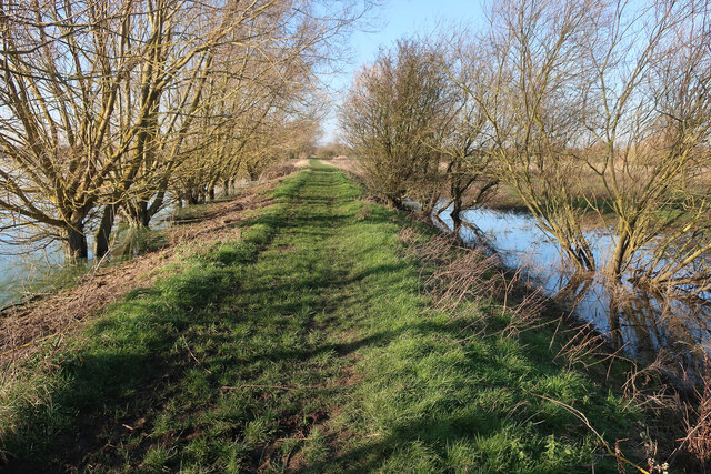
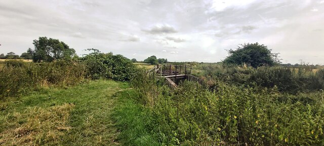
Surrounded by lush green fields and meandering footpaths, Church End offers residents the opportunity to enjoy the beauty of the countryside. It is a peaceful and charming village, providing a sense of tranquility and a close-knit community spirit.

If you have any feedback on the listing, please let us know in the comments section below.
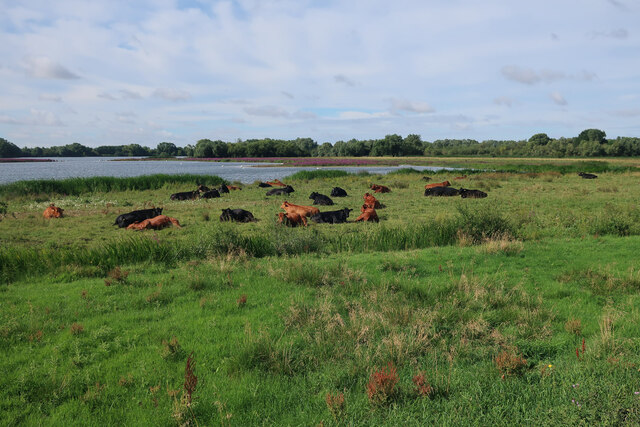
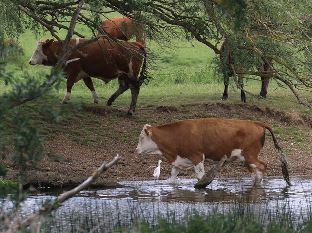
Church End Images

Images are sourced within 2km of 52.303615/-0.001853 or Grid Reference TL3669. Thanks to Geograph Open Source API. All images are credited.

St Mary’s Church, Over A Grade I listed building with C13th origins but mainly early C14th, see: <span class="nowrap"><a title="https://britishlistedbuildings.co.uk/101317811-church-of-st-mary-over" rel="nofollow ugc noopener" href="https://britishlistedbuildings.co.uk/101317811-church-of-st-mary-over">Link</a><img style="margin-left:2px;" alt="External link" title="External link - shift click to open in new window" src="https://s1.geograph.org.uk/img/external.png" width="10" height="10"/></span> .
Photo taken during the 2021 sponsored cycle ride in aid of Cambridgeshire Historic Churches Trust (<span class="nowrap"><a title="https://camhct.uk/" rel="nofollow ugc noopener" href="https://camhct.uk/">Link</a><img style="margin-left:2px;" alt="External link" title="External link - shift click to open in new window" src="https://s1.geograph.org.uk/img/external.png" width="10" height="10"/></span> ). Next stop: <a href="https://www.geograph.org.uk/photo/6963611">TL3669 : St Andrew's Church, Swavesey</a>.
St Mary’s Church, Over
A Grade I listed building with C13th origins but mainly early C14th, see: LinkExternal link . Photo taken during the 2021 sponsored cycle ride in aid of Cambridgeshire Historic Churches Trust (LinkExternal link ). Next stop: TL3669 : St Andrew's Church, Swavesey.
The porch of St Mary's Church, Over A Grade I listed building with C13th origins but mainly early C14th, see: <span class="nowrap"><a title="https://britishlistedbuildings.co.uk/101317811-church-of-st-mary-over" rel="nofollow ugc noopener" href="https://britishlistedbuildings.co.uk/101317811-church-of-st-mary-over">Link</a><img style="margin-left:2px;" alt="External link" title="External link - shift click to open in new window" src="https://s1.geograph.org.uk/img/external.png" width="10" height="10"/></span> . The porch is remarkably large & ornate. 
Photo taken during the 2021 sponsored cycle ride in aid of Cambridgeshire Historic Churches Trust (<span class="nowrap"><a title="https://camhct.uk/" rel="nofollow ugc noopener" href="https://camhct.uk/">Link</a><img style="margin-left:2px;" alt="External link" title="External link - shift click to open in new window" src="https://s1.geograph.org.uk/img/external.png" width="10" height="10"/></span> ). Next stop: <a href="https://www.geograph.org.uk/photo/6963611">TL3669 : St Andrew's Church, Swavesey</a>.
The porch of St Mary's Church, Over
A Grade I listed building with C13th origins but mainly early C14th, see: LinkExternal link . The porch is remarkably large & ornate. Photo taken during the 2021 sponsored cycle ride in aid of Cambridgeshire Historic Churches Trust (LinkExternal link ). Next stop: TL3669 : St Andrew's Church, Swavesey.
Old flood gates at the end of Covell's Drain Well past being any use.
Old flood gates at the end of Covell's Drain
Well past being any use.
Path by the Great Ouse With high water levels in Ferry Lagoon to the left.
Path by the Great Ouse
With high water levels in Ferry Lagoon to the left.
Cattle north of Ferry Lagoon
White-legged Damselfly (Platycnemis pennipes) Present in small numbers at the northern edge of Fen Drayton Lakes RSPB reserve.
White-legged Damselfly (Platycnemis pennipes)
Present in small numbers at the northern edge of Fen Drayton Lakes RSPB reserve.
Cattle by the Great Ouse With a Cattle Egret in attendance, as is now unremarkable. Just three years ago it would have been quite a notable bird sighting.
Cattle by the Great Ouse
With a Cattle Egret in attendance, as is now unremarkable. Just three years ago it would have been quite a notable bird sighting.
Building plot by Station Road Infill development in Over.
Building plot by Station Road
Infill development in Over.
Station Road, Over
Station Road, Over
Station Road, Over St Mary's Church is on the left
Station Road, Over
St Mary's Church is on the left
St Mary's Church, Over
Footbridge and Sluice Gate at Covell's Drain
Riverbank north of Ferry Lagoon With flood waters gradually receding.
Riverbank north of Ferry Lagoon
With flood waters gradually receding.
Victorian wallbox, Church End, Over
A communal wooden bench, outside Over church Space for five couples to sit, with armrests in between.  An unusual arrangement
A communal wooden bench, outside Over church
Space for five couples to sit, with armrests in between. An unusual arrangement
Terraced houses, Church End, Over Over is a village near the River Great Ouse in Cambridgeshire.
It is ten miles east of Huntingdon and is also ten miles northwest from Cambridge.
Over contains the basic village facilities, including a primary school, shop, one public house (the Admiral Vernon) and St. Mary's Church. In recent years, the village has expanded rapidly, with the inclusion of several housing estates, a community and conference centre and modern sporting facilities. An Over day centre was set up in 1989. The Over Community Centre was set up in 1999.
Terraced houses, Church End, Over
Over is a village near the River Great Ouse in Cambridgeshire. It is ten miles east of Huntingdon and is also ten miles northwest from Cambridge. Over contains the basic village facilities, including a primary school, shop, one public house (the Admiral Vernon) and St. Mary's Church. In recent years, the village has expanded rapidly, with the inclusion of several housing estates, a community and conference centre and modern sporting facilities. An Over day centre was set up in 1989. The Over Community Centre was set up in 1999.
East window, St Mary's church, Over Also showing the carving behind the altar.  The upper pane of the window shows Christ's ascension, the five lower panes show events in Mary's life: annunciation, birth of Christ, crucifixion, coming of wise men, presentation in the temple
East window, St Mary's church, Over
Also showing the carving behind the altar. The upper pane of the window shows Christ's ascension, the five lower panes show events in Mary's life: annunciation, birth of Christ, crucifixion, coming of wise men, presentation in the temple
Interior of St Mary's church, Over A 13th and 14th-century church of Barnack limestone, much restored in 1840. The highlight of the 14th-century work is an abundance of Decorated Gothic ornamentation, including traditional flower-balls and a wonderful collection of gargoyles in the shape of birds, beasts and strange monsters.
The other feature of note is the lovely south porch, rather oddly lacking some of the ornamentation visible in other parts of the church, but a wonderful piece of architecture nonetheless. The porch was built between the years 1320-1330 and the entrance is flanked by a pair of octagonal spires. The interior of the porch is vast, as large as many a cathedral porch.
Grade I listed. <span class="nowrap"><a title="https://www.britishlistedbuildings.co.uk/101317811-church-of-st-mary-over" rel="nofollow ugc noopener" href="https://www.britishlistedbuildings.co.uk/101317811-church-of-st-mary-over">Link</a><img style="margin-left:2px;" alt="External link" title="External link - shift click to open in new window" src="https://s1.geograph.org.uk/img/external.png" width="10" height="10"/></span>
Interior of St Mary's church, Over
A 13th and 14th-century church of Barnack limestone, much restored in 1840. The highlight of the 14th-century work is an abundance of Decorated Gothic ornamentation, including traditional flower-balls and a wonderful collection of gargoyles in the shape of birds, beasts and strange monsters. The other feature of note is the lovely south porch, rather oddly lacking some of the ornamentation visible in other parts of the church, but a wonderful piece of architecture nonetheless. The porch was built between the years 1320-1330 and the entrance is flanked by a pair of octagonal spires. The interior of the porch is vast, as large as many a cathedral porch. Grade I listed. LinkExternal link
Show me another place!

Church End is located at Grid Ref: TL3669 (Lat: 52.303615, Lng: -0.001853)

Administrative County: Cambridgeshire

District: South Cambridgeshire

Police Authority: Cambridgeshire

What 3 Words

///tangling.renting.processor. Near Swavesey, Cambridgeshire

Related Wikis

Swavesey railway station

Swavesey railway station was a station in Swavesey, Cambridgeshire on the line between Cambridge and St Ives which was closed for passenger services in...

Swavesey Priory

Swavesey Priory was a medieval monastic house in the village of Swavesey, Cambridgeshire, England. A church existed in Swavesey at the time of the Norman...

Swavesey Rural District

Swavesey was a rural district in Cambridgeshire, England, from 1894 to 1934. It was formed under the Local Government Act 1894 from the part of the St...

Mare Fen

Mare Fen is a 16.3 hectare Local Nature Reserve north of Swavesey in Cambridgeshire, England. It is owned by Cambridgeshire County Council, and was formerly...

Swavesey

Swavesey is a village lying on the Prime Meridian in Cambridgeshire, England, with a population of 2,463. The village is situated 9 miles to the north...

Swavesey Village College

Swavesey Village College is a village college and academy school in the village of Swavesey in south Cambridgeshire, England. In 2011, Swavesey Village...

Over, Cambridgeshire

Over is a large village near the River Great Ouse in the English county of Cambridgeshire, just east of the prime meridian. The parish covers an area of...

Needingworth

Needingworth is a village in Cambridgeshire, England. Needingworth lies approximately 7 miles (11 km) east of Huntingdon and just west of the Prime Meridian...

Nearby Amenities

Located within 500m of 52.303615,-0.001853
Traffic Signals
Traffic Signals: signal
Lat/Long: 52.3063782/-0.0008287
Recycling
Lat/Long: 52.3049204/-0.0028396
Access: no
Barrier: bollard
Bicycle: yes
Foot: yes
Height: 1
Horse: yes
Lat/Long: 52.3028633/-0.0043559
Bus Stop
Chequers Court
Bus: yes
Naptan AtcoCode: 0500SSWAV001
Naptan Bearing: NE
Naptan CommonName: Chequers Court
Naptan Indicator: opp
Naptan Landmark: Chequers Court
Naptan NaptanCode: cmbgatpt
Naptan ShortCommonName: Chequers Court
Naptan Street: Station Road
Naptan Verified: no
Public Transport: platform
Source: naptan_import
Lat/Long: 52.3029997/-0.0041125
Bus Stop
Swavesey Station
Bus: yes
Naptan AtcoCode: 0500SSWAV002
Naptan Bearing: NE
Naptan CommonName: Swavesey Station
Naptan Indicator: opp
Naptan Landmark: Swavesey Station
Naptan NaptanCode: cmbgatpw
Naptan ShortCommonName: Swavesey Station
Naptan Street: Over Road
Naptan Verified: no
Public Transport: platform
Source: naptan_import
Lat/Long: 52.3070127/-1.53E-5
Bus Stop
Chequers Court
Bus: yes
Naptan AtcoCode: 0500SSWAV006
Naptan Bearing: SW
Naptan BusStopType: CUS
Naptan CommonName: Chequers Court
Naptan Indicator: near
Naptan Landmark: Chequers Court
Naptan NaptanCode: cmbgatwj
Naptan ShortCommonName: Chequers Court
Naptan Street: Station Road
Naptan Verified: no
Public Transport: platform
Source: naptan_import
Lat/Long: 52.3029535/-0.0040413
Swavesey Kiss and Ride
Bus: yes
Naptan AtcoCode: 0500SSWAV011
Naptan Bearing: SW
Naptan BusStopType: CUS
Naptan CommonName: Swavesey Station
Naptan Indicator: near
Naptan Landmark: Swavesey Station
Naptan NaptanCode: cmbgawag
Naptan ShortCommonName: Swavesey Station
Naptan Street: Over Road
Naptan Verified: no
Public Transport: platform
Source: naptan_import
Lat/Long: 52.3069575/5.56E-5
Bus Stop
Wallman's Lane
Bench: yes
Bus: yes
Naptan AtcoCode: 0500SSWAV017
Naptan Bearing: S
Naptan CommonName: Wallman's Lane
Naptan Indicator: near
Naptan Landmark: Wallman's Lane
Naptan NaptanCode: cmbgawda
Naptan ShortCommonName: Wallman's Lane
Naptan Street: High Street
Naptan Verified: no
Public Transport: platform
Shelter: public_transport
Source: naptan_import
Lat/Long: 52.3005633/-0.0041341
Bus Stop
The Busway Swavesey
Naptan AtcoCode: 0500SSWAV020
Naptan Bearing: SE
Naptan CommonName: The Busway Swavesey
Naptan Crossing: Station Road
Naptan Indicator: S-bound
Naptan Landmark: Station Road
Naptan NaptanCode: cmbgjwgp
Naptan ShortCommonName: Busway Swavesey
Naptan Street: Guided Busway
Naptan Verified: no
Note: location adjusted from survey
Public Transport: platform
Source: naptan_import
Lat/Long: 52.3061979/0.0003041
Bus Stop
The Busway Swavesey
Bus: yes
Naptan AtcoCode: 0500SSWAV021
Naptan Bearing: NW
Naptan CommonName: The Busway Swavesey
Naptan Crossing: Station Road
Naptan Indicator: N-bound
Naptan Landmark: Station Road
Naptan NaptanCode: cmbgjwgt
Naptan ShortCommonName: Busway Swavesey
Naptan Street: Guided Busway
Naptan Verified: no
Note: location adjusted from survey
Public Transport: platform
Source: naptan_import
Lat/Long: 52.3061679/2.8E-6
Swavesey
Historic Railway: station
Railway: site
Source: NPE
Wikidata: Q7654067
Wikipedia: en:Swavesey railway station
Lat/Long: 52.3062702/-0.0004317
Barrier: kissing_gate
Lat/Long: 52.3001513/0.0004876
Barrier: bus_trap
Lat/Long: 52.3064959/-0.0014696
Barrier: bus_trap
Lat/Long: 52.3062561/-0.0002383
Line Attachment: anchor
Location Transition: yes
Power: pole
Lat/Long: 52.3053691/0.0038999
Line Attachment: anchor
Location Transition: yes
Power: pole
Lat/Long: 52.3050755/0.0035431
Power: pole
Lat/Long: 52.3019693/-0.0002415
Power: pole
Lat/Long: 52.304109/0.0023923
Power: pole
Lat/Long: 52.3010443/-0.0002763
Power: pole
Lat/Long: 52.3030386/0.0010701
Power: pole
Lat/Long: 52.3002143/-0.0002978
Barrier: height
Maxheight: 2.1
Lat/Long: 52.30682/-4.55E-5
Barrier: height
Maxheight: 2.1
Lat/Long: 52.306987/0.0001852
Barrier: kissing_gate
Lat/Long: 52.3002148/-0.0015515
Swavesey Priory
Historic: archaeological_site
Wikidata: Q7654063
Lat/Long: 52.3062363/-0.0024822
Information: board
Operator: Cambridgeshire County Council
Tourism: information
Lat/Long: 52.3038912/-0.0037303
Post Box
Brand: Royal Mail
Brand Wikidata: Q638098
Collection Times: Mo-Fr 17:00; Sa 10:00
Operator: Royal Mail
Operator Wikidata: Q638098
Post Box Type: pillar
Ref: CB24 498
Royal Cypher: EIIR
Royal Cypher Wikidata: Q33102113
Lat/Long: 52.3016876/-0.0043932
Turning Circle
Lat/Long: 52.3018127/-0.0056335
Meridian Marker
Historic: memorial
Inscription: This post marks the Greenwich Meridian and commemorates the Swavesey Millennium celebrations
Memorial: stone
Lat/Long: 52.3057796/-0.0017588
Defibrillator
Defibrillator Location: Outside front door Sawvesey Memorial Hall
Emergency: defibrillator
Indoor: no
Ref GB The Circuit: DD332FA7-8D20-47DE-89C3-AEF9008118B8
Lat/Long: 52.3007506/-0.0040994
Bench
Backrest: yes
Material: wood
Seats: 2
Lat/Long: 52.3050426/-0.002632
Swavesey
Man Made: village_sign
Source: survey
Tourism: artwork
Lat/Long: 52.301568/-0.0044796
Barrier: cycle_barrier
Lat/Long: 52.2997597/-0.0039723
Advertising: board
Inscription: Donated by Swavesey WI - 2005
Lat/Long: 52.2997614/-0.0040224
Bicycle Parking
Bicycle Parking: stands
Capacity: 14
Covered: no
Lat/Long: 52.3015638/-0.0045006
Board Title: Swavesey Priory
Board Type: history
Information: board
Tourism: information
Lat/Long: 52.3064065/-0.0013329
Bicycle Repair Station
Brand: Cyclepods
Service Bicycle Pump: yes
Service Bicycle Tools: no
Lat/Long: 52.3061926/-0.0001806
Defibrillator
Defibrillator Location: Mounted on outside of building
Emergency: defibrillator
Indoor: no
Lat/Long: 52.3062524/0.0005396
Crossing
Crossing: unmarked
Crossing Island: no
Kerb: lowered
Tactile Paving: yes
Lat/Long: 52.3070767/0.0001461
Alan's Carpets
Phone: +44 1954 232298
Shop: carpet
Lat/Long: 52.3022058/-0.0051465
Eyes of Swavesey
Addr City: Swavesey
Addr Housenumber: 2
Addr Postcode: CB24 4QJ
Addr Street: Station Road
Phone: +44 1954 231158
Shop: optician
Website: https://eyesofswavesey.co.uk/
Lat/Long: 52.3021131/-0.0048568
La'Mac
Phone: +44 1954 231445
Shop: hairdresser
Lat/Long: 52.3014272/-0.0045228
High St Swavesey
Man Made: street_cabinet
Operator: Cadent
Ref: 194377
Substance: gas
Utility: gas
Lat/Long: 52.3013784/-0.0046626
Swavesey Information
Booth: K6
Tourism: information
Lat/Long: 52.3005898/-0.0041334
Advertising: board
Board Title: Swavesey Parish Notices
Lat/Long: 52.3006782/-0.0041531
Bench
Backrest: yes
Material: metal
Lat/Long: 52.3005789/-0.0040121
Bench
Backrest: yes
Material: metal
Lat/Long: 52.3006113/-0.0039612
Inscription: Swavesey Memorial Garden This project has been kindly funded by: Swavesey Branch - The Royal British Legion, The George Long Charity, Swavesey Parish Council, Swavesey Windmill & South Cambridgeshire District Council
Lat/Long: 52.3005697/-0.0040092
Barrier: bollard
Lat/Long: 52.2998153/-0.0055632
Entrance: main
Lat/Long: 52.3000695/-0.0060252
Entrance: main
Lat/Long: 52.3001066/-0.0060158
Entrance: main
Lat/Long: 52.3001437/-0.0060063
The data included in this document is from www.openstreetmap.org. The data is made available under ODbL.

Have you been to Church End?

Leave your review of Church End below (or comments, questions and feedback).