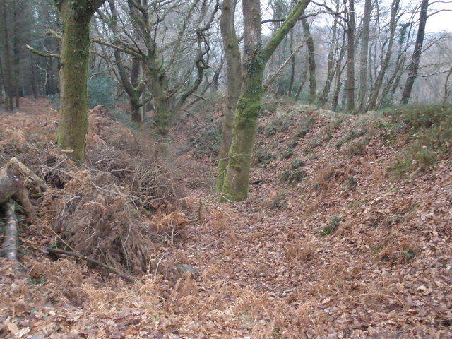
Cleave Copse

Wood, Forest in Devon Mid Devon

England

Cleave Copse

The village of Crockernwell
The village of Crockernwell Credit: Roger A Smith

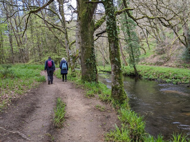
Cleave Copse is a charming woodland located in Devon, England. Situated in the heart of the county, this ancient forest covers an area of approximately 50 acres. It is a renowned destination for nature enthusiasts, hikers, and those seeking solace in the peaceful surroundings of the countryside.

The copse is predominantly composed of native broadleaf trees, including oak, beech, and ash, which create a dense and diverse canopy. The rich undergrowth is home to a variety of flora, such as bluebells, primroses, and ferns, adding to the copse's natural beauty.

The woodland is crisscrossed by a network of well-maintained footpaths, allowing visitors to explore its hidden treasures. These paths wind through the trees, revealing picturesque clearings and babbling brooks, offering a tranquil setting for picnics or meditation.

Cleave Copse is also a haven for wildlife. It provides a habitat for numerous species, including deer, squirrels, badgers, and a wide range of birdlife. Birdwatchers can spot woodpeckers, owls, and various songbirds, making it a popular spot for birding enthusiasts.

The copse is open to the public year-round, with no admission fees. It is managed by a local conservation group, ensuring the preservation of its natural beauty and biodiversity. Visitors are encouraged to respect the environment, follow designated paths, and take their litter with them to maintain the copse's pristine condition.

Overall, Cleave Copse offers a serene escape from the hustle and bustle of daily life, providing a chance to connect with nature and appreciate the stunning landscapes of Devon.

If you have any feedback on the listing, please let us know in the comments section below.
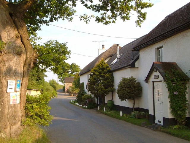
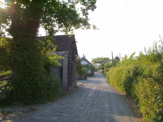
Cleave Copse Images

Images are sourced within 2km of 50.708004/-3.7447249 or Grid Reference SX7691. Thanks to Geograph Open Source API. All images are credited.

The village of Crockernwell
A view across the road between Crockernwell and Cheriton Cross
Cows grazing in a field to the west of Higher Eggbeer
Houses in Cheriton Cross
Cattle proceeding to wherever it is that they go to at 1700 each day
One dozen yurts and a caravan on Higher Eggbeer
A view across the Teign valley in the direction of Moretonhampstead
Former Toll House, Cheriton Cross On the South side of the main street through the village (ex A30).

Milestone Society National ID: DV.CHE
Former Toll House, Cheriton Cross
On the South side of the main street through the village (ex A30). Milestone Society National ID: DV.CHE
Old Boundary Marker beside Scotley Bridge Parish Boundary Marker on the south side of the road at the west end of Scotley Bridge. Inscribed D R and D on opposite faces and BOUNDARY on its side. On the boundary of Drewsteignton and Dunsford parishes.

Milestone Society National ID: DV_DREDUN01pb
Old Boundary Marker beside Scotley Bridge
Parish Boundary Marker on the south side of the road at the west end of Scotley Bridge. Inscribed D R and D on opposite faces and BOUNDARY on its side. On the boundary of Drewsteignton and Dunsford parishes. Milestone Society National ID: DV_DREDUN01pb
Walkers next to the river, heading west
Barn at Greystone Cross The crossroads is slightly staggered.  The road to the left is a few metres beyond that seen here, joining from the right
Barn at Greystone Cross
The crossroads is slightly staggered. The road to the left is a few metres beyond that seen here, joining from the right
The eastern end of Crockernwell In the distance are the sloping fields of Higher Eggbeer farm <a href="https://www.geograph.org.uk/photo/186216">SX7692 : Higher Eggbeer</a>
The eastern end of Crockernwell
In the distance are the sloping fields of Higher Eggbeer farm SX7692 : Higher Eggbeer
Polford Bridge  The bridge crosses a small stream that flows south to the Teign.  Just beyond the bridge is access to Sunny Cottages
Polford Bridge
The bridge crosses a small stream that flows south to the Teign. Just beyond the bridge is access to Sunny Cottages
Cottages west of Cheriton Bishop
The Old Thatch Inn Signs show that the inn is for sale
The Old Thatch Inn
Signs show that the inn is for sale
Dunsford Road, Cheriton Bishop From its junction with the old A30, with an old oak, after which the first cottage is named.
Dunsford Road, Cheriton Bishop
From its junction with the old A30, with an old oak, after which the first cottage is named.
Dunsford Road, Cheriton Bishop A reverse view of <a href="https://www.geograph.org.uk/photo/2645201">SX7792 : Dunsford Road, Cheriton Bishop</a>, from one oak tree to another.
Dunsford Road, Cheriton Bishop
A reverse view of SX7792 : Dunsford Road, Cheriton Bishop, from one oak tree to another.
Cheriton Cross When the old A30 was widened in 1969, the medieval cross was moved. It also serves as a war memorial <span class="nowrap"><a title="http://www.britishlistedbuildings.co.uk/en-95141-cheriton-cross-cheriton-bishop" rel="nofollow ugc noopener" href="http://www.britishlistedbuildings.co.uk/en-95141-cheriton-cross-cheriton-bishop">Link</a><img style="margin-left:2px;" alt="External link" title="External link - shift click to open in new window" src="https://s1.geograph.org.uk/img/external.png" width="10" height="10"/></span> .
Cheriton Cross
When the old A30 was widened in 1969, the medieval cross was moved. It also serves as a war memorial LinkExternal link .
Show me another place!

Cleave Copse is located at Grid Ref: SX7691 (Lat: 50.708004, Lng: -3.7447249)

Administrative County: Devon

District: Mid Devon

Police Authority: Devon and Cornwall

What 3 Words

///sideboard.cute.photos. Near Moretonhampstead, Devon

Related Wikis

Wooston Castle

Wooston Castle is an Iron Age Hill fort situated on the edge of a hill overlooking the Teign Valley in Devon some 200 metres above sea level, only 3 km...

Crockernwell

Crockernwell is a small village with a Methodist church. It is located 2 miles west of Cheriton Bishop and 12 miles west of Exeter, Devon, England. �...

Great Fulford

Great Fulford is an historic estate in the parish of Dunsford, Devon. The grade I listed manor house, known as Great Fulford House, is about 9 miles west...

West Country English

West Country English is a group of English language varieties and accents used by much of the native population of South West England, the area sometimes...

Devon

Devon (/ˈdɛvən/ DEV-ən, historically also known as Devonshire /-ʃɪər, -ʃər/ -⁠sheer, -⁠shər) is a ceremonial county in South West England. It is bordered...

Prestonbury Castle

Prestonbury Castle is an Iron Age Hill fort on the north east edge of Dartmoor in Devon, England. Situated on a massive hilltop some 240 metres above sea...
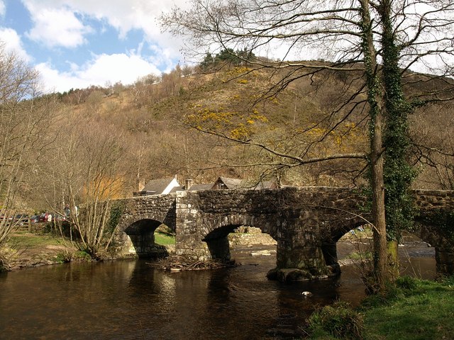
Fingle Bridge

Fingle Bridge is a 17th-century stone arch bridge carrying an unclassified road over the River Teign near Drewsteignton, within Dartmoor National Park...

Cheriton Bishop

Cheriton Bishop is a village and civil parish situated on the northern borders of Dartmoor National park between Exeter and Okehampton, in Devon, England...

Have you been to Cleave Copse?

Leave your review of Cleave Copse below (or comments, questions and feedback).