Bagtor Woods

Wood, Forest in Devon Teignbridge

England

Bagtor Woods

Old Boundary Marker on Halsanger Common in Ashburton parish Estate Boundary Marker in Ashburton parish beside a track southwest of the road from Rushlade Bridge to Cold East Cross. Inscribed PW / 1746 marks the manorial land boundary of Phillip Woodley of Halsanger.

Milestone Society National ID: DV_ASPWxem
Old Boundary Marker on Halsanger Common in Ashburton parish Credit: T Jenkinson

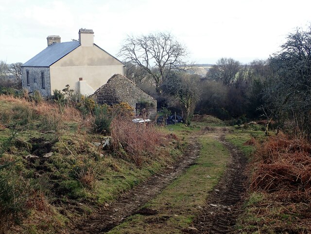
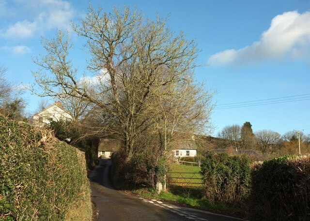
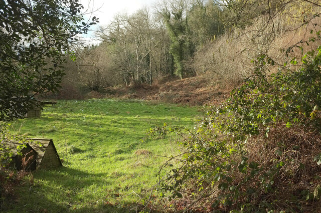
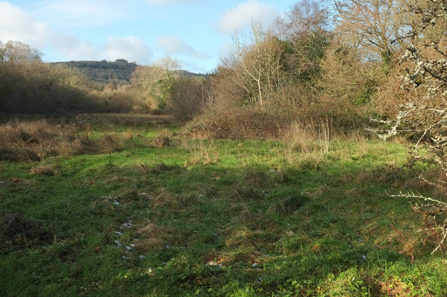
Bagtor Woods is a picturesque woodland located in Devon, England. Covering an area of approximately 100 acres, it is nestled within the Dartmoor National Park, offering visitors a tranquil and serene setting. The woods are easily accessible, situated just a short drive away from the town of Moretonhampstead.

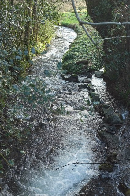
Bagtor Woods is renowned for its diverse range of tree species, including oak, beech, and birch, which create a rich and vibrant canopy. The forest floor is adorned with a carpet of bluebells during the springtime, providing a stunning display of color and fragrance.

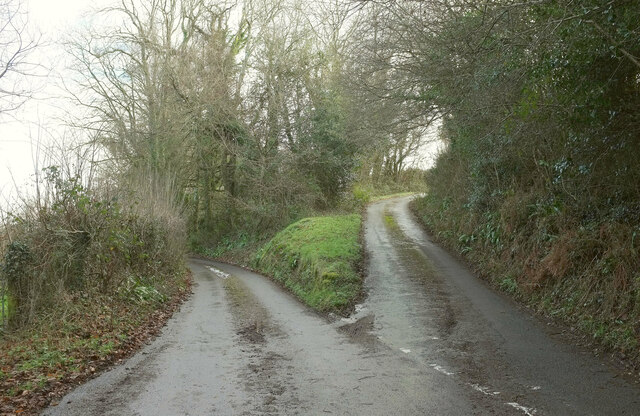
The woods are crisscrossed with numerous pathways and trails, making it an ideal location for walkers, hikers, and nature enthusiasts. The trails vary in difficulty, catering to all levels of fitness and mobility. Along the way, visitors may spot a variety of wildlife, including deer, squirrels, and a plethora of bird species.

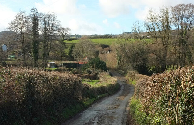
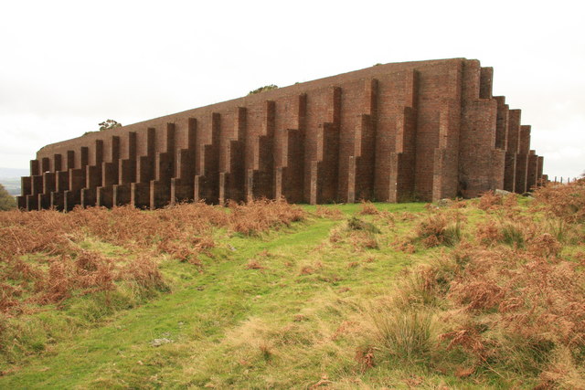
Bagtor Woods also holds historical significance, as it was once part of the ancient Templer Way, a route used by the Templer family to transport granite from the nearby quarries. Visitors can still see remnants of the old granite tramway that once passed through the woods, further adding to the area's charm and heritage.

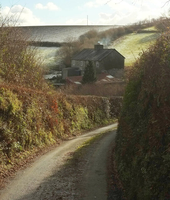
In addition to its natural beauty, Bagtor Woods offers several amenities for visitors, including picnic areas and benches where one can relax and take in the surroundings. The woods are open throughout the year, allowing visitors to experience its ever-changing beauty in different seasons.

Overall, Bagtor Woods is a hidden gem in Devon, offering a peaceful retreat from the bustle of everyday life and providing a perfect setting for nature lovers and outdoor enthusiasts.

If you have any feedback on the listing, please let us know in the comments section below.
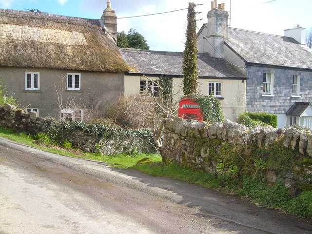
Bagtor Woods Images

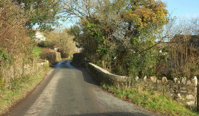
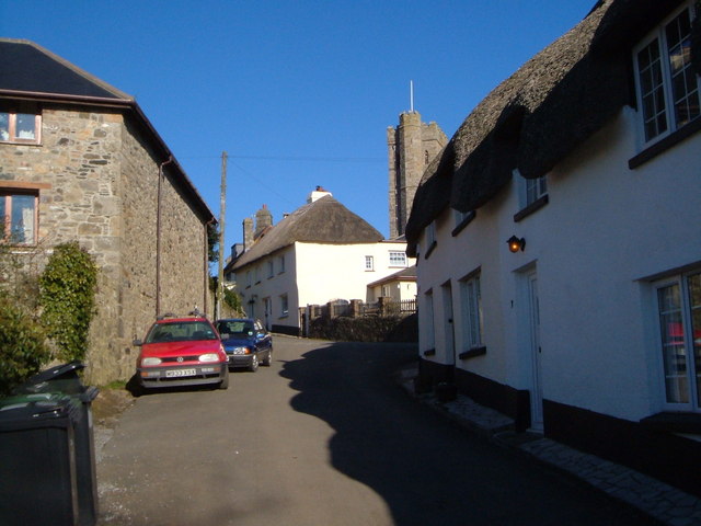
Images are sourced within 2km of 50.558997/-3.7501998 or Grid Reference SX7674. Thanks to Geograph Open Source API. All images are credited.

Old Boundary Marker on Halsanger Common in Ashburton parish Estate Boundary Marker in Ashburton parish beside a track southwest of the road from Rushlade Bridge to Cold East Cross. Inscribed PW / 1746 marks the manorial land boundary of Phillip Woodley of Halsanger.

Milestone Society National ID: DV_ASPWxem
Old Boundary Marker on Halsanger Common in Ashburton parish
Estate Boundary Marker in Ashburton parish beside a track southwest of the road from Rushlade Bridge to Cold East Cross. Inscribed PW / 1746 marks the manorial land boundary of Phillip Woodley of Halsanger. Milestone Society National ID: DV_ASPWxem
Old Boundary Marker near Bag Tor Mine, Ilsington parish Parish Boundary Marker on the moor near the ruined spoil tips and hollows of Bag Tor Mine. Ilsington parish. Inscribed B for Bagtor Manor and I with a bar for Ilsington Manor. Cut in 1835. Dave Brewer’s No. 30. See also <a title="https://www.geograph.org.uk/photo/1642630" href="https://www.geograph.org.uk/photo/1642630">Link</a>.

Milestone Society National ID: DV_ILB30pb
Old Boundary Marker near Bag Tor Mine, Ilsington parish
Parish Boundary Marker on the moor near the ruined spoil tips and hollows of Bag Tor Mine. Ilsington parish. Inscribed B for Bagtor Manor and I with a bar for Ilsington Manor. Cut in 1835. Dave Brewer’s No. 30. See also Link. Milestone Society National ID: DV_ILB30pb
Rippon Tor Cross Almost certainly a medieval stone cutters worst nightmare. A cross being quarried from a promising rock broke mid way during the process. Scale 2m.
Rippon Tor Cross
Almost certainly a medieval stone cutters worst nightmare. A cross being quarried from a promising rock broke mid way during the process. Scale 2m.
Bag Tor Tors are landforms created by the erosion and weathering of rock usually granites.
Bag Tor
Tors are landforms created by the erosion and weathering of rock usually granites.
Bagtor Cottages Originally occupied by the manager of the Tin Mine located in the area. Sadly the cottages have been the subject of vandalism, the end one was set on fire.
Bagtor Cottages
Originally occupied by the manager of the Tin Mine located in the area. Sadly the cottages have been the subject of vandalism, the end one was set on fire.
Bagtor Barton The Farmhouse next to Bagtor House, Islington, Newton Abbot. As well as running Holiday Cottages <span class="nowrap"><a title="https://www.bagtorholidaycottages.com/" rel="nofollow ugc noopener" href="https://www.bagtorholidaycottages.com/">Link</a><img style="margin-left:2px;" alt="External link" title="External link - shift click to open in new window" src="https://s1.geograph.org.uk/img/external.png" width="10" height="10"/></span>. The family raise Aberdeen Angus Cattle and sell Beef from Farm Wilder <span class="nowrap"><a title="https://farmwilder.co.uk/our-farms/bagtor-barton/" rel="nofollow ugc noopener" href="https://farmwilder.co.uk/our-farms/bagtor-barton/">Link</a><img style="margin-left:2px;" alt="External link" title="External link - shift click to open in new window" src="https://s1.geograph.org.uk/img/external.png" width="10" height="10"/></span>
Bagtor Barton
The Farmhouse next to Bagtor House, Islington, Newton Abbot. As well as running Holiday Cottages LinkExternal link. The family raise Aberdeen Angus Cattle and sell Beef from Farm Wilder LinkExternal link
Blocked cripple hole, Emsworthy In a dry stone wall near the car park west of Saddle Tor.
Blocked cripple hole, Emsworthy
In a dry stone wall near the car park west of Saddle Tor.
Lane junction near Ilsington Southwest of the village: left for Lounston, right for Sigford.
Lane junction near Ilsington
Southwest of the village: left for Lounston, right for Sigford.
Sigford The junction is shown a little closer in <a href="https://www.geograph.org.uk/photo/5567247">SX7773 : Lane at Sigford</a>, nearly sixteen years earlier.  Little Grey House, the central of the three houses, is listed <span class="nowrap"><a title="https://historicengland.org.uk/listing/the-list/list-entry/1240944?section=official-list-entry" rel="nofollow ugc noopener" href="https://historicengland.org.uk/listing/the-list/list-entry/1240944?section=official-list-entry">Link</a><img style="margin-left:2px;" alt="External link" title="External link - shift click to open in new window" src="https://s1.geograph.org.uk/img/external.png" width="10" height="10"/></span> .
Sigford
The junction is shown a little closer in SX7773 : Lane at Sigford, nearly sixteen years earlier. Little Grey House, the central of the three houses, is listed LinkExternal link .
River Lemon Looking downstream from Cocksland Bridge. Immediately below the camera is a small weir.
River Lemon
Looking downstream from Cocksland Bridge. Immediately below the camera is a small weir.
Lane to Bagtor House Seen near the bridge over the River Sig. Followed by the Dartmoor Way and NCN272.
Lane to Bagtor House
Seen near the bridge over the River Sig. Followed by the Dartmoor Way and NCN272.
Field, Horridge From the lane near Mountsland, and probably the one shown in <a href="https://www.geograph.org.uk/photo/2892343">SX7574 : Field Below Mountsland Common</a>.
Field, Horridge
From the lane near Mountsland, and probably the one shown in SX7574 : Field Below Mountsland Common.
Lane near Halshanger With puddles and snow remaining from the previous day's weather.
Lane near Halshanger
With puddles and snow remaining from the previous day's weather.
Langworthy Brook Confusingly, perhaps, Langworthy Brook is the address of several properties as well as a local stream, and this pair of semis is included. Plenty of snow remains on the fields from the previous day's fall. The lane is followed by the Dartmoor Way and NCN272.
Langworthy Brook
Confusingly, perhaps, Langworthy Brook is the address of several properties as well as a local stream, and this pair of semis is included. Plenty of snow remains on the fields from the previous day's fall. The lane is followed by the Dartmoor Way and NCN272.
Towards Rippon Tor Looking left from <a href="https://www.geograph.org.uk/photo/7388713">SX7874 : Towards Higher Sigford</a>. That looks a huge spread of animal feed. Beyond it, on the right, is the wooded Lemon valley.
Towards Rippon Tor
Looking left from SX7874 : Towards Higher Sigford. That looks a huge spread of animal feed. Beyond it, on the right, is the wooded Lemon valley.
Sigford Bridge Over the River Lemon. The lane has come from Bethel Cross.
Sigford Bridge
Over the River Lemon. The lane has come from Bethel Cross.
Lower Sigford Bridge Sigford is a modest-sized hamlet but it has two river bridges, this one over the River Sig, and one over the River Lemon <a href="https://www.geograph.org.uk/photo/7388730">SX7773 : Sigford Bridge</a>.
Lower Sigford Bridge
Sigford is a modest-sized hamlet but it has two river bridges, this one over the River Sig, and one over the River Lemon SX7773 : Sigford Bridge.
Meadow by the Sig Looking left from <a href="https://www.geograph.org.uk/photo/7388741">SX7773 : Lower Sigford Bridge</a>. A little snow remains from the previous day.
Meadow by the Sig
Looking left from SX7773 : Lower Sigford Bridge. A little snow remains from the previous day.
Show me another place!

Bagtor Woods is located at Grid Ref: SX7674 (Lat: 50.558997, Lng: -3.7501998)

Administrative County: Devon

District: Teignbridge

Police Authority: Devon and Cornwall

What 3 Words

///overdrive.leans.degrading. Near Ashburton, Devon

Nearby Locations

Bagtor Woods

Related Wikis

Rippon Tor Rifle Range

Rippon Tor Rifle Range is a disused rifle range from World War II on Dartmoor, Devon, England. The range is situated southeast of the 473 m high Rippon...

Ilsington

Ilsington is a village and civil parish situated on the eastern edge of Dartmoor, Devon, England. It is one of the largest parishes in the county, and...

Rippon Tor

Rippon Tor is a striking tor on eastern Dartmoor, in England, that stands at 473 metres (1,552 ft) above sea level. It has three cairns, of which are some...

Sigford

Sigford is a small hamlet in the Parish of Ilsington, on the eastern edge of Dartmoor, Devon, England. It is situated at the confluence of three rivers...

Have you been to Bagtor Woods?

Leave your review of Bagtor Woods below (or comments, questions and feedback).