Church End

Settlement in Yorkshire

England

Church End

The Blue Post in North Frodingham
The Blue Post in North Frodingham Credit: peter robinson

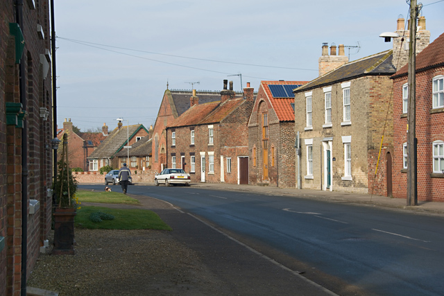
Church End is a small village located in the county of Yorkshire, England. Situated amidst the picturesque countryside, it is known for its tranquil and idyllic setting. With a population of just under 500 residents, it offers a close-knit community feel and a peaceful atmosphere.

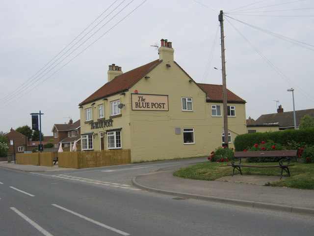
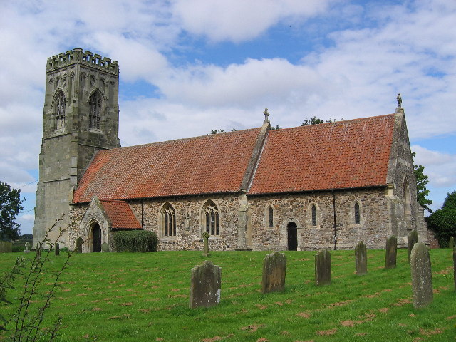
The village takes its name from the presence of a historic church, which stands prominently in the heart of Church End. This beautiful church, dating back several centuries, is a significant landmark and adds to the charm and character of the village. It serves as a focal point for religious and community gatherings.

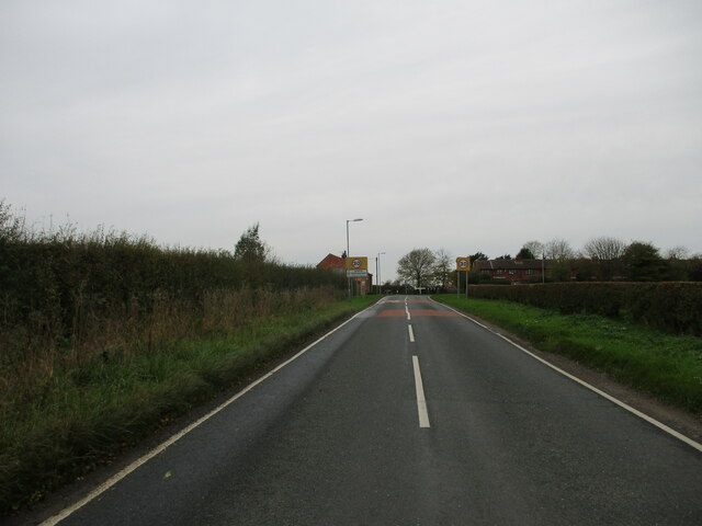
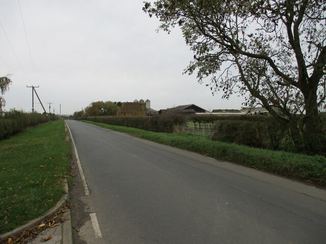
Surrounded by rolling hills and lush green fields, Church End is a haven for nature lovers and outdoor enthusiasts. The countryside offers a myriad of walking and cycling trails, providing an opportunity to explore the stunning natural beauty of the area. Additionally, the village benefits from its proximity to several nature reserves and parks, making it an ideal destination for those seeking a peaceful retreat.

While Church End may be small in size, it boasts a strong sense of community spirit. Local residents actively participate in various community events and initiatives, fostering a friendly and welcoming atmosphere. The village also has a few amenities, including a village hall, a small convenience store, and a local pub, where locals and visitors can socialize and unwind.

Overall, Church End, Yorkshire, is a charming and serene village, offering a close community, natural beauty, and a sense of tranquility that is characteristic of the Yorkshire countryside.

If you have any feedback on the listing, please let us know in the comments section below.

Church End Images

Images are sourced within 2km of 53.961606/-0.34013 or Grid Reference TA0953. Thanks to Geograph Open Source API. All images are credited.

The Blue Post in North Frodingham
Main Street, North Frodingham Looking west along the B1249 Beeford to Driffield road as it runs through the centre of the village
Main Street, North Frodingham
Looking west along the B1249 Beeford to Driffield road as it runs through the centre of the village
Farm, North Frodingham Marked as 'poultry houses' on the map, these buildings on the northern side of Cross Road appear to be making extensive use of solar energy, limited though it may have been on the day of this shot.
Farm, North Frodingham
Marked as 'poultry houses' on the map, these buildings on the northern side of Cross Road appear to be making extensive use of solar energy, limited though it may have been on the day of this shot.
Mount Pleasant Farm, North Frodingham Farmhouse on Cross Road, seen from Mount Pleasant Road
Mount Pleasant Farm, North Frodingham
Farmhouse on Cross Road, seen from Mount Pleasant Road
Drain parallel to Old Howe
Walking  into  North  Frodingham  along  Bridlington  Balk To do a decent walk in this area lane walking is a must
Walking into North Frodingham along Bridlington Balk
To do a decent walk in this area lane walking is a must
Corner  House  North  Frodingham  extended The main road goes right into the village and Grange Road goes left around the Corner House
Corner House North Frodingham extended
The main road goes right into the village and Grange Road goes left around the Corner House
North  Frodingham  playing  field  over  the  roller
North Frodingham playing field over the roller
Mount  Pleasant  Road  North  Frodingham
Mount Pleasant Road North Frodingham
Mount  Pleasant  Road  North  Frodingham  toward  Cross  Road Minor road running south of the village
Mount Pleasant Road North Frodingham toward Cross Road
Minor road running south of the village
Cross  Road  at  the  junction with  Mount  Pleasant  Road Mount Pleasant Farm on the left
Cross Road at the junction with Mount Pleasant Road
Mount Pleasant Farm on the left
Grange  Road  at  the  junction  with  Cross  Road
Grange Road at the junction with Cross Road
Grange  Road  with  Field  House  farm  on  the  right
Grange Road with Field House farm on the right
Entrance to Carr House Farm
North Frodingham, St Elgin's church This is the south facing wall of the tower of St Elgin's church in the parish of North Frodingham. The benchmark and bolt are cut into the 4th stone course.
North Frodingham, St Elgin's church
This is the south facing wall of the tower of St Elgin's church in the parish of North Frodingham. The benchmark and bolt are cut into the 4th stone course.
North Frodingham, St Elgin's church A wider angle showing the south facing wall of the tower of St Elgin's church in the parish of North Frodingham. The benchmark and bolt are cut into the 4th stone course of the tower.
North Frodingham, St Elgin's church
A wider angle showing the south facing wall of the tower of St Elgin's church in the parish of North Frodingham. The benchmark and bolt are cut into the 4th stone course of the tower.
North Frodingham, Carr Farm This farm is situated on the west side of the highway, and approximately half a mile south of North Frodingham. On the east facing wall there is a bench mark cut into the 5th course of bricks.
North Frodingham, Carr Farm
This farm is situated on the west side of the highway, and approximately half a mile south of North Frodingham. On the east facing wall there is a bench mark cut into the 5th course of bricks.
North Frodingham, Carr Farm A wider angle showing the roadside position of Carr Farm on the west side of the highway, and approximately half a mile south of North Frodingham. On this east facing wall there is a bench mark cut into the 5th course of bricks.
North Frodingham, Carr Farm
A wider angle showing the roadside position of Carr Farm on the west side of the highway, and approximately half a mile south of North Frodingham. On this east facing wall there is a bench mark cut into the 5th course of bricks.
Show me another place!

Church End is located at Grid Ref: TA0953 (Lat: 53.961606, Lng: -0.34013)

Division: East Riding

Unitary Authority: East Riding of Yorkshire

Police Authority: Humberside

What 3 Words

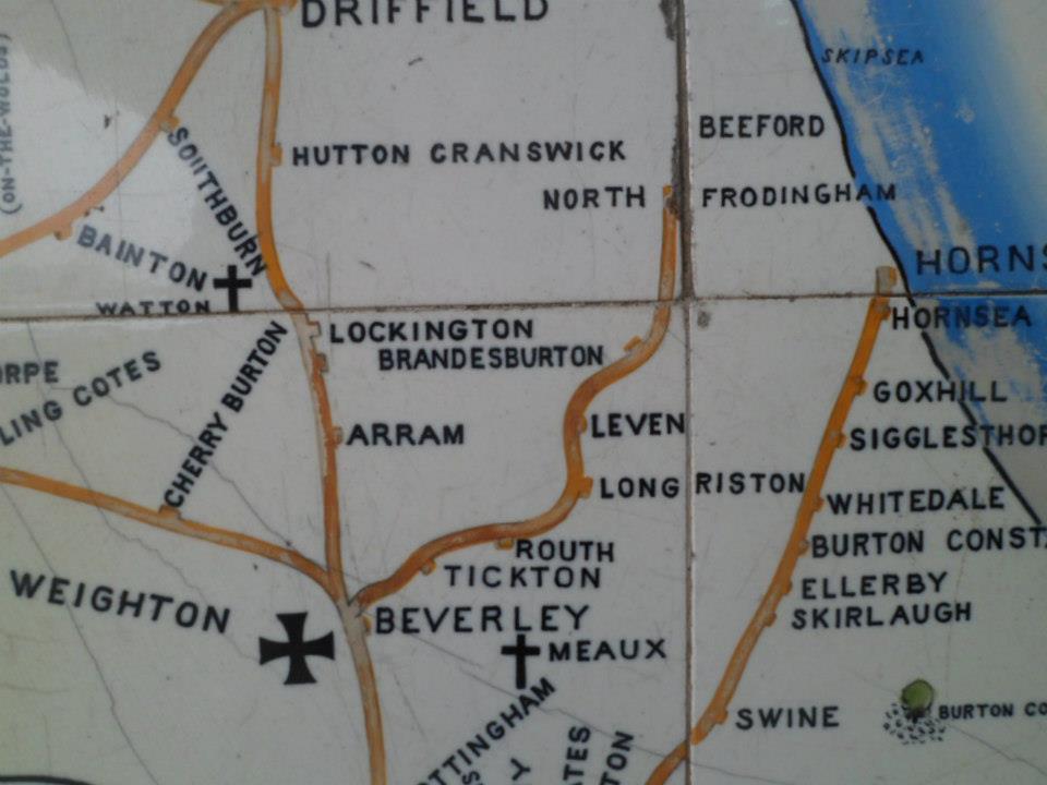
///decoding.likes.vocal. Near Beeford, East Yorkshire

Related Wikis

Church End, East Riding of Yorkshire

Church End is a hamlet in the East Riding of Yorkshire, England. It is situated approximately 1 mile (1.6 km) west of the village of North Frodingham...

North Holderness Light Railway

The North Holderness Light Railway was a proposed light railway, which was to have been constructed between Beverley and North Frodingham, in the East...

Fisholme

Fisholme is a small area in the East Riding of Yorkshire, England that is situated between Brigham and Emmotland. The canal section of the Driffield Navigation...

North Frodingham

North Frodingham is a village and civil parish in the East Riding of Yorkshire, England. It is situated approximately 5.5 miles (9 km) south-east of the...

Nearby Amenities

Located within 500m of 53.961606,-0.34013
Church End
Is In: East Riding of Yorkshire, England, UK
Is In County: East Riding of Yorkshire
Place: locality
Wikidata: Q975712
Lat/Long: 53.9653797/-0.3413558
Power: pole
Lat/Long: 53.9598213/-0.3341402
Power: pole
Lat/Long: 53.9607148/-0.3359288
Power: pole
Lat/Long: 53.9615587/-0.3377309
Power: pole
Lat/Long: 53.9624839/-0.3396622
Power: pole
Lat/Long: 53.9630974/-0.3409222
Power: pole
Lat/Long: 53.9637897/-0.341843
Power: pole
Lat/Long: 53.9645321/-0.3427726
The data included in this document is from www.openstreetmap.org. The data is made available under ODbL.

Have you been to Church End?

Leave your review of Church End below (or comments, questions and feedback).