Ausewell Wood

Wood, Forest in Devon Teignbridge

England

Ausewell Wood

Old Bridge Marker near Buckland Bridge, Widecombe in the Moor County Bridge Marker on the northwest side of the road southwest of Buckland Bridge, River Webburn. Widecombe in the Moor parish. Inscribed C to mark the extent of roadway adjoining the bridge that the County was obliged to maintain.

Milestone Society National ID: DV_WIDEC01br
Old Bridge Marker near Buckland Bridge, Widecombe in the Moor Credit: T Jenkinson

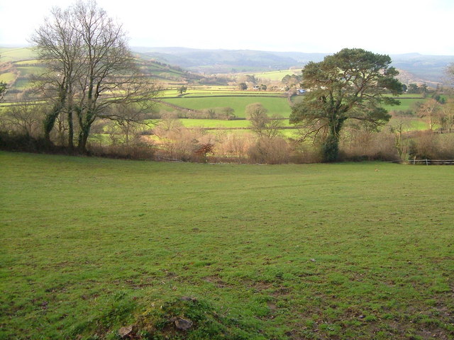
Ausewell Wood, located in Devon, England, is a captivating woodland that covers an area of approximately 150 acres. This ancient forest is nestled within the beautiful Dartmoor National Park, offering visitors a serene and enchanting experience. Ausewell Wood is renowned for its diverse ecosystem, comprising a mixture of broadleaf trees, including oak, beech, and birch, as well as several coniferous species.

As one ventures into the wood, they are greeted by a lush green canopy overhead, allowing only dappled sunlight to filter through, creating a magical ambiance. The woodland floor is adorned with an array of vibrant wildflowers, such as bluebells, primroses, and foxgloves, adding bursts of color to the landscape.

The wood boasts an extensive network of well-maintained footpaths, inviting visitors to explore its hidden nooks and crannies. These paths wind through ancient trees, leading to secluded clearings and babbling brooks, providing ample opportunities for peaceful strolls and picnics. Birdsong fills the air, making it a paradise for birdwatchers, with species such as woodpeckers, owls, and warblers calling the wood their home.

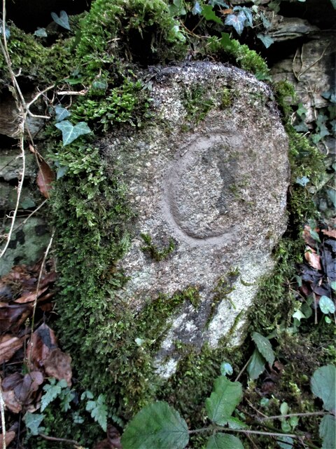
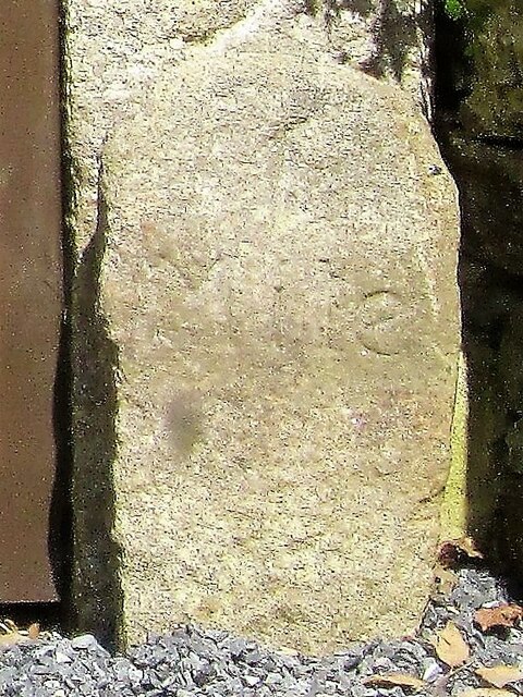
Ausewell Wood has a rich history, with evidence of human activity dating back to prehistoric times. Archaeological remains, including ancient burial mounds and stone circles, can be discovered within the wood, offering a glimpse into the past. The wood is also a designated Site of Special Scientific Interest, recognized for its importance in preserving the diverse flora and fauna of the region.

Whether one seeks solace in nature, wishes to explore its historical significance, or simply desires to immerse themselves in the beauty of Devon's woodlands, Ausewell Wood provides an idyllic setting for all.

If you have any feedback on the listing, please let us know in the comments section below.

Ausewell Wood Images

Images are sourced within 2km of 50.530344/-3.7885345 or Grid Reference SX7371. Thanks to Geograph Open Source API. All images are credited.

Old Bridge Marker near Buckland Bridge, Widecombe in the Moor County Bridge Marker on the northwest side of the road southwest of Buckland Bridge, River Webburn. Widecombe in the Moor parish. Inscribed C to mark the extent of roadway adjoining the bridge that the County was obliged to maintain.

Milestone Society National ID: DV_WIDEC01br
Old Bridge Marker near Buckland Bridge, Widecombe in the Moor
County Bridge Marker on the northwest side of the road southwest of Buckland Bridge, River Webburn. Widecombe in the Moor parish. Inscribed C to mark the extent of roadway adjoining the bridge that the County was obliged to maintain. Milestone Society National ID: DV_WIDEC01br
Old Milestone (Parole stone), West of Hele Cross The milestone is now located in front of the main post of the side gate to the west of the main entrance to Dart Vale, on the north side of the road. Originally the milestone was located opposite the entrance to Dart Vale, on the south side of the road.  Parish of Ashburton (Teignbridge District). Carved stone post, Ashburton Parole stone design, erected by the Government in the 18th century. (French prisoners of war on parole were stationed in Ashburton 1794-98 and were allowed to walk up to one mile from the town)

Inscription reads:-
1 / Mile

Milestone Society National ID: DV_ASPS01B
Old Milestone (Parole stone), West of Hele Cross
The milestone is now located in front of the main post of the side gate to the west of the main entrance to Dart Vale, on the north side of the road. Originally the milestone was located opposite the entrance to Dart Vale, on the south side of the road. Parish of Ashburton (Teignbridge District). Carved stone post, Ashburton Parole stone design, erected by the Government in the 18th century. (French prisoners of war on parole were stationed in Ashburton 1794-98 and were allowed to walk up to one mile from the town) Inscription reads:- 1 / Mile Milestone Society National ID: DV_ASPS01B
Junction of Headborough Road and Holne Cross
About to cross Holne Bridge
Lodge house in the woods
Path, Deeper Marsh A rocky path by the River Dart.
Path, Deeper Marsh
A rocky path by the River Dart.
Dart Country Park Looking across the River Dart Country Park
Dart Country Park
Looking across the River Dart Country Park
Holne Bridge - Dartmoor An old narrow bridge on the Ashburton - Princetown road.
Holne Bridge - Dartmoor
An old narrow bridge on the Ashburton - Princetown road.
Holne Chase - Dartmoor The Ashburton - Princetown road as it passes through the woods of Holne Chase beside the Dart valley.
Holne Chase - Dartmoor
The Ashburton - Princetown road as it passes through the woods of Holne Chase beside the Dart valley.
Buckland Beacon Viewed from Welstor Rock, looking west.
Buckland Beacon
Viewed from Welstor Rock, looking west.
River Dart at Deeper Marsh The flat land in the foreground within the incised meander is part of a very popular recreational area. Beyond the river (not placid in the rest of this square) is the river-cliff and steep wooded slopes of Holne Chase. Looking roughly east.
River Dart at Deeper Marsh
The flat land in the foreground within the incised meander is part of a very popular recreational area. Beyond the river (not placid in the rest of this square) is the river-cliff and steep wooded slopes of Holne Chase. Looking roughly east.
View near Druid Looking south from the steep lane near Druid Cottage.
View near Druid
Looking south from the steep lane near Druid Cottage.
Southbrook This hamlet forms a major part of the scattered village of Buckland in the Moor (see <a title="https://www.geograph.org.uk/photo/17309" href="https://www.geograph.org.uk/photo/17309">Link</a> ). View looking north-west.
Southbrook
This hamlet forms a major part of the scattered village of Buckland in the Moor (see Link ). View looking north-west.
Below Buckland Beacon View looking south from the edge of the access land below the Beacon. The house on the left is Beacon Hill, and the woods beyond surround Ausewell Rocks.
Below Buckland Beacon
View looking south from the edge of the access land below the Beacon. The house on the left is Beacon Hill, and the woods beyond surround Ausewell Rocks.
Looking towards Bowdley View from near Welstor Cross looking ENE towards the Ashburn valley. Some of the features can be seen in <a title="https://www.geograph.org.uk/photo/145330" href="https://www.geograph.org.uk/photo/145330">Link</a> from the other direction. Photographer out of square by a few yards.
Looking towards Bowdley
View from near Welstor Cross looking ENE towards the Ashburn valley. Some of the features can be seen in Link from the other direction. Photographer out of square by a few yards.
Woods near Ausewell Rocks A rather gloomy track through the conifer plantations - looking WSW.
Woods near Ausewell Rocks
A rather gloomy track through the conifer plantations - looking WSW.
Near Hele Cross, Ashburton Some ribbon development on the lane between Hele Cross and Holne Turn, seen looking roughly west.
Near Hele Cross, Ashburton
Some ribbon development on the lane between Hele Cross and Holne Turn, seen looking roughly west.
Lane to Bowdley Looking up the lane to Bowdley and Waveney from Waterleat Farm, past the sign indicating the bridleway along Pennsland Lane. The building above right is Welstor, and the trees on the right mark the valley of the River Ashburn.
Lane to Bowdley
Looking up the lane to Bowdley and Waveney from Waterleat Farm, past the sign indicating the bridleway along Pennsland Lane. The building above right is Welstor, and the trees on the right mark the valley of the River Ashburn.
Show me another place!

Ausewell Wood is located at Grid Ref: SX7371 (Lat: 50.530344, Lng: -3.7885345)

Administrative County: Devon

District: Teignbridge

Police Authority: Devon and Cornwall

What 3 Words

///taller.luxury.holly. Near Ashburton, Devon

Related Wikis

Holne Chase Castle

Holne Chase Castle is an Iron Age hill fort situated close to Buckland-in-the-Moor in Devon, England. The fort is situated on a promontory on the Northern...

Holne Bridge

Holne Bridge is a Grade II* listed medieval bridge over the River Dart, Dartmoor, Devon, England. It is on the road between Ashburton and Two Bridges,...

Buckland Beacon

Buckland Beacon is a granite tor and conical beacon, near to the village of Buckland-in-the-Moor on Dartmoor, England. It is well known for its Ten Commandments...

Buckland-in-the-Moor

Buckland in the Moor is a village and civil parish in the Teignbridge district of Devon, England. According to the 2001 census it had a population of...

West Webburn River

The West Webburn is a stream on Dartmoor in Devon in south-west England. It rises on the eastern side of the moors flowing off the east side of Hameldown...

Newbridge, River Dart

Newbridge or New Bridge is a Grade II* listed medieval bridge over the River Dart, Dartmoor, Devon, England. It is on the road between Ashburton and Two...

River Ashburn

Ashburn is a river in the Dartmoor moors in Devon in south-west England, flowing through the Ashburton valley to the River Dart. The River Ashburn is a...

Ashburton Town Hall

Ashburton Town Hall is a municipal building in the North Street, Ashburton, Devon, England. The town hall, which is the meeting place of Ashburton Town...

Nearby Amenities

Located within 500m of 50.530344,-3.7885345
Direction: 270
Tourism: viewpoint
Lat/Long: 50.5317699/-3.7869837
The data included in this document is from www.openstreetmap.org. The data is made available under ODbL.

Have you been to Ausewell Wood?

Leave your review of Ausewell Wood below (or comments, questions and feedback).