Ausewell Common

Downs, Moorland in Devon Teignbridge

England

Ausewell Common

Old Bridge Marker near Buckland Bridge, Widecombe in the Moor County Bridge Marker on the northwest side of the road southwest of Buckland Bridge, River Webburn. Widecombe in the Moor parish. Inscribed C to mark the extent of roadway adjoining the bridge that the County was obliged to maintain.

Milestone Society National ID: DV_WIDEC01br
Old Bridge Marker near Buckland Bridge, Widecombe in the Moor Credit: T Jenkinson

Ausewell Common is a vast expanse of natural beauty located in the county of Devon, England. Spanning over 1,000 acres, it is a diverse landscape that combines downs, moorland, and coastal features. Situated near the popular seaside town of Teignmouth, it offers a stunning contrast between the rugged coastline and rolling hills.

The common is characterized by its rich biodiversity and unique habitats. It is home to a variety of animal and plant species, making it a haven for nature enthusiasts and wildlife lovers. Visitors can spot rare birds, such as the Dartford Warbler and the Cirl Bunting, as well as wild ponies that roam freely across the moors.

The terrain of Ausewell Common is a patchwork of heathland, grassland, and woodlands. Gorse and bracken dominate the landscape, adding vibrant colors throughout the year. The common is crisscrossed by a network of footpaths and trails, allowing visitors to explore its hidden corners and enjoy breathtaking views.

In addition to its natural beauty, Ausewell Common has historical significance. It was once used as a training ground for soldiers during World War II, and remnants of military structures can still be found scattered across the area. These remnants serve as a reminder of the common's past and add an intriguing element to its charm.

Overall, Ausewell Common is a captivating destination for those seeking tranquility, natural wonders, and a glimpse into history. Whether it's a leisurely stroll, birdwatching, or simply taking in the panoramic views, visitors are sure to be captivated by the beauty and serenity of this exceptional piece of Devon.

If you have any feedback on the listing, please let us know in the comments section below.

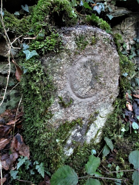
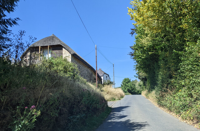
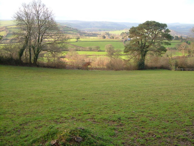
Ausewell Common Images

Images are sourced within 2km of 50.527393/-3.7863206 or Grid Reference SX7371. Thanks to Geograph Open Source API. All images are credited.

Old Bridge Marker near Buckland Bridge, Widecombe in the Moor County Bridge Marker on the northwest side of the road southwest of Buckland Bridge, River Webburn. Widecombe in the Moor parish. Inscribed C to mark the extent of roadway adjoining the bridge that the County was obliged to maintain.

Milestone Society National ID: DV_WIDEC01br
Old Bridge Marker near Buckland Bridge, Widecombe in the Moor
County Bridge Marker on the northwest side of the road southwest of Buckland Bridge, River Webburn. Widecombe in the Moor parish. Inscribed C to mark the extent of roadway adjoining the bridge that the County was obliged to maintain. Milestone Society National ID: DV_WIDEC01br
Old Milestone (Parole stone), West of Hele Cross The milestone is now located in front of the main post of the side gate to the west of the main entrance to Dart Vale, on the north side of the road. Originally the milestone was located opposite the entrance to Dart Vale, on the south side of the road.  Parish of Ashburton (Teignbridge District). Carved stone post, Ashburton Parole stone design, erected by the Government in the 18th century. (French prisoners of war on parole were stationed in Ashburton 1794-98 and were allowed to walk up to one mile from the town)

Inscription reads:-
1 / Mile

Milestone Society National ID: DV_ASPS01B
Old Milestone (Parole stone), West of Hele Cross
The milestone is now located in front of the main post of the side gate to the west of the main entrance to Dart Vale, on the north side of the road. Originally the milestone was located opposite the entrance to Dart Vale, on the south side of the road. Parish of Ashburton (Teignbridge District). Carved stone post, Ashburton Parole stone design, erected by the Government in the 18th century. (French prisoners of war on parole were stationed in Ashburton 1794-98 and were allowed to walk up to one mile from the town) Inscription reads:- 1 / Mile Milestone Society National ID: DV_ASPS01B
Buildings at Higher Headborough Farm
Junction of Headborough Road and Holne Cross
About to cross Holne Bridge
Lodge house in the woods
The road to Dartmoor at Summerhill Cross The hedge on the right has been cut back and the stonework under the greenery is obvious.
The road to Dartmoor at Summerhill Cross
The hedge on the right has been cut back and the stonework under the greenery is obvious.
Lane to Hele From the point where the green lane carrying Ashburton Bridleway 7 joins it. It quickly crosses into <a href="https://www.geograph.org.uk/gridref/SX7470">SX7470</a>.
Lane to Hele
From the point where the green lane carrying Ashburton Bridleway 7 joins it. It quickly crosses into SX7470.
Green lane by Lavender House This route with public access leaves the lane shown in <a href="https://www.geograph.org.uk/photo/3777030">SX7469 : Lane to Hele</a> as it bends past the Lavender House Hotel, whose car park is behind the hedge on the left.
Green lane by Lavender House
This route with public access leaves the lane shown in SX7469 : Lane to Hele as it bends past the Lavender House Hotel, whose car park is behind the hedge on the left.
Dart Country Park Looking across the River Dart Country Park
Dart Country Park
Looking across the River Dart Country Park
Holne Bridge - Dartmoor An old narrow bridge on the Ashburton - Princetown road.
Holne Bridge - Dartmoor
An old narrow bridge on the Ashburton - Princetown road.
Holne Chase - Dartmoor The Ashburton - Princetown road as it passes through the woods of Holne Chase beside the Dart valley.
Holne Chase - Dartmoor
The Ashburton - Princetown road as it passes through the woods of Holne Chase beside the Dart valley.
Buckland Beacon Viewed from Welstor Rock, looking west.
Buckland Beacon
Viewed from Welstor Rock, looking west.
River Dart at Deeper Marsh The flat land in the foreground within the incised meander is part of a very popular recreational area. Beyond the river (not placid in the rest of this square) is the river-cliff and steep wooded slopes of Holne Chase. Looking roughly east.
River Dart at Deeper Marsh
The flat land in the foreground within the incised meander is part of a very popular recreational area. Beyond the river (not placid in the rest of this square) is the river-cliff and steep wooded slopes of Holne Chase. Looking roughly east.
Westabrook Looking south from Ashburton Footpath 5 towards Westabrook farm, and the Westabrook suburb of the town. On the left, the River Ashburn heads through a narrow cleft into the town, whose church tower is visible.
Westabrook
Looking south from Ashburton Footpath 5 towards Westabrook farm, and the Westabrook suburb of the town. On the left, the River Ashburn heads through a narrow cleft into the town, whose church tower is visible.
View near Druid Looking south from the steep lane near Druid Cottage.
View near Druid
Looking south from the steep lane near Druid Cottage.
Belford Mill, Ashburn valley,  from near Lurgeford farm Looking north up the narrow wooded River Ashburn valley as it leaves Dartmoor. The former water-mill, used for wool and corn, and known as the "Coffin Mill" because of its shape, is described at <span class="nowrap"><a title="https://www.historicengland.org.uk/listing/the-list/list-entry/1282905" rel="nofollow ugc noopener" href="https://www.historicengland.org.uk/listing/the-list/list-entry/1282905">Link</a><img style="margin-left:2px;" alt="External link" title="External link - shift click to open in new window" src="https://s1.geograph.org.uk/img/external.png" width="10" height="10"/></span> .
Belford Mill, Ashburn valley, from near Lurgeford farm
Looking north up the narrow wooded River Ashburn valley as it leaves Dartmoor. The former water-mill, used for wool and corn, and known as the "Coffin Mill" because of its shape, is described at LinkExternal link .
Southbrook This hamlet forms a major part of the scattered village of Buckland in the Moor (see <a title="https://www.geograph.org.uk/photo/17309" href="https://www.geograph.org.uk/photo/17309">Link</a> ). View looking north-west.
Southbrook
This hamlet forms a major part of the scattered village of Buckland in the Moor (see Link ). View looking north-west.
Show me another place!

Ausewell Common is located at Grid Ref: SX7371 (Lat: 50.527393, Lng: -3.7863206)

Administrative County: Devon

District: Teignbridge

Police Authority: Devon and Cornwall

What 3 Words

///messing.browsers.trickles. Near Ashburton, Devon

Related Wikis

Holne Bridge

Holne Bridge is a Grade II* listed medieval bridge over the River Dart, Dartmoor, Devon, England. It is on the road between Ashburton and Two Bridges,...

Holne Chase Castle

Holne Chase Castle is an Iron Age hill fort situated close to Buckland-in-the-Moor in Devon, England. The fort is situated on a promontory on the Northern...

Buckland Beacon

Buckland Beacon is a granite tor and conical beacon, near to the village of Buckland-in-the-Moor on Dartmoor, England. It is well known for its Ten Commandments...

River Ashburn

Ashburn is a river in the Dartmoor moors in Devon in south-west England, flowing through the Ashburton valley to the River Dart. The River Ashburn is a...

Buckland-in-the-Moor

Buckland in the Moor is a village and civil parish in the Teignbridge district of Devon, England. According to the 2001 census it had a population of...

Newbridge, River Dart

Newbridge or New Bridge is a Grade II* listed medieval bridge over the River Dart, Dartmoor, Devon, England. It is on the road between Ashburton and Two...

Ashburton Town Hall

Ashburton Town Hall is a municipal building in the North Street, Ashburton, Devon, England. The town hall, which is the meeting place of Ashburton Town...

West Webburn River

The West Webburn is a stream on Dartmoor in Devon in south-west England. It rises on the eastern side of the moors flowing off the east side of Hameldown...

Nearby Amenities

Located within 500m of 50.527393,-3.7863206
Generator Method: photovoltaic
Generator Output Electricity: yes
Generator Source: solar
Generator Type: solar_photovoltaic_panel
Location: roof
Power: generator
Lat/Long: 50.5245304/-3.7872121
Direction: 270
Tourism: viewpoint
Lat/Long: 50.5317699/-3.7869837
The data included in this document is from www.openstreetmap.org. The data is made available under ODbL.

Have you been to Ausewell Common?

Leave your review of Ausewell Common below (or comments, questions and feedback).