Radley Copse

Wood, Forest in Devon North Devon

England

Radley Copse

Mariansleigh: River Mole at Alswear Three parishes meet here: beyond the bend the river runs into King’s Nympton and the right bank is in Queen’s Nympton
Mariansleigh: River Mole at Alswear Credit: Martin Bodman

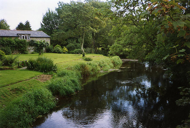
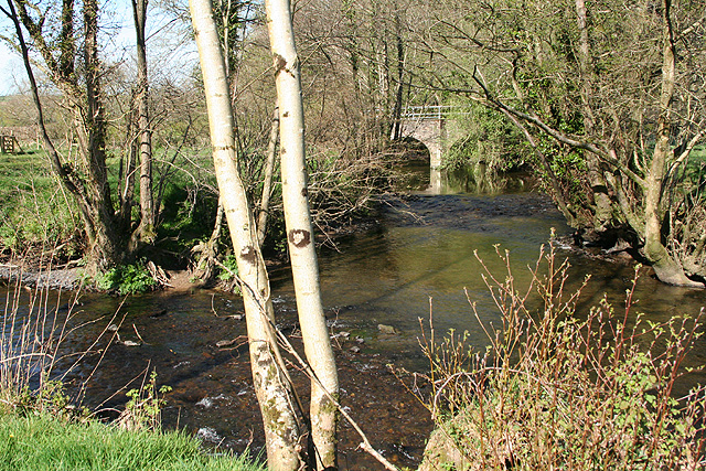
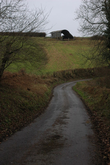
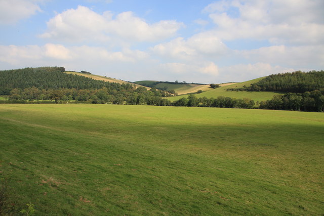
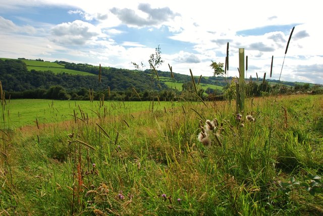
Radley Copse is a picturesque woodland located in Devon, England. Stretching across an area of approximately 100 acres, this enchanting forest is a haven for nature enthusiasts and outdoor lovers alike.

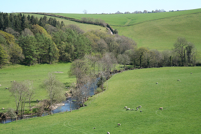
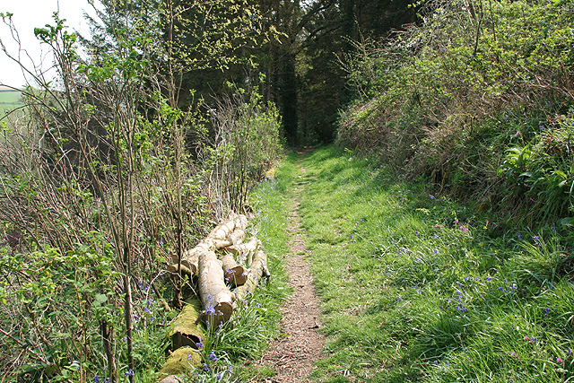
The copse is home to a diverse range of flora and fauna, boasting a rich ecosystem. Tall, majestic oak trees dominate the landscape, their gnarled branches creating a dense canopy that provides shelter to various woodland creatures. The forest floor is carpeted with a vibrant tapestry of wildflowers, ferns, and mosses, creating a picturesque scene that changes with the seasons.

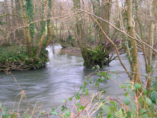
Numerous walking trails crisscross the copse, offering visitors the opportunity to explore its natural beauty. These pathways wind through the forest, leading to hidden clearings, babbling brooks, and tranquil ponds. Along the way, visitors may encounter an array of wildlife, including deer, foxes, and a wide variety of bird species.

Radley Copse is not only a haven for wildlife but also a place of historical significance. The remnants of an ancient Iron Age settlement can be found within its boundaries, adding an element of intrigue and mystery to the area. Archaeological finds, such as pottery shards and tools, have been discovered here, providing insight into the lives of the people who once inhabited this forested land.

With its tranquil ambiance, diverse wildlife, and rich history, Radley Copse offers a captivating experience for anyone seeking a connection with nature. Whether it be exploring the woodland trails, observing the local wildlife, or simply enjoying a peaceful picnic amidst the trees, this hidden gem in Devon is sure to leave a lasting impression on all who visit.

If you have any feedback on the listing, please let us know in the comments section below.
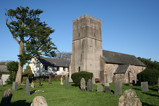
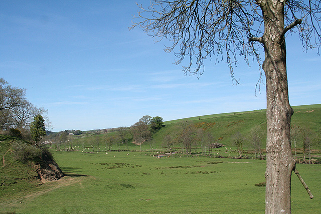
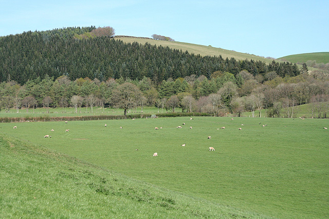
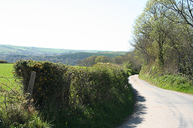
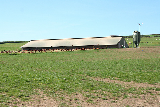
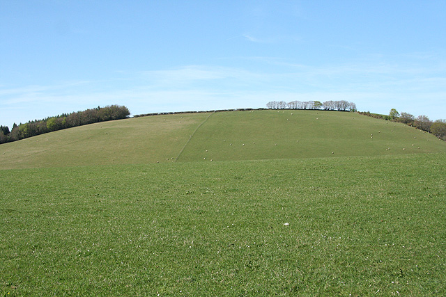
Radley Copse Images

Images are sourced within 2km of 50.995543/-3.811752 or Grid Reference SS7223. Thanks to Geograph Open Source API. All images are credited.

Mariansleigh: River Mole at Alswear Three parishes meet here: beyond the bend the river runs into King’s Nympton and the right bank is in Queen’s Nympton
Mariansleigh: River Mole at Alswear
Three parishes meet here: beyond the bend the river runs into King’s Nympton and the right bank is in Queen’s Nympton
Mariansleigh: St Mary’s church The village name suggests the original dedication was to St Marina and this may have been lost at the Reformation. Looking north east
Mariansleigh: St Mary’s church
The village name suggests the original dedication was to St Marina and this may have been lost at the Reformation. Looking north east
South Molton: Mole valley Near the entrance to Great Hele Barton, looking north-north-east, up the valley
South Molton: Mole valley
Near the entrance to Great Hele Barton, looking north-north-east, up the valley
George Nympton: river Mole Looking south east by the entrance to Little Hele and a little below the confluence of the Mole and the Yeo
George Nympton: river Mole
Looking south east by the entrance to Little Hele and a little below the confluence of the Mole and the Yeo
George Nympton: Mole valley Looking north east across the Mole flood plain towards Blastridge Plantation, which stands beyond the square
George Nympton: Mole valley
Looking north east across the Mole flood plain towards Blastridge Plantation, which stands beyond the square
Mariansleigh: lane to Alswear Looking west-north-west
Mariansleigh: lane to Alswear
Looking west-north-west
Bishop’s Nympton: near Westwood A poultry farm
Bishop’s Nympton: near Westwood
A poultry farm
Bishop’s Nympton: Crosse A Devon longhouse by the back lane from Bishop’s Nympton to South Molton. Looking north east
Bishop’s Nympton: Crosse
A Devon longhouse by the back lane from Bishop’s Nympton to South Molton. Looking north east
Bishop’s Nympton: towards Blastridge Hill View from Radley Cross looking north. The hill is beyond the square
Bishop’s Nympton: towards Blastridge Hill
View from Radley Cross looking north. The hill is beyond the square
George Nympton: the Mole and the Yeo Confluence of two rivers by a public footpath. Looking north east to the lowest bridge on the Yeo
George Nympton: the Mole and the Yeo
Confluence of two rivers by a public footpath. Looking north east to the lowest bridge on the Yeo
George Nympton: Cheyney The house stands on the parish boundary with Queen’s Nympton. The lane ahead runs to Alswear. Turn right for George Nympton village. Looking south-south-east
George Nympton: Cheyney
The house stands on the parish boundary with Queen’s Nympton. The lane ahead runs to Alswear. Turn right for George Nympton village. Looking south-south-east
Queen’s Nympton: towards Little Frenchstone Looking north-north-east. Two small valleys intervene between the camera and the farm which is beyond the square
Queen’s Nympton: towards Little Frenchstone
Looking north-north-east. Two small valleys intervene between the camera and the farm which is beyond the square
King’s Nympton: overlooking New Mill New Mill, now a private house, seen from a public footpath on its boundary. This was the lowest watermill on the Little Silver Stream, a tributary of the Mole. Looking east-south-east
King’s Nympton: overlooking New Mill
New Mill, now a private house, seen from a public footpath on its boundary. This was the lowest watermill on the Little Silver Stream, a tributary of the Mole. Looking east-south-east
King’s Nympton: footpath above New Mill The path runs up the Little Silver valley to Kempstown and Romansleigh. Looking south east
King’s Nympton: footpath above New Mill
The path runs up the Little Silver valley to Kempstown and Romansleigh. Looking south east
Barn near Mariansleigh Barn in a field above Middle Wood to the west of Mariansleigh.
Barn near Mariansleigh
Barn in a field above Middle Wood to the west of Mariansleigh.
Mole valley north of Alswear The flat river plain of the River Mole.
Mole valley north of Alswear
The flat river plain of the River Mole.
Confluence of the River Mole and Crooked oak Here the River Mole is joined by the Crooked Oak, the third largest tributary of the river. The Brook rises around a mile and a half East of East Knowstone and meanders through the settelments of Ash mill and Bishops Nympton before it meets the Mole here
Confluence of the River Mole and Crooked oak
Here the River Mole is joined by the Crooked Oak, the third largest tributary of the river. The Brook rises around a mile and a half East of East Knowstone and meanders through the settelments of Ash mill and Bishops Nympton before it meets the Mole here
Mole Valley Green Burial Ground A burial ground for those who want a quiet countryside final resting place.  This area is on organic farmland and well away from roads and buildings.  The views here are spectacular. (Picture taken with kind permission of the farmer).
Mole Valley Green Burial Ground
A burial ground for those who want a quiet countryside final resting place. This area is on organic farmland and well away from roads and buildings. The views here are spectacular. (Picture taken with kind permission of the farmer).
Show me another place!

Radley Copse is located at Grid Ref: SS7223 (Lat: 50.995543, Lng: -3.811752)

Administrative County: Devon

District: North Devon

Police Authority: Devon and Cornwall

What 3 Words

///supporter.annotated.remote. Near South Molton, Devon

Related Wikis

Queen's Nympton

Queen's Nympton or Queensnympton is a small civil parish in the North Devon district of Devon, England. According to the 2001 census it had a population...

Alswear

Alswear is a village in Devon, England, approximately 25 miles (40 km) northwest of Exeter. == References == == External links == Media related to Alswear...

Mariansleigh

Mariansleigh is a village and civil parish in Devon, England. In 2021 the parish had a population of 170. == External links == GENUKI Mariansleigh Page

South Molton Community College

South Molton Community College (known to students and teachers as SMCC) is a coeducational foundation secondary school located in South Molton in the English...

Nearby Amenities

Located within 500m of 50.995543,-3.811752
The data included in this document is from www.openstreetmap.org. The data is made available under ODbL.

Have you been to Radley Copse?

Leave your review of Radley Copse below (or comments, questions and feedback).