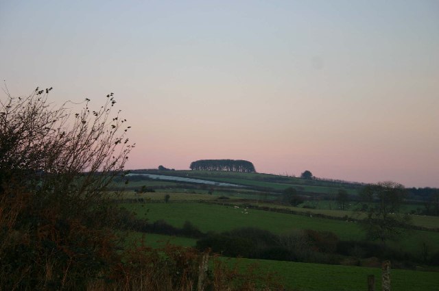
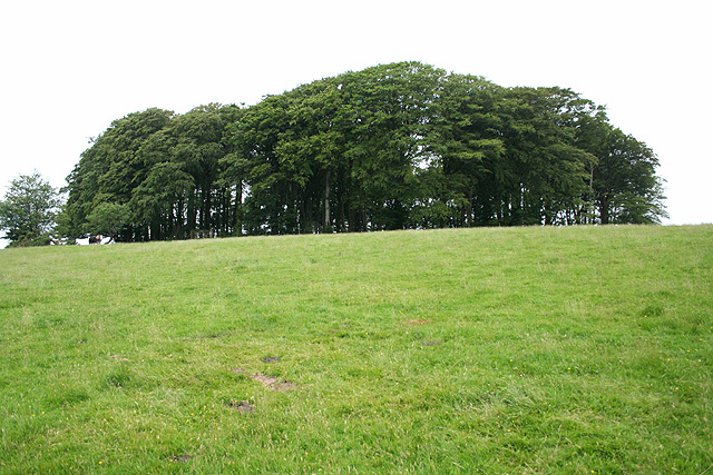
Bampfylde Clump

Wood, Forest in Devon North Devon

England

Bampfylde Clump

The Poltimore Arms, North Molton
The Poltimore Arms, North Molton Credit: Ivan Taylor

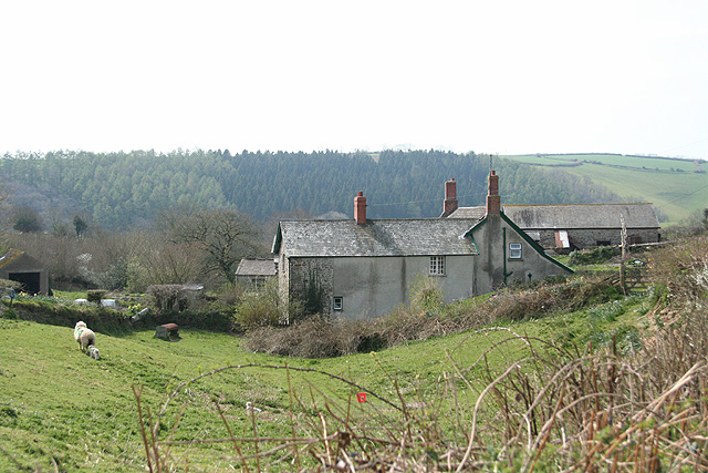
Bampfylde Clump is a small woodland area located in the county of Devon, England. Situated near the town of Exeter, it is nestled within the picturesque countryside, offering a tranquil escape for nature lovers and outdoor enthusiasts alike.

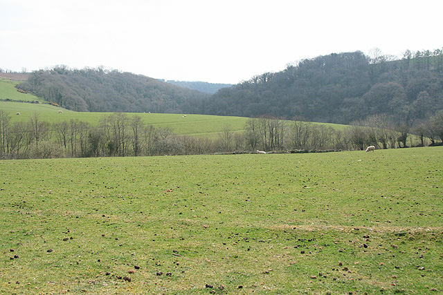
Covering an area of approximately 10 acres, Bampfylde Clump is predominantly made up of deciduous trees, including oak, beech, and birch, which create a stunning canopy during the summer months. The woodland floor is rich with a diverse range of flora, such as bluebells, wood anemones, and primroses, adding vibrant splashes of color to the landscape.

The clump is crisscrossed with a network of well-maintained footpaths, allowing visitors to explore the area at their own pace. These paths lead to various viewpoints, providing panoramic vistas of the surrounding countryside and the nearby River Exe. Additionally, there is a small picnic area where visitors can relax and enjoy a meal amidst the tranquil surroundings.

Bampfylde Clump has a rich history, dating back to the early 19th century. It was originally planted as a private woodland by the Bampfylde family, who owned the nearby Poltimore House. The clump served as an ornamental addition to the estate, providing a picturesque backdrop for the grand house.

Today, Bampfylde Clump is managed by the National Trust, who ensure its preservation and accessibility for the public to enjoy. It is a popular destination for walkers, joggers, and families seeking a peaceful retreat in nature. With its stunning scenery, diverse flora, and rich history, Bampfylde Clump is a hidden gem in the Devon countryside.

If you have any feedback on the listing, please let us know in the comments section below.

Bampfylde Clump Images

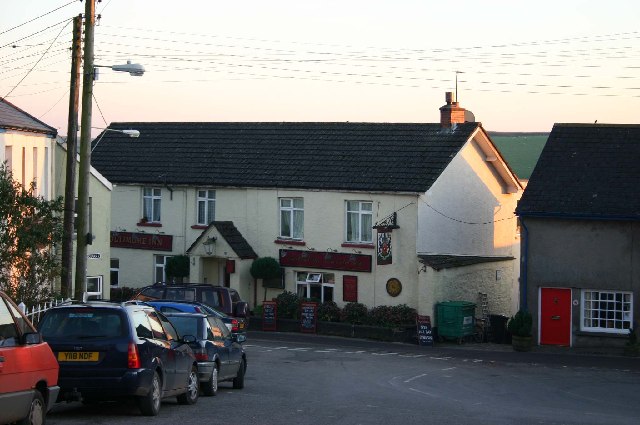
Images are sourced within 2km of 51.069313/-3.8152743 or Grid Reference SS7231. Thanks to Geograph Open Source API. All images are credited.

The Poltimore Arms, North Molton
Bampfylde Clump, at the top of Bampfylde Hill This clump of trees is said to have been a landmark for the local miners returning home after a night in the pubs of North Molton.
Bampfylde Clump, at the top of Bampfylde Hill
This clump of trees is said to have been a landmark for the local miners returning home after a night in the pubs of North Molton.
Along the edge of South Wood, near Heasley Mill
North Molton: Heasley Mill The hamlet acquired its full name in the late 18th century when a four-storey water-powered woollen factory was established here. It ceased work by 1860 or thereabouts and was demolished by the time of the First World War. It stood on the small green to the right of the Heasley House Hotel, the large Georgian building in the centre of the group. A further watermill beyond the green survives as a house conversion. Looking north east
North Molton: Heasley Mill
The hamlet acquired its full name in the late 18th century when a four-storey water-powered woollen factory was established here. It ceased work by 1860 or thereabouts and was demolished by the time of the First World War. It stood on the small green to the right of the Heasley House Hotel, the large Georgian building in the centre of the group. A further watermill beyond the green survives as a house conversion. Looking north east
North Molton: Bampfylde Mine The mine was worked for copper in the 18th and 19th centuries. Seven waterwheels were on site in 1868, powered by more than one leat; these were used for pumping the mine and crushing and dressing the ores. Looking south east. [For more information see ‘Exmoor’s Industrial Archaeology’, edited by Michael Atkinson, Exmoor Press, 1997]
North Molton: Bampfylde Mine
The mine was worked for copper in the 18th and 19th centuries. Seven waterwheels were on site in 1868, powered by more than one leat; these were used for pumping the mine and crushing and dressing the ores. Looking south east. [For more information see ‘Exmoor’s Industrial Archaeology’, edited by Michael Atkinson, Exmoor Press, 1997]
North Molton: North Heasley Part of the complex of farm buildings here. Looking south-south-east
North Molton: North Heasley
Part of the complex of farm buildings here. Looking south-south-east
North Molton: towards North Heasley Looking north east. Fyldon Common is on the skyline
North Molton: towards North Heasley
Looking north east. Fyldon Common is on the skyline
North Molton: stream near Stony Bridge Looking north with Venn Wood, beyond the square, on the right
North Molton: stream near Stony Bridge
Looking north with Venn Wood, beyond the square, on the right
North Molton: West Park Looking west-south-west with Lee Wood on the horizon
North Molton: West Park
Looking west-south-west with Lee Wood on the horizon
North Molton: towards Parkers Wood With Timber Wood on the right: a view towards a wooded valley
North Molton: towards Parkers Wood
With Timber Wood on the right: a view towards a wooded valley
Harvest, Lower Barton The fields in the foreground and middle distance are on opposite sides of the valley, with Flitton Mill Wood hidden below. On the far hill baling is in progress in the evening sun.
Harvest, Lower Barton
The fields in the foreground and middle distance are on opposite sides of the valley, with Flitton Mill Wood hidden below. On the far hill baling is in progress in the evening sun.
Baling A telephoto view of the same scene as <a href="https://www.geograph.org.uk/photo/444550">SS7131 : Harvest, Lower Barton</a> showing machinery at work producing large bales.
Baling
A telephoto view of the same scene as SS7131 : Harvest, Lower Barton showing machinery at work producing large bales.
North Molton: All Saints church Looking east along the nave to the rood screen and chancel. Note the clerestory, an untypical feature for a Devon church. The piers of the north aisle lean inwards at about 14 degrees
North Molton: All Saints church
Looking east along the nave to the rood screen and chancel. Note the clerestory, an untypical feature for a Devon church. The piers of the north aisle lean inwards at about 14 degrees
North Molton: All Saints Church In the Bampfylde Chapel. An early 17th century alabaster monument commemorating Sir Amyas Bampfylde, his wife Elizabeth and their numerous offspring. Looking east-south-east
North Molton: All Saints Church
In the Bampfylde Chapel. An early 17th century alabaster monument commemorating Sir Amyas Bampfylde, his wife Elizabeth and their numerous offspring. Looking east-south-east
North Molton: Bampfylde Clump A circular plantation of beech trees on the nearest high point above North Molton village with views to all points of the compass. Access is by permissive footpath
North Molton: Bampfylde Clump
A circular plantation of beech trees on the nearest high point above North Molton village with views to all points of the compass. Access is by permissive footpath
North Molton: track to Bampfylde Clump Permissive path from the lane near Bampfylde Cross, looking east-north-east
North Molton: track to Bampfylde Clump
Permissive path from the lane near Bampfylde Cross, looking east-north-east
North Molton: Great Heasley Seen from the lane between Heasley Mill and Rewe Cross
North Molton: Great Heasley
Seen from the lane between Heasley Mill and Rewe Cross
North Molton: near North Heasley Cross Looking east-north-east towards Exmoor beyond North Radworthy
North Molton: near North Heasley Cross
Looking east-north-east towards Exmoor beyond North Radworthy
Show me another place!

Bampfylde Clump is located at Grid Ref: SS7231 (Lat: 51.069313, Lng: -3.8152743)

Administrative County: Devon

District: North Devon

Police Authority: Devon and Cornwall

What 3 Words

///implanted.beside.statue. Near South Molton, Devon

Related Wikis

North Molton

North Molton is a village, parish and former manor in North Devon, England. The population of the parish in 2001 was 1,047, decreasing to 721 in the 2011...

South Radworthy

South Radworthy is a hamlet in the civil parish of North Molton, in the North Devon District of the county of Devon, England. It is about three miles to...

Bentwitchen

Bentwitchen is a hamlet in Devon, England. == References ==

North Radworthy

North Radworthy is a hamlet and historic estate in the civil parish and former manor of North Molton, in the North Devon district of the county of Devon...

Bremridge

Bremridge is a historic estate within the former hundred of South Molton in Devon, England. It is now within the parish of Filleigh but was formerly in...

High Bray

High Bray is a village, church of England parish and former civil parish, now in the parish of Brayford, in the North Devon district, in the county of...

Whitechapel, Bishops Nympton

Whitechapel is an ancient former manor within the parish of Bishops Nympton, in north Devon. It was the earliest known residence of the locally influential...

Bremridge Wood

Bremridge Wood formerly part of the Domesday Book estate of Bremridge near South Molton, Devon, England, is the site of an Iron Age enclosure or hill fort...

Nearby Amenities

Located within 500m of 51.069313,-3.8152743
Generator Method: photovoltaic
Generator Output Electricity: yes
Generator Source: solar
Generator Type: solar_photovoltaic_panel
Location: roof
Power: generator
Lat/Long: 51.0663022/-3.8188206
The data included in this document is from www.openstreetmap.org. The data is made available under ODbL.

Have you been to Bampfylde Clump?

Leave your review of Bampfylde Clump below (or comments, questions and feedback).