Bampfylde Hill Plantation

Wood, Forest in Devon North Devon

England

Bampfylde Hill Plantation

Bampfylde Clump, at the top of Bampfylde Hill This clump of trees is said to have been a landmark for the local miners returning home after a night in the pubs of North Molton.
Bampfylde Clump, at the top of Bampfylde Hill Credit: Ivan Taylor

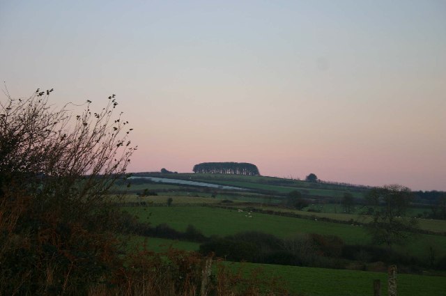
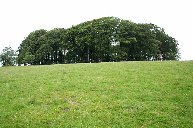
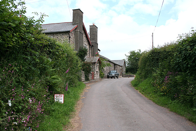
Bampfylde Hill Plantation, located in Devon, England, is a picturesque woodland area that spans over several acres. Situated on the slopes of Bampfylde Hill, the plantation offers breathtaking views of the surrounding countryside and serves as a haven for nature enthusiasts and hikers alike.

The plantation is primarily composed of a diverse range of tree species, including oak, beech, ash, and birch, among others. This variety of trees creates a vibrant and lush forest ecosystem, providing a habitat for numerous wildlife species. Visitors to Bampfylde Hill Plantation often have the opportunity to spot various woodland creatures, such as deer, foxes, rabbits, and a wide array of bird species.

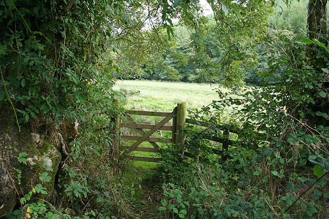
The plantation features well-maintained paths and trails that allow visitors to explore the woodland at their own pace. These paths wind through the trees, offering peaceful and tranquil surroundings for those seeking a break from the hustle and bustle of daily life. Additionally, there are designated picnic areas and benches scattered throughout the plantation, providing pleasant spots for visitors to relax and enjoy the natural beauty of the area.

Bampfylde Hill Plantation is open to the public year-round and is a popular destination for families, couples, and individuals seeking outdoor recreation. Whether it's a leisurely walk, a picnic, or birdwatching, the plantation offers something for everyone, providing a serene and idyllic escape into nature.

If you have any feedback on the listing, please let us know in the comments section below.

Bampfylde Hill Plantation Images

Images are sourced within 2km of 51.072685/-3.816434 or Grid Reference SS7231. Thanks to Geograph Open Source API. All images are credited.

Bampfylde Clump, at the top of Bampfylde Hill This clump of trees is said to have been a landmark for the local miners returning home after a night in the pubs of North Molton.
Bampfylde Clump, at the top of Bampfylde Hill
This clump of trees is said to have been a landmark for the local miners returning home after a night in the pubs of North Molton.
Along the edge of South Wood, near Heasley Mill
North Molton: in the Mole valley A footpath between Mines Bridge and Higher Mines Wood. Looking east-south-east
North Molton: in the Mole valley
A footpath between Mines Bridge and Higher Mines Wood. Looking east-south-east
North Molton: Heasley Mill The hamlet acquired its full name in the late 18th century when a four-storey water-powered woollen factory was established here. It ceased work by 1860 or thereabouts and was demolished by the time of the First World War. It stood on the small green to the right of the Heasley House Hotel, the large Georgian building in the centre of the group. A further watermill beyond the green survives as a house conversion. Looking north east
North Molton: Heasley Mill
The hamlet acquired its full name in the late 18th century when a four-storey water-powered woollen factory was established here. It ceased work by 1860 or thereabouts and was demolished by the time of the First World War. It stood on the small green to the right of the Heasley House Hotel, the large Georgian building in the centre of the group. A further watermill beyond the green survives as a house conversion. Looking north east
North Molton: Bampfylde Mine The mine was worked for copper in the 18th and 19th centuries. Seven waterwheels were on site in 1868, powered by more than one leat; these were used for pumping the mine and crushing and dressing the ores. Looking south east. [For more information see ‘Exmoor’s Industrial Archaeology’, edited by Michael Atkinson, Exmoor Press, 1997]
North Molton: Bampfylde Mine
The mine was worked for copper in the 18th and 19th centuries. Seven waterwheels were on site in 1868, powered by more than one leat; these were used for pumping the mine and crushing and dressing the ores. Looking south east. [For more information see ‘Exmoor’s Industrial Archaeology’, edited by Michael Atkinson, Exmoor Press, 1997]
North Molton: North Heasley Part of the complex of farm buildings here. Looking south-south-east
North Molton: North Heasley
Part of the complex of farm buildings here. Looking south-south-east
North Molton: towards North Heasley Looking north east. Fyldon Common is on the skyline
North Molton: towards North Heasley
Looking north east. Fyldon Common is on the skyline
Harvest, Lower Barton The fields in the foreground and middle distance are on opposite sides of the valley, with Flitton Mill Wood hidden below. On the far hill baling is in progress in the evening sun.
Harvest, Lower Barton
The fields in the foreground and middle distance are on opposite sides of the valley, with Flitton Mill Wood hidden below. On the far hill baling is in progress in the evening sun.
Baling A telephoto view of the same scene as <a href="https://www.geograph.org.uk/photo/444550">SS7131 : Harvest, Lower Barton</a> showing machinery at work producing large bales.
Baling
A telephoto view of the same scene as SS7131 : Harvest, Lower Barton showing machinery at work producing large bales.
North Molton: Bampfylde Clump A circular plantation of beech trees on the nearest high point above North Molton village with views to all points of the compass. Access is by permissive footpath
North Molton: Bampfylde Clump
A circular plantation of beech trees on the nearest high point above North Molton village with views to all points of the compass. Access is by permissive footpath
North Molton: track to Bampfylde Clump Permissive path from the lane near Bampfylde Cross, looking east-north-east
North Molton: track to Bampfylde Clump
Permissive path from the lane near Bampfylde Cross, looking east-north-east
North Molton: Great Heasley Seen from the lane between Heasley Mill and Rewe Cross
North Molton: Great Heasley
Seen from the lane between Heasley Mill and Rewe Cross
North Molton: near North Heasley Cross Looking east-north-east towards Exmoor beyond North Radworthy
North Molton: near North Heasley Cross
Looking east-north-east towards Exmoor beyond North Radworthy
North Molton: towards Great Heasley Looking east
North Molton: towards Great Heasley
Looking east
North Molton: below Coombeshead Looking south-south-west towards a hilltop poultry farm
North Molton: below Coombeshead
Looking south-south-west towards a hilltop poultry farm
North Molton: above Coombeshead Looking east-south-east
North Molton: above Coombeshead
Looking east-south-east
North Molton: lane near Coombeshead Looking west
North Molton: lane near Coombeshead
Looking west
North Molton: South Wood Looking south-south-west
North Molton: South Wood
Looking south-south-west
Show me another place!

Bampfylde Hill Plantation is located at Grid Ref: SS7231 (Lat: 51.072685, Lng: -3.816434)

Administrative County: Devon

District: North Devon

Police Authority: Devon and Cornwall

What 3 Words

///firebird.consumed.panting. Near South Molton, Devon

Related Wikis

North Molton

North Molton is a village, parish and former manor in North Devon, England. The population of the parish in 2001 was 1,047, decreasing to 721 in the 2011...

South Radworthy

South Radworthy is a hamlet in the civil parish of North Molton, in the North Devon District of the county of Devon, England. It is about three miles to...

Bentwitchen

Bentwitchen is a hamlet in Devon, England. == References ==

North Radworthy

North Radworthy is a hamlet and historic estate in the civil parish and former manor of North Molton, in the North Devon district of the county of Devon...

High Bray

High Bray is a village, church of England parish and former civil parish, now in the parish of Brayford, in the North Devon district, in the county of...

Bremridge

Bremridge is a historic estate within the former hundred of South Molton in Devon, England. It is now within the parish of Filleigh but was formerly in...

Brayford

Brayford is a village and civil parish in Devon, England, situated about 5 miles (8.0 km) from South Molton and 6 miles (9.7 km) from Barnstaple. It lies...

Bremridge Wood

Bremridge Wood formerly part of the Domesday Book estate of Bremridge near South Molton, Devon, England, is the site of an Iron Age enclosure or hill fort...

Nearby Amenities

Located within 500m of 51.072685,-3.816434
Generator Method: photovoltaic
Generator Output Electricity: yes
Generator Source: solar
Generator Type: solar_photovoltaic_panel
Location: roof
Power: generator
Lat/Long: 51.0733565/-3.8212574
The data included in this document is from www.openstreetmap.org. The data is made available under ODbL.

Have you been to Bampfylde Hill Plantation?

Leave your review of Bampfylde Hill Plantation below (or comments, questions and feedback).