Blacklands Wood

Wood, Forest in Devon North Devon

England

Blacklands Wood

South West Coast Path The South West Coast Path National Trail - 630 miles of superb coastal walking. From Minehead on the edge of the Exmoor National Park to the shores of Poole Harbour in Dorset. It is the longest of all Britain's National Trails.
Website: <span class="nowrap"><a title="http://www.southwestcoastpath.com/" rel="nofollow ugc noopener" href="http://www.southwestcoastpath.com/">Link</a><img style="margin-left:2px;" alt="External link" title="External link - shift click to open in new window" src="https://s1.geograph.org.uk/img/external.png" width="10" height="10"/></span>
South West Coast Path Credit: Lauren

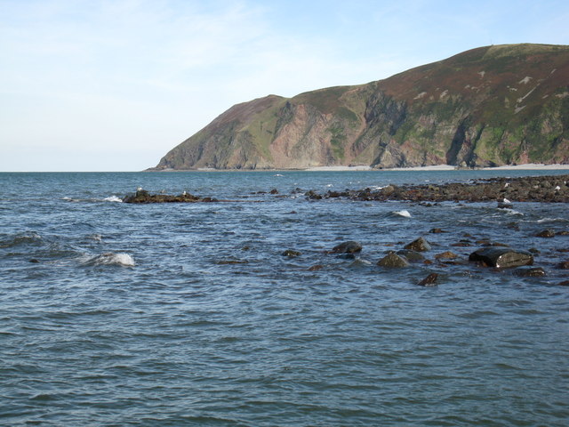
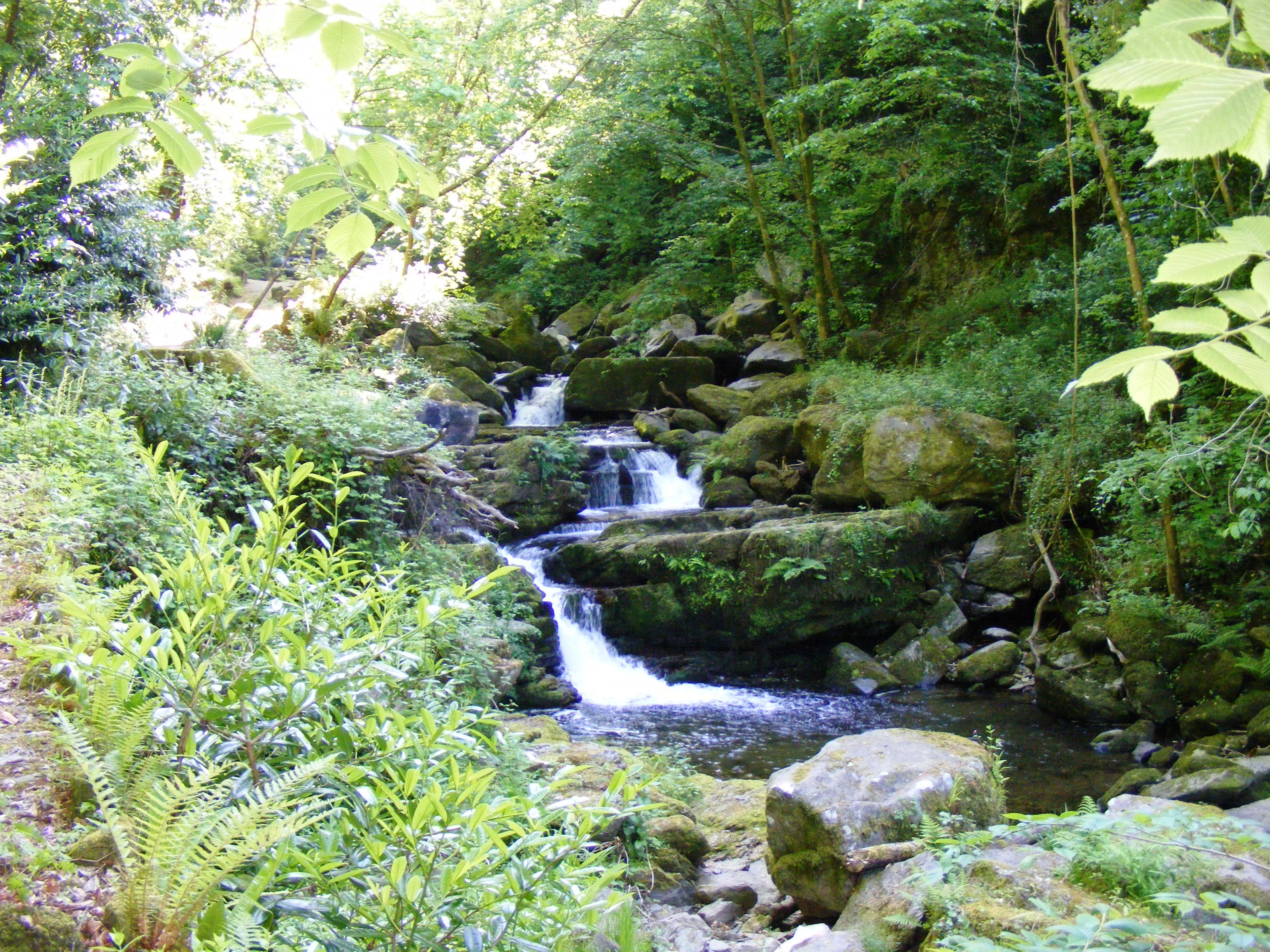
Blacklands Wood, located in Devon, England, is a picturesque woodland that covers an area of approximately 40 hectares. It is situated near the village of Cannington and is easily accessible to visitors from nearby towns and cities. The wood is owned and managed by the Forestry Commission, ensuring its preservation and maintenance.

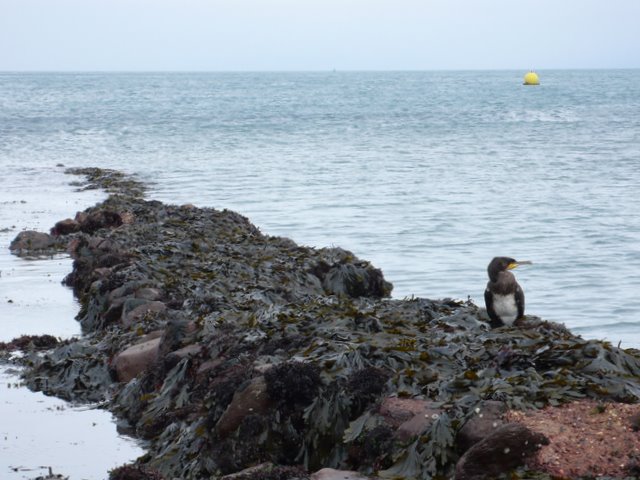
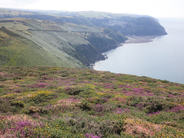
The woodland is predominantly composed of broadleaf trees, including oak, beech, and ash, which create a diverse and rich ecosystem. The dense canopy provides a sheltered habitat for various bird species, such as woodpeckers and owls, making it a popular destination for birdwatchers. Additionally, the wood is home to a diverse range of flora, including bluebells, primroses, and wild garlic, which create a vibrant and colorful display during springtime.

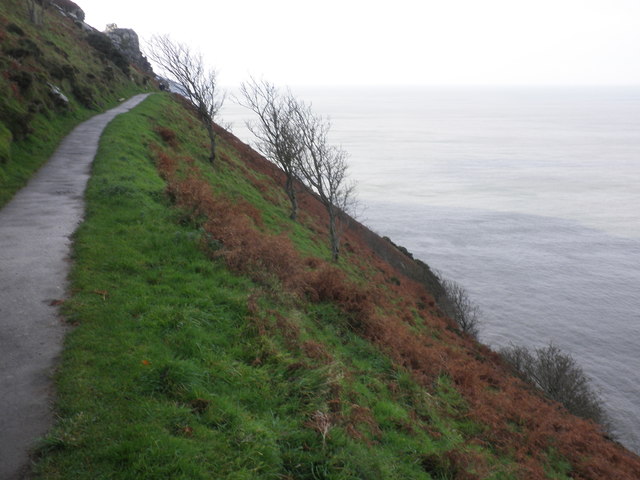
Blacklands Wood offers a plethora of recreational activities for visitors. There are several well-maintained walking trails that meander through the woodland, allowing visitors to explore its beauty at their own pace. The trails are suitable for all ages and abilities, making it an ideal location for family outings.

Furthermore, the wood has designated picnic areas, providing visitors with the opportunity to relax and enjoy a meal surrounded by nature. For those seeking a more adventurous experience, there are designated areas for camping and cycling, allowing visitors to immerse themselves in the tranquil surroundings.

Overall, Blacklands Wood in Devon offers a serene escape from the hustle and bustle of everyday life. Its natural beauty, diverse wildlife, and range of recreational activities make it a popular destination for nature enthusiasts and families alike.

If you have any feedback on the listing, please let us know in the comments section below.

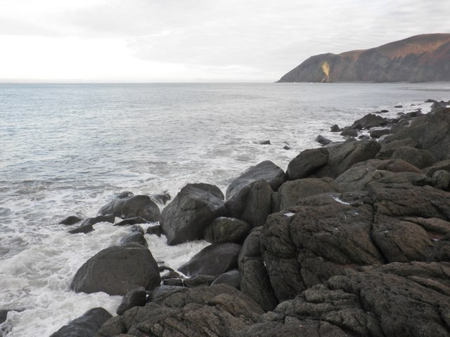
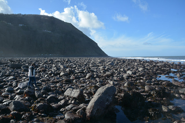
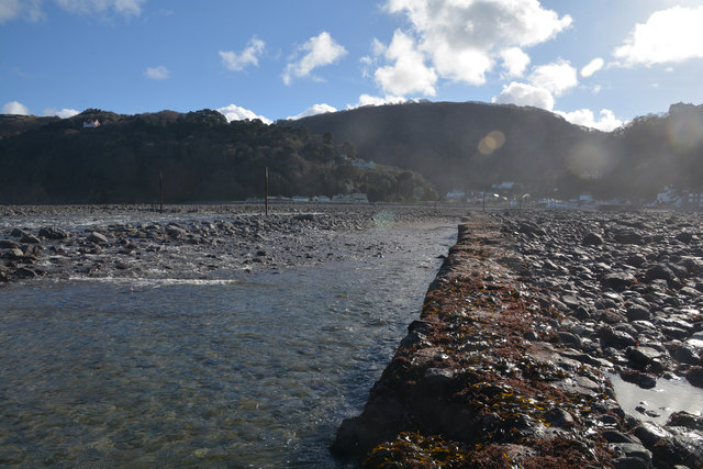
Blacklands Wood Images

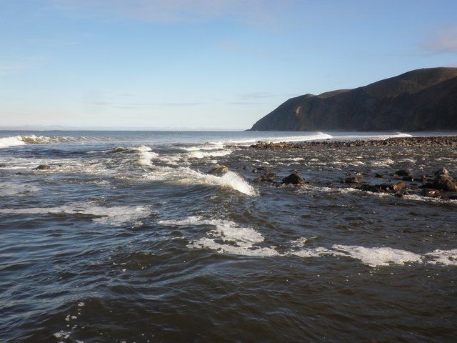
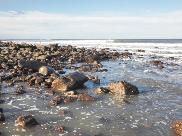
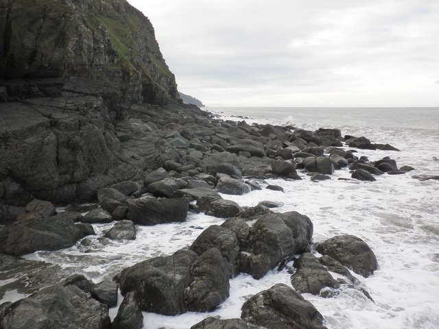
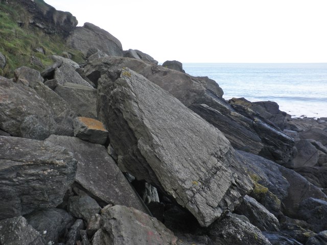
Images are sourced within 2km of 51.231181/-3.8254344 or Grid Reference SS7249. Thanks to Geograph Open Source API. All images are credited.

South West Coast Path The South West Coast Path National Trail - 630 miles of superb coastal walking. From Minehead on the edge of the Exmoor National Park to the shores of Poole Harbour in Dorset. It is the longest of all Britain's National Trails.
Website: <span class="nowrap"><a title="http://www.southwestcoastpath.com/" rel="nofollow ugc noopener" href="http://www.southwestcoastpath.com/">Link</a><img style="margin-left:2px;" alt="External link" title="External link - shift click to open in new window" src="https://s1.geograph.org.uk/img/external.png" width="10" height="10"/></span>
South West Coast Path
The South West Coast Path National Trail - 630 miles of superb coastal walking. From Minehead on the edge of the Exmoor National Park to the shores of Poole Harbour in Dorset. It is the longest of all Britain's National Trails. Website: LinkExternal link
Lyn Mouth rocks These rocks are only visible when there is a very low tide. The photo was taken at 16:03 BST during a low autumn tide. Foreland Point is clearly visible in the distance with the gully known as Great Red showing between the cliffs in the centre.
Lyn Mouth rocks
These rocks are only visible when there is a very low tide. The photo was taken at 16:03 BST during a low autumn tide. Foreland Point is clearly visible in the distance with the gully known as Great Red showing between the cliffs in the centre.
The Foreland overlooking Lynmouth Bay
Ruddy Ball Ruddy Ball is part of the cliff face in Lynton North Devon. The photograph was taken close to the foot of the cliff at low tide.
Ruddy Ball
Ruddy Ball is part of the cliff face in Lynton North Devon. The photograph was taken close to the foot of the cliff at low tide.
Cormorant at Lynmouth These rocks are just exposed at low tide at the very southern edge of the grid square.
Cormorant at Lynmouth
These rocks are just exposed at low tide at the very southern edge of the grid square.
Cliff path, above Ruddy Ball
Looking down, towards Sillery Sands
View towards the Lyn Mouth
Lyn Mouth and the Bristol Channel Looking north east from Lynton, near the upper cliff railway station.
Lyn Mouth and the Bristol Channel
Looking north east from Lynton, near the upper cliff railway station.
Breaking waves at the harbour entrance, Lynmouth
Water's edge, Lynmouth
View west, from Ruddy Ball
Rock slabs, Ruddy Ball
Rising tide, Ruddy Ball
Lynmouth : Lyn Mouth At the mouth of the Lyn and you're pretty much in the sea.
Lynmouth : Lyn Mouth
At the mouth of the Lyn and you're pretty much in the sea.
Lynmouth : Western Beach Looking out across the pebble beach.
Lynmouth : Western Beach
Looking out across the pebble beach.
Lynmouth : Western Beach Looking back along the River Lyn and Lynmouth.
Lynmouth : Western Beach
Looking back along the River Lyn and Lynmouth.
Lynmouth : Marker A marker out in the sea.
Lynmouth : Marker
A marker out in the sea.
Show me another place!

Blacklands Wood is located at Grid Ref: SS7249 (Lat: 51.231181, Lng: -3.8254344)

Administrative County: Devon

District: North Devon

Police Authority: Devon and Cornwall

What 3 Words

///builders.crush.lordship. Near Lynton, Devon

Related Wikis

West Lyn River

The West Lyn is a river in England which rises high in Exmoor, Somerset, and joins the East Lyn at Lynmouth in Devon. The upper reaches have been designated...

East Lyn River

The East Lyn is a river which rises high in Exmoor, in the English county of Somerset. It flows through the East Lyn Valley in Devon. == Watercourse... ==

Lynmouth

Lynmouth is a village in Devon, England, on the northern edge of Exmoor. The village straddles the confluence of the West Lyn and East Lyn rivers, in a...

Lyn and Exmoor Museum

The Lyn and Exmoor Museum is a small museum in Lynton, Devon, England, housed in the town's oldest surviving domestic dwelling, a Grade II listed, whitewashed...

Nearby Amenities

Located within 500m of 51.231181,-3.8254344
Source: PGS
Lat/Long: 51.2322992/-3.8185365
Source: PGS
Lat/Long: 51.2323181/-3.8192659
Source: PGS
Lat/Long: 51.2317273/-3.8207228
Source: PGS
Lat/Long: 51.2325131/-3.8206019
Source: PGS
Lat/Long: 51.2325331/-3.8206264
Source: PGS
Lat/Long: 51.232701/-3.820607
Source: PGS
Lat/Long: 51.2328119/-3.8206307
Source: PGS
Lat/Long: 51.2329363/-3.8207183
Source: PGS
Lat/Long: 51.2338517/-3.8233729
Source: PGS
Lat/Long: 51.23491/-3.8264476
Source: PGS
Lat/Long: 51.2349795/-3.8267004
Source: PGS
Lat/Long: 51.2350271/-3.8271889
Source: PGS
Lat/Long: 51.235036/-3.8276463
Source: PGS
Lat/Long: 51.235097/-3.8280043
Turning Circle
Lat/Long: 51.2285232/-3.8222303
Lynmouth
Place: village
Wikidata: Q1234805
Wikipedia: en:Lynmouth
Lat/Long: 51.229864/-3.8290651
Lynmouth Bay
Addr Country: GB
Public Transport: station
Railway: station
Usage: tourism
Wheelchair: yes
Wikidata: Q18619254
Wikipedia: en:Lynmouth Bay railway station
Lat/Long: 51.2316264/-3.8323694
Tourism: hotel
Lat/Long: 51.2302987/-3.8308607
Cafe
Note: part of Riverside Cottage hotel
Lat/Long: 51.230132/-3.8303465
Maurice Bishop's Studio
Level: 0
Phone: +44 1598 752444
Postal Code: EX35 6EH
Tourism: gallery
Website: https://www.mauricebishop.co.uk/
Lat/Long: 51.2303471/-3.8303641
Lynmouth Flood Memorial Hall
Fee: no
Opening Hours: 10:00-18:00
Tourism: museum
Wheelchair: no
Wikidata: Q6708877
Wikipedia: en:Lynmouth Lifeboat Station
Lat/Long: 51.230901/-3.8312251
Post Box
Brand: Royal Mail
Collection Times: Mo-Fr 09:00; Sa 07:00
Operator: Royal Mail
Operator Wikidata: Q638098
Post Box Type: pillar
Ref: EX35 122D
Royal Cypher: GVIR
Royal Cypher Wikidata: Q33102169
Lat/Long: 51.230109/-3.829997
Fast Food
Esplanade Fish Bar
Addr Housenumber: 2
Addr Street: The Esplanade
Cuisine: fish_and_chips
Phone: +44 1598 753798
Takeaway: yes
Lat/Long: 51.2316708/-3.83162
Image: https://archive.org/details/lynmouth-2021-09-07/DSCN4731.JPG
Seamark Light Category: vertical
Seamark Light Character: F
Seamark Light Colour: green
Seamark Light Height: 6
Seamark Light Multiple: 2
Seamark Light Range: 5
Seamark Light Reference: A 5593
Seamark Type: light_minor
Source: US NGA Pub. 114. 2011-05-26.
Lat/Long: 51.2320248/-3.8307108
Image: https://archive.org/details/lynmouth-2021-09-07/DSCN4736.JPG
Seamark Light Category: vertical
Seamark Light Character: F
Seamark Light Colour: red
Seamark Light Height: 6
Seamark Light Multiple: 2
Seamark Light Range: 5
Seamark Light Reference: A 5592
Seamark Type: light_minor
Source: US NGA Pub. 114. 2011-05-26.
Lat/Long: 51.2318267/-3.8305745
Turning Circle
Noexit: yes
Lat/Long: 51.2292931/-3.8277435
Barrier: bollard
Bicycle: no
Foot: yes
Lat/Long: 51.230336/-3.8306646
Bus Stop
Lynmouth Lyndale Car Park
Bus: yes
Public Transport: platform
Lat/Long: 51.2295306/-3.8287059
Cafe
Lyndale Tea Rooms
Lat/Long: 51.2295031/-3.8286255
Toilets
Lat/Long: 51.2292449/-3.8278989
Source: PGS
Lat/Long: 51.2324292/-3.8198736
Source: PGS
Lat/Long: 51.2324534/-3.8204043
Bench
Backrest: no
Lat/Long: 51.2298526/-3.8288626
Restaurant
Coffee Mill
Addr Housenumber: 7
Addr Street: Riverside Road
Cuisine: coffee_shop
Phone: +44 1598 752772
Lat/Long: 51.2304528/-3.8306995
Bench
Lat/Long: 51.2306691/-3.8184388
Bench
Lat/Long: 51.2296073/-3.8273487
Bench
Lat/Long: 51.2295354/-3.8272043
Bench
Backrest: yes
Lat/Long: 51.2286318/-3.8227867
Bench
Lat/Long: 51.2316298/-3.8283174
Bench
Backrest: yes
Lat/Long: 51.2286687/-3.8230818
Bench
Lat/Long: 51.2307077/-3.8192811
Bench
Backrest: yes
Lat/Long: 51.2315677/-3.8286078
Bench
Backrest: yes
Lat/Long: 51.2285793/-3.8225448
Bench
Backrest: yes
Lat/Long: 51.2279935/-3.8204827
Bench
Lat/Long: 51.231697/-3.8280465
Toilets
Fee: no
Female: yes
Male: no
Lat/Long: 51.2308794/-3.831209
Give Way
Direction: backward
Lat/Long: 51.229539/-3.8291016
Give Way
Lat/Long: 51.2307714/-3.8309927
Cafe
Lynmouth bay café
Name En: Lynmouth bay café
Lat/Long: 51.230193/-3.8301062
Bar
The Ancient Mariner
Wheelchair: yes
Lat/Long: 51.2305959/-3.8311189
Cafe
The Pavilion
Level: 1
Lat/Long: 51.2316727/-3.8318744
Exmoor National Park Visitors Centre
Information: office
Level: 0
Tourism: information
Lat/Long: 51.2316748/-3.8317971
Bath Hotel
Tourism: hotel
Lat/Long: 51.2305272/-3.8310629
Public Bookcase
Lynmouth Library
Booth: K6
Disused Amenity: telephone
Listed Status: Grade II
Man Made: telephone_box
Public Bookcase Type: phone_box
Lat/Long: 51.2310142/-3.8312479
Bench
Backrest: no
Lat/Long: 51.2307914/-3.8311319
Bench
Backrest: no
Lat/Long: 51.2308197/-3.831146
Toilets
Fee: no
Female: no
Male: yes
Lat/Long: 51.2309781/-3.8312527
Drinking Water
Lat/Long: 51.2308/-3.83114
Cafe
The Bake House Café & Takeaway
Cuisine: cake;cornish_pasty;ice_cream
Image: https://archive.org/details/lynmouth-2021-09-07/DSCN4651.JPG
Level: 0
Lat/Long: 51.231118/-3.831305
Defibrillator
Defibrillator Location: On exterior wall of Lynmouth Flood Memorial Hall, to the right of the shelter.
Emergency: defibrillator
Indoor: no
Lat/Long: 51.230936/-3.8312129
Defibrillator
Defibrillator Location: On exterior wall of Cliff Railway Ticket Office, by the entrance at the bottom.
Emergency: defibrillator
Lat/Long: 51.2317573/-3.832284
Post House Interiors
Shop: gift
Lat/Long: 51.2300543/-3.8299937
Hardings
Addr City: Lynton
Addr Housenumber: 17
Addr Postcode: EX35 6EH
Addr Street: Lynmouth Street
Addr Village: Lynmouth
Shop: clothes
Website: https://www.exmoorsheepskin.co.uk/
Lat/Long: 51.2300891/-3.8301698
The Victorian Portrait Co.
Addr City: Lynton
Addr Housenumber: 15
Addr Postcode: EX35 6EH
Addr Street: Lynmouth Street
Addr Village: Lynmouth
Craft: photographer
Website: https://www.victorianportraitcompany.co.uk/
Lat/Long: 51.2301135/-3.8302616
Bench
Backrest: yes
Colour: green
Covered: yes
Lat/Long: 51.2317225/-3.8321105
Access: yes
Drinking Water: yes
Drinking Water Legal: yes
Man Made: water_tap
Lat/Long: 51.2308597/-3.8312379
Noexit: yes
Lat/Long: 51.2292344/-3.8276275
The Walker
Artist Name: Richard Graham
Artwork Type: statue
Material: metal
Tourism: artwork
Lat/Long: 51.2318302/-3.8318141
Booth: K6
Covered: booth
Disused Amenity: telephone
Listed Status: Grade II
Lat/Long: 51.2298857/-3.8289493
Man Made: flagpole
Lat/Long: 51.2306944/-3.8311306
Addr Housename: The Manor Cottage
Lat/Long: 51.2311844/-3.8313337
Life Ring
Emergency: life_ring
Lat/Long: 51.2318068/-3.8310418
Street Lamp
Lamp Mount: straight_mast
Lat/Long: 51.2311529/-3.8313981
Addr Housename: Seabreeze Cottage
Lat/Long: 51.2315577/-3.8314658
Street Lamp
Lamp Mount: straight_mast
Lat/Long: 51.2317273/-3.8317274
Street Lamp
Lat/Long: 51.2317462/-3.832076
Bench
Backrest: yes
Colour: green
Covered: yes
Lat/Long: 51.2317328/-3.8320425
Street Lamp
Lat/Long: 51.2317706/-3.8324016
Give Way
Direction: backward
Lat/Long: 51.229887/-3.8291296
Craft: pottery
Lat/Long: 51.2289926/-3.8273969
Street Lamp
Lamp Mount: straight_mast
Lat/Long: 51.2297081/-3.8290337
Barrier: kerb
Kerb: lowered
Tactile Paving: no
Lat/Long: 51.2299174/-3.8289993
Ice Cream
Caravel Fudge & Toy Shop
Confectionery: fudge
Shop: confectionery
Shop 1: toys
Lat/Long: 51.2302867/-3.8302481
Spinning Wheel Quality Gifts
Level: 0
Shop: gift
Lat/Long: 51.2304362/-3.83057
Street Lamp
Lat/Long: 51.2317135/-3.831264
Donation Box
Historic: sea_mine
Operator: Shipwrecked Mariners' Society
Lat/Long: 51.2317569/-3.8312355
Rhenish Tower
Board Type: history
Image: https://archive.org/details/lynmouth-2021-09-07/DSCN4718.JPG
Information: board
Network: Lynmouth Heritage Trail
Operator: Lynton and Lynmouth Town Council
Ref: 2
Tourism: information
Lat/Long: 51.2317265/-3.8312677
Bench
Backrest: yes
Lat/Long: 51.231772/-3.8311929
Bench
Backrest: yes
Lat/Long: 51.2317689/-3.831156
Historic: memorial
Image: https://archive.org/details/lynmouth-2021-09-07/DSCN4684.JPG
Memorial: plaque
Lat/Long: 51.2303131/-3.8288862
Street Lamp
Lamp Mount: straight_mast
Lat/Long: 51.230314/-3.8289047
Street Lamp
Lamp Mount: straight_mast
Lat/Long: 51.2315598/-3.8286368
Waste Basket
Waste: trash
Lat/Long: 51.230664/-3.8289328
Bench
Backrest: yes
Material: wood
Lat/Long: 51.2304698/-3.8285382
Bench
Backrest: yes
Material: wood
Lat/Long: 51.23072/-3.8284819
Bench
Backrest: yes
Material: wood
Lat/Long: 51.2306976/-3.8288742
Playground: structure
Lat/Long: 51.2305118/-3.8286965
Baby: yes
Playground: swing
Lat/Long: 51.2306533/-3.8288493
Playground: swing
Lat/Long: 51.2305924/-3.8288111
Barrier: entrance
Lat/Long: 51.2307385/-3.8193877
Lynton & Lynmouth Visitor Car Park Map
Information: map
Tourism: information
Lat/Long: 51.2295801/-3.8285135
Defibrillator
Defibrillator Location: On exterior wall of building
Emergency: defibrillator
Ref GB The Circuit: 00C204DA-951D-4B1A-8727-AD73009ADF60
Lat/Long: 51.2295622/-3.8285656
Waste Basket
Survey Date: 2023-05-13
Waste: dog_excrement
Lat/Long: 51.2284537/-3.8219716
Waste Basket
Survey Date: 2023-05-13
Lat/Long: 51.2284666/-3.8220022
Grit Bin
Survey Date: 2023-05-13
Lat/Long: 51.2286523/-3.822258
Post Box
Collection Times: Mo-Fr 09:00; Sa 07:00
Operator: Royal Mail
Operator Wikidata: Q638098
Post Box Mounting: brick_pillar
Post Box Type: wall
Ref: EX35 65D
Royal Cypher: EIIR
Royal Cypher Wikidata: Q33102113
Survey Date: 2023-05-14
Lat/Long: 51.2291208/-3.8263081
Charging Station
Survey Date: 2023-05-13
Lat/Long: 51.2291914/-3.8274768
Recycling
Recycling Type: container
Survey Date: 2023-05-13
Lat/Long: 51.2298197/-3.8287795
Bench
Backrest: yes
Survey Date: 2023-05-13
Lat/Long: 51.2301295/-3.829958
Life Ring
Emergency: life_ring
Survey Date: 2023-05-13
Lat/Long: 51.2307538/-3.8307422
Bench
Backrest: yes
Survey Date: 2023-05-13
Lat/Long: 51.2306634/-3.829707
Bench
Backrest: yes
Survey Date: 2023-05-13
Lat/Long: 51.2318613/-3.8322344
Waste Basket
Survey Date: 2023-05-13
Waste: dog_excrement
Lat/Long: 51.2288711/-3.8265331
Charging Station
Survey Date: 2023-05-13
Lat/Long: 51.229241/-3.8275594
Waste Basket
Survey Date: 2023-05-13
Waste: dog_excrement
Lat/Long: 51.2297488/-3.8283944
Waste Basket
Survey Date: 2023-05-13
Lat/Long: 51.2298166/-3.8287633
Bench
Backrest: yes
Survey Date: 2023-05-13
Lat/Long: 51.2302146/-3.8303458
Waste Basket
Survey Date: 2023-05-13
Lat/Long: 51.2308619/-3.8311277
Bench
Survey Date: 2023-05-13
Lat/Long: 51.2306834/-3.8297662
Binoculars
Survey Date: 2023-05-13
Lat/Long: 51.2318404/-3.8324016
Waste Basket
Survey Date: 2023-05-13
Lat/Long: 51.230693/-3.8307605
Bench
Backrest: yes
Survey Date: 2023-05-13
Lat/Long: 51.2306356/-3.8296424
Charging Station
Survey Date: 2023-05-13
Lat/Long: 51.2292111/-3.8275129
The data included in this document is from www.openstreetmap.org. The data is made available under ODbL.

Have you been to Blacklands Wood?

Leave your review of Blacklands Wood below (or comments, questions and feedback).