Sweaton Plantation

Wood, Forest in Devon Teignbridge

England

Sweaton Plantation

Dartmoor looking towards Sharp Tor, Yartor Down This view is from near Rowbrook Hill car park on the road between Dartmeet and Ponsworthy.
Dartmoor looking towards Sharp Tor, Yartor Down Credit: Richard Rogerson

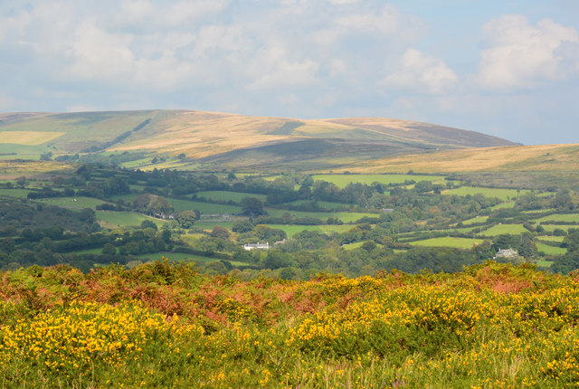
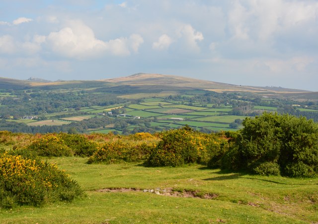
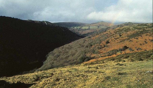
Sweaton Plantation is a picturesque woodland area located in Devon, England. Situated near the town of Wood, the plantation covers a substantial area of lush forest, making it an ideal destination for nature enthusiasts and outdoor enthusiasts alike.

The plantation features a diverse range of tree species, such as oak, beech, and birch, creating a vibrant and enchanting environment. The dense canopy overhead provides a cool and peaceful atmosphere, making it a perfect place for leisurely walks, picnics, or simply enjoying the tranquility of nature.

For those interested in wildlife, Sweaton Plantation is home to a variety of animal species. Birdwatchers can spot a multitude of avian inhabitants, including woodpeckers, owls, and various songbirds. Additionally, the plantation's dense undergrowth provides shelter for small mammals like squirrels and rabbits, adding to the area's biodiversity.

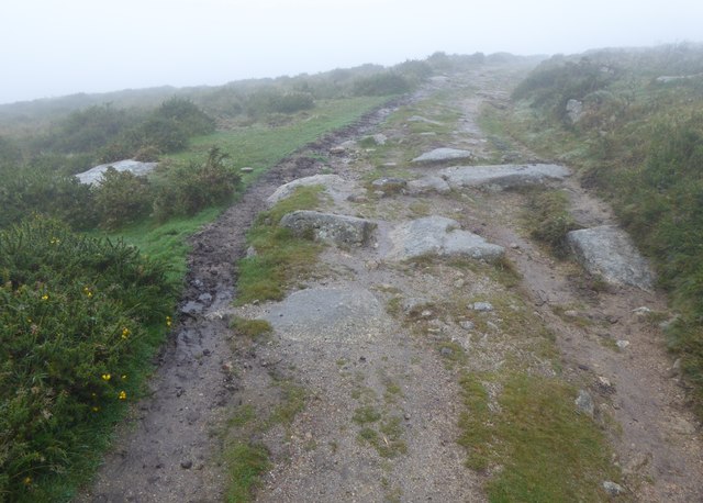
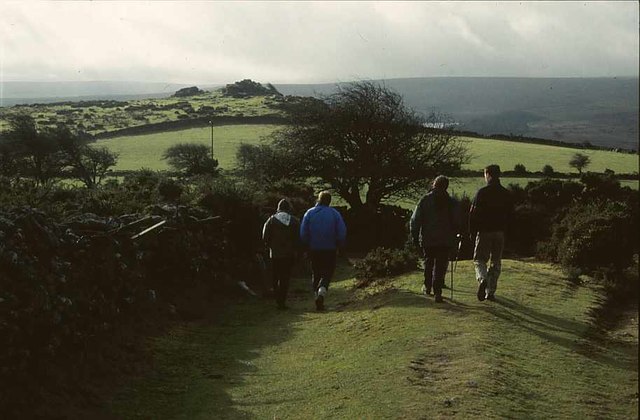
Visitors to Sweaton Plantation can explore numerous walking trails that wind through the forest, allowing them to immerse themselves in the natural beauty of the surroundings. These trails cater to a range of fitness levels, from leisurely strolls to more challenging hikes, ensuring there is something for everyone.

The plantation is well-maintained and offers amenities such as picnic areas, benches, and information boards that provide educational tidbits about the local flora and fauna. As a result, Sweaton Plantation attracts not only locals but also tourists seeking a peaceful retreat in the heart of Devon's countryside.

Overall, Sweaton Plantation is a stunning woodland area that offers a serene escape from the hustle and bustle of everyday life. With its diverse ecosystem and well-maintained trails, it is a must-visit destination for nature lovers and those seeking a tranquil experience in Devon.

If you have any feedback on the listing, please let us know in the comments section below.

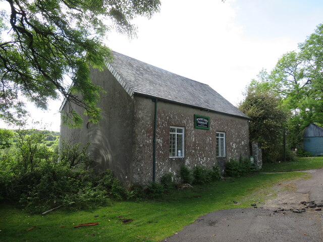
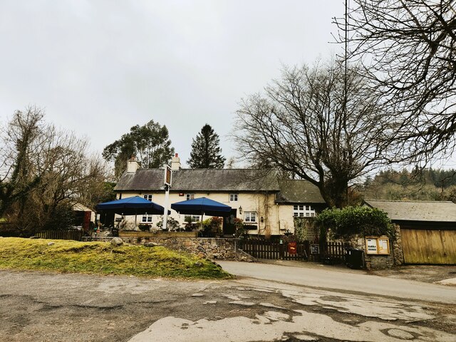
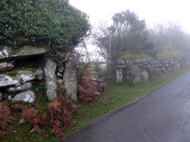
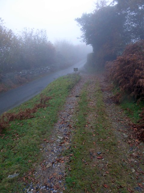
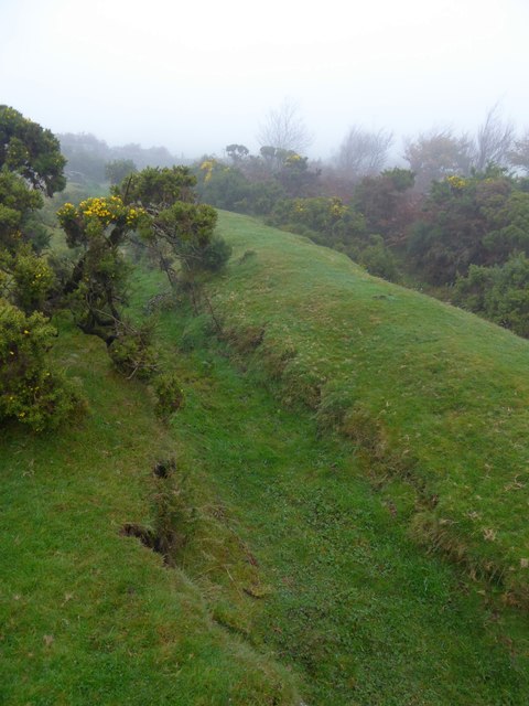
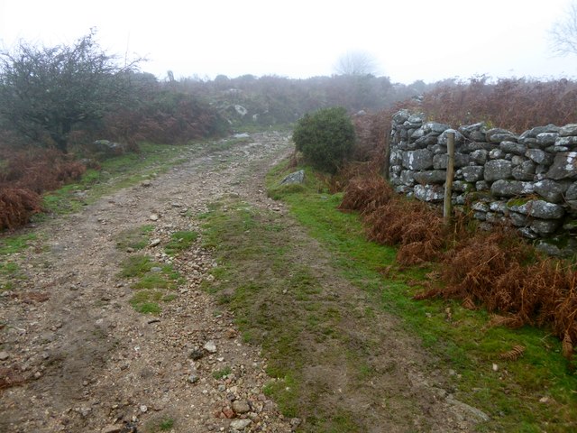
Sweaton Plantation Images

Images are sourced within 2km of 50.546726/-3.8299469 or Grid Reference SX7073. Thanks to Geograph Open Source API. All images are credited.

Dartmoor looking towards Sharp Tor, Yartor Down This view is from near Rowbrook Hill car park on the road between Dartmeet and Ponsworthy.
Dartmoor looking towards Sharp Tor, Yartor Down
This view is from near Rowbrook Hill car park on the road between Dartmeet and Ponsworthy.
St Peter's Church, Buckland in the Moor
Poundsgate Chapel, Dartmoor This is a well-known landmark for those crossing Dartmoor from Ashburton to Princetown or Tavistock. It was built as a place of worship in 1833 and has been in regular use ever since.
Poundsgate Chapel, Dartmoor
This is a well-known landmark for those crossing Dartmoor from Ashburton to Princetown or Tavistock. It was built as a place of worship in 1833 and has been in regular use ever since.
Tavistock Inn, Poundsgate
Moorland in autumn, Ponsworthy, Devon
Sherbeton Common, Dartmoor, Devon
Stile and gate at the start of a footpath to Ponsworthy From one of the minor roads on Bel Tor; the walls are granite
Stile and gate at the start of a footpath to Ponsworthy
From one of the minor roads on Bel Tor; the walls are granite
Track in the mist on Sherberton Common A track onto the common land from a minor road north-east of Bel Tor
Track in the mist on Sherberton Common
A track onto the common land from a minor road north-east of Bel Tor
Ditch and earth wall on Mel Tor The Two Moors Way runs beside this feature on the moor <a href="https://www.geograph.org.uk/photo/1542980">SX6972 : Two Moors Way, Mel Tor</a>
Ditch and earth wall on Mel Tor
The Two Moors Way runs beside this feature on the moor SX6972 : Two Moors Way, Mel Tor
Two Moors Way in the mist on Mel Tor
Two Moors Way on Dr Blackall's Drive in the mist The "Drive" is often rough, with rocky outcrops
Two Moors Way on Dr Blackall's Drive in the mist
The "Drive" is often rough, with rocky outcrops
Old Walls Turbine Building For description of the Hydro-electric power installation see <span class="nowrap"><a title="https://www.widecombe-in-the-moor.com/history/minutes/2002/old_walls_hydroelectrics.php" rel="nofollow ugc noopener" href="https://www.widecombe-in-the-moor.com/history/minutes/2002/old_walls_hydroelectrics.php">Link</a><img style="margin-left:2px;" alt="External link" title="External link - shift click to open in new window" src="https://s1.geograph.org.uk/img/external.png" width="10" height="10"/></span>

See <a href="https://www.geograph.org.uk/photo/2022229">SX7074 : West Webburn River; the weir for Old Walls</a> and <a href="https://www.geograph.org.uk/photo/1318620">SX7074 : Widecombe in the Moor: Old Walls leat 1</a> for pictures of the weir and leat that supply the water to the turbines.
Old Walls Turbine Building
For description of the Hydro-electric power installation see LinkExternal link See SX7074 : West Webburn River; the weir for Old Walls and SX7074 : Widecombe in the Moor: Old Walls leat 1 for pictures of the weir and leat that supply the water to the turbines.
Old Walls disused turbine building Now superseded by the installation shown in <a href="https://www.geograph.org.uk/photo/4872137">SX6974 : Old Walls Turbine Building</a>. For a description of the Old Walls hydro-electric scheme see <span class="nowrap"><a title="https://www.widecombe-in-the-moor.com/history/minutes/2002/old_walls_hydroelectrics.php" rel="nofollow ugc noopener" href="https://www.widecombe-in-the-moor.com/history/minutes/2002/old_walls_hydroelectrics.php">Link</a><img style="margin-left:2px;" alt="External link" title="External link - shift click to open in new window" src="https://s1.geograph.org.uk/img/external.png" width="10" height="10"/></span>
Old Walls disused turbine building
Now superseded by the installation shown in SX6974 : Old Walls Turbine Building. For a description of the Old Walls hydro-electric scheme see LinkExternal link
Sharp Tor, Dartmoor
Sharp Tor, Dartmoor
Two Moors Way near Bel Tor, 2001 A party of walkers sets off for Dr Blackall's Drive and the two Moors Way to Holne. Mel Tor is visible ahead, and the gleam across the Dart valley is Venford Reservoir.
Two Moors Way near Bel Tor, 2001
A party of walkers sets off for Dr Blackall's Drive and the two Moors Way to Holne. Mel Tor is visible ahead, and the gleam across the Dart valley is Venford Reservoir.
Meltor Wood, 2001 Low trees on the steep side of the Dart valley, seen from the Two Moors Way following Dr Blackall's Drive. The rainbow is between Sharp Tor and Mel Tor; on the opposite side are crags at Bench Tor.
Meltor Wood, 2001
Low trees on the steep side of the Dart valley, seen from the Two Moors Way following Dr Blackall's Drive. The rainbow is between Sharp Tor and Mel Tor; on the opposite side are crags at Bench Tor.
Old Milestone, Sherberton Common The milestone is located on an unclassified road below Corndon Down, at the slow bends between crossways, 400m South West of Lock's Gate, on the bank close to road edge under a gorse bush, on the south side of road. Parish of Buckland in the Moor (Teignbridge District). Carved stone post, Old Widecombe stone design, erected by the parish in the 18th century. For later image see: DV_WDTV03 <a href="https://www.geograph.org.uk/photo/6102848">SX6973 : Old Milestone on Sherberton Common</a> 

Inscription reads:-
: W(idecombe in the Moor) 3 :

Devon & Dartmoor HER.
HER Number: MDV123118 <span class="nowrap"><a title="https://www.heritagegateway.org.uk/Gateway/Results_Single.aspx?uid=MDV123118&resourceID=104" rel="nofollow ugc noopener" href="https://www.heritagegateway.org.uk/Gateway/Results_Single.aspx?uid=MDV123118&resourceID=104">Link</a><img style="margin-left:2px;" alt="External link" title="External link - shift click to open in new window" src="https://s1.geograph.org.uk/img/external.png" width="10" height="10"/></span>

Milestone Society National ID: DV_WDTV03
Old Milestone, Sherberton Common
The milestone is located on an unclassified road below Corndon Down, at the slow bends between crossways, 400m South West of Lock's Gate, on the bank close to road edge under a gorse bush, on the south side of road. Parish of Buckland in the Moor (Teignbridge District). Carved stone post, Old Widecombe stone design, erected by the parish in the 18th century. For later image see: DV_WDTV03 SX6973 : Old Milestone on Sherberton Common Inscription reads:- : W(idecombe in the Moor) 3 : Devon & Dartmoor HER. HER Number: MDV123118 LinkExternal link Milestone Society National ID: DV_WDTV03
Old Wayside Cross on Dartmoor - Ouldsbroom Cross Ouldsbroom Cross, old head, shaft and base. Starkey No.81 by the B3357, in parish of Widecombe in the Moor (Teignbridge District), junction of road to Ponsworthy, on grass beside road.

Grade II listed.
List Entry Number: 1241648 <span class="nowrap"><a title="https://historicengland.org.uk/listing/the-list/list-entry/1241648" rel="nofollow ugc noopener" href="https://historicengland.org.uk/listing/the-list/list-entry/1241648">Link</a><img style="margin-left:2px;" alt="External link" title="External link - shift click to open in new window" src="https://s1.geograph.org.uk/img/external.png" width="10" height="10"/></span>

Scheduled Monument.
List Entry Number:1003293
<span class="nowrap"><a title="https://historicengland.org.uk/listing/the-list/list-entry/1003293" rel="nofollow ugc noopener" href="https://historicengland.org.uk/listing/the-list/list-entry/1003293">Link</a><img style="margin-left:2px;" alt="External link" title="External link - shift click to open in new window" src="https://s1.geograph.org.uk/img/external.png" width="10" height="10"/></span>

Surveyed

Milestone Society National ID: DVTE_WID07
Old Wayside Cross on Dartmoor - Ouldsbroom Cross
Ouldsbroom Cross, old head, shaft and base. Starkey No.81 by the B3357, in parish of Widecombe in the Moor (Teignbridge District), junction of road to Ponsworthy, on grass beside road. Grade II listed. List Entry Number: 1241648 LinkExternal link Scheduled Monument. List Entry Number:1003293 LinkExternal link Surveyed Milestone Society National ID: DVTE_WID07
Show me another place!

Sweaton Plantation is located at Grid Ref: SX7073 (Lat: 50.546726, Lng: -3.8299469)

Administrative County: Devon

District: Teignbridge

Police Authority: Devon and Cornwall

What 3 Words

///tolls.stated.newsstand. Near Ashburton, Devon

Related Wikis

Leusdon

Leusdon is a parish in the southern part of Dartmoor in the county of Devon, UK. It is near Poundsgate and Ponsworthy. The village church is St John the...

Ponsworthy

Ponsworthy is a hamlet on the eastern side of Dartmoor, Devon, England. It lies in the steep valley of the West Webburn River about 3.5 km (2.2 mi) southwest...

East Webburn River

The East Webburn is a stream in the Dartmoor moors in Devon in south-west England. It rises on the western side of the moors flowing off the west side...
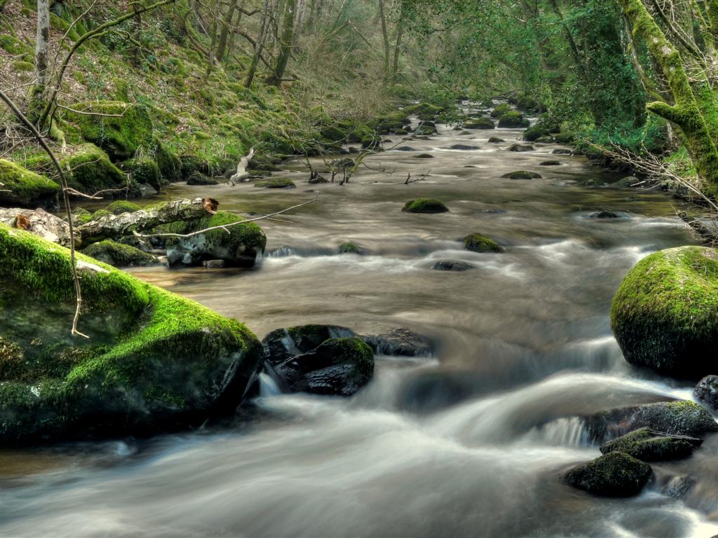
West Webburn River

The West Webburn is a stream on Dartmoor in Devon in south-west England. It rises on the eastern side of the moors flowing off the east side of Hameldown...

Nearby Amenities

Located within 500m of 50.546726,-3.8299469
Ponsworthy
Is In: Devon, England, UK
Place: hamlet
Source: NPE
Wikidata: Q7227984
Wikipedia: en:Ponsworthy
Lat/Long: 50.5494888/-3.8354197
Leusdon
Place: hamlet
Wikidata: Q6534641
Wikipedia: en:Leusdon
Lat/Long: 50.5444725/-3.8265196
Sweaton
Place: locality
Lat/Long: 50.5479934/-3.8354811
West Webburn River
Source: OS_OpenData_StreetView
Lat/Long: 50.5472146/-3.8302024
Post Box
Brand: Royal Mail
Brand Wikidata: Q638098
Brand Wikipedia: en:Royal Mail
Collection Times: Mo-Fr 12:00; Sa 11:45; Su off
Drive Through: no
Operator: Royal Mail
Operator Wikidata: Q638098
Post Box Mounting: wall
Post Box Type: lamp
Ref: TQ13 14
Royal Cypher: EIIR
Royal Cypher Wikidata: Q33102113
Source: survey;streetlevel imagery;aerial imagery
Lat/Long: 50.5441083/-3.8261467
ER 2012
Historic: memorial
Source: survey
Lat/Long: 50.5435563/-3.8258728
ER 1977
Historic: memorial
Source: survey
Lat/Long: 50.5434963/-3.8255929
Grit Bin
Source: survey
Lat/Long: 50.5484382/-3.8356958
Generator Method: photovoltaic
Generator Output Electricity: yes
Generator Source: solar
Generator Type: solar_photovoltaic_panel
Location: roof
Power: generator
Lat/Long: 50.5446281/-3.8265317
The data included in this document is from www.openstreetmap.org. The data is made available under ODbL.

Have you been to Sweaton Plantation?

Leave your review of Sweaton Plantation below (or comments, questions and feedback).