Chivelstone

Settlement in Devon South Hams

England

Chivelstone

Houses at Lannacombe Green It was difficult to get a clear view as the valley bottom is thickly wooded.
Houses at Lannacombe Green Credit: Bill Boaden

Chivelstone is a small village located in the South Hams district of Devon, England. Situated on the southern coast of the county, it lies approximately 7 miles east of Kingsbridge and 15 miles south of Dartmouth. The village is nestled within the stunning countryside of the South Hams Area of Outstanding Natural Beauty, boasting picturesque landscapes and tranquil surroundings.

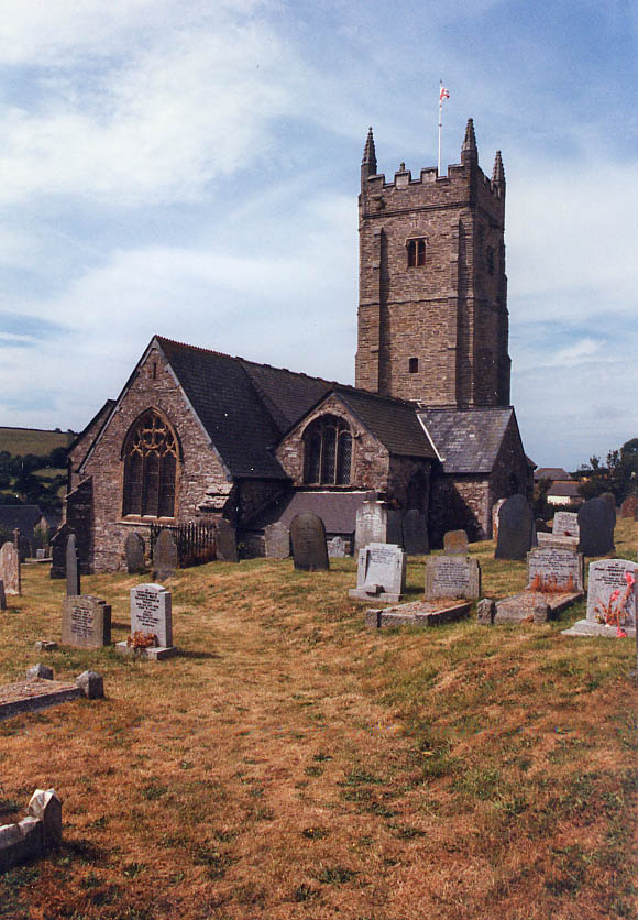
Chivelstone is characterized by its charming traditional stone cottages and historic buildings, which give the village a timeless and quaint atmosphere. The local community is tight-knit and friendly, with a population of around 200 residents. The village is proud of its heritage and has managed to preserve many of its architectural gems, such as St. Sylvester's Church, a Grade II listed building dating back to the 13th century.

The village is surrounded by beautiful countryside, with rolling hills, fields, and woodlands offering a range of outdoor activities and scenic walks. The nearby South West Coast Path provides stunning coastal views and is a popular route for walkers and hikers.

Despite its small size, Chivelstone is not far from amenities and attractions. The nearby town of Kingsbridge offers a range of shops, restaurants, and services, while the historic port town of Dartmouth is within easy reach for a day out exploring its maritime history and enjoying the scenic River Dart.

Chivelstone is a peaceful and idyllic village, offering a tranquil retreat from the hustle and bustle of city life, and a perfect base for exploring the natural beauty of Devon's South Hams region.

If you have any feedback on the listing, please let us know in the comments section below.
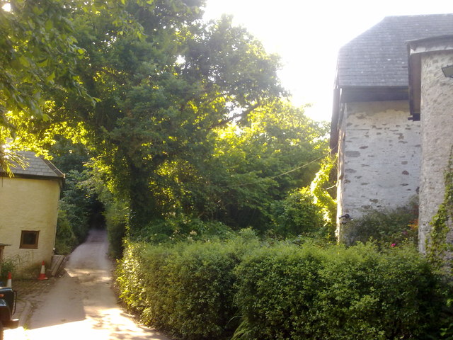
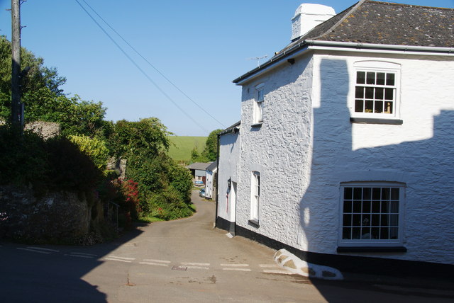
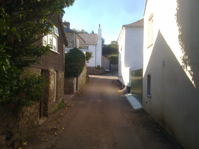
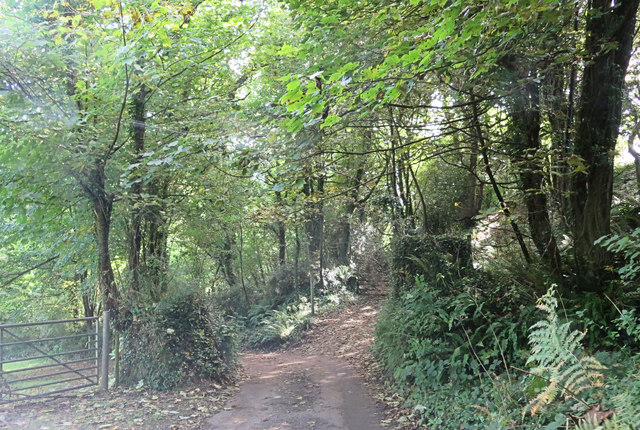
Chivelstone Images

Images are sourced within 2km of 50.236041/-3.707972 or Grid Reference SX7838. Thanks to Geograph Open Source API. All images are credited.

Houses at Lannacombe Green It was difficult to get a clear view as the valley bottom is thickly wooded.
Houses at Lannacombe Green
It was difficult to get a clear view as the valley bottom is thickly wooded.
Side street in Kellaton
Entering Kellaton from the south
Un-named track and lane junction east of Lannacombe Green
Western Kellaton
Western Kellaton
A coastal walk around Start Point [51] The narrow lane nears Lannacombe Green.
Beginning at the car park at Start Farm, the route is southwards along the South West Coast Path. A side trip is made to the lighthouse on the point before heading west to follow the South West Coast Path as far as Lannacombe Beach. Turning north and inland, narrow lanes are followed to Lannacombe Green before heading east up a stiff ascent to Hollowcombe Head. Then a steep descent to Hallsands where the South West Coast Path is rejoined and followed south back to the starting point.
A coastal walk around Start Point [51]
The narrow lane nears Lannacombe Green. Beginning at the car park at Start Farm, the route is southwards along the South West Coast Path. A side trip is made to the lighthouse on the point before heading west to follow the South West Coast Path as far as Lannacombe Beach. Turning north and inland, narrow lanes are followed to Lannacombe Green before heading east up a stiff ascent to Hollowcombe Head. Then a steep descent to Hallsands where the South West Coast Path is rejoined and followed south back to the starting point.
A coastal walk around Start Point [56] Looking back down the lane from the same point as <a href="https://www.geograph.org.uk/photo/7583143">SX8038 : A coastal walk around Start Point [55]</a> gives a view of the hills on the far side of Lannacombe valley.
Beginning at the car park at Start Farm, the route is southwards along the South West Coast Path. A side trip is made to the lighthouse on the point before heading west to follow the South West Coast Path as far as Lannacombe Beach. Turning north and inland, narrow lanes are followed to Lannacombe Green before heading east up a stiff ascent to Hollowcombe Head. Then a steep descent to Hallsands where the South West Coast Path is rejoined and followed south back to the starting point.
A coastal walk around Start Point [56]
Looking back down the lane from the same point as SX8038 : A coastal walk around Start Point [55] gives a view of the hills on the far side of Lannacombe valley. Beginning at the car park at Start Farm, the route is southwards along the South West Coast Path. A side trip is made to the lighthouse on the point before heading west to follow the South West Coast Path as far as Lannacombe Beach. Turning north and inland, narrow lanes are followed to Lannacombe Green before heading east up a stiff ascent to Hollowcombe Head. Then a steep descent to Hallsands where the South West Coast Path is rejoined and followed south back to the starting point.
A coastal walk around Start Point [58] As the lane climbs higher, the views of the surrounding hills and those on the far side of the Lannacombe valley open out.
Beginning at the car park at Start Farm, the route is southwards along the South West Coast Path. A side trip is made to the lighthouse on the point before heading west to follow the South West Coast Path as far as Lannacombe Beach. Turning north and inland, narrow lanes are followed to Lannacombe Green before heading east up a stiff ascent to Hollowcombe Head. Then a steep descent to Hallsands where the South West Coast Path is rejoined and followed south back to the starting point.
A coastal walk around Start Point [58]
As the lane climbs higher, the views of the surrounding hills and those on the far side of the Lannacombe valley open out. Beginning at the car park at Start Farm, the route is southwards along the South West Coast Path. A side trip is made to the lighthouse on the point before heading west to follow the South West Coast Path as far as Lannacombe Beach. Turning north and inland, narrow lanes are followed to Lannacombe Green before heading east up a stiff ascent to Hollowcombe Head. Then a steep descent to Hallsands where the South West Coast Path is rejoined and followed south back to the starting point.
A coastal walk around Start Point [59] Hollowcombe Cottage has a fine view of the surrounding hills.
Beginning at the car park at Start Farm, the route is southwards along the South West Coast Path. A side trip is made to the lighthouse on the point before heading west to follow the South West Coast Path as far as Lannacombe Beach. Turning north and inland, narrow lanes are followed to Lannacombe Green before heading east up a stiff ascent to Hollowcombe Head. Then a steep descent to Hallsands where the South West Coast Path is rejoined and followed south back to the starting point.
A coastal walk around Start Point [59]
Hollowcombe Cottage has a fine view of the surrounding hills. Beginning at the car park at Start Farm, the route is southwards along the South West Coast Path. A side trip is made to the lighthouse on the point before heading west to follow the South West Coast Path as far as Lannacombe Beach. Turning north and inland, narrow lanes are followed to Lannacombe Green before heading east up a stiff ascent to Hollowcombe Head. Then a steep descent to Hallsands where the South West Coast Path is rejoined and followed south back to the starting point.
Footpath descending through woods near Lannacombe Green
Houses in Kellaton
Houses in Kellaton
Whitewashed cottage, Kellaton
Narrow street in Kellaton Remote S Devon village
Narrow street in Kellaton
Remote S Devon village
Kellaton Post Office Interesting architecture, & still open!
Kellaton Post Office
Interesting architecture, & still open!
Cottage at Kellaton Peartree Cottage is seen from the steep little lane entering the hamlet from the east.
Cottage at Kellaton
Peartree Cottage is seen from the steep little lane entering the hamlet from the east.
Kellaton Post Office (closed) Alas, <a href="https://www.geograph.org.uk/photo/826255">SX8039 : Kellaton Post Office</a> has now closed for business. The intriguing little building is on a steep hill on the northern of the two lanes that comprise the hamlet.
Kellaton Post Office (closed)
Alas, SX8039 : Kellaton Post Office has now closed for business. The intriguing little building is on a steep hill on the northern of the two lanes that comprise the hamlet.
Cottages at Kellaton The three cottages are at the top of the hill above <a href="https://www.geograph.org.uk/photo/1487997">SX8039 : Kellaton Post Office (closed)</a>.
Cottages at Kellaton
The three cottages are at the top of the hill above SX8039 : Kellaton Post Office (closed).
Lane to Lannacombe Green The little lane from South Allington runs through a tunnel of trees for 200 metres as it follows the valley to Lannacombe. Beside it on the left is a long apple orchard.
Lane to Lannacombe Green
The little lane from South Allington runs through a tunnel of trees for 200 metres as it follows the valley to Lannacombe. Beside it on the left is a long apple orchard.
Show me another place!

Chivelstone is located at Grid Ref: SX7838 (Lat: 50.236041, Lng: -3.707972)

Administrative County: Devon

District: South Hams

Police Authority: Devon and Cornwall

What 3 Words

///transmitted.chop.warms. Near Salcombe, Devon

Related Wikis

Chivelstone

Chivelstone is a village and civil parish in Devon, England. The parish contains the villages of East Prawle and South Allington as well as the hamlets...

South Pool

South Pool is a village, parish and former manor in South Hams, Devon, England. It is situated 3 1/2 miles south-east of the town of Kingsbridge and 2...

Ford, Chivelstone

Ford is a hamlet about 6 miles from Stoke Fleming, in the civil parish of Chivelstone, in the South Hams district, in the county of Devon, England. Ford...

RNAS Prawle Point

The RNAS Naval Air Station Prawle Point was a British First World War airfield outside the village of East Prawle in Devon, England and 2.6 miles (4.2...

Nearby Amenities

Located within 500m of 50.236041,-3.707972
Chivelstone
Place: village
Source: OS_OpenData_StreeView
Lat/Long: 50.2353337/-3.7082834
Chivelstone Cross
Place: locality
Lat/Long: 50.2357589/-3.7047889
Generator Method: photovoltaic
Generator Output Electricity: yes
Generator Source: solar
Generator Type: solar_photovoltaic_panel
Location: roof
Power: generator
Lat/Long: 50.2360024/-3.706953
Generator Method: photovoltaic
Generator Output Electricity: yes
Generator Source: solar
Generator Type: solar_photovoltaic_panel
Location: roof
Power: generator
Lat/Long: 50.2359655/-3.7075478
Generator Method: photovoltaic
Generator Output Electricity: yes
Generator Source: solar
Generator Type: solar_photovoltaic_panel
Location: roof
Power: generator
Lat/Long: 50.2360153/-3.7076738
Generator Method: photovoltaic
Generator Output Electricity: yes
Generator Source: solar
Generator Type: solar_photovoltaic_panel
Location: roof
Power: generator
Lat/Long: 50.2362675/-3.7080936
Generator Method: photovoltaic
Generator Output Electricity: yes
Generator Source: solar
Generator Type: solar_photovoltaic_panel
Location: roof
Power: generator
Lat/Long: 50.2362769/-3.7084396
Telephone
Booth: K6
Covered: booth
Survey Date: 2022-02-19
Lat/Long: 50.2355455/-3.7039293
Generator Method: wind_turbine
Generator Source: wind
Power: generator
Lat/Long: 50.2385741/-3.7079955
The data included in this document is from www.openstreetmap.org. The data is made available under ODbL.

Have you been to Chivelstone?

Leave your review of Chivelstone below (or comments, questions and feedback).