Barnet, Chipping

Settlement in Hertfordshire

England

Barnet, Chipping

King George's Fields Amid the surrounding sprawl of suburbia, King George's Fields provide the people of Barnet with a green oasis.

Most of the fields were bought for the public in 1935 to mark the Silver Jubilee of King George V.

As you can see if you look closely at the centre of the photo, there are distant views across to Canary Wharf.
King George's Fields Credit: Mark Percy

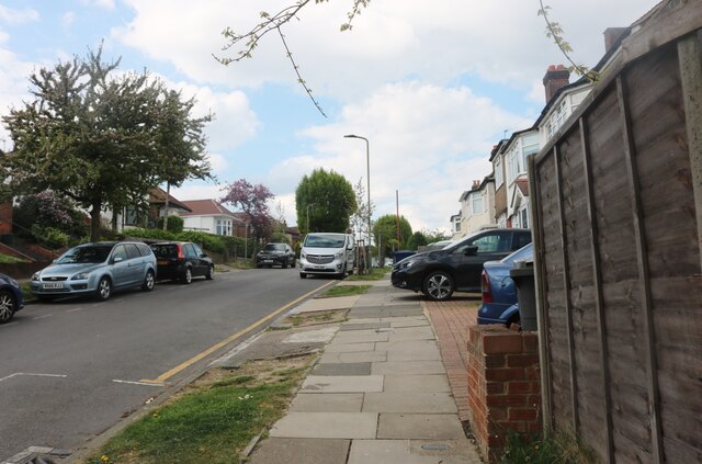
Barnet, Chipping, Hertfordshire is a historic market town located in the southern region of England. Situated approximately 10 miles northwest of central London, Barnet is part of the London Borough of Barnet and falls within the ceremonial county of Hertfordshire. The town is predominantly residential, with a population of around 33,000 people.

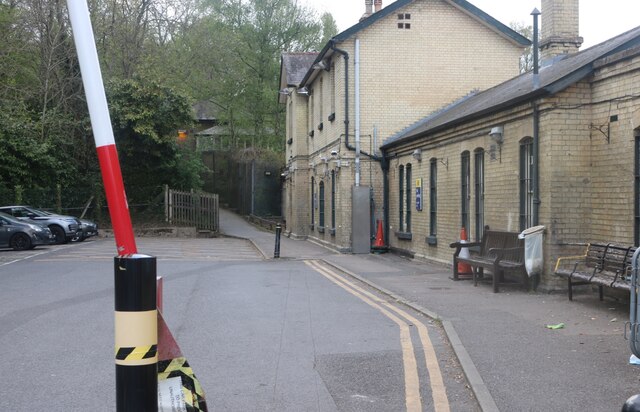
Barnet has a rich history that dates back to Roman times, and evidence of its past can be seen in the form of historical buildings and landmarks, such as the 12th-century St John the Baptist Church and the Grade I listed Monken Hadley Church. The town is also known for its traditional market, which has been operating since the 12th century and continues to attract locals and visitors alike.

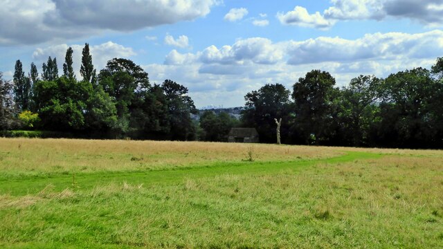
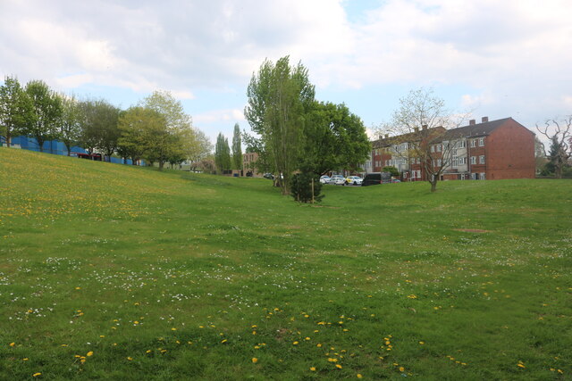
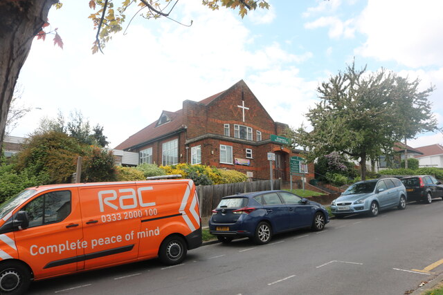
In addition to its historical significance, Barnet offers a range of amenities and facilities to its residents. The town center is home to a variety of shops, restaurants, and cafes, providing ample opportunities for shopping and dining. Barnet also benefits from several green spaces and parks, such as the popular King George's Fields and Old Court House Recreation Ground, which offer recreational activities and a tranquil escape from the urban environment.

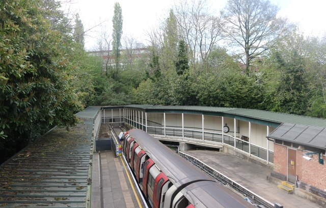
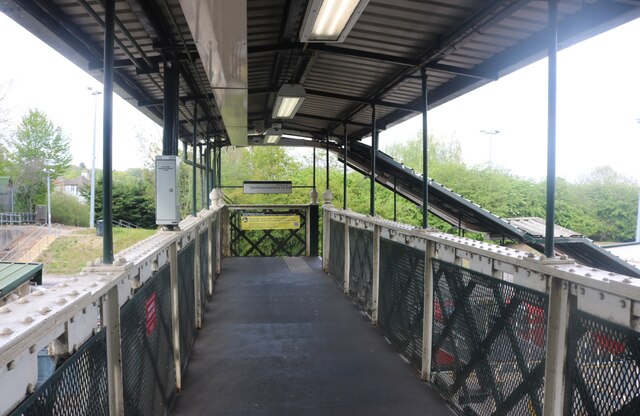
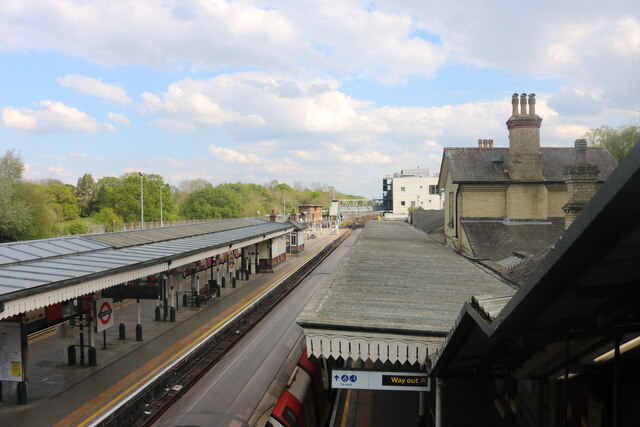
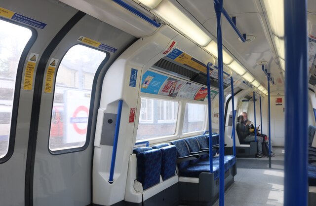
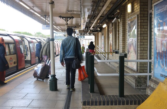
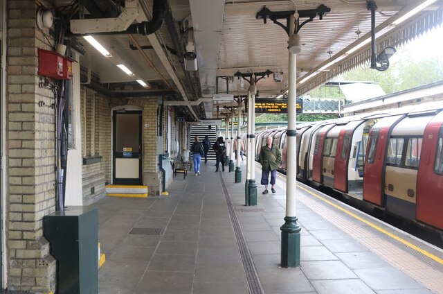
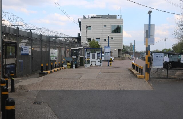
Transport links in Barnet are excellent, with several railway stations providing easy access to London and other parts of Hertfordshire. The town is also well-served by buses, making it a convenient location for commuters.

Overall, Barnet, Chipping, Hertfordshire combines a rich historical heritage with modern amenities, making it an attractive place to live, work, and visit.

If you have any feedback on the listing, please let us know in the comments section below.

Barnet, Chipping Images

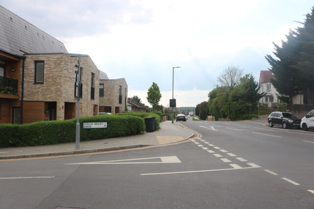
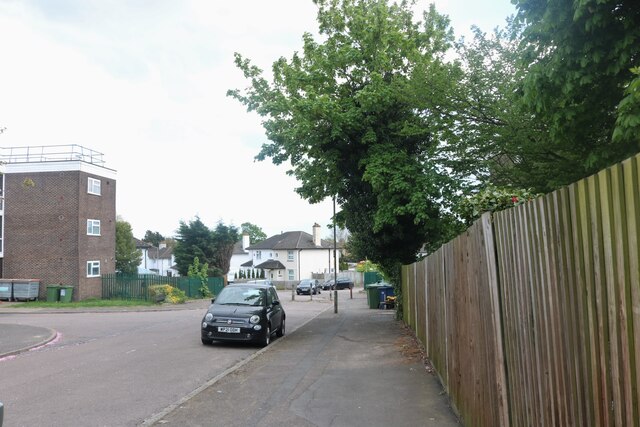
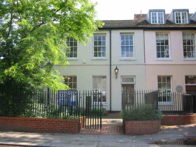
Images are sourced within 2km of 51.650799/-0.203966 or Grid Reference TQ2496. Thanks to Geograph Open Source API. All images are credited.

King George's Fields Amid the surrounding sprawl of suburbia, King George's Fields provide the people of Barnet with a green oasis.

Most of the fields were bought for the public in 1935 to mark the Silver Jubilee of King George V.

As you can see if you look closely at the centre of the photo, there are distant views across to Canary Wharf.
King George's Fields
Amid the surrounding sprawl of suburbia, King George's Fields provide the people of Barnet with a green oasis. Most of the fields were bought for the public in 1935 to mark the Silver Jubilee of King George V. As you can see if you look closely at the centre of the photo, there are distant views across to Canary Wharf.
High Barnet - all change The end of the Northern Line
High Barnet - all change
The end of the Northern Line
Platform crossing at High Barnet Station
High Barnet Station
High Barnet Station
Northern Line train leaving High Barnet Station
The railway line by High Barnet Station
Alighting the train at High Barnet Station
Platform 1 at High Barnet Station
High Barnet Station
High Barnet Station
The entrance to High Barnet Station car park
The entrance to High Barnet Station
High Barnet Station car park The office block is called Abrams House.
High Barnet Station car park
The office block is called Abrams House.
Green by Barnet Hill
Underhill Baptist Church, Barnet
Elton Avenue, Barnet
Dollis Valley Drive, Barnet The original Dollis Valley Estate from the early 1970s is being demolished and replaced by far nicer buildings, much like the very similar West Hendon Estate who have done the same thing. This is all part of the Barnet Borough regeneration.
Dollis Valley Drive, Barnet
The original Dollis Valley Estate from the early 1970s is being demolished and replaced by far nicer buildings, much like the very similar West Hendon Estate who have done the same thing. This is all part of the Barnet Borough regeneration.
Dollis Valley Drive at the junction of Mays Lane
Brent Place, Barnet
Brent Place, Barnet
Show me another place!

Barnet, Chipping is located at Grid Ref: TQ2496 (Lat: 51.650799, Lng: -0.203966)

Unitary Authority: Barnet

Police Authority: Metropolitan

What 3 Words

///memory.host.member. Near Barnet, London

Related Wikis

Old Court House Recreation Ground

Old Court House Recreation Ground is a public park in High Barnet in the London Borough of Barnet. It is one of the borough's Premier Parks and received...

53 Wood Street

53 Wood Street is a grade II listed house at Wood Street in the market town of Chipping Barnet, a northern suburb of London in the United Kingdom. The...

Barnet Museum

Barnet Museum is in the London Borough of Barnet. It has displays on topics including the Battle of Barnet, Barnet Fair and Barnet Market. It is a centre...

North London Coroner's Court

The North London Coroner's Court is a municipal building located at 29 Wood Street, Chipping Barnet, London. The building, which served as Barnet Town...

Nearby Amenities

Located within 500m of 51.650799,-0.203966
Barnet High Street / Barnet Church
Bus: yes
Local Ref: H
Public Transport: stop_position
Lat/Long: 51.6525735/-0.1988456
Mini Roundabout
Direction: clockwise
Lat/Long: 51.6529749/-0.2068859
Mini Roundabout
Direction: clockwise
Lat/Long: 51.6531753/-0.2068656
Ref GB Tflcid: RWG287160
Traffic Calming: hump
Lat/Long: 51.6505194/-0.2078252
Turning Circle
Lat/Long: 51.6494818/-0.2052506
Police
Barnet Police Station
Note: Closed to public
Opening Hours: closed
Operator: Metropolitan Police
Lat/Long: 51.6525188/-0.198299
Fuel
Texaco
Lat/Long: 51.6528081/-0.2095502
Pub
The King's Head
Addr Housenumber: 84
Addr Postcode: EN5 5SN
Addr Street: High Street
Fhrs Id: 757082
Website: https://www.mcmullens.co.uk/king-s-head
Lat/Long: 51.6534067/-0.2007979
Bus Stop
Barnet High Street / Barnet Church
Bench: yes
Bin: yes
Bus: yes
Local Ref: G
Naptan AtcoCode: 490003634G
Naptan Bearing: S
Naptan CommonName: Barnet Church Fitzjohn Avenue
Naptan Indicator: Stop G
Naptan Street: BARNET HIGH STREET
Public Transport: platform
Ref: 55104
Shelter: yes
Tactile Paving: no
Lat/Long: 51.6528371/-0.1991937
Bus Stop
Barnet High Street / Barnet Church
Bus: yes
Local Ref: H
Naptan AtcoCode: 490003634H
Naptan Bearing: S
Naptan CommonName: Barnet Church Fitzjohn Avenue
Naptan Indicator: Stop H
Naptan Street: BARNET HIGH STREET
Public Transport: platform
Ref: 76990
Lat/Long: 51.6526211/-0.1987338
Bus Stop
Barnet Church
Bench: yes
Bin: yes
Bus: yes
Local Ref: K
Naptan AtcoCode: 490003634K
Naptan Bearing: N
Naptan CommonName: Barnet Church Fitzjohn Avenue
Naptan Indicator: K
Naptan Street: BARNET HIGH STREET
Public Transport: platform
Ref: 55649
Shelter: yes
Tactile Paving: no
Lat/Long: 51.6528059/-0.1994461
Bus Stop
Barnet Church
Bus: yes
Local Ref: L
Naptan AtcoCode: 490003634L
Naptan Bearing: N
Naptan CommonName: Barnet Church Fitzjohn Avenue
Naptan Indicator: L
Naptan Street: BARNET HIGH STREET
Public Transport: platform
Ref: 77191
Lat/Long: 51.6525922/-0.1990527
Bus Stop
Fitzjohn Avenue
Bus: yes
Local Ref: M
Naptan AtcoCode: 490003634M
Naptan Bearing: N
Naptan CommonName: Barnet Church Fitzjohn Avenue
Naptan Indicator: M
Naptan Street: BARNET HIGH STREET
Note: Bus stand.
Public Transport: platform
Ref: 75465
Lat/Long: 51.6523131/-0.1986128
Bus Stop
Barnet High Street
Bench: yes
Bin: no
Local Ref: D
Naptan AtcoCode: 490003639D
Naptan Bearing: N
Naptan CommonName: Barnet High Street
Naptan Indicator: D
Naptan Street: BARNET HIGH STREET
Naptan Verified: no
Public Transport: platform
Ref: 48003
Shelter: yes
Tactile Paving: no
Lat/Long: 51.6544068/-0.2015454
Bus Stop
Barnet High Street
Bench: no
Bin: yes
Local Ref: J
Naptan AtcoCode: 490003639J
Naptan Bearing: N
Naptan CommonName: Barnet High Street
Naptan Indicator: J
Naptan Street: BARNET HIGH STREET
Naptan Verified: no
Public Transport: platform
Ref: 58265
Shelter: no
Tactile Paving: no
Lat/Long: 51.6537063/-0.2015274
Bus Stop
High Barnet Station / Meadway
Bench: yes
Bin: yes
Local Ref: N
Naptan AtcoCode: 490009772N
Naptan Bearing: S
Naptan CommonName: Meadway (EN5)
Naptan Indicator: N
Naptan Street: BARNET HIGH STREET
Naptan Verified: no
Public Transport: platform
Ref: 59465
Shelter: yes
Lat/Long: 51.6514016/-0.1969905
Bus Stop
Manor Road
Local Ref: Y
Naptan AtcoCode: 490009584W
Naptan Bearing: N
Naptan CommonName: Manor Road (EN5)
Naptan Verified: no
Public Transport: platform
Lat/Long: 51.6528612/-0.2052927
Bus Stop
Manor Road / Wood Street
Local Ref: X
Naptan AtcoCode: 490009588N
Naptan Bearing: N
Naptan CommonName: Manor Road Wood Street
Naptan Street: MANOR ROAD
Naptan Verified: no
Public Transport: platform
Shelter: yes
Lat/Long: 51.6527857/-0.2036413
Bus Stop
Salisbury Road
Bench: no
Bin: no
Local Ref: T
Naptan AtcoCode: 490011868T
Naptan Bearing: N
Naptan CommonName: Barnet Salisbury Road
Naptan Indicator: T
Naptan Street: SALISBURY ROAD
Naptan Verified: no
Public Transport: platform
Ref: 48023
Shelter: no
Tactile Paving: no
Lat/Long: 51.6549599/-0.2043831
Bus Stop
Union Street
Local Ref: M
Naptan AtcoCode: 490013909E
Naptan Bearing: E
Naptan CommonName: Union Street Wood Street
Naptan Indicator: Stop
Naptan Verified: no
Public Transport: platform
Lat/Long: 51.6530511/-0.2071885
Bus Stop
Union Street
Local Ref: F
Naptan AtcoCode: 490013909W
Naptan Bearing: W
Naptan CommonName: Union Street Wood Street
Naptan Street: WOOD STREET
Naptan Verified: no
Public Transport: platform
Lat/Long: 51.6529576/-0.207618
Bus Stop
Willow Drive
Naptan AtcoCode: 490014705N
Naptan Bearing: N
Naptan CommonName: Willow Drive
Naptan Street: MANOR ROAD
Naptan Verified: no
Public Transport: platform
Shelter: no
Lat/Long: 51.6493019/-0.2041399
Bus Stop
Willow Drive
Naptan AtcoCode: 490014705S
Naptan Bearing: S
Naptan CommonName: Willow Drive
Naptan Street: MANOR ROAD
Naptan Verified: no
Public Transport: platform
Shelter: no
Lat/Long: 51.6491152/-0.2039787
Bus Stop
Barnet Church / Wood Street
Bench: yes
Bin: yes
Local Ref: E
Naptan AtcoCode: 490015142E
Naptan Bearing: W
Naptan CommonName: Barnet Church Wood Street
Naptan Indicator: Stop E
Naptan Street: WOOD STREET
Naptan Verified: no
Public Transport: platform
Shelter: yes
Tactile Paving: no
Lat/Long: 51.6529832/-0.2023205
Bus Stop
Barnet Church / Wood Street
Bench: yes
Bin: yes
Bus: yes
Local Ref: F
Naptan AtcoCode: 490015142F
Naptan Bearing: E
Naptan CommonName: Barnet Church Wood Street
Naptan Indicator: Stop F
Naptan Verified: no
Public Transport: platform
Shelter: yes
Tactile Paving: no
Lat/Long: 51.6530773/-0.2016645
Crossing
Crossing: traffic_signals
Lat/Long: 51.6523975/-0.1984206
Give Way
Lat/Long: 51.6531076/-0.2002901
High Barnet
Place: suburb
Lat/Long: 51.6531493/-0.2005407
Pub
Ye Olde Mitre Inne
Brand: Greene King
Brand Wikidata: Q5564162
Start Date: 1536
Website: https://www.greeneking.co.uk/pubs/hertfordshire/ye-olde-mitre
Wikidata: Q20876233
Lat/Long: 51.6530747/-0.199487
Crossing
Crossing: unmarked
Crossing Island: yes
Tactile Paving: yes
Lat/Long: 51.6529312/-0.2067273
Crossing
Crossing: unmarked
Crossing Island: yes
Tactile Paving: yes
Lat/Long: 51.652836/-0.2059629
Pub
The Lord Nelson
Lat/Long: 51.6524761/-0.2100384
Shop: car_repair
Lat/Long: 51.6526275/-0.2092377
Costcutter
Brand: Costcutter
Brand Wikidata: Q5175072
Shop: convenience
Lat/Long: 51.6528397/-0.2092203
Fast Food
Loon Wan
Cuisine: chinese
Lat/Long: 51.6528447/-0.209129
Jasmin Express
Shop: laundry
Lat/Long: 51.6528447/-0.2090527
Cafe
Cafe Opera
Lat/Long: 51.6528281/-0.2093665
Noexit: yes
Lat/Long: 51.6528331/-0.2043622
Noexit: yes
Lat/Long: 51.6518771/-0.1985344
Barnet Church
Bus: yes
Local Ref: K
Public Transport: stop_position
Lat/Long: 51.652841/-0.1993762
Pub
The Black Horse
Lat/Long: 51.653131/-0.206677
Noexit: yes
Lat/Long: 51.6537288/-0.2066766
Noexit: yes
Lat/Long: 51.6538253/-0.2069358
Give Way
Direction: backward
Lat/Long: 51.6539953/-0.2000265
Elite Barber Shop
Shop: hairdresser
Lat/Long: 51.6519547/-0.1975476
Serenity Hair
Shop: hairdresser
Lat/Long: 51.6521352/-0.197816
Spencer & Sener
Addr City: Barnet, London
Addr Housenumber: 14
Addr Postcode: EN5 5RU
Addr Street: High Street
Office: estate_agent
Lat/Long: 51.6520665/-0.1976397
Fast Food
Papa John's
Brand Wikidata: Q2759586
Cuisine: pizza
Website: https://www.papajohns.co.uk/stores/barnet
Lat/Long: 51.6523324/-0.1981204
Barnet Gallery
Addr City: Barnet
Addr Housenumber: 12
Addr Street: High Street
Shop: craft
Lat/Long: 51.6520091/-0.1975763
Mantriella
Clothes: wedding
Shop: clothes
Lat/Long: 51.6522908/-0.1980588
Restaurant
SouvLike It
Cuisine: greek
Lat/Long: 51.6526801/-0.1986944
Barnet Motor Factors
Shop: car_repair
Lat/Long: 51.6525869/-0.1984993
The Sound Garden
Shop: music
Lat/Long: 51.6526306/-0.1985891
Body Street
Leisure: fitness_centre
Lat/Long: 51.6522417/-0.1979836
Fast Food
Domino's
Addr Country: GB
Brand: Domino's
Brand Wikidata: Q839466
Brand Wikipedia: en:Domino's Pizza
Contact Website: https://www.dominos.co.uk/pizza-near-me/barnet/42-high-street
Cuisine: pizza
Takeaway: yes
Lat/Long: 51.6527394/-0.1988157
Bradbury Glass
Shop: doityourself
Lat/Long: 51.6527426/-0.1981888
Crazy Connection
Shop: hifi
Lat/Long: 51.6529465/-0.1992013
Chudy's Beauty Shop
Lat/Long: 51.6530114/-0.1993449
Cover
Shop: clothes
Lat/Long: 51.6529781/-0.1992724
Londis
Brand: Londis
Brand Wikidata: Q21008564
Shop: convenience
Lat/Long: 51.6528974/-0.1991262
Cafe
George's Cafe
Lat/Long: 51.6530405/-0.1993985
Paddy Power
Brand Wikidata: Q3888718
Check Date: 2012-02-15
Fixme: Check on ground
Shop: bookmaker
Lat/Long: 51.6531345/-0.19966
Tesco Express
Addr Housenumber: 64
Addr Postcode: EN5 5SJ
Addr Street: High Street
Brand: Tesco Express
Brand Wikidata: Q98456772
Contact Website: https://www.tesco.com/store-locator/barnet/64-66-high-st
Fhrs Id: 757654
Shop: supermarket
Lat/Long: 51.6531662/-0.1998182
Restaurant
Dudley's Pancake House
Lat/Long: 51.6533077/-0.1992938
Theatre
The Bull
Lat/Long: 51.6532091/-0.2000071
Restaurant
Emchai
Lat/Long: 51.6533484/-0.2006082
Nature & Health
Lat/Long: 51.6533293/-0.2005284
Cafe
Barnet Cafe
Addr Housenumber: 80
Addr Postcode: EN5 5SN
Addr Street: High Street
Cuisine: english_breakfast;burger;chips
Fhrs Id: 1523344
Opening Hours: Mo-Sa 07:00-19:00; Su 08:00-18:00
Lat/Long: 51.6533641/-0.2006752
Famous Rez
Addr City: Barnet
Addr Housenumber: 86
Addr Postcode: EN5 5SN
Addr Street: High Street
Opening Hours: Mo-Sa 09:00-19:00; Su 10:00-17:00
Shop: hairdresser
Lat/Long: 51.6534349/-0.2008945
Central Park
Shop: clothes
Lat/Long: 51.6534859/-0.2010433
Hopscotch Essential Treats
Addr City: Barnet
Addr Housenumber: 88
Addr Postcode: EN5 5SN
Addr Street: High Street
Contact Facebook: HopscotchTreats
Contact Instagram: hopscotchtreatsbarnet
Contact Twitter: hopscotchtreats
Opening Hours: Tu-Fr 10:30-18:00; Sa 10:00-17:30
Operator: Hopscotch Trading Ltd
Payment American Express: no
Payment Coins: yes
Payment Contactless: yes
Payment Credit Cards: yes
Payment Debit Cards: yes
Payment Diners Club: yes
Payment Maestro: yes
Payment Mastercard: yes
Payment Visa: yes
Phone: +44 20 8364 9777
Shop: confectionery;tea
Website: https://www.hopscotchessentials.co.uk
Lat/Long: 51.653462/-0.2009857
Cafe
Costa Coffee
Addr City: Barnet
Addr Housenumber: 90
Addr Postcode: EN5 5SN
Addr Street: High Street
Brand: Costa
Brand Wikidata: Q608845
Brand Wikipedia: en:Costa Coffee
Fhrs Id: 1350037
Internet Access: wlan
Internet Access Fee: no
Opening Hours: Mo-Fr 06:30-18:00; Sa 07:30-18:00; Su 09:00-16:30
Lat/Long: 51.6535183/-0.2011138
Toy Galaxy
Addr Housenumber: 112a
Addr Postcode: EN5 5XQ
Addr Street: High Street
Phone: +44 20 8449 0966
Shop: toys
Website: https://www.toygalaxy.co.uk
Wheelchair: yes
Lat/Long: 51.6543451/-0.2014141
Robert Dyas
Brand: Robert Dyas
Brand Wikidata: Q7343720
Opening Hours: Mo-Sa 09:00-18:00; Su 10:30-16:30
Shop: hardware
Lat/Long: 51.654054/-0.2013833
Shop: vacant
Lat/Long: 51.6544733/-0.2014477
Fast Food
McDonald's
Addr Housenumber: 102
Addr Postcode: EN5 5XQ
Addr Street: High Street
Brand: McDonald's
Brand Wikidata: Q38076
Brand Wikipedia: en:McDonald's
Contact Website: https://www.mcdonalds.com/gb/en-gb/location/barnet/barnet/102-high-street/8260055.html
Cuisine: burger
Drive Through: no
Fhrs Id: 1096544
Opening Hours: Mo-Th 06:00-24:00; Fr,Sa 06:00-22:00; Su 07:00-24:00
Takeaway: yes
Toilets: yes
Toilets Wheelchair: yes
Wheelchair: yes
Lat/Long: 51.6538959/-0.2013498
Village Food Centre
Addr Housenumber: 108
Addr Postcode: EN5 5XQ
Addr Street: High Street
Fhrs Id: 930517
Shop: supermarket
Lat/Long: 51.6542744/-0.2014021
Pound Planet
Shop: convenience
Lat/Long: 51.6544134/-0.2014383
Specsavers
Brand: Specsavers
Brand Wikidata: Q2000610
Brand Wikipedia: en:Specsavers
Contact Website: https://www.specsavers.co.uk/stores/barnet
Opening Hours: Mo-Sa 09:00-18:00; Su 10:00-16:00
Shop: optician
Lat/Long: 51.6539832/-0.2013766
Fast Food
Greggs
Addr Housenumber: 134
Addr Postcode: EN5 5XQ
Addr Street: High Street
Brand: Greggs
Brand Wikidata: Q3403981
Brand Wikipedia: en:Greggs
Contact Website: https://www.greggs.co.uk/shop-finder?shop-code=2271
Cuisine: sandwich;bakery
Fhrs Id: 758283
Opening Hours: Mo-Sa 06:30-20:00; Su 07:30-17:00
Shop: bakery
Takeaway: yes
Lat/Long: 51.6550346/-0.2015562
North London Hospice
Operator: North London Hospice
Operator Website: https://northlondonhospice.org
Operator Wikidata: Q18160980
Phone: +44 20 8343 6813
Shop: charity
Lat/Long: 51.654559/-0.2014617
Bank
NatWest
Brand: NatWest
Brand Wikidata: Q2740021
Brand Wikipedia: en:NatWest
Opening Hours: Mo,Tu,Th,Fr 09:30-16:30; We 10:00-16:30
Website: https://www.natwest.com/search-results/locator/branch.html?sortcode=516134&name=Barnet
Lat/Long: 51.6546272/-0.2014812
Iceland
Addr Housenumber: 126
Addr Postcode: EN5 5XQ
Addr Street: High Street
Brand: Iceland
Brand Wikidata: Q721810
Brand Wikipedia: en:Iceland (supermarket)
Contact Website: https://www.iceland.co.uk/store-finder/store?StoreID=332&StoreName=BARNET
Fhrs Id: 756933
Opening Hours: Mo-Sa 08:00-20:00; Su 11:00-17:00
Shop: frozen_food
Lat/Long: 51.6547637/-0.2015
Oxfam
Brand: Oxfam
Brand Wikidata: Q267941
Brand Wikipedia: en:Oxfam
Contact Website: https://www.oxfam.org.uk/shops/oxfam-shop-barnet/
Shop: charity
Lat/Long: 51.6549679/-0.2015469
Noexit: yes
Lat/Long: 51.6525193/-0.1995961
Bicycle Parking
Bicycle Parking: stands
Capacity: 10
Covered: no
Lat/Long: 51.6535911/-0.2015277
Bicycle Parking
Capacity: 3
Lat/Long: 51.6515953/-0.1974699
Telephone
Booth: KXPlus
Covered: booth
Lat/Long: 51.651765/-0.1977601
Telephone
Booth: KXPlus
Covered: booth
Lat/Long: 51.6525279/-0.1985201
Telephone
Booth: KXPlus
Covered: booth
Lat/Long: 51.6525106/-0.1984923
Wenzel's
Addr Housenumber: 79
Addr Postcode: EN5 5UR
Addr Street: High Street
Brand: Wenzel's
Brand Website: https://www.wenzels.co.uk
Brand Wikidata: Q99357750
Fhrs Id: 1255299
Opening Hours: Mo-Sa 07:00-17:30; Su 08:00-17:00
Shop: bakery
Website: https://www.wenzels.co.uk/our-stores/barnet
Lat/Long: 51.6542903/-0.2017418
Shop: vacant
Lat/Long: 51.6543887/-0.2017622
Bank
Nationwide
Brand: Nationwide
Brand Wikidata: Q846735
Brand Wikipedia: en:Nationwide Building Society
Contact Website: https://locations.nationwidebranches.co.uk/barnet/87-high-street
Opening Hours: Mo,Tu,Th,Fr 09:30-16:30; We 10:00-16:30
Lat/Long: 51.6545094/-0.2017871
Bank
Barclays
Brand: Barclays
Brand Wikidata: Q245343
Brand Wikipedia: en:Barclays
Opening Hours: Mo-Fr 09:30-15:30; We 10:00-15:30; Sa 09:30-13:30
Lat/Long: 51.6547424/-0.2018353
Bank
Halifax
Brand: Halifax
Brand Wikidata: Q3310164
Brand Wikipedia: en:Halifax (bank)
Opening Hours: Mo-Fr 09:00-15:30
Lat/Long: 51.6548867/-0.2019013
Bar
Barnet Snooker Lounge
Lat/Long: 51.6549889/-0.2019927
Phone & Vape
Shop: mobile_phone
Lat/Long: 51.6549655/-0.2018999
Fitzjohn Avenue
Bus: yes
Local Ref: M
Public Transport: stop_position
Lat/Long: 51.6523534/-0.1985342
Crossing
Crossing: traffic_signals
Lat/Long: 51.6524052/-0.1986269
Crossing
Button Operated: yes
Crossing: traffic_signals
Crossing Island: no
Tactile Paving: yes
Traffic Signals Sound: yes
Traffic Signals Vibration: yes
Lat/Long: 51.6530238/-0.201975
Cafe
Caffè Nero
Addr Housenumber: 128
Addr Postcode: EN5 5XQ
Addr Street: High Street
Brand: Caffè Nero
Brand Wikidata: Q675808
Contact Website: https://caffenero.com/uk/store/barnet-high-st-664/
Cuisine: coffee_shop
Fhrs Id: 860323
Internet Access: wlan
Internet Access Fee: no
Takeaway: yes
Toilets: yes
Toilets Access: customers
Toilets Wheelchair: designated
Lat/Long: 51.6548892/-0.2015358
Co-op Funeral Care
Addr City: Barnet
Addr Housenumber: 74
Addr Postcode: EN5 5SN
Addr Street: High Street
Opening Hours: Mo-Fr 09:00-17:00
Operator: Co-op
Shop: funeral_directors
Website: https://www.coop.co.uk/funeralcare/funeral-directors/barnet/EN5-5SN/74-high-street
Lat/Long: 51.653306/-0.2004421
Bureau De Change
Lat/Long: 51.6549422/-0.2015593
Box Junction enforcement
Man Made: surveillance
Operator: London Borough of Barnet
Lat/Long: 51.6531408/-0.200401
Bench
Lat/Long: 51.6525635/-0.2021387
Bench
Lat/Long: 51.6525122/-0.2021307
Bench
Lat/Long: 51.651925/-0.202503
Bench
Lat/Long: 51.6519372/-0.2026327
Covered: no
Leisure: picnic_table
Lat/Long: 51.6518218/-0.2028669
Covered: no
Leisure: picnic_table
Lat/Long: 51.6518205/-0.202798
Barnet High Street / Barnet Church
Bus: yes
Local Ref: G
Public Transport: stop_position
Lat/Long: 51.6527902/-0.1992696
Atm
Currency GBP: yes
Drive Through: no
Operator: Bank of Ireland UK
Lat/Long: 51.6538165/-0.2016475
Bicycle Parking
Bicycle Parking: stands
Capacity: 2
Covered: no
Lat/Long: 51.6529225/-0.1993544
Bicycle Parking
Bicycle Parking: stands
Capacity: 70
Covered: yes
Lat/Long: 51.6523855/-0.2005353
Chipping Barnet
Alt Name: High Barnet
Place: town
Population: 111973
Short Name: Barnet
Wikidata: Q2884709
Wikipedia: en:Chipping Barnet
Lat/Long: 51.65309/-0.2002261
Barnet Museum
Contact Facebook: barnetmuseum
Contact Twitter: museumbarnet
Fee: no
Opening Hours: Tu-Su 14:30-16:30; Fr off; Sa 10:30-16:00
Phone: +44 20 8440 8066
Tourism: museum
Website: https://www.barnetmuseum.co.uk
Wikidata: Q4861613
Wikipedia: en:Barnet Museum
Lat/Long: 51.6528191/-0.2024586
Pub
Red Lion
Brand: Stonehouse Pizza & Carvery
Brand Wikidata: Q78192049
Website: https://www.stonehouserestaurants.co.uk/nationalsearch/eastofengland/theredlionbarnet
Wikidata: Q20876387
Lat/Long: 51.6524746/-0.1990388
Courthouse
Barnet Coroners Court
Lat/Long: 51.6529106/-0.2020295
Post Box
Collection Times: Mo-Fr 17:30; Sa 12:30
Operator: Royal Mail
Operator Wikidata: Q638098
Ref: BARNET P.O
Royal Cypher: no
Lat/Long: 51.6538454/-0.2016528
Barnet Church
Bus: yes
Local Ref: L
Public Transport: stop_position
Lat/Long: 51.6526293/-0.1989536
Traffic Signals
Crossing: no
Traffic Signals: traffic_lights
Lat/Long: 51.6530562/-0.200471
Bus Stop
Hail & Ride Thornton Road
Physically Present: no
Public Transport: platform
Lat/Long: 51.6545395/-0.2078872
Bus Stop
Hail & Ride Thornton Road
Physically Present: no
Public Transport: platform
Lat/Long: 51.6544259/-0.2080109
Crossing
Crossing: unmarked
Crossing Island: yes
Tactile Paving: yes
Traffic Calming: island
Lat/Long: 51.6530846/-0.2068663
Cafe
Patisserie Joie De Vie
Addr Housenumber: 96
Addr Postcode: EN5 5SN
Addr Street: High Street
Contact Facebook: https://www.facebook.com/pages/Patisserie-Joie-De-Vie/293918760732447
Description: French Patisserie also serving lunch.
Fhrs Id: 778257
Opening Hours: Mo-Su 08:00-18:30
Phone: +44 20 3441 4720
Lat/Long: 51.6536317/-0.2012398
Millets
Brand: Millets
Brand Wikidata: Q64822903
Opening Hours: Mo-Sa 09:00-17:30; Su 10:00-16:00
Shop: outdoor
Lat/Long: 51.6546634/-0.201819
Fast Food
Ozzi's Burrito Shack
Addr Housenumber: 89
Addr Postcode: EN5 5UR
Addr Street: High Street
Contact Facebook: ozzisburritoshack
Contact Phone: +44 20 8441 3758
Contact Website: https://ozzisburritoshack.co.uk
Cuisine: mexican
Fhrs Id: 845679
Lat/Long: 51.6545602/-0.2017976
Fast Food
You Me Sushi
Addr Housenumber: 91
Addr Postcode: EN5 5UR
Addr Street: High Street
Brand: You Me Sushi
Brand Website: https://www.youmesushi.com
Contact Phone: +44 20 8191 1868
Contact Website: https://youmesushi.com/branches/high-barnet
Cuisine: sushi
Fhrs Id: 1531914
Opening Hours: Mo-We 11:00-22:00; Th,Su 11:00-22:30; Fr,Sa 11:00-23:00
Lat/Long: 51.6546017/-0.2018062
Dentist
Zental Dental Barnet
Addr City: Barnet
Addr Housenumber: 85
Addr Postcode: EN5 5UR
Addr Street: High Street
Contact Facebook: https://www.facebook.com/zentaluk
Contact Phone: +44 203 982 8602
Contact Website: https://www.zental.uk
Email: barnet@zental.uk
Healthcare: dentist
Healthcare Speciality: dental_oral_maxillo_facial_surgery
Opening Hours: Mo-Sa 09:00-18:00
Operator: Zental
Payment American Express: yes
Payment Apple Pay: yes
Payment Cash: yes
Payment Credit Cards: yes
Payment Debit Cards: yes
Payment Google Pay: yes
Payment Maestro: yes
Payment Mastercard: yes
Payment Visa: yes
Wheelchair: yes
Lat/Long: 51.6544466/-0.2017741
Snappy Snaps
Brand: Snappy Snaps
Brand Wikidata: Q7547351
Brand Wikipedia: en:Snappy Snaps
Opening Hours: Mo-Sa 09:30-18:00
Shop: photo
Lat/Long: 51.6543396/-0.201752
Vision Express
Brand: Vision Express
Brand Wikidata: Q7936150
Brand Wikipedia: en:Vision Express
Opening Hours: Mo-Sa 09:00-17:30
Shop: optician
Lat/Long: 51.6550087/-0.2019114
Zarrin Patisserie
Addr Housenumber: 107
Addr Postcode: EN5 5UZ
Addr Street: High Street
Cuisine: persian
Fhrs Id: 1437822
Shop: bakery
Lat/Long: 51.6550622/-0.2019114
Advertising: billboard
Lat/Long: 51.651814/-0.1977484
Waste Basket
Lat/Long: 51.6540394/-0.1998034
Crossing
Crossing: uncontrolled
Crossing Ref: zebra
Lat/Long: 51.6530017/-0.2078558
Traffic Signals
Traffic Signals: signal
Traffic Signals Direction: backward
Lat/Long: 51.6511939/-0.1967589
Historic: memorial
Memorial: obelisk
Lat/Long: 51.6532156/-0.2014873
Give Way
Direction: forward
Lat/Long: 51.6530277/-0.1985982
Give Way
Direction: forward
Lat/Long: 51.6527427/-0.1990334
Give Way
Direction: forward
Lat/Long: 51.6524368/-0.1987754
Give Way
Direction: backward
Lat/Long: 51.6515367/-0.1973893
Crossing
Crossing: unmarked
Lat/Long: 51.6515169/-0.197422
Crossing
Crossing: unmarked
Crossing Island: no
Crossing Markings: no
Tactile Paving: yes
Traffic Calming: table
Lat/Long: 51.6524115/-0.1988143
Tactile Paving: yes
Lat/Long: 51.6527431/-0.1989693
Tactile Paving: yes
Lat/Long: 51.6527786/-0.1990423
Crossing
Crossing: unmarked
Crossing Island: no
Tactile Paving: yes
Traffic Calming: table
Lat/Long: 51.6527625/-0.1990092
Crossing
Crossing: unmarked
Lat/Long: 51.6536947/-0.2013115
Give Way
Lat/Long: 51.6529944/-0.2001553
Traffic Signals
Crossing: no
Traffic Signals: traffic_lights
Lat/Long: 51.6530257/-0.2004445
Traffic Signals
Crossing: no
Traffic Signals: traffic_lights
Traffic Signals Direction: backward
Lat/Long: 51.6530048/-0.19981
Traffic Signals
Crossing: no
Traffic Signals: pedestrian_crossing
Lat/Long: 51.6529768/-0.2003461
Traffic Signals
Crossing: no
Traffic Signals: traffic_lights
Traffic Signals Direction: backward
Lat/Long: 51.6532011/-0.2004333
Crossing
Crossing: traffic_signals
Crossing Island: separate
Crossing Markings: dots
Crossing Signals: yes
Lat/Long: 51.6530938/-0.2004394
Crossing
Crossing: traffic_signals
Crossing Island: separate
Crossing Markings: dots
Crossing Signals: yes
Lat/Long: 51.6531677/-0.2003281
Crossing
Crossing: traffic_signals
Crossing Island: separate
Crossing Markings: dots
Crossing Signals: yes
Lat/Long: 51.6530271/-0.2004046
Crossing
Crossing: traffic_signals
Crossing Island: separate
Crossing Markings: dots
Crossing Signals: yes
Lat/Long: 51.6529803/-0.2004066
Crossing
Button Operated: yes
Crossing: traffic_signals
Crossing Island: no
Crossing Ref: pelican
Tactile Paving: yes
Traffic Signals Sound: yes
Traffic Signals Vibration: yes
Lat/Long: 51.6541103/-0.201538
Give Way
Lat/Long: 51.6548308/-0.2017293
Give Way
Direction: backward
Lat/Long: 51.6549825/-0.204769
Give Way
Direction: forward
Lat/Long: 51.6550082/-0.2048814
Crossing
Crossing: unmarked
Tactile Paving: yes
Lat/Long: 51.6542327/-0.2016481
Crossing
Crossing: unmarked
Crossing Island: yes
Tactile Paving: yes
Traffic Calming: island
Lat/Long: 51.6533858/-0.2063117
Barrier: bollard
Lat/Long: 51.6536071/-0.201498
Barrier: bollard
Lat/Long: 51.6535942/-0.2014843
Barrier: bollard
Lat/Long: 51.653583/-0.2014723
Visual Eyes
Craft: optician
Phone: +44 20 8441 1200
Shop: optician
Website: https://www.visualeyes.org.uk/
Lat/Long: 51.6535476/-0.2011623
Cafe
Cha Wan Jia
Addr Housenumber: 94
Addr Postcode: EN5 5SN
Addr Street: High Street
Contact Instagram: chawanjia_uk
Cuisine: bubble_tea
Fhrs Id: 1486296
Lat/Long: 51.6535828/-0.2012019
Bicycle Parking
Bicycle Parking: stands
Capacity: 8
Covered: no
Lat/Long: 51.6547754/-0.2017266
Bicycle Parking
Bicycle Parking: stands
Capacity: 6
Covered: no
Lat/Long: 51.6545401/-0.2016821
Bicycle Parking
Bicycle Parking: stands
Capacity: 6
Covered: no
Lat/Long: 51.6544544/-0.2016676
Board Type: history
Description: Historical information about the Battle of Barnet and Barnet Church
Information: board
Tourism: information
Lat/Long: 51.6535139/-0.2014832
Doctors
Skincare
Contact Website: https://www.skincarenetwork.co.uk
Healthcare: doctor
Healthcare Speciality: dermatology
Opening Hours: Mo-Fr 08:00-20:00; Sa 08:00-12:00
Lat/Long: 51.6533107/-0.2017698
Cherry Lodge Cancer Care
Contact Phone: +44 20 8441 7000
Opening Hours: Mo-Sa 09:00-17:00
Shop: charity
Lat/Long: 51.6535249/-0.2017061
All Aboard
Brand: All Aboard
Brand Website: https://www.allaboardshops.com
Shop: charity
Lat/Long: 51.6539066/-0.2017021
Andrews
Office: estate_agent
Lat/Long: 51.6539528/-0.201701
Taylor's Dry Cleaners
Opening Hours: Mo-Sa 09:00-17:30
Shop: dry_cleaning
Lat/Long: 51.6540139/-0.2017164
Age UK
Brand: Age UK
Brand Wikidata: Q4691850
Shop: charity
Lat/Long: 51.6540499/-0.2017191
Cancer Research UK
Brand: Cancer Research UK
Brand Wikidata: Q326079
Shop: charity
Lat/Long: 51.6541018/-0.2017189
Boots Opticians
Brand: Boots Opticians
Brand Wikidata: Q4944037
Opening Hours: Mo-We,Fr 09:00-17:30; Sa 09:00-17:00
Shop: optician
Short Name: Boots
Lat/Long: 51.6541638/-0.2017299
Atm
Lat/Long: 51.654721/-0.2018005
Bicycle Parking
Bicycle Parking: stands
Capacity: 6
Covered: no
Lat/Long: 51.6541879/-0.2016257
Bicycle Parking
Bicycle Parking: stands
Capacity: 2
Ref GB Tflcid: RWG281103
Lat/Long: 51.652484/-0.1984937
Bicycle Parking
Bicycle Parking: stands
Capacity: 2
Ref GB Tflcid: RWG281102
Lat/Long: 51.6525551/-0.1986293
Bicycle Parking
Bicycle Parking: stands
Capacity: 4
Ref GB Tflcid: RWG281108
Lat/Long: 51.6515059/-0.1970473
Bicycle Parking
Bicycle Parking: stands
Capacity: 2
Ref GB Tflcid: RWG281104
Lat/Long: 51.6524083/-0.1983568
Bicycle Parking
Bicycle Parking: stands
Capacity: 2
Ref GB Tflcid: RWG281105
Lat/Long: 51.652395/-0.1983303
Bicycle Parking
Bicycle Parking: wall_loops
Capacity: 3
Ref GB Tflcid: RWG281082
Lat/Long: 51.6516344/-0.2024396
Bicycle Parking
Bicycle Parking: stands
Capacity: 6
Ref GB Tflcid: RWG281069
Lat/Long: 51.6530937/-0.2011754
Bicycle Parking
Bicycle Parking: stands
Capacity: 2
Ref GB Tflcid: RWG281083
Lat/Long: 51.651655/-0.2029635
TaxAssist Accountants
Brand: TaxAssist Accountants
Brand Wikidata: Q122459380
Office: tax_advisor
Website: https://www.taxassist.co.uk/accountants/barnet/
Lat/Long: 51.651056/-0.1967741
Jetline Holidays
Addr Housename: Jetline House
Shop: travel_agency
Lat/Long: 51.651091/-0.1968433
Warhammer
Brand: Warhammer
Brand Wikidata: Q587270
Shop: games
Lat/Long: 51.6511425/-0.1969185
Bell Maison
Office: accountant
Lat/Long: 51.6511843/-0.1969918
Fast Food
Subway
Brand: Subway
Brand Wikidata: Q244457
Cuisine: sandwich
Takeaway: yes
Lat/Long: 51.6512294/-0.197054
Glamorous Nails
Beauty: nails
Shop: beauty
Lat/Long: 51.6512997/-0.1971889
Shop: vacant
Lat/Long: 51.6512588/-0.1971237
Addr Flats: 1-10
Addr Housenumber: 7C
Addr Street: High Street
Lat/Long: 51.6511779/-0.1969259
Raw Salon
Shop: hairdresser
Lat/Long: 51.6513824/-0.1972984
Archers
Office: estate_agent
Lat/Long: 51.6514026/-0.1973581
Addr Housename: Lawn Mansions
Addr Street: Normandy Avenue
Lat/Long: 51.6513348/-0.197435
Shop: vacant
Lat/Long: 51.6513401/-0.1972361
Schmidt
Brand: Schmidt
Brand Wikidata: Q3487620
Shop: kitchen
Lat/Long: 51.6519681/-0.1981474
Addr Housenumber: 13-15
Addr Street: High Street
Lat/Long: 51.6519309/-0.1980579
Ider Furniture
Shop: furniture
Lat/Long: 51.6518674/-0.1979373
Money Transfer
Unique Exchange
Lat/Long: 51.651772/-0.1978102
Cafe
Aroma Bean
Lat/Long: 51.651836/-0.197897
Smart Cutz
Shop: hairdresser
Lat/Long: 51.6518086/-0.1978568
Shop: vacant
Lat/Long: 51.6522087/-0.1979208
Crossing
Crossing: unmarked
Crossing Island: yes
Lat/Long: 51.6528776/-0.2088751
Crossing
Crossing: unmarked
Crossing Island: yes
Tactile Paving: yes
Lat/Long: 51.6532461/-0.2069934
Traffic Signals
Traffic Signals: pedestrian_crossing
Lat/Long: 51.652378/-0.1985782
Traffic Signals
Traffic Signals: pedestrian_crossing
Lat/Long: 51.6524153/-0.1984515
Entrance: yes
Lat/Long: 51.6532781/-0.2008431
Noexit: yes
Lat/Long: 51.6519407/-0.198751
Noexit: yes
Lat/Long: 51.6524183/-0.1995356
Social Facility
Social Facility: nursing_home
Lat/Long: 51.6537508/-0.2084734
Hadley AV
Addr City: Barnet
Addr Housenumber: 9
Addr Postcode: EN5 3DJ
Addr Street: West End Lane
Check Date: 2024-03-24
Contact Email: info@hadleyav.co.uk
Contact Instagram: https://www.instagram.com/hadley.av/
Contact Twitter: https://twitter.com/HadleyAVco
Currency XBT: yes
Payment Lightning: yes
Payment Lightning Contactless: no
Payment Onchain: yes
Phone: +44 0844 8704807
Shop: computer
Website: https://www.hadleyav.co.uk/
Lat/Long: 51.6522063/-0.2100221
The data included in this document is from www.openstreetmap.org. The data is made available under ODbL.

Have you been to Barnet, Chipping?

Leave your review of Barnet, Chipping below (or comments, questions and feedback).