Chipley

Settlement in Somerset Somerset West and Taunton

England

Chipley

Taunton Deane : Country Lane A small lane heading through the countryside.
Taunton Deane : Country Lane Credit: Lewis Clarke

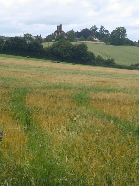
Chipley is a small village located in the county of Somerset, in the southwestern region of England. Situated approximately 5 miles east of Taunton, it is nestled in the charming countryside of the Taunton Deane district. The village is part of the civil parish of Halse and is surrounded by picturesque farmland and rolling hills.

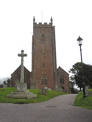
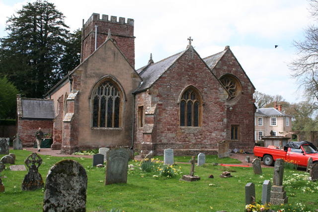
Despite its small size, Chipley boasts a rich history that dates back centuries. The village is mentioned in the Domesday Book of 1086, highlighting its significance in medieval times. Today, the village retains much of its traditional charm with a cluster of historic buildings, including a 14th-century church, St. Margaret's, which stands as a testament to its historical past.

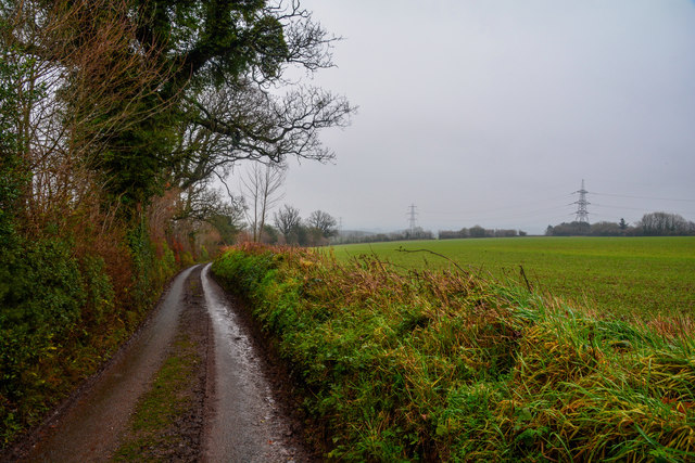
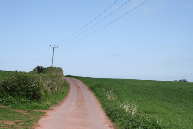
Chipley's location offers residents and visitors a peaceful and idyllic setting, making it a popular destination for those seeking a tranquil retreat. The surrounding countryside provides ample opportunities for outdoor activities such as hiking, cycling, and horse riding, with several scenic trails and bridleways to explore.

While it may lack in amenities, Chipley benefits from its close proximity to Taunton, which offers a wider range of services including shops, supermarkets, schools, and healthcare facilities. The village also benefits from good transport links, with the A358 road running nearby, providing convenient access to nearby towns and cities.

Overall, Chipley is a quintessential English village that encapsulates the beauty of rural Somerset. Its historic charm, coupled with its natural surroundings, make it an appealing place for those seeking a peaceful retreat in the heart of the English countryside.

If you have any feedback on the listing, please let us know in the comments section below.

Chipley Images

Images are sourced within 2km of 51.005275/-3.261067 or Grid Reference ST1123. Thanks to Geograph Open Source API. All images are credited.

Taunton Deane : Country Lane A small lane heading through the countryside.
Taunton Deane : Country Lane
A small lane heading through the countryside.
Pylon south of Leigh Furzes
Road through Knappy Copse
Langford Budville: lane at Runnington Runnington parish has been absorbed into neighbouring Langford Budville
Langford Budville: lane at Runnington
Runnington parish has been absorbed into neighbouring Langford Budville
Langford Budville: footpath at Runnington The West Deane Way, leading to Runnington, which includes the small church of St Peter and St Paul
Langford Budville: footpath at Runnington
The West Deane Way, leading to Runnington, which includes the small church of St Peter and St Paul
Langford Budville: Langford Heathfield Nature Reserve The common is a 91.6 hectare (226 acre) Site of Special Scientific Interest, home to thirty or more butterfly species, plants such as the heath spotted and early purple orchids, petty whin and pale dog violet. Tree pipits, nightingales and sparrowhawks inhabit the woods. The estate is managed by the Somerset Wildlife Trust
Langford Budville: Langford Heathfield Nature Reserve
The common is a 91.6 hectare (226 acre) Site of Special Scientific Interest, home to thirty or more butterfly species, plants such as the heath spotted and early purple orchids, petty whin and pale dog violet. Tree pipits, nightingales and sparrowhawks inhabit the woods. The estate is managed by the Somerset Wildlife Trust
Milverton: Chipley Park Jabiru leads Royal Predica in the first race of the Point-to-Point meeting held here on 5 February 2006
Milverton: Chipley Park
Jabiru leads Royal Predica in the first race of the Point-to-Point meeting held here on 5 February 2006
Milverton: Chipley Park A demonstration by Tiverton Foxhounds at their Point-to-Point meeting held on 5 February 2006
Milverton: Chipley Park
A demonstration by Tiverton Foxhounds at their Point-to-Point meeting held on 5 February 2006
Milverton: Chipley Park 5 February 2006. In the fourth race Fair to to, Sir Norman, Fanion de Nevlliac and Barton Saint tackle one of the fences on this point-to-point circuit. The meeting is held by the Tiverton Foxhounds Hunt.
Milverton: Chipley Park
5 February 2006. In the fourth race Fair to to, Sir Norman, Fanion de Nevlliac and Barton Saint tackle one of the fences on this point-to-point circuit. The meeting is held by the Tiverton Foxhounds Hunt.
Milverton: orchard near Olands A public footpath runs through the orchard to Milverton Court
Milverton: orchard near Olands
A public footpath runs through the orchard to Milverton Court
Nynehead: mistletoe-clad trees By an old entrance to Chipley Park. Looking roughly north east
Nynehead: mistletoe-clad trees
By an old entrance to Chipley Park. Looking roughly north east
Nynehead: footpath to Chipley Looking west
Nynehead: footpath to Chipley
Looking west
Milverton: Baghay Farm Many of the farm buildings have recently been converted for residential use. Looking north
Milverton: Baghay Farm
Many of the farm buildings have recently been converted for residential use. Looking north
Nynehead: Heywood Farmhouse for Heywood farm, which is marked Haywood on the 1988 edition of the Ordnance Survey 1:25,000. Looking north-north-east
Nynehead: Heywood
Farmhouse for Heywood farm, which is marked Haywood on the 1988 edition of the Ordnance Survey 1:25,000. Looking north-north-east
Langford Budville: North Gundenham Farm The large barn, centre, has only recently been erected
Langford Budville: North Gundenham Farm
The large barn, centre, has only recently been erected
Langford Budville: back lane Running between the B3187 Wellington-Milverton road and Heywood
Langford Budville: back lane
Running between the B3187 Wellington-Milverton road and Heywood
Milverton: lane near Higher Lovelinch Looking north
Milverton: lane near Higher Lovelinch
Looking north
Langford Budville: road to Wiveliscombe Looking north-north-west on Langford Heathfield, with the turning, left, to Poleshill just visible
Langford Budville: road to Wiveliscombe
Looking north-north-west on Langford Heathfield, with the turning, left, to Poleshill just visible
Show me another place!

Chipley is located at Grid Ref: ST1123 (Lat: 51.005275, Lng: -3.261067)

Administrative County: Somerset

District: Somerset West and Taunton

Police Authority: Avon and Somerset

What 3 Words

///direct.frown.purely. Near Milverton, Somerset

Nearby Locations

Chipley Chipley Park

Related Wikis

Langford Budville

Langford Budville is a village and civil parish in Somerset, England, situated near the River Tone 2 miles (3.2 km) north-west of Wellington, 4.5 miles...

Langford Heathfield

Langford Heathfield (grid reference ST100235) is a 95.4 hectare (235.7 acre) biological Site of Special Scientific Interest at Langford Budville, 3 km...

Church of St Peter and St Paul, Runnington

The Anglican Church of St Peter and St Paul at Runnington in Langford Budville, Somerset, England was built in the 15th century. It is a Grade II* listed...

Milverton, Somerset

Milverton is a village and civil parish in Somerset, England, situated in the valley of the River Tone 5 miles (8.0 km) west of Taunton. The village has...

Nynehead

Nynehead is a village and civil parish in Somerset, England, situated on the River Tone, 7 miles (11 km) south-west of Taunton and 1.5 miles (2 km) north...

Nynehead Court

Nynehead Court is a Grade II* listed building at Nynehead in Somerset, England. == History == The building dates back to the late 14th century with major...

The Old House, Milverton

The Old House in Milverton in Somerset, England is a Grade II* listed building dating from the late 14th and early 15th century, although there may also...
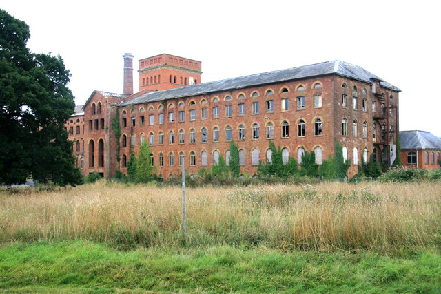
Tonedale Mills

Tonedale Mills, together with the neighbouring Tone Works, is a large textile mill in Wellington, Somerset, and the largest in South West England. Owned...

Related Videos

India in a Jar with a Dash of Devon team by Chef Collin Pereira spiced up the Milverton Street Fair

Indiainajar spiced up the #milverton Street Fair during the first Bank Holiday Monday of May. #somerset #wellington #bankholiday ...

Class 37 Double Header Special - 37667 & 37688 - Locomotive Services Ltd Private Tour

Class 37's 37667 & 37688 pulling the Locomotive Services Ltd private tour between Bristol East Depot and Penzance on 4th April ...

Nearby Amenities

Located within 500m of 51.005275,-3.261067
Give Way
Direction: forward
Lat/Long: 51.0013914/-3.2622497
Direction: forward
Maxspeed: 30 mph
Source Maxspeed: sign
Traffic Sign: maxspeed
Lat/Long: 51.0029778/-3.2628185
Direction: backward
Maxspeed: 30 mph
Source Maxspeed: sign
Traffic Sign: maxspeed
Lat/Long: 51.0057064/-3.2621628
Chipley
Is In: Somerset, England, United Kingdom
Place: hamlet
Lat/Long: 51.0044153/-3.2624781
Give Way
Direction: forward
Lat/Long: 51.0015442/-3.2615501
Power: pole
Lat/Long: 51.0071376/-3.2672793
Power: pole
Lat/Long: 51.0062651/-3.2667375
Power: pole
Lat/Long: 51.0055697/-3.2662922
Power: pole
Lat/Long: 51.0045554/-3.2656297
Power: pole
Lat/Long: 51.0038735/-3.2652032
Power: pole
Lat/Long: 51.002854/-3.2645783
Power: pole
Lat/Long: 51.0010665/-3.263441
The data included in this document is from www.openstreetmap.org. The data is made available under ODbL.

Have you been to Chipley?

Leave your review of Chipley below (or comments, questions and feedback).