Chimney-end

Settlement in Oxfordshire West Oxfordshire

England

Chimney-end

Village Cross, Leafield A medieval "Central Cross" in "the Greens", opposite the parish church. Base, steps and octagonal shaft are original, the cross would have been added in 1873 when the <a href="https://www.geograph.org.uk/photo/7609839">SP3115 : Village Cross, plaque, Leafield</a> explaining restoration was conducted in thanks to deliverance from the smallpox plague.

Grade II listed monument Nᴼ 1300897 see <span class="nowrap"><a title="https://historicengland.org.uk/listing/the-list/list-entry/1300897" rel="nofollow ugc noopener" href="https://historicengland.org.uk/listing/the-list/list-entry/1300897">Link</a><img style="margin-left:2px;" alt="External link" title="External link - shift click to open in new window" src="https://s1.geograph.org.uk/img/external.png" width="10" height="10"/></span>

Milestone Society National ID: OXWO_LEA
Village Cross, Leafield Credit: Mr Red

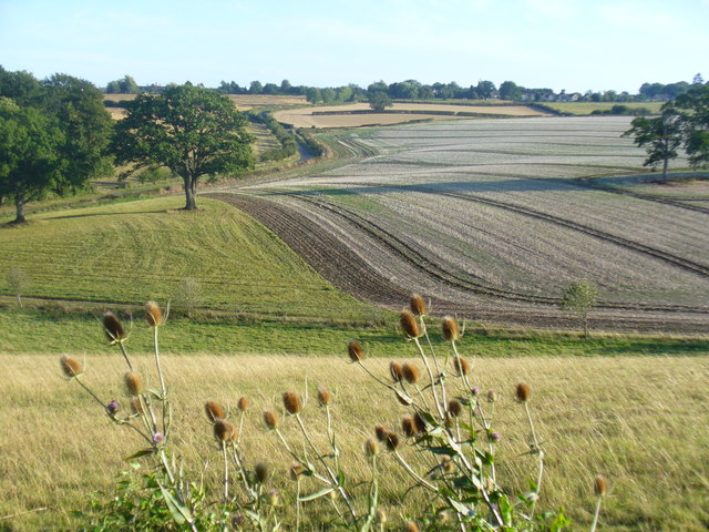
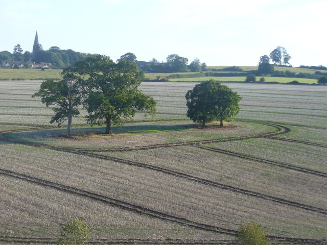
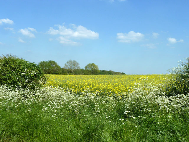
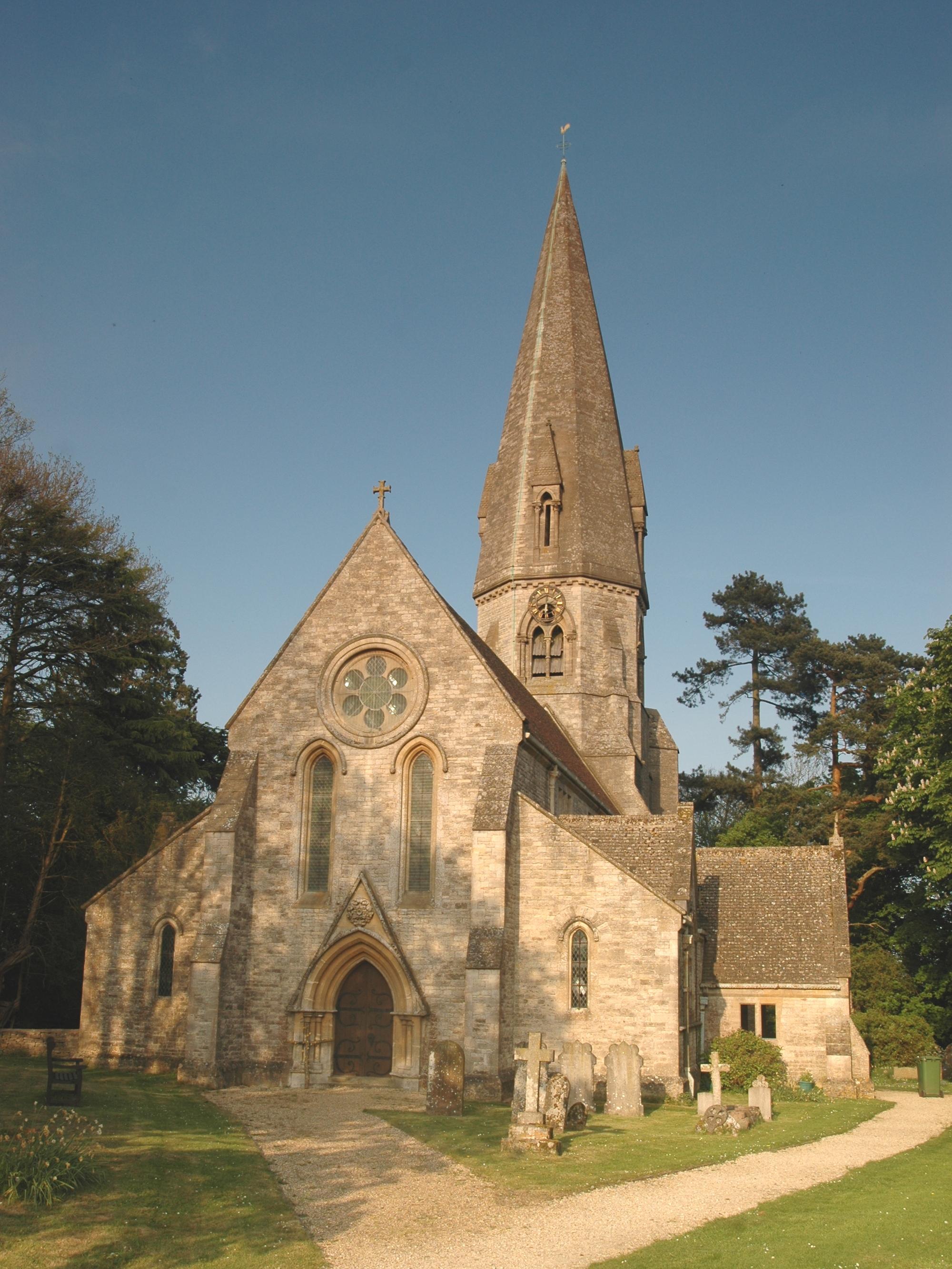
Chimney-end is a small village located in Oxfordshire, England. Situated in the picturesque countryside, it is surrounded by rolling hills and lush green fields, providing a tranquil and idyllic setting. The village is nestled in the Cherwell Valley, offering stunning views of the nearby Cherwell River.

With a population of around 500 residents, Chimney-end has a close-knit community that is known for its friendly and welcoming atmosphere. The village is primarily residential, consisting of charming cottages and a few small businesses. Its quaint and traditional architecture adds to its charm and character.

Despite its small size, Chimney-end offers a range of amenities to its residents. It has a local pub, the Chimney Arms, which is a popular gathering spot for locals and visitors alike. The pub serves traditional English food and a variety of beverages, providing a cozy and inviting atmosphere.

The village is also home to a primary school, providing education for the local children. The school is well-regarded for its high academic standards and nurturing environment, contributing to the strong sense of community within Chimney-end.

For outdoor enthusiasts, Chimney-end offers plenty of recreational activities. The surrounding countryside provides ample opportunities for walking, cycling, and exploring nature. The village is also conveniently located near several nature reserves and country parks, allowing residents to enjoy the natural beauty of Oxfordshire.

Overall, Chimney-end is a charming village that offers a peaceful and rural lifestyle, making it an attractive place to live for those seeking a slower pace of life in a beautiful countryside setting.

If you have any feedback on the listing, please let us know in the comments section below.
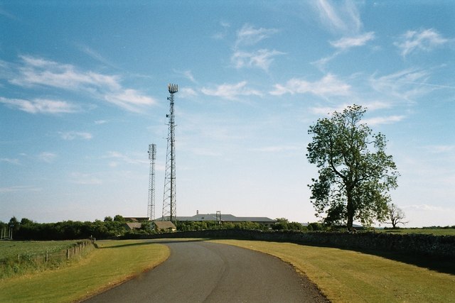
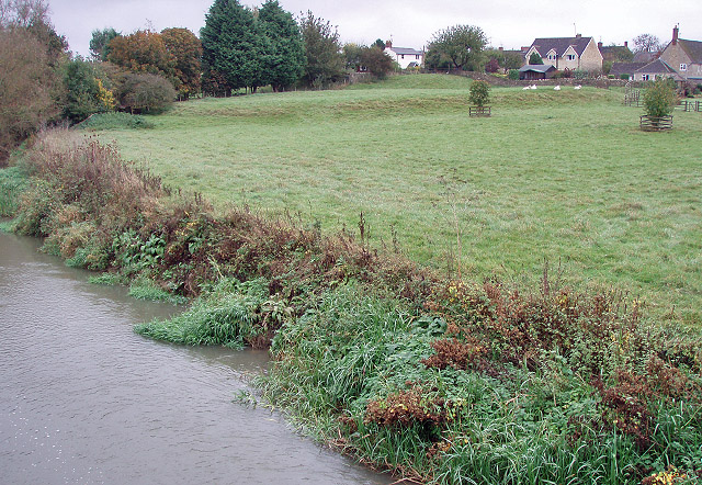
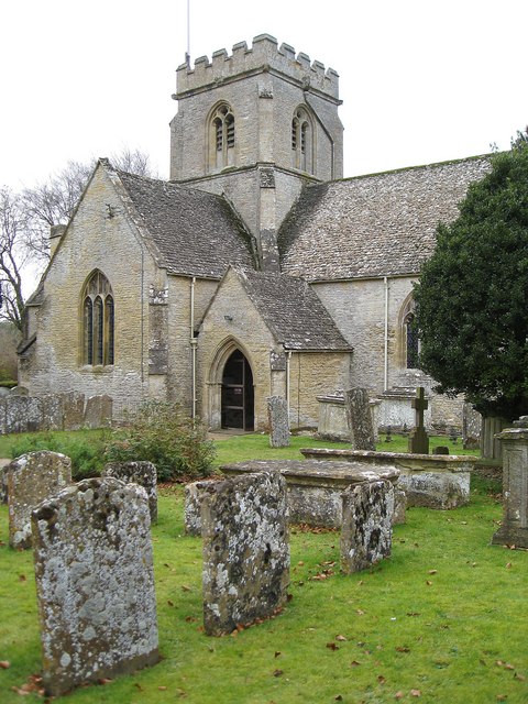
Chimney-end Images

Images are sourced within 2km of 51.832758/-1.5515287 or Grid Reference SP3115. Thanks to Geograph Open Source API. All images are credited.

Village Cross, Leafield A medieval "Central Cross" in "the Greens", opposite the parish church. Base, steps and octagonal shaft are original, the cross would have been added in 1873 when the <a href="https://www.geograph.org.uk/photo/7609839">SP3115 : Village Cross, plaque, Leafield</a> explaining restoration was conducted in thanks to deliverance from the smallpox plague.

Grade II listed monument Nᴼ 1300897 see <span class="nowrap"><a title="https://historicengland.org.uk/listing/the-list/list-entry/1300897" rel="nofollow ugc noopener" href="https://historicengland.org.uk/listing/the-list/list-entry/1300897">Link</a><img style="margin-left:2px;" alt="External link" title="External link - shift click to open in new window" src="https://s1.geograph.org.uk/img/external.png" width="10" height="10"/></span>

Milestone Society National ID: OXWO_LEA
Village Cross, Leafield
A medieval "Central Cross" in "the Greens", opposite the parish church. Base, steps and octagonal shaft are original, the cross would have been added in 1873 when the SP3115 : Village Cross, plaque, Leafield explaining restoration was conducted in thanks to deliverance from the smallpox plague. Grade II listed monument Nᴼ 1300897 see LinkExternal link Milestone Society National ID: OXWO_LEA
Village Cross, plaque, Leafield Memorial plate on a medieval "central cross". The view of the cross is <a href="https://www.geograph.org.uk/photo/7609836">SP3115 : Village Cross, Leafield</a>.

Inscription:
"In the name of the Father, and of the Son and of the Holy Ghost, amen. This ancient cross was restored by the inhabitants of Leafield as a memorial of their deliverance from the scourge of small pox AD 1873"
Village Cross, plaque, Leafield
Memorial plate on a medieval "central cross". The view of the cross is SP3115 : Village Cross, Leafield. Inscription: "In the name of the Father, and of the Son and of the Holy Ghost, amen. This ancient cross was restored by the inhabitants of Leafield as a memorial of their deliverance from the scourge of small pox AD 1873"
Fingerpost, The Greens, Leafield At the junction of The Greens and Fairspear Road, with the village school in the background.

Inscription: Technical Centre / Shipton-u-Wychwood // Finstock 3 / Charlbury 5 // 
Fieldassarts 1 / Fordwells 1 / Asthall Leigh 1¾

Milestone Society National ID: OX_SP3115
Fingerpost, The Greens, Leafield
At the junction of The Greens and Fairspear Road, with the village school in the background. Inscription: Technical Centre / Shipton-u-Wychwood // Finstock 3 / Charlbury 5 // Fieldassarts 1 / Fordwells 1 / Asthall Leigh 1¾ Milestone Society National ID: OX_SP3115
Derelict shed In a field just east of Dodds Farm, beside the road from Field Assarts to Crawley.
Derelict shed
In a field just east of Dodds Farm, beside the road from Field Assarts to Crawley.
Derelict shed near Dodds Farm Just east of the farm, in a field beside the road from Field Assarts to Crawley.
Derelict shed near Dodds Farm
Just east of the farm, in a field beside the road from Field Assarts to Crawley.
The Pearl Chinese restaurant On the eastern edge of Leafield. This was once called the Spindleberry, and has had other names, although these escape me at the moment.
The Pearl Chinese restaurant
On the eastern edge of Leafield. This was once called the Spindleberry, and has had other names, although these escape me at the moment.
Fiveash Bottom Evening sunshine on the fields near Leafield, at the edge of Wychwood Forest.
Fiveash Bottom
Evening sunshine on the fields near Leafield, at the edge of Wychwood Forest.
Fiveash Bottom from Hatchings Lane Summer evening near Leafield. The field on the hillside shows clear tractor wheel marks.
<span class="nowrap"><a title="http://www.leafieldvillage.co.uk/" rel="nofollow ugc noopener" href="http://www.leafieldvillage.co.uk/">Link</a><img style="margin-left:2px;" alt="External link" title="External link - shift click to open in new window" src="https://s1.geograph.org.uk/img/external.png" width="10" height="10"/></span>
Fiveash Bottom from Hatchings Lane
Summer evening near Leafield. The field on the hillside shows clear tractor wheel marks. LinkExternal link
Leafield Parish Church St Michael and All Angels - landmark church with tall spire. It was designed by Sir George Gilbert Scott (1859).
<span class="nowrap"><a title="http://www.leafieldvillage.co.uk/" rel="nofollow ugc noopener" href="http://www.leafieldvillage.co.uk/">Link</a><img style="margin-left:2px;" alt="External link" title="External link - shift click to open in new window" src="https://s1.geograph.org.uk/img/external.png" width="10" height="10"/></span>
Leafield Parish Church
St Michael and All Angels - landmark church with tall spire. It was designed by Sir George Gilbert Scott (1859). LinkExternal link
Village Cross, Leafield The base is original but the shaft was restored in 1873, following 1850 vandalism. Beyond is the parish church spire.
<span class="nowrap"><a title="http://www.leafieldvillage.co.uk/" rel="nofollow ugc noopener" href="http://www.leafieldvillage.co.uk/">Link</a><img style="margin-left:2px;" alt="External link" title="External link - shift click to open in new window" src="https://s1.geograph.org.uk/img/external.png" width="10" height="10"/></span>
Village Cross, Leafield
The base is original but the shaft was restored in 1873, following 1850 vandalism. Beyond is the parish church spire. LinkExternal link
Sheds and pens for free range chickens
Purrants Lane
Purrants Lane
Purrants lane passes entrance to Leafield Pig Farm
May blossom Any colour you like as long as it's white. Hawthorn and Cow Parsley.
May blossom
Any colour you like as long as it's white. Hawthorn and Cow Parsley.
Country lane junction The timeless aspect of the view is marred by the finger pointing straight on to Leafield Technical Centre.
Country lane junction
The timeless aspect of the view is marred by the finger pointing straight on to Leafield Technical Centre.
Entering Field Assarts An interesting name. An assart is cleared forested land for use in agriculture or other purposes.
Entering Field Assarts
An interesting name. An assart is cleared forested land for use in agriculture or other purposes.
Leafield church St. Michael and All Angels.
Leafield church
St. Michael and All Angels.
Field of oil-seed rape East of Hatching Lane.
Field of oil-seed rape
East of Hatching Lane.
Show me another place!

Chimney-end is located at Grid Ref: SP3115 (Lat: 51.832758, Lng: -1.5515287)

Administrative County: Oxfordshire

District: West Oxfordshire

Police Authority: Thames Valley

What 3 Words

///cycle.rewriting.create. Near Shipton under Wychwood, Oxfordshire

Related Wikis

Leafield Castle

Leafield Castle (also known as Leafield Barrow) is a motte castle in the village of Leafield in the north west region of Oxfordshire. All that is left...

Leafield

Leafield is a village and civil parish about 4 miles (6.4 km) northwest of Witney in West Oxfordshire. The parish includes the hamlet of Langley, 1 mile...

Leafield Technical Centre

Leafield Technical Centre is a former radio transmission station, now turned motorsports centre of excellence, located in the hamlet of Langley, in the...

Ascott d'Oyley

Ascott d'Oyley is a village in Oxfordshire, England. The name ‘Ascott’ is derived from the Old English ēast (east) and cot (cottage), whilst d’Oyley was...

Wychwood

Wychwood or Wychwood Forest is a 501.7-hectare (1,240-acre) biological Site of Special Scientific Interest north of Witney in Oxfordshire. It is also a...

Ascott Earl Castle

Ascott Earl Castle was a castle in the village of Ascott Earl, Oxfordshire, England. == Details == Ascott Earl Castle was built in the village of Ascott...

Ascott Earl

Ascott Earl is a village in Oxfordshire, England. There are the remains of a motte-and-bailey castle beside the river Evenlode. == External links == Media...

Minster Lovell

Minster Lovell is a village and civil parish on the River Windrush about 2+1⁄2 miles (4 km) west of Witney in Oxfordshire. The 2011 Census recorded the...

Nearby Amenities

Located within 500m of 51.832758,-1.5515287
Barrier: stile
Foot: yes
Lat/Long: 51.8326088/-1.5486003
Barrier: stile
Foot: yes
Lat/Long: 51.8321144/-1.5463263
Power: pole
Source: Bing
Lat/Long: 51.8313872/-1.5449425
Power: pole
Source: Bing
Lat/Long: 51.8328421/-1.5512259
Power: pole
Source: Bing
Lat/Long: 51.8325901/-1.5498982
Power: pole
Source: Bing
Lat/Long: 51.8323421/-1.548662
Power: pole
Source: Bing
Lat/Long: 51.8330956/-1.5525026
Power: pole
Source: Bing
Lat/Long: 51.8322802/-1.5461914
Power: pole
Source: Bing
Lat/Long: 51.8331884/-1.5513076
Power: pole
Source: Bing
Lat/Long: 51.8343074/-1.5563438
Power: pole
Source: Bing
Lat/Long: 51.833573/-1.5550732
Power: pole
Source: Bing
Lat/Long: 51.8336671/-1.5532563
Power: pole
Source: Bing
Lat/Long: 51.8338369/-1.556559
Power: pole
Source: Bing
Lat/Long: 51.8333509/-1.5537686
Power: pole
Source: Bing
Lat/Long: 51.8318764/-1.5461108
Power: pole
Source: Bing
Lat/Long: 51.8327681/-1.5495881
Power: pole
Source: Bing
Lat/Long: 51.8321092/-1.5473823
Power: pole
Source: Bing
Lat/Long: 51.8323434/-1.5478162
Power: pole
Source: Bing
Lat/Long: 51.8340063/-1.55479
Power: pole
Source: Bing
Lat/Long: 51.8300975/-1.548249
Power: pole
Source: Bing
Lat/Long: 51.8300626/-1.5464921
Power: pole
Source: Bing
Lat/Long: 51.833829/-1.5564501
Power: pole
Source: Bing
Lat/Long: 51.8319238/-1.5461248
Power: pole
Source: Bing
Lat/Long: 51.8301263/-1.5499463
Power: pole
Source: Bing
Lat/Long: 51.8329998/-1.5476052
Power: pole
Source: Bing
Lat/Long: 51.8347814/-1.5463819
Power: pole
Source: Bing
Lat/Long: 51.8335502/-1.546732
Power: pole
Source: Bing
Lat/Long: 51.8341913/-1.5465484
Power: pole
Source: Bing
Lat/Long: 51.8320202/-1.5532826
Power: pole
Source: Bing
Lat/Long: 51.8313772/-1.5521462
Power: pole
Source: Bing
Lat/Long: 51.8345779/-1.5519024
Power: pole
Source: Bing
Lat/Long: 51.8363162/-1.549185
Power: pole
Source: Bing
Lat/Long: 51.8354511/-1.5505449
Power: pole
Lat/Long: 51.8346261/-1.5578771
Power: pole
Lat/Long: 51.8337644/-1.5560998
Power: pole
Lat/Long: 51.833255/-1.555489
Power: pole
Lat/Long: 51.8326382/-1.5543804
Power: pole
Lat/Long: 51.8307567/-1.5510502
Power: pole
Source: Bing
Lat/Long: 51.8336877/-1.5532419
Power: pole
Source: Bing
Lat/Long: 51.8339776/-1.5548052
The data included in this document is from www.openstreetmap.org. The data is made available under ODbL.

Have you been to Chimney-end?

Leave your review of Chimney-end below (or comments, questions and feedback).