Chimney
Settlement in Oxfordshire West Oxfordshire
England
Chimney

Chimney is a small village located in the county of Oxfordshire, England. Situated approximately 7 miles southwest of the city of Oxford, the village is nestled in the beautiful countryside of the Upper Thames Valley. With a population of just over 400 residents, Chimney offers a tranquil and idyllic setting for those seeking a peaceful rural lifestyle.
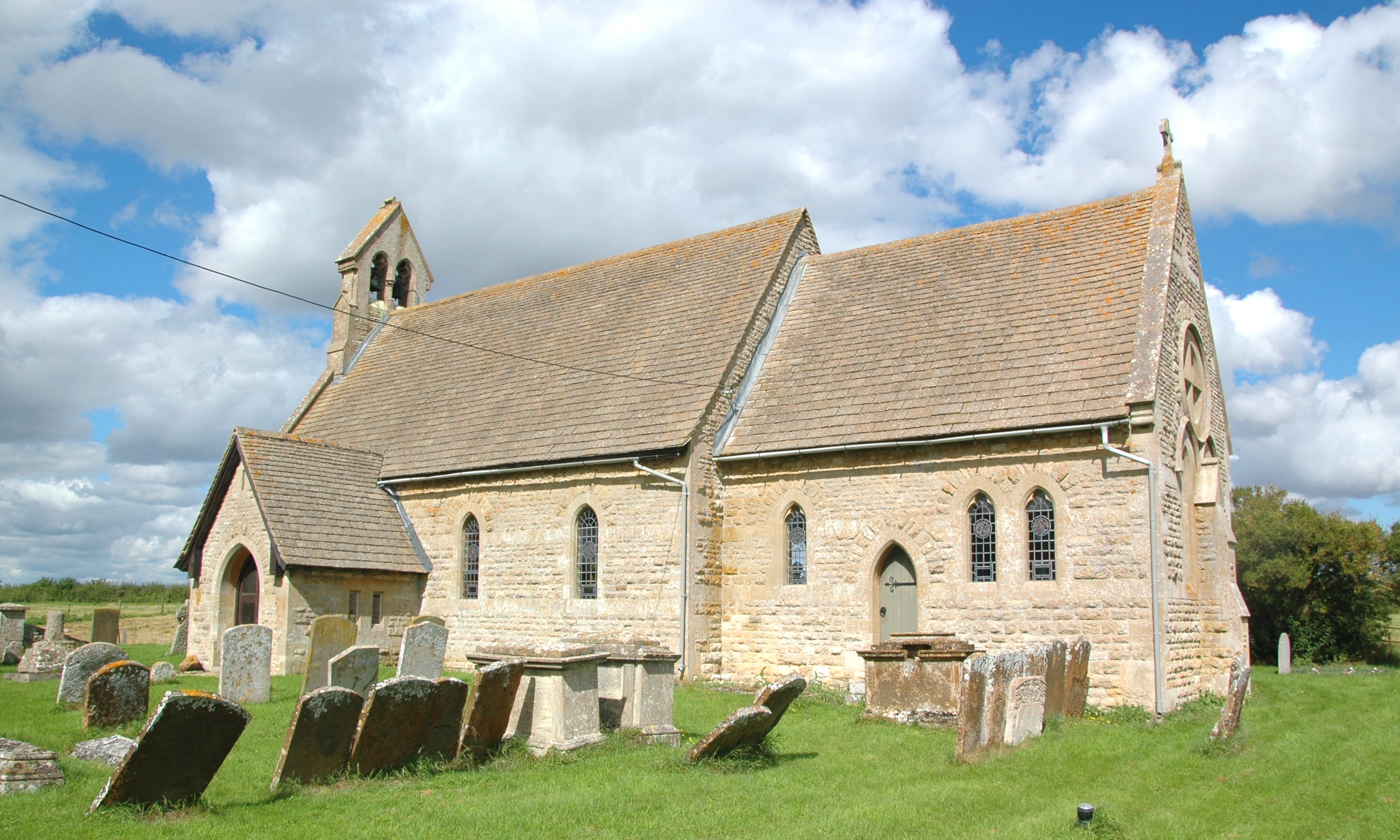
The village is characterized by its charming and picturesque architecture, with many of the houses dating back to the 17th and 18th centuries. The predominantly stone-built cottages and farmhouses give Chimney a quintessentially English feel. The village is also home to a historic church, St. Mary's, which dates back to the 12th century and adds to the overall charm of the area.
Despite its small size, Chimney has a strong community spirit and several amenities to cater to the needs of its residents. These include a local pub, The Red Lion, which serves as a hub for socializing and enjoying traditional pub food. The village also boasts a primary school, providing education for the younger members of the community.
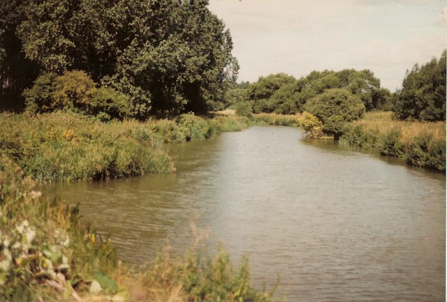
Surrounded by rolling hills and lush green fields, Chimney offers ample opportunities for outdoor activities such as hiking, cycling, and horse riding. The nearby River Thames provides additional recreational opportunities, including boating and fishing.
Overall, Chimney is a peaceful and picturesque village that offers a quintessential English countryside experience. Its rich history, beautiful architecture, and strong sense of community make it an attractive place to live or visit for those seeking a slower pace of life.
If you have any feedback on the listing, please let us know in the comments section below.
Chimney Images
Images are sourced within 2km of 51.70521/-1.484056 or Grid Reference SP3500. Thanks to Geograph Open Source API. All images are credited.


Chimney is located at Grid Ref: SP3500 (Lat: 51.70521, Lng: -1.484056)
Administrative County: Oxfordshire
District: West Oxfordshire
Police Authority: Thames Valley
What 3 Words
///tiny.century.outlawing. Near Standlake, Oxfordshire
Nearby Locations
Related Wikis

Chimney, Oxfordshire
Chimney is a hamlet and former civil parish, now in the parish of Aston, Cote, Shifford and Chimney, in the West Oxfordshire district, in the county of...
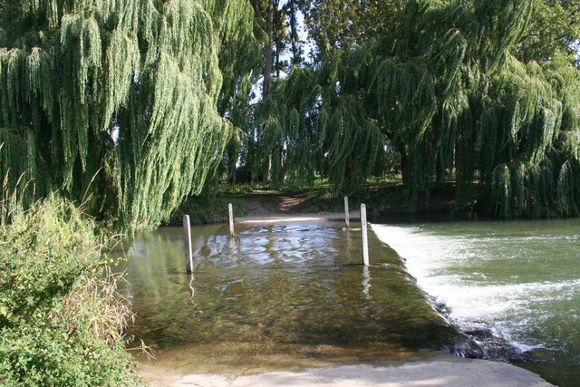
Chimney Meadows
Chimney Meadows is a 49.6-hectare (123-acre) biological Site of Special Scientific Interest between Abingdon-on-Thames and Faringdon in Oxfordshire. It...
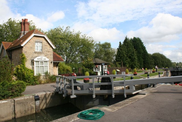
Shifford Lock
Shifford Lock is a lock on the River Thames in England. It is in the centre of a triangle formed by the small villages of Shifford, Duxford and Chimney...
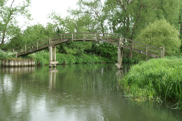
Tenfoot Bridge
Tenfoot Bridge is a wooden footbridge across the River Thames in Oxfordshire, England. It is situated on the reach above Shifford Lock and was built in...
Duxford, Oxfordshire
Duxford is a hamlet in the civil parish of Hinton Waldrist 5.5 miles (9 km) northeast of Faringdon. It was part of Berkshire until the 1974 boundary changes...

Cote, Oxfordshire
Cote is a hamlet about 4 miles (6.4 km) south of Witney and 1 mile (1.6 km) north of the River Thames in West Oxfordshire, England. Cote is part of the...
Shifford
Shifford is a hamlet in the civil parish of Aston, Cote, Shifford and Chimney in Oxfordshire, England. It is on the north bank of the River Thames about...

Tadpole Bridge
Tadpole Bridge is a road bridge across the River Thames in Oxfordshire, England, carrying a road between Bampton to the north and Buckland to the south...
Nearby Amenities
Located within 500m of 51.70521,-1.484056Have you been to Chimney?
Leave your review of Chimney below (or comments, questions and feedback).