Chilwell

Settlement in Nottinghamshire Broxtowe

England

Chilwell

Inham Nook Housing Estate A surprisingly large estate of social housing on the hill at Chilwell. Now rather better served by public transport than it was at the time of photo as the NET tram passes through the estate.
Inham Nook Housing Estate Credit: SK53

Chilwell is a small village located in the borough of Broxtowe, Nottinghamshire, in the East Midlands region of England. Situated approximately 6 miles southwest of Nottingham city center, Chilwell has a population of around 18,000 people.

The village is well connected with excellent transport links, including nearby access to the M1 motorway and regular bus services to Nottingham and other surrounding towns. The closest train station is Beeston, which is just a short distance away.

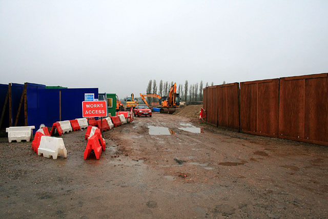
Chilwell has a rich history, with evidence of Roman settlements found in the area. The village grew significantly during the Industrial Revolution, primarily due to the establishment of the Chilwell Ordnance Factory in the early 20th century. This factory played a crucial role in both World Wars, producing munitions and explosives.

Today, Chilwell is a primarily residential area with a mix of modern housing developments and older, traditional properties. The village offers a range of amenities, including shops, supermarkets, pubs, and restaurants, providing residents with all the necessary conveniences.

Chilwell is also known for its green spaces, with several parks and open areas for recreational activities. The nearby Attenborough Nature Reserve, located just across the River Trent, is a popular destination for nature enthusiasts and bird watchers.

Overall, Chilwell offers a peaceful and well-connected community, making it an attractive place to live for families and individuals seeking a quieter lifestyle within easy reach of Nottingham.

If you have any feedback on the listing, please let us know in the comments section below.

Chilwell Images

Images are sourced within 2km of 52.917692/-1.237749 or Grid Reference SK5135. Thanks to Geograph Open Source API. All images are credited.

Inham Nook Housing Estate A surprisingly large estate of social housing on the hill at Chilwell. Now rather better served by public transport than it was at the time of photo as the NET tram passes through the estate.
Inham Nook Housing Estate
A surprisingly large estate of social housing on the hill at Chilwell. Now rather better served by public transport than it was at the time of photo as the NET tram passes through the estate.
Housing in Inham Nook Estate
Toton Lane Park and Ride This is looking across the car park towards the NET Tramway terminus at Toton Lane.
Toton Lane Park and Ride
This is looking across the car park towards the NET Tramway terminus at Toton Lane.
Seaburn Road, Toton Part of the large mid-20th century housing development on the west side of Stapleford Lane.
Seaburn Road, Toton
Part of the large mid-20th century housing development on the west side of Stapleford Lane.
Crossroads at Toton Recreating this 'First' for the square <a title="https://www.geograph.org.uk/photo/64195" href="https://www.geograph.org.uk/photo/64195">Link</a>
Crossroads at Toton
Recreating this 'First' for the square Link
Stapleford Lane, Toton Looking towards Stapleford near Woodstock Road. The housing was developed in the 1950s and 60s.
Stapleford Lane, Toton
Looking towards Stapleford near Woodstock Road. The housing was developed in the 1950s and 60s.
Woodstock Road, Toton Typical post-WW2 housing estate, with the local shop. The bus stop enjoys, in 2023, just one early morning journey each weekday.
Woodstock Road, Toton
Typical post-WW2 housing estate, with the local shop. The bus stop enjoys, in 2023, just one early morning journey each weekday.
New building on the site of "The Magpie" An apartment block it would seem.

Note the stone boundary wall has not been removed. <a href="https://www.geograph.org.uk/photo/4782068">SK4936 : The Magpie, Toton Lane, Stapleford</a>.
New building on the site of "The Magpie"
An apartment block it would seem. Note the stone boundary wall has not been removed. SK4936 : The Magpie, Toton Lane, Stapleford.
Judson Avenue Open Space A small area of green space with flowering cherry trees, benches and a toddlers' play area.
Judson Avenue Open Space
A small area of green space with flowering cherry trees, benches and a toddlers' play area.
A Nottingham-bound tram crossing a bridleway
Overflow carpark at Bardfills Garden Centre
Closed footpath This access to Bardills Roundabout is closed during the tram works.
Closed footpath
This access to Bardills Roundabout is closed during the tram works.
Construction site This is a major construction site for the tramway works on the location of the large terminal Park & Ride site. The crop will probably not be disturbed before harvest time.
Construction site
This is a major construction site for the tramway works on the location of the large terminal Park & Ride site. The crop will probably not be disturbed before harvest time.
Surveying the tram route The partial removal of hedges indicates the line of the new tramway.
Surveying the tram route
The partial removal of hedges indicates the line of the new tramway.
Tramlines in the crop The tractor marks are on the line of the new tramway. The new Park & Ride site is under construction in the background.
Tramlines in the crop
The tractor marks are on the line of the new tramway. The new Park & Ride site is under construction in the background.
Site entrance To the area where the Chilwell Park-and-Ride will be, the terminus of the Chilwel line of the NET tram system.
Site entrance
To the area where the Chilwell Park-and-Ride will be, the terminus of the Chilwel line of the NET tram system.
NET contractor depot At the Chilwell Park-and-Ride location.
NET contractor depot
At the Chilwell Park-and-Ride location.
Park-and-Ride site to be This will be the terminus of the Chilwell line of the NET tram.
Park-and-Ride site to be
This will be the terminus of the Chilwell line of the NET tram.
Show me another place!

Chilwell is located at Grid Ref: SK5135 (Lat: 52.917692, Lng: -1.237749)

Administrative County: Nottinghamshire

District: Broxtowe

Police Authority: Nottinghamshire

What 3 Words

///cycles.left.bump. Near Long Eaton, Derbyshire

Nearby Locations

Chilwell

Related Wikis

Chilwell

Chilwell is a suburban area and former civil parish in the borough of Broxtowe in Nottinghamshire, England. It lies on the west side of the town of Beeston...

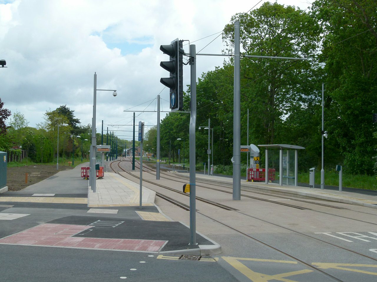
Bramcote Lane tram stop

Bramcote Lane is a tram stop on the Nottingham Express Transit (NET) network, in the district of Broxtowe and suburb of Chilwell. It is situated on reserved...

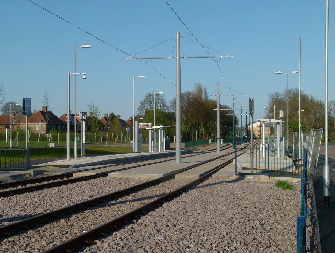
Eskdale Drive tram stop

Eskdale Drive is a tram stop on the Nottingham Express Transit (NET) network, in the district of Broxtowe and suburb of Chilwell. It is situated on reserved...

Chilwell Olympia

Chilwell Olympia is a sports centre in Chilwell, near Nottingham. It is run by Broxtowe Borough Council with the aim of meeting the recreational and sporting...

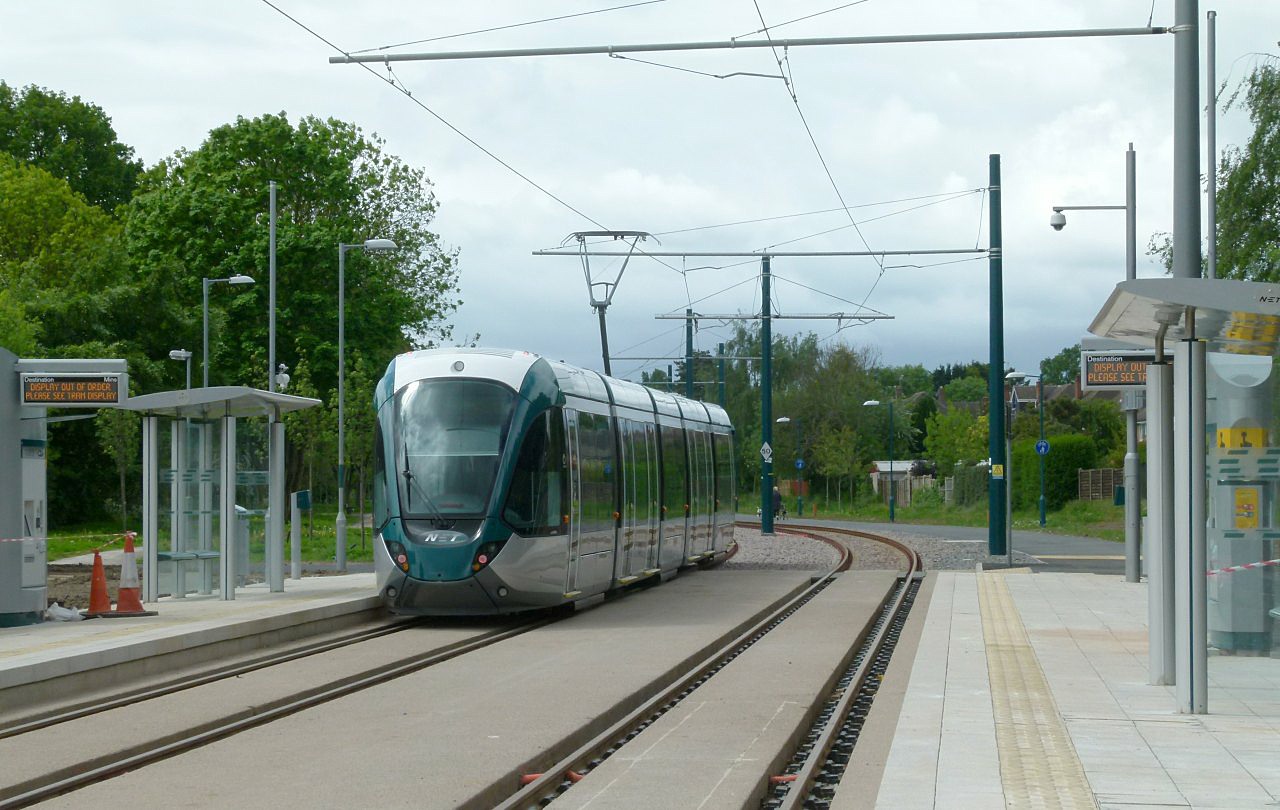
Cator Lane tram stop

Cator Lane is a tram stop on the Nottingham Express Transit (NET) network, in the district of Broxtowe and suburb of Chilwell. It is situated on reserved...

Lakeview College

Lakeview College was a sixth-form located in Beeston, Nottingham. It was located on the same campus as Chilwell School and Chilwell Olympia. It had approximately...
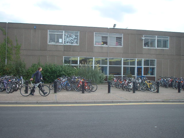
Chilwell School

Chilwell School (formerly known as Chilwell Comprehensive School) is a secondary school located in Chilwell, near Nottingham, England. The school is located...

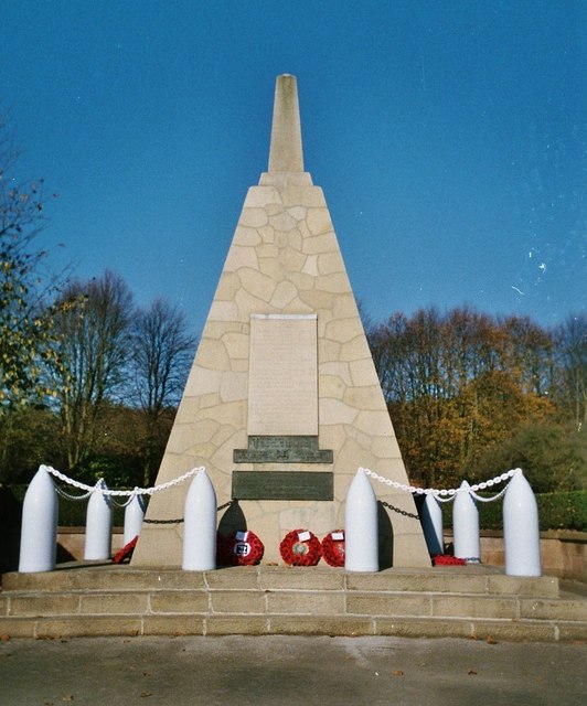
Chilwell Filling Factory Memorial

The memorial to munitions workers of National Filling Factory No.6, Chilwell is a Grade II listed building on the north side of Chetwynd Road inside Chetwynd...

Nearby Amenities

Located within 500m of 52.917692,-1.237749
Chilwell
Is In Conurbation: Nottingham
Is In County: Nottinghamshire
Is In District: Broxtowe
Place: suburb
Wikidata: Q5099264
Wikipedia: en:Chilwell
Lat/Long: 52.9139657/-1.2402537
Check Date: 2023-02-19
Source: survey; Bing
Traffic Calming: hump
Lat/Long: 52.9197659/-1.2361293
Source: Bing
Traffic Calming: hump
Lat/Long: 52.9201203/-1.2323496
Check Date: 2021-06-26
Source: survey; Bing
Traffic Calming: cushion
Lat/Long: 52.9206771/-1.2361689
Turning Circle
Lat/Long: 52.9136087/-1.2351436
Turning Circle
Lat/Long: 52.9168272/-1.2313017
Post Box
Check Date: 2023-02-19
Collection Times: Mo-Fr 16:00; Sa 11:30
Post Box Type: pillar
Ref: NG9 605
Royal Cypher: GR
Royal Cypher Wikidata: Q33102273
Source: survey
Lat/Long: 52.9158312/-1.2352355
Barrier: bollard
Lat/Long: 52.9214367/-1.2349157
Barrier: bollard
Lat/Long: 52.9215502/-1.2344071
Turning Circle
Lat/Long: 52.9142594/-1.2401458
Turning Circle
Lat/Long: 52.9168847/-1.2397878
Turning Circle
Lat/Long: 52.9160562/-1.2421564
Turning Circle
Lat/Long: 52.9163398/-1.2404891
Turning Circle
Lat/Long: 52.9189279/-1.2427146
Turning Circle
Lat/Long: 52.9193832/-1.2425549
Turning Circle
Lat/Long: 52.9196355/-1.2420189
Steps
Source: survey
Step Count: 1
Lat/Long: 52.9165197/-1.2403557
Turning Circle
Source: Yahoo
Lat/Long: 52.9148459/-1.2415908
Post Box
Collection Times: Mo-Fr 17:00; Sa 11:30
Ele: 31.608887
Operator: Royal Mail
Post Box Type: pillar
Ref: NG9 606
Royal Cypher: GR
Royal Cypher Wikidata: Q33102273
Source: GPS
Lat/Long: 52.913293/-1.2389404
Post Box
Collection Times: Mo-Fr 16:00; Sa 11:30
Post Box Type: pillar
Ref: NG9 652
Royal Cypher: GVIR
Royal Cypher Wikidata: Q33102169
Source: survey
Lat/Long: 52.919526/-1.2403966
Telephone
Booth: KX100
Source: survey
Lat/Long: 52.9196399/-1.2405297
Bus Stop
Hallams Lane
Bench: no
Bin: no
Bus: yes
Naptan AtcoCode: 3300BR0023
Naptan Bearing: NE
Naptan CommonName: Hallams Lane
Naptan Indicator: adj
Naptan Landmark: Hallams Lane
Naptan NaptanCode: ntsadgdg
Naptan Notes: none
Naptan PlusbusZoneRef: NTNG
Naptan Street: High Road
Naptan Verified: yes
Public Transport: platform
Shelter: no
Source: naptan_import
Lat/Long: 52.9180764/-1.232088
Bus Stop
Hallams Lane
Bus: yes
Naptan AtcoCode: 3300BR0077
Naptan Bearing: SW
Naptan CommonName: Hallams Lane
Naptan Crossing: Hallam Road
Naptan Indicator: opp
Naptan NaptanCode: ntsadatp
Naptan Notes: none
Naptan PlusbusZoneRef: NTNG
Naptan Street: High Road
Naptan Verified: yes
Public Transport: platform
Shelter: no
Source: naptan_import
Lat/Long: 52.91781/-1.2325459
Bus Stop
Sandby Court
Bench: yes
Bin: yes
Bus: yes
Lit: no
Naptan AtcoCode: 3300BR0155
Naptan Bearing: N
Naptan CommonName: Sandby Court
Naptan Crossing: Sandby Court
Naptan Indicator: adj
Naptan NaptanCode: ntsdawap
Naptan Notes: none (This stop renumbered from 3300CH18)
Naptan PlusbusZoneRef: NTNG
Naptan Street: Bramcote Lane
Naptan Verified: yes
Public Transport: platform
Shelter: yes
Source: naptan_import
Tactile Paving: no
Lat/Long: 52.922062/-1.2369647
Bus Stop
Burton Drive
Bus: yes
Naptan AtcoCode: 3300BR0211
Naptan Bearing: E
Naptan CommonName: Burton Drive
Naptan Crossing: Burton Drive
Naptan Indicator: opp
Naptan NaptanCode: ntsawjam
Naptan Notes: none (This stop renumbered from 3300CH15)
Naptan PlusbusZoneRef: NTNG
Naptan Street: Field Lane
Naptan Verified: yes
Public Transport: platform
Shelter: yes
Source: naptan_import
Lat/Long: 52.9181359/-1.2413528
School Lane
Naptan AtcoCode: 3300BR0217
Naptan Bearing: N
Naptan CommonName: School Lane
Naptan Indicator: N-bound
Naptan Landmark: Oldham Court
Naptan NaptanCode: ntsdpwdj
Naptan Notes: none
Naptan PlusbusZoneRef: NTNG
Naptan Street: School Lane
Naptan Verified: no
Physically Present: no
Source: naptan_import
Lat/Long: 52.916377/-1.2362228
Bus Stop
Field Lane
Bench: no
Bin: no
Bus: yes
Naptan AtcoCode: 3300BR0227
Naptan Bearing: E
Naptan CommonName: Field Lane
Naptan Indicator: o/s 6
Naptan NaptanCode: ntsdadad
Naptan Notes: none (This stop renumbered from 3300CH16)
Naptan PlusbusZoneRef: NTNG
Naptan Street: Field Lane
Naptan Verified: yes
Public Transport: platform
Ref: BR0227
Shelter: no
Source: naptan_import
Tactile Paving: no
Lat/Long: 52.918473/-1.2371003
Bus Stop
High Road
Bench: yes
Bin: yes
Bus: yes
Naptan AtcoCode: 3300BR0379
Naptan Bearing: N
Naptan CommonName: High Road
Naptan Indicator: o/s 319
Naptan Landmark: Charlton Arms
Naptan NaptanCode: ntsadgdj
Naptan Notes: none
Naptan PlusbusZoneRef: NTNG
Naptan Street: High Road
Naptan Verified: yes
Public Transport: platform
Shelter: yes
Source: naptan_import
Tactile Paving: no
Lat/Long: 52.9158685/-1.2352416
School Lane
Naptan AtcoCode: 3300BR0399
Naptan Bearing: E
Naptan CommonName: School Lane
Naptan Indicator: E-bound
Naptan Landmark: Oldham Court
Naptan NaptanCode: ntsatpma
Naptan Notes: none
Naptan PlusbusZoneRef: NTNG
Naptan Street: School Lane
Naptan Verified: no
Physically Present: no
Source: naptan_import
Lat/Long: 52.9160946/-1.2356478
Bus Stop
Depot Corner
Bench: yes
Bin: yes
Bus: yes
Naptan AtcoCode: 3300BR0400
Naptan Bearing: SW
Naptan CommonName: Attenborough Road
Naptan Crossing: Attenborough Road
Naptan Indicator: adj
Naptan NaptanCode: ntsadawa
Naptan Notes: none
Naptan PlusbusZoneRef: NTNG
Naptan Street: High Road
Naptan Verified: yes
Public Transport: platform
Shelter: yes
Source: naptan_import
Tactile Paving: no
Lat/Long: 52.9138104/-1.2369223
Bus Stop
High Road
Bench: no
Bin: no
Bus: yes
Naptan AtcoCode: 3300BR0401
Naptan Bearing: SE
Naptan CommonName: High Road
Naptan Indicator: o/s 383
Naptan Landmark: Charlton Arms
Naptan NaptanCode: ntsadatw
Naptan Notes: none
Naptan PlusbusZoneRef: NTNG
Naptan Street: High Road
Naptan Verified: yes
Public Transport: platform
Shelter: no
Source: naptan_import
Tactile Paving: no
Lat/Long: 52.9155679/-1.2348242
Bus Stop
Bramcote Lane
Local Ref: N-bound
Naptan AtcoCode: 3300BR0465
Naptan Bearing: N
Naptan Crossing: Hall Drive
Naptan PlusbusZoneRef: NTNG
Naptan Street: Bramcote Lane
Naptan Verified: no
Physically Present: no
Public Transport: platform
Ref: ntsawgdt
Source: naptan_import
Lat/Long: 52.92065/-1.2366682
Traffic Signals
Button Operated: yes
Crossing: traffic_signals
Crossing Ref: pelican
Tactile Paving: yes
Traffic Signals Sound: yes
Traffic Signals Vibration: yes
Lat/Long: 52.9157913/-1.2350775
Addr City: Nottingham
Addr Housenumber: 1-8
Addr Interpolation: all
Addr Postcode: NG9 5FB
Addr Street: Towlson Court
Addr Suburb: Chilwell
Entrance: yes
Source Addr Postcode: OS Open Data Codepoint
Lat/Long: 52.9141137/-1.2342274
Barrier: bollard
Lat/Long: 52.9153318/-1.2336386
Post Box
Collection Times: Mo-Fr 17:30; Sa 11:00
Post Box Type: pillar
Ref: NG9 642
Royal Cypher: GR
Royal Cypher Wikidata: Q33102273
Source: survey
Lat/Long: 52.9158747/-1.231313
Crossing: informal
Lat/Long: 52.9152939/-1.2314668
Traffic Calming: cushion
Lat/Long: 52.9182248/-1.2391804
Check Date: 2023-02-19
Traffic Calming: cushion
Lat/Long: 52.9184444/-1.2369604
Traffic Calming: cushion
Lat/Long: 52.9179976/-1.2431591
Traffic Calming: cushion
Lat/Long: 52.9180425/-1.2419939
Traffic Calming: cushion
Lat/Long: 52.9183163/-1.2380902
Traffic Calming: cushion
Lat/Long: 52.9181413/-1.2403572
Traffic Calming: cushion
Lat/Long: 52.9179475/-1.2444926
Traffic Signals
Lat/Long: 52.9213232/-1.2367057
Barrier: cycle_barrier
Lat/Long: 52.9213426/-1.2386058
Eskdale Drive
Network: Nottingham Express Transit
Operator: Tramlink Nottingham Ltd.
Public Transport: stop_position
Railway: tram_stop
Source: Nottingham City Council Open Data
Tram: yes
Wheelchair: yes
Lat/Long: 52.9203098/-1.2430866
Eskdale Drive
Network: Nottingham Express Transit
Operator: Tramlink Nottingham Ltd.
Public Transport: stop_position
Railway: tram_stop
Source: Nottingham City Council Open Data
Tram: yes
Wheelchair: yes
Lat/Long: 52.9203479/-1.2431039
Bramcote Lane
Network: Nottingham Express Transit
Operator: Tramlink Nottingham Ltd.
Public Transport: stop_position
Railway: tram_stop
Source: Nottingham City Council Open Data
Tram: yes
Lat/Long: 52.9215465/-1.2363429
Bramcote Lane
Network: Nottingham Express Transit
Operator: Tramlink Nottingham Ltd.
Public Transport: stop_position
Railway: tram_stop
Source: Nottingham City Council Open Data
Tram: yes
Lat/Long: 52.9215124/-1.2363139
Depot Corner
Junction: yes
Lat/Long: 52.913502/-1.237761
Barrier: cycle_barrier
Lat/Long: 52.9163151/-1.2408549
Barrier: cycle_barrier
Lat/Long: 52.9163312/-1.2407279
Barrier: cycle_barrier
Source: survey
Lat/Long: 52.916414/-1.2404374
Steps
Source: survey
Step Count: 1
Lat/Long: 52.9165836/-1.2403941
Steps
Source: survey
Step Count: 1
Lat/Long: 52.9166205/-1.2404167
Bicycle Parking
Bicycle Parking: stands
Capacity: 6
Check Date Capacity: 2023-02-19
Covered: yes
Lat/Long: 52.9159407/-1.2354747
Barrier: yes
Source: survey
Lat/Long: 52.9159871/-1.2367819
Steps
Source: survey
Step Count: 5
Lat/Long: 52.9189294/-1.2439925
Source: survey
Traffic Calming: hump
Lat/Long: 52.9182516/-1.2409133
Source: survey
Traffic Calming: hump
Lat/Long: 52.9189199/-1.2411803
Source: survey
Traffic Calming: hump
Lat/Long: 52.919582/-1.2414575
Check Date: 2021-06-26
Source: survey
Traffic Calming: hump
Lat/Long: 52.9202337/-1.2431019
Addr City: Nottingham
Addr Housenumber: 46a
Addr Postcode: NG9 5ES
Addr Street: Blenheim Drive
Addr Suburb: Chilwell
Building: residential
Entrance: yes
Note: On first floor
Source: Bing; survey
Source Addr Postcode: OS Open Data Codepoint
Lat/Long: 52.9197452/-1.2406126
Addr City: Nottingham
Addr Housenumber: 46b;48a
Addr Postcode: NG9 5ES
Addr Street: Blenheim Drive
Addr Suburb: Chilwell
Building: residential
Entrance: yes
Note: On first floor
Source: Bing; survey
Source Addr Postcode: OS Open Data Codepoint
Lat/Long: 52.9196513/-1.2407585
Addr City: Nottingham
Addr Housenumber: 50a;52a
Addr Postcode: NG9 5ES
Addr Street: Blenheim Drive
Addr Suburb: Chilwell
Building: residential
Entrance: yes
Note: On first floor
Source: Bing; survey
Source Addr Postcode: OS Open Data Codepoint
Lat/Long: 52.9195864/-1.2411115
Check Date: 2021-06-26
Source: Bing
Traffic Calming: hump
Lat/Long: 52.9195596/-1.2405154
Check Date: 2021-06-26
Source: Bing
Traffic Calming: hump
Lat/Long: 52.9197771/-1.2393679
Check Date: 2021-06-26
Source: Bing
Traffic Calming: hump
Lat/Long: 52.9199542/-1.2383977
Check Date: 2021-06-26
Source: Bing
Traffic Calming: hump
Lat/Long: 52.9201493/-1.2369749
Power: substation
Source: survey
Lat/Long: 52.9175739/-1.2303418
Gregory's Roses / Charles Gregory / Charles Walter Gregory
Dedicatee: Charles Gregory;Charles Walter Gregory
Historic: memorial
Inscription: Former offices of the world famous Chilwell Mark. Gregory's Roses. Established here 1897 by Charles Gregory 1867-1940 and continued by his son Charles Walter Gregory 1908-1980.
Landmark: memorial_plaque
Memorial: plaque
Operator: Southern Broxtowe Blue Plaque Group
Plaque Colour: blue
Lat/Long: 52.9171744/-1.2337425
Addr City: Nottingham
Addr Housenumber: 1-8
Addr Interpolation: all
Addr Postcode: NG9 5EZ
Addr Street: Brentnall Court
Addr Suburb: Chilwell
Entrance: yes
Source Addr Postcode: OS Open Data Codepoint
Lat/Long: 52.9142802/-1.2344617
Addr City: Nottingham
Addr Housenumber: 9-18
Addr Interpolation: all
Addr Postcode: NG9 5FB
Addr Street: Towlson Court
Addr Suburb: Chilwell
Entrance: yes
Source Addr Postcode: OS Open Data Codepoint
Lat/Long: 52.9141135/-1.2340845
Addr City: Nottingham
Addr Housenumber: 9-18
Addr Interpolation: all
Addr Postcode: NG9 5EZ
Addr Street: Brentnall Court
Addr Suburb: Chilwell
Entrance: yes
Source Addr Postcode: OS Open Data Codepoint
Lat/Long: 52.9142792/-1.2343188
Man Made: mast
Source: survey
Lat/Long: 52.9139333/-1.2339258
Source: survey; Bing
Traffic Calming: cushion
Lat/Long: 52.9208697/-1.2351455
Source: survey; Bing
Traffic Calming: cushion
Lat/Long: 52.9211277/-1.233794
Check Date: 2023-02-19
Source: survey; Bing
Traffic Calming: hump
Lat/Long: 52.91799/-1.2327328
Check Date: 2023-02-19
Source: survey; Bing
Traffic Calming: hump
Lat/Long: 52.9185245/-1.231684
Check Date: 2023-02-19
Source: survey; Bing
Traffic Calming: hump
Lat/Long: 52.9187082/-1.2359207
Source: survey; Bing
Traffic Calming: hump
Lat/Long: 52.9188518/-1.2350305
Source: survey; Bing
Traffic Calming: hump
Lat/Long: 52.9190873/-1.2323211
Source: survey; Bing
Traffic Calming: hump
Lat/Long: 52.9192368/-1.2341379
Source: Bing
Traffic Calming: hump
Lat/Long: 52.9201255/-1.2341783
Entrance: yes
Lat/Long: 52.9205327/-1.235194
Entrance: yes
Lat/Long: 52.9206105/-1.2347897
Entrance: yes
Lat/Long: 52.9206409/-1.235392
Entrance: yes
Lat/Long: 52.9206825/-1.2343782
Entrance: yes
Lat/Long: 52.9207205/-1.2349791
Entrance: yes
Lat/Long: 52.9207606/-1.2339683
Entrance: yes
Lat/Long: 52.9207961/-1.2345744
Entrance: yes
Lat/Long: 52.9208731/-1.2341691
Entrance: yes
Lat/Long: 52.9210482/-1.2327864
Entrance: yes
Lat/Long: 52.9210749/-1.2331025
Chilwell Hall / Charlton Family
Historic: memorial
Inscription: Site of CHILWELL HALL 1300-1933 / Home of the CHARLTON FAMILY / Landowners, prominent in local affairs 1620-1932
Landmark: memorial_plaque
Memorial: plaque
Note: Attached to wall
Operator: Southern Broxtowe Blue Plaque Group
Plaque Colour: blue
Lat/Long: 52.9184981/-1.230458
Addr City: Nottingham
Addr Postcode: NG9 5EH
Addr Street: School Lane
Addr Suburb: Chilwell
Building: house
Fixme: number missing
Note: Built 2013
Source: Bing; survey
Source Addr Postcode: OS Open Data Codepoint
Lat/Long: 52.9164781/-1.2363819
Addr City: Nottingham
Addr Housenumber: 1
Addr Postcode: NG9 5HD
Addr Street: Ulmus Court
Addr Suburb: Chilwell
Entrance: main
Source: survey
Source Addr Postcode: OS Opendata Codepoint
Lat/Long: 52.9210147/-1.2337334
Addr City: Nottingham
Addr Housenumber: 10
Addr Postcode: NG9 5HD
Addr Street: Ulmus Court
Addr Suburb: Chilwell
Entrance: main
Source: survey
Source Addr Postcode: OS Opendata Codepoint
Lat/Long: 52.9208897/-1.2331925
Addr City: Nottingham
Addr Housenumber: 2
Addr Postcode: NG9 5HD
Addr Street: Ulmus Court
Addr Suburb: Chilwell
Entrance: main
Source: survey
Source Addr Postcode: OS Opendata Codepoint
Lat/Long: 52.9210317/-1.2336472
Addr City: Nottingham
Addr Housenumber: 3
Addr Postcode: NG9 5HD
Addr Street: Ulmus Court
Addr Suburb: Chilwell
Entrance: main
Source: survey
Source Addr Postcode: OS Opendata Codepoint
Lat/Long: 52.9210387/-1.2336119
Addr City: Nottingham
Addr Housenumber: 4
Addr Postcode: NG9 5HD
Addr Street: Ulmus Court
Addr Suburb: Chilwell
Entrance: main
Source: survey
Source Addr Postcode: OS Opendata Codepoint
Lat/Long: 52.9210577/-1.2335155
Addr City: Nottingham
Addr Housenumber: 5
Addr Postcode: NG9 5HD
Addr Street: Ulmus Court
Addr Suburb: Chilwell
Entrance: main
Source: survey
Source Addr Postcode: OS Opendata Codepoint
Lat/Long: 52.9209778/-1.2334713
Addr City: Nottingham
Addr Housenumber: 6
Addr Postcode: NG9 5HD
Addr Street: Ulmus Court
Addr Suburb: Chilwell
Entrance: main
Source: survey
Source Addr Postcode: OS Opendata Codepoint
Lat/Long: 52.9209436/-1.2334528
Addr City: Nottingham
Addr Housenumber: 7
Addr Postcode: NG9 5HD
Addr Street: Ulmus Court
Addr Suburb: Chilwell
Entrance: main
Source: survey
Source Addr Postcode: OS Opendata Codepoint
Lat/Long: 52.9209286/-1.2334447
Addr City: Nottingham
Addr Housenumber: 8
Addr Postcode: NG9 5HD
Addr Street: Ulmus Court
Addr Suburb: Chilwell
Entrance: main
Source: survey
Source Addr Postcode: OS Opendata Codepoint
Lat/Long: 52.9208959/-1.2334269
Addr City: Nottingham
Addr Housenumber: 9
Addr Postcode: NG9 5HD
Addr Street: Ulmus Court
Addr Suburb: Chilwell
Entrance: main
Source: survey
Source Addr Postcode: OS Opendata Codepoint
Lat/Long: 52.9208664/-1.2333017
Bus Stop
Hallams Lane
Bench: no
Bin: no
Bus: yes
Departures Board: realtime
Naptan AtcoCode: 3300BR0154
Naptan NaptanCode: ntsdawam
Public Transport: platform
Ref: BR0154
Shelter: no
Source: survey
Tactile Paving: no
Lat/Long: 52.9188914/-1.2363923
Traffic Signals
Button Operated: yes
Crossing: traffic_signals
Crossing Ref: toucan
Tactile Paving: yes
Traffic Signals Sound: no
Traffic Signals Vibration: yes
Lat/Long: 52.9215364/-1.2367426
Bicycle Parking
Bicycle Parking: stands
Capacity: 10
Covered: no
Lat/Long: 52.9215698/-1.2366134
Description: Milestone. In hedge. No inscription visible.
Historic: milepost
Material: stone
Source: survey
Lat/Long: 52.917848/-1.2326442
Entrance: main
Lat/Long: 52.9158034/-1.2353166
Entrance: main
Step Count: 2
Lat/Long: 52.9158305/-1.2353528
Entrance: main
Step Count: 1
Lat/Long: 52.9158559/-1.2353877
Entrance: main
Step Count: 1
Lat/Long: 52.9158785/-1.2354186
Buttermeads
Entrance: yes
Lat/Long: 52.9179852/-1.2319752
The Meads
Entrance: yes
Lat/Long: 52.9179671/-1.2319858
Defibrillator
Emergency: defibrillator
Indoor: no
Ref: AAC19
Source: survey
Lat/Long: 52.9136664/-1.2377949
Entrance: main
Lat/Long: 52.9136713/-1.2378415
Vending Machine
Vending: public_transport_tickets
Lat/Long: 52.9203773/-1.2431185
Vending Machine
Vending: public_transport_tickets
Lat/Long: 52.9202813/-1.2430607
Vending Machine
Check Date: 2023-02-19
Vending: public_transport_tickets
Lat/Long: 52.9216988/-1.2359778
Vending Machine
Check Date: 2023-02-19
Vending: public_transport_tickets
Lat/Long: 52.9215898/-1.2358856
Direction: 170
Generator Method: photovoltaic
Generator Output Electricity: yes
Generator Solar Modules: 12
Generator Source: solar
Generator Type: solar_photovoltaic_panel
Location: roof
Power: generator
Lat/Long: 52.9180403/-1.2449404
Direction: 165
Generator Method: photovoltaic
Generator Output Electricity: yes
Generator Solar Modules: 15
Generator Source: solar
Generator Type: solar_photovoltaic_panel
Location: roof
Power: generator
Lat/Long: 52.9172482/-1.2445791
Generator Method: photovoltaic
Generator Output Electricity: yes
Generator Source: solar
Generator Type: solar_photovoltaic_panel
Location: roof
Power: generator
Lat/Long: 52.9211107/-1.241592
Generator Method: photovoltaic
Generator Output Electricity: yes
Generator Source: solar
Generator Type: solar_photovoltaic_panel
Location: roof
Power: generator
Lat/Long: 52.9215004/-1.2390466
Direction: SSE
Generator Method: photovoltaic
Generator Output Electricity: yes
Generator Solar Modules: 10
Generator Source: solar
Generator Type: solar_photovoltaic_panel
Location: roof
Power: generator
Lat/Long: 52.9180564/-1.2338203
Direction: S
Generator Method: photovoltaic
Generator Output Electricity: yes
Generator Solar Modules: 12
Generator Source: solar
Generator Type: solar_photovoltaic_panel
Location: roof
Power: generator
Lat/Long: 52.9201294/-1.2332479
Generator Method: photovoltaic
Generator Output Electricity: yes
Generator Source: solar
Generator Type: solar_photovoltaic_panel
Location: roof
Power: generator
Lat/Long: 52.9210332/-1.2349012
Generator Method: photovoltaic
Generator Output Electricity: yes
Generator Source: solar
Generator Type: solar_photovoltaic_panel
Location: roof
Power: generator
Lat/Long: 52.9205626/-1.2396541
Generator Method: photovoltaic
Generator Output Electricity: yes
Generator Source: solar
Generator Type: solar_photovoltaic_panel
Location: roof
Power: generator
Lat/Long: 52.9203589/-1.2405795
Generator Method: photovoltaic
Generator Output Electricity: yes
Generator Source: solar
Generator Type: solar_photovoltaic_panel
Location: roof
Power: generator
Lat/Long: 52.9190603/-1.2400752
Generator Method: photovoltaic
Generator Output Electricity: yes
Generator Source: solar
Generator Type: solar_photovoltaic_panel
Location: roof
Power: generator
Lat/Long: 52.9184926/-1.2385021
Generator Method: photovoltaic
Generator Output Electricity: yes
Generator Source: solar
Generator Type: solar_photovoltaic_panel
Location: roof
Power: generator
Lat/Long: 52.9188246/-1.2366621
Generator Method: photovoltaic
Generator Output Electricity: yes
Generator Source: solar
Generator Type: solar_photovoltaic_panel
Location: roof
Power: generator
Lat/Long: 52.9186831/-1.2368499
Generator Method: photovoltaic
Generator Output Electricity: yes
Generator Source: solar
Generator Type: solar_photovoltaic_panel
Location: roof
Power: generator
Lat/Long: 52.9175914/-1.2407203
Generator Method: photovoltaic
Generator Output Electricity: yes
Generator Source: solar
Generator Type: solar_photovoltaic_panel
Location: roof
Power: generator
Lat/Long: 52.9165143/-1.2405808
Generator Method: photovoltaic
Generator Output Electricity: yes
Generator Source: solar
Generator Type: solar_photovoltaic_panel
Location: roof
Power: generator
Lat/Long: 52.9167326/-1.242571
Generator Method: photovoltaic
Generator Output Electricity: yes
Generator Source: solar
Generator Type: solar_photovoltaic_panel
Location: roof
Power: generator
Lat/Long: 52.917876/-1.2419139
Generator Method: photovoltaic
Generator Output Electricity: yes
Generator Source: solar
Generator Type: solar_photovoltaic_panel
Location: roof
Power: generator
Lat/Long: 52.9181914/-1.2424771
Generator Method: photovoltaic
Generator Output Electricity: yes
Generator Source: solar
Generator Type: solar_photovoltaic_panel
Location: roof
Power: generator
Lat/Long: 52.9184858/-1.2428231
Generator Method: photovoltaic
Generator Output Electricity: yes
Generator Source: solar
Generator Type: solar_photovoltaic_panel
Location: roof
Power: generator
Lat/Long: 52.9188545/-1.2416591
Generator Method: photovoltaic
Generator Output Electricity: yes
Generator Source: solar
Generator Type: solar_photovoltaic_panel
Location: roof
Power: generator
Lat/Long: 52.920331/-1.2412648
Generator Method: photovoltaic
Generator Output Electricity: yes
Generator Source: solar
Generator Type: solar_photovoltaic_panel
Location: roof
Power: generator
Lat/Long: 52.9202331/-1.2414056
Generator Method: photovoltaic
Generator Output Electricity: yes
Generator Source: solar
Generator Type: solar_photovoltaic_panel
Location: roof
Power: generator
Lat/Long: 52.9199841/-1.2424877
Generator Method: photovoltaic
Generator Output Electricity: yes
Generator Source: solar
Generator Type: solar_photovoltaic_panel
Location: roof
Power: generator
Lat/Long: 52.9192022/-1.2418047
Generator Method: photovoltaic
Generator Output Electricity: yes
Generator Source: solar
Generator Type: solar_photovoltaic_panel
Location: roof
Power: generator
Lat/Long: 52.9192058/-1.2417864
Generator Method: photovoltaic
Generator Output Electricity: yes
Generator Source: solar
Generator Type: solar_photovoltaic_panel
Location: roof
Power: generator
Lat/Long: 52.919109/-1.2442399
Generator Method: photovoltaic
Generator Output Electricity: yes
Generator Source: solar
Generator Type: solar_photovoltaic_panel
Location: roof
Power: generator
Lat/Long: 52.9191237/-1.2441525
Generator Method: photovoltaic
Generator Output Electricity: yes
Generator Source: solar
Generator Type: solar_photovoltaic_panel
Location: roof
Power: generator
Lat/Long: 52.9206591/-1.2391052
Generator Method: photovoltaic
Generator Output Electricity: yes
Generator Source: solar
Generator Type: solar_photovoltaic_panel
Location: roof
Power: generator
Lat/Long: 52.9204197/-1.2385392
Direction: SSW
Generator Method: photovoltaic
Generator Output Electricity: yes
Generator Solar Modules: 13
Generator Source: solar
Generator Type: solar_photovoltaic_panel
Location: roof
Power: generator
Lat/Long: 52.9144527/-1.2423351
Direction: WSW
Generator Method: photovoltaic
Generator Output Electricity: yes
Generator Solar Modules: 16
Generator Source: solar
Generator Type: solar_photovoltaic_panel
Location: roof
Power: generator
Lat/Long: 52.9142603/-1.2398809
Direction: SSE
Generator Method: photovoltaic
Generator Output Electricity: yes
Generator Solar Modules: 13
Generator Source: solar
Generator Type: solar_photovoltaic_panel
Location: roof
Power: generator
Lat/Long: 52.9152549/-1.2404264
Direction: SE
Generator Method: photovoltaic
Generator Output Electricity: yes
Generator Solar Modules: 18
Generator Source: solar
Generator Type: solar_photovoltaic_panel
Location: roof
Power: generator
Lat/Long: 52.9157846/-1.2387316
Direction: 235
Generator Method: photovoltaic
Generator Output Electricity: yes
Generator Solar Modules: 16
Generator Source: solar
Generator Type: solar_photovoltaic_panel
Location: roof
Power: generator
Lat/Long: 52.915356/-1.2340377
Direction: 75
Generator Method: photovoltaic
Generator Output Electricity: yes
Generator Solar Modules: 12
Generator Source: solar
Generator Type: solar_photovoltaic_panel
Location: roof
Power: generator
Lat/Long: 52.9163362/-1.2367682
Direction: 165
Generator Method: photovoltaic
Generator Output Electricity: yes
Generator Solar Modules: 8
Generator Source: solar
Generator Type: solar_photovoltaic_panel
Location: roof
Power: generator
Lat/Long: 52.9174133/-1.2382729
Direction: 75
Generator Method: photovoltaic
Generator Output Electricity: yes
Generator Solar Modules: 8
Generator Source: solar
Generator Type: solar_photovoltaic_panel
Location: roof
Power: generator
Lat/Long: 52.9170979/-1.2376627
Direction: 255
Generator Method: photovoltaic
Generator Output Electricity: yes
Generator Solar Modules: 4
Generator Source: solar
Generator Type: solar_photovoltaic_panel
Location: roof
Power: generator
Lat/Long: 52.9170858/-1.2377016
Direction: 165
Generator Method: photovoltaic
Generator Output Electricity: yes
Generator Solar Modules: 4
Generator Source: solar
Generator Type: solar_photovoltaic_panel
Location: roof
Power: generator
Lat/Long: 52.9170954/-1.237766
Direction: 260
Generator Method: photovoltaic
Generator Output Electricity: yes
Generator Solar Modules: 8
Generator Source: solar
Generator Type: solar_photovoltaic_panel
Location: roof
Power: generator
Lat/Long: 52.9167526/-1.2388362
Direction: 80
Generator Method: photovoltaic
Generator Output Electricity: yes
Generator Solar Modules: 8
Generator Source: solar
Generator Type: solar_photovoltaic_panel
Location: roof
Power: generator
Lat/Long: 52.9167542/-1.238753
Direction: 80
Generator Method: photovoltaic
Generator Output Electricity: yes
Generator Solar Modules: 12
Generator Source: solar
Generator Type: solar_photovoltaic_panel
Location: roof
Power: generator
Lat/Long: 52.9164356/-1.2386162
Direction: W
Generator Method: photovoltaic
Generator Output Electricity: yes
Generator Solar Modules: 6
Generator Source: solar
Generator Type: solar_photovoltaic_panel
Location: roof
Power: generator
Lat/Long: 52.9174578/-1.235926
Direction: 235
Generator Method: photovoltaic
Generator Output Electricity: yes
Generator Solar Modules: 16
Generator Source: solar
Generator Type: solar_photovoltaic_panel
Location: roof
Power: generator
Lat/Long: 52.9163661/-1.2329621
Direction: 215
Generator Method: photovoltaic
Generator Output Electricity: yes
Generator Solar Modules: 16
Generator Source: solar
Generator Type: solar_photovoltaic_panel
Location: roof
Power: generator
Lat/Long: 52.9162003/-1.2331754
Direction: SE
Generator Method: photovoltaic
Generator Output Electricity: yes
Generator Solar Modules: 15
Generator Source: solar
Generator Type: solar_photovoltaic_panel
Location: roof
Power: generator
Lat/Long: 52.9157364/-1.2337376
Direction: 145
Generator Method: photovoltaic
Generator Output Electricity: yes
Generator Solar Modules: 18
Generator Source: solar
Generator Type: solar_photovoltaic_panel
Location: roof
Power: generator
Lat/Long: 52.9156654/-1.2331865
Direction: 235
Generator Method: photovoltaic
Generator Output Electricity: yes
Generator Solar Modules: 12
Generator Source: solar
Generator Type: solar_photovoltaic_panel
Location: roof
Power: generator
Lat/Long: 52.9154543/-1.2336515
Direction: SW
Generator Method: photovoltaic
Generator Output Electricity: yes
Generator Solar Modules: 10
Generator Source: solar
Generator Type: solar_photovoltaic_panel
Location: roof
Power: generator
Lat/Long: 52.9153091/-1.2324257
Direction: 175
Generator Method: photovoltaic
Generator Output Electricity: yes
Generator Solar Modules: 18
Generator Source: solar
Generator Type: solar_photovoltaic_panel
Location: roof
Power: generator
Lat/Long: 52.917142/-1.2319094
Direction: 175
Generator Method: photovoltaic
Generator Output Electricity: yes
Generator Solar Modules: 18
Generator Source: solar
Generator Type: solar_photovoltaic_panel
Location: roof
Power: generator
Lat/Long: 52.9171452/-1.2317994
Direction: SSW
Generator Method: photovoltaic
Generator Output Electricity: yes
Generator Solar Modules: 16
Generator Source: solar
Generator Type: solar_photovoltaic_panel
Location: roof
Power: generator
Lat/Long: 52.9169823/-1.2310759
Direction: SSW
Generator Method: photovoltaic
Generator Output Electricity: yes
Generator Solar Modules: 18
Generator Source: solar
Generator Type: solar_photovoltaic_panel
Location: roof
Power: generator
Lat/Long: 52.9172067/-1.2310886
Direction: 235
Generator Method: photovoltaic
Generator Output Electricity: yes
Generator Solar Modules: 10
Generator Source: solar
Generator Type: solar_photovoltaic_panel
Location: roof
Power: generator
Lat/Long: 52.9173894/-1.2321401
Direction: 235
Generator Method: photovoltaic
Generator Output Electricity: yes
Generator Solar Modules: 5
Generator Source: solar
Generator Type: solar_photovoltaic_panel
Location: roof
Power: generator
Lat/Long: 52.9137306/-1.2355978
Direction: 145
Generator Method: photovoltaic
Generator Output Electricity: yes
Generator Solar Modules: 4
Generator Source: solar
Generator Type: solar_photovoltaic_panel
Location: roof
Power: generator
Lat/Long: 52.9136604/-1.2355649
Direction: 235
Generator Method: photovoltaic
Generator Output Electricity: yes
Generator Solar Modules: 4
Generator Source: solar
Generator Type: solar_photovoltaic_panel
Location: roof
Power: generator
Lat/Long: 52.9137098/-1.2355986
Direction: 145
Generator Method: photovoltaic
Generator Output Electricity: 4
Generator Solar Modules: 5
Generator Source: solar
Generator Type: solar_photovoltaic_panel
Location: roof
Power: generator
Lat/Long: 52.9136595/-1.2356253
Direction: S
Generator Method: photovoltaic
Generator Output Electricity: yes
Generator Solar Modules: 6
Generator Source: solar
Generator Type: solar_photovoltaic_panel
Location: roof
Power: generator
Lat/Long: 52.9174466/-1.2358959
Direction: SE
Generator Method: photovoltaic
Generator Output Electricity: yes
Generator Solar Modules: 7
Generator Source: solar
Generator Type: solar_photovoltaic_panel
Location: roof
Power: generator
Lat/Long: 52.9152917/-1.2323708
Direction: 150
Generator Method: photovoltaic
Generator Output Electricity: yes
Generator Solar Modules: 4
Generator Source: solar
Generator Type: solar_photovoltaic_panel
Location: roof
Power: generator
Lat/Long: 52.9152458/-1.2338914
Direction: 240
Generator Method: photovoltaic
Generator Output Electricity: yes
Generator Solar Modules: 6
Generator Source: solar
Generator Type: solar_photovoltaic_panel
Location: roof
Power: generator
Lat/Long: 52.91526/-1.2339429
Access: yes
Addr Housenumber: 69
Addr Postcode: NG9 5EF
Addr Street: Bramcote Lane
Door: automatic
Entrance: yes
Wheelchair: yes
Lat/Long: 52.9205436/-1.2368914
Loading Dock
Lat/Long: 52.9204895/-1.2369459
Bus Stop
Hall Drive
Bench: no
Bin: no
Bus: yes
Public Transport: platform
Shelter: no
Tactile Paving: no
Lat/Long: 52.920592/-1.2366812
The data included in this document is from www.openstreetmap.org. The data is made available under ODbL.

Have you been to Chilwell?

Leave your review of Chilwell below (or comments, questions and feedback).