Anderby
Settlement in Lincolnshire East Lindsey
England
Anderby

Anderby is a small coastal village located in the East Lindsey district of Lincolnshire, England. Situated on the North Sea coast, it is about 8 miles northeast of the town of Skegness. With a population of around 300 residents, Anderby is known for its tranquil and picturesque setting.
The village is primarily residential and features a mix of traditional cottages and modern houses. The surrounding landscape consists of rolling countryside, farmland, and beautiful sandy beaches, making it an attractive destination for nature enthusiasts and beachgoers alike.
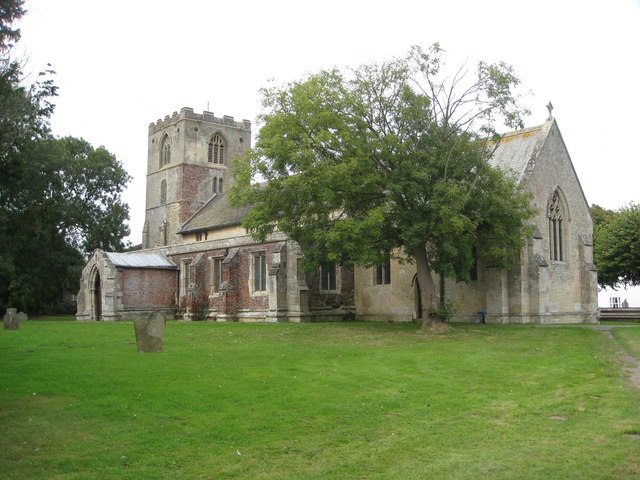
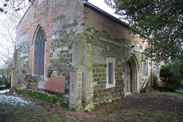
Anderby boasts a rich history, dating back to Roman times, and evidence of Roman occupation can still be seen in the area. The village is home to St. Andrew's Church, a Grade II listed building that dates back to the 13th century. The church is known for its distinctive tower and beautiful stained glass windows.
One of the main attractions in Anderby is the Anderby Creek beach, which has been awarded the prestigious Blue Flag status for its cleanliness and excellent water quality. The beach offers stunning views of the North Sea and is a popular spot for swimming, sunbathing, and picnicking. It also serves as a gateway to the Lincolnshire Coastal Path, a long-distance walking trail that stretches along the coast.
In addition to its natural beauty, Anderby is also home to the Cloud Bar, a unique landmark that was designed by artist Katie Paterson. The Cloud Bar is a wooden hut that allows visitors to experience the sound of different clouds through a series of recordings taken from around the world.
Overall, Anderby is a charming village that offers a blend of natural beauty, historical landmarks, and a peaceful coastal lifestyle.
If you have any feedback on the listing, please let us know in the comments section below.
Anderby Images
Images are sourced within 2km of 53.259167/0.316082 or Grid Reference TF5476. Thanks to Geograph Open Source API. All images are credited.


Anderby is located at Grid Ref: TF5476 (Lat: 53.259167, Lng: 0.316082)
Division: Parts of Lindsey
Administrative County: Lincolnshire
District: East Lindsey
Police Authority: Lincolnshire
What 3 Words
///acrobatic.dreamers.putts. Near Chapel St Leonards, Lincolnshire
Nearby Locations
Related Wikis

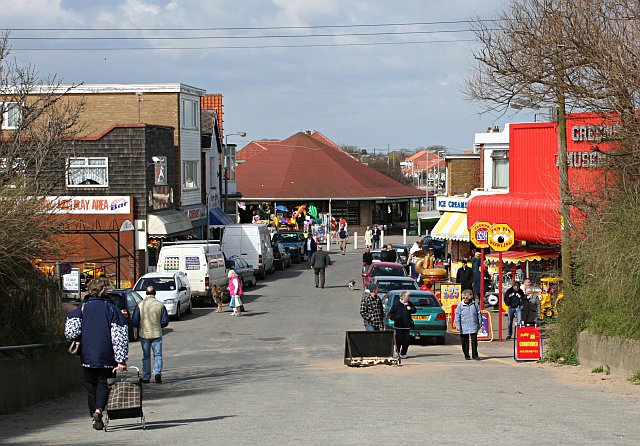
Anderby Creek
Anderby Creek is a small holiday village in Lincolnshire, England, to the north of Skegness. Part of the parish of Anderby, it is on the North Sea coast...

Anderby
Anderby is a village and civil parish in the East Lindsey district of Lincolnshire, England. It has a population of 335, according to the 2001 Census....

Huttoft
Huttoft is a village in the East Lindsey district of Lincolnshire, England, about 4 miles (6 km) east of the market town of Alford, on the A52 road between...

Mumby
Mumby is a village in the East Lindsey district of Lincolnshire, England. It is located 4 miles (6 km) south-east from the town of Alford. In 2001 the...
Hogsthorpe
Hogsthorpe is a small village in the East Lindsey district of Lincolnshire, England. It is situated approximately 2 miles (3 km) from the North Sea and...

Helsey
Helsey is a hamlet in the civil parish of Mumby, and the East Lindsey district of Lincolnshire, England. It lies on the A52 1 mile (1.6 km) north-east...
Chapel St Leonards
Chapel St. Leonards is a seaside resort village and civil parish in the East Lindsey district of Lincolnshire, England. It is situated 5 miles (8 km) north...
Cumberworth
Cumberworth is a small village and civil parish in the East Lindsey district of Lincolnshire, England. It is situated approximately 3 miles (5 km) south...
Nearby Amenities
Located within 500m of 53.259167,0.316082Have you been to Anderby?
Leave your review of Anderby below (or comments, questions and feedback).