Shoe Wood

Wood, Forest in Devon North Devon

England

Shoe Wood

East Down : A39 Looking along the A39.
East Down : A39 Credit: Lewis Clarke

Shoe Wood is a picturesque forest located in the county of Devon, England. Covering an area of approximately 100 hectares, it is renowned for its stunning natural beauty and diverse range of flora and fauna. The wood is situated in the heart of Devon, near the village of Wood, and is easily accessible by both car and foot.

Shoe Wood is characterized by its dense canopy of towering trees, predominantly oak and beech, which provide a majestic setting for visitors to explore. The forest floor is adorned with a carpet of vibrant wildflowers and ferns, creating a vibrant and enchanting atmosphere.

The woodland is home to a rich variety of wildlife, making it a popular destination for nature enthusiasts and birdwatchers. Visitors may be fortunate enough to spot deer, foxes, badgers, and a wide range of bird species, including owls, woodpeckers, and jays.

There are several well-maintained walking trails that crisscross the wood, allowing visitors to fully immerse themselves in the tranquility and beauty of the surroundings. These paths offer opportunities to discover hidden streams and ponds, adding to the charm of the woodland experience.

Shoe Wood also boasts a small picnic area, where visitors can relax and enjoy a packed lunch amidst the peaceful ambiance of the forest. The wood is open to the public year-round and is particularly popular during the spring and summer months when the woodland is at its most vibrant.

In summary, Shoe Wood in Devon is a captivating forest that offers a serene and idyllic retreat for nature lovers. With its ancient trees, diverse wildlife, and scenic walking trails, it provides a truly enchanting experience for all who venture into its depths.

If you have any feedback on the listing, please let us know in the comments section below.

Shoe Wood Images

Images are sourced within 2km of 51.14603/-4.0031913 or Grid Reference SS5940. Thanks to Geograph Open Source API. All images are credited.

East Down : A39 Looking along the A39.
East Down : A39
Looking along the A39.
East Down : A39 Looking along the road.
East Down : A39
Looking along the road.
Arlington : A39 Looking along the A39.
Arlington : A39
Looking along the A39.
Arlington : Windford Hill A39 Looking along Windford Hill.
Arlington : Windford Hill A39
Looking along Windford Hill.
Arlington : Roadside A wall and place for vehicles off Windford Hill.
Arlington : Roadside
A wall and place for vehicles off Windford Hill.
Arlington : Country Lane A country lane heads down to Windford Hill.
Arlington : Country Lane
A country lane heads down to Windford Hill.
Arlington : Home Farm Home Farm in Arlington.
Arlington : Home Farm
Home Farm in Arlington.
Arlington : Gatepiers Approximately 800 metres - north-west of Arlington Court GV II Gatepiers. Probably mid C19. Ashlar square on section with pyramid caps and ball finals surmounted by large cast iron herons.
Arlington : Gatepiers
Approximately 800 metres - north-west of Arlington Court GV II Gatepiers. Probably mid C19. Ashlar square on section with pyramid caps and ball finals surmounted by large cast iron herons.
Arlington : Arlington Court Grounds A sign and track through the grounds.
Arlington : Arlington Court Grounds
A sign and track through the grounds.
Arlington : Track A small path through Arlington Court grounds.
Arlington : Track
A small path through Arlington Court grounds.
Arlington : Arlington Court Grounds A footpath through the grounds of Arlington Court.
Arlington : Arlington Court Grounds
A footpath through the grounds of Arlington Court.
Arlington : Countryside Scenery Looking out across the countryside.
Arlington : Countryside Scenery
Looking out across the countryside.
Arlington : Arlington Court Looking towards the rear of the building.
Arlington : Arlington Court
Looking towards the rear of the building.
Arlington : Arlington Court Grounds Two benches looking out into the open grassland.
Arlington : Arlington Court Grounds
Two benches looking out into the open grassland.
Arlington : Arlington Court Grounds Looking out across the grounds of Arlington Court.
Arlington : Arlington Court Grounds
Looking out across the grounds of Arlington Court.
Arlington : Arlington Court Grounds Looking across the grounds of Arlington Court.
Arlington : Arlington Court Grounds
Looking across the grounds of Arlington Court.
Arlington : Arlington Court Grounds - Wilderness Pond The grounds surrounding the house at Arlington are set in the picturesque style. Parkland was introduced and planting within the Pleasure Grounds was used to frame a series of designed views.
Arlington : Arlington Court Grounds - Wilderness Pond
The grounds surrounding the house at Arlington are set in the picturesque style. Parkland was introduced and planting within the Pleasure Grounds was used to frame a series of designed views.
Arlington : Arlington Court The Arlington estate belonged to the Chichester family for eleven generations.
Arlington : Arlington Court
The Arlington estate belonged to the Chichester family for eleven generations.
Show me another place!

Shoe Wood is located at Grid Ref: SS5940 (Lat: 51.14603, Lng: -4.0031913)

Administrative County: Devon

District: North Devon

Police Authority: Devon and Cornwall

What 3 Words

///series.rebirth.ghosts. Near Combe Martin, Devon

Related Wikis

Churchill, Devon

Churchill (colloquially known as Hollyhurst) is a hamlet in the north of Devon, England, and is located near the village of East Down, and the town of...

East Down, Devon

East Down is a village and civil parish in the Barnstaple district of Devon, England. It includes the hamlets of Churchill, Shortacombe, Brockham and Clifton...
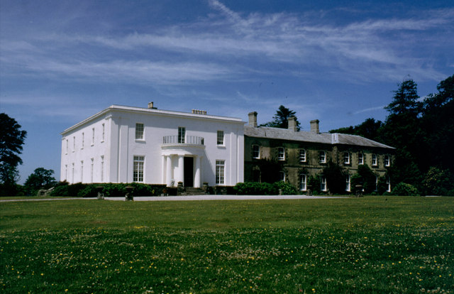
Arlington Court

Arlington Court is a neoclassical style country house built 1820–23, situated in the parish of Arlington, next to the parish church of St James, 5+1⁄4...

Arlington, Devon

Arlington was a manor, and is a village and civil parish in the North Devon district of Devon in England. The parish includes the villages of Arlington...

Nearby Amenities

Located within 500m of 51.14603,-4.0031913
Barrier: stile
Lat/Long: 51.1428075/-3.9998402
The data included in this document is from www.openstreetmap.org. The data is made available under ODbL.

Have you been to Shoe Wood?

Leave your review of Shoe Wood below (or comments, questions and feedback).