Quarry Wood

Wood, Forest in Devon Torridge

England

Quarry Wood

Track on Shuteley Farm
Track on Shuteley Farm Credit: Roger Cornfoot

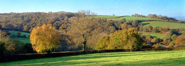
Quarry Wood is a picturesque woodland located in Devon, England. Stretching over an expansive area, it is known for its diverse range of flora and fauna, making it a haven for nature enthusiasts and wildlife lovers alike.

The wood is predominantly comprised of ancient trees, including oak, beech, and ash, which tower over the forest floor, creating a dense canopy that provides shade and shelter for the myriad of species that call Quarry Wood their home. The lush undergrowth is adorned with a variety of wildflowers, including bluebells, primroses, and foxgloves, painting the forest floor with vibrant hues during the spring and summer months.

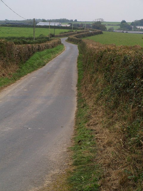
Nature trails meander through the wood, allowing visitors to explore its beauty while immersing themselves in the tranquil ambiance. The woodland is home to a multitude of wildlife, including deer, badgers, and squirrels, which can often be spotted darting through the trees or foraging for food.

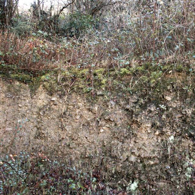
Quarry Wood is not only a haven for wildlife but also a place of historical interest. The wood has been used for centuries as a source of timber, and remnants of old quarrying activities can still be seen, adding an air of intrigue and heritage to the area.

Nature lovers flock to Quarry Wood throughout the year to witness its ever-changing beauty. Whether it's the vibrant colors of autumn, the delicate blossoms of spring, or the peacefulness of a winter's day, this woodland never fails to captivate all who visit, making it a true gem in the heart of Devon.

If you have any feedback on the listing, please let us know in the comments section below.
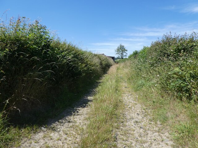
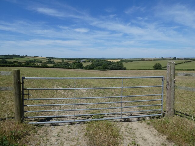
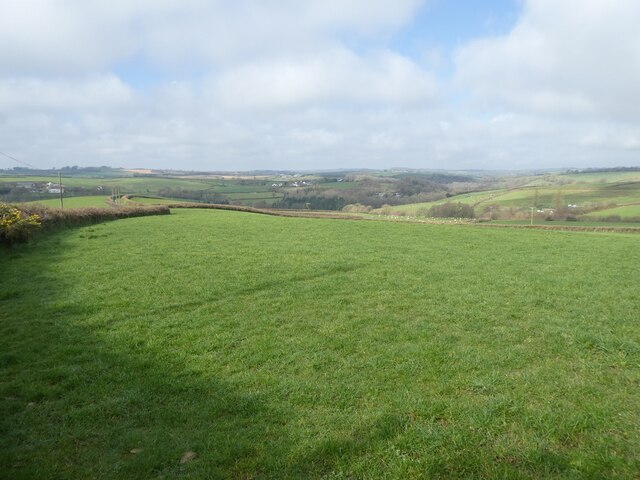
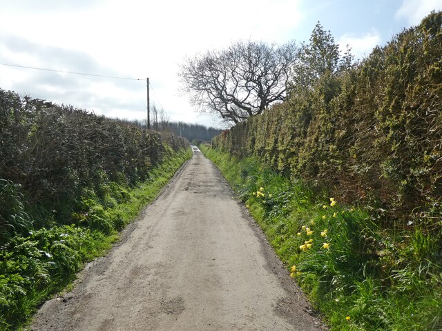
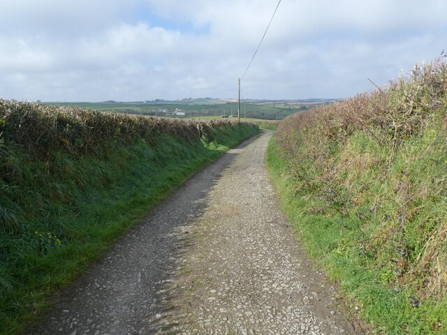
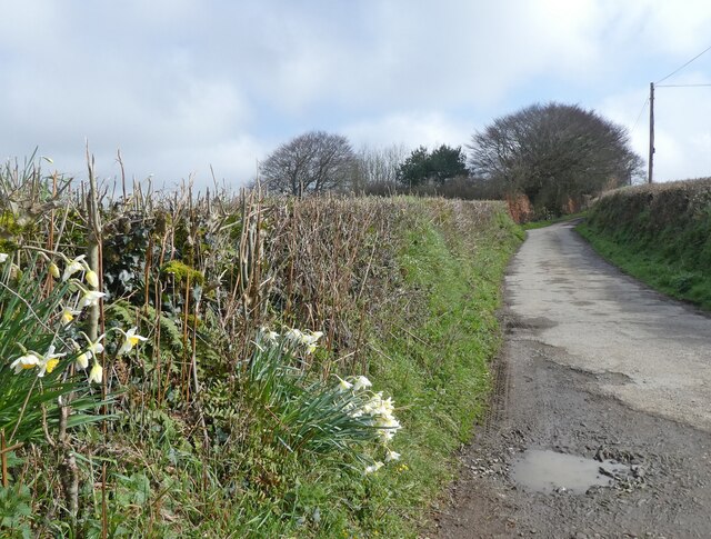
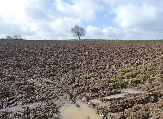
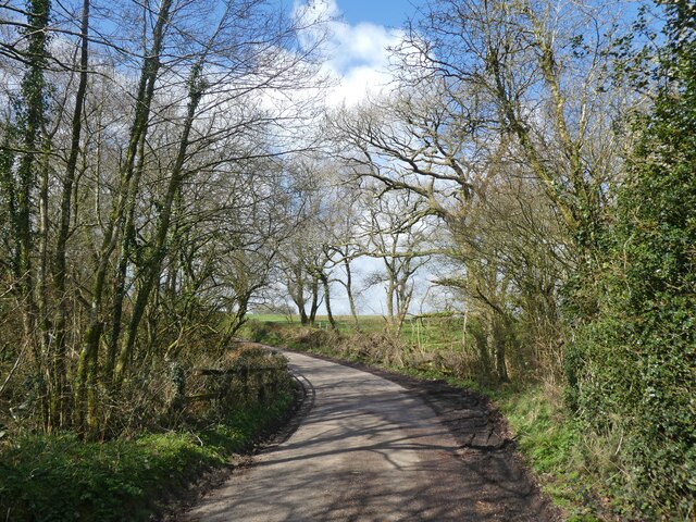
Quarry Wood Images

Images are sourced within 2km of 50.963567/-3.9957006 or Grid Reference SS5920. Thanks to Geograph Open Source API. All images are credited.

Track on Shuteley Farm
Turning for Ashleigh Apiary
View towards Yelland Moor
Pasture, south of High Bickington
Lane to Deptford
Lane to Deptford
Quarries Lane
Quarries Lane
Quarries Lane
Quarries Lane
Ploughed field at Glenmore Farm
Lane to Natty Cross
Lane to Natty Cross
Autumn view from centre of grid square Grazing land on Devon Culm. Knapp Wood is on upper left, which is natural woodland.
Autumn view from centre of grid square
Grazing land on Devon Culm. Knapp Wood is on upper left, which is natural woodland.
High Bickington High Street Looking down the High Street towards the Village School. Behind is the Church which is in Grid square SS5920
High Bickington High Street
Looking down the High Street towards the Village School. Behind is the Church which is in Grid square SS5920
High Bickington High Street and Post Office The Post Office on the corner also sells groceries since the Village Shop closed. The SS60 grid line passes at this point.
High Bickington High Street and Post Office
The Post Office on the corner also sells groceries since the Village Shop closed. The SS60 grid line passes at this point.
The Old George Inn Dating from the 16th Century, The Old George Inn in Poplar Terrace is one of two pubs in High Bickington. The 1Km Grid line runs down this road.
The Old George Inn
Dating from the 16th Century, The Old George Inn in Poplar Terrace is one of two pubs in High Bickington. The 1Km Grid line runs down this road.
Devon Culm Subsoil This is what is under your feet in this part of Devon. The subsoil is very stony and well-drained with a thin but fertile topsoil with a high clay content. This bank was cut into a fairly steep hillside. Agriculturally, this type of land is mainly used for grazing or forestry.
Devon Culm Subsoil
This is what is under your feet in this part of Devon. The subsoil is very stony and well-drained with a thin but fertile topsoil with a high clay content. This bank was cut into a fairly steep hillside. Agriculturally, this type of land is mainly used for grazing or forestry.
Lane to Deptford The lane from Natty Cross to Deptford, running between trim hedges.
Lane to Deptford
The lane from Natty Cross to Deptford, running between trim hedges.
Vauterhill Moor An isolated group of trees on pasture in a thinly inhabited part of Devon, seen from the lane from Deptford to Natty Cross.
Vauterhill Moor
An isolated group of trees on pasture in a thinly inhabited part of Devon, seen from the lane from Deptford to Natty Cross.
Southwood From the point at which High Bickington Bridleway 4 diverges from the farm track to Snape, this view looks across a field to the group of houses at Southwood. Deep Lane runs behind the hedge on the far side of the field as it drops down towards the Taw valley.
Southwood
From the point at which High Bickington Bridleway 4 diverges from the farm track to Snape, this view looks across a field to the group of houses at Southwood. Deep Lane runs behind the hedge on the far side of the field as it drops down towards the Taw valley.
Taylor's Lane Not a great deal of evidence of an actual lane along this stretch of High Bickington Bridleway 4, which is here just a field path, but at either end of this stretch, which curves gracefully beside a field boundary, is a proper track, so doubtless this was once enclosed. The views across the Taw valley are excellent. The conspicuous buildings on the left are at Little Silver, in SS6220.
Taylor's Lane
Not a great deal of evidence of an actual lane along this stretch of High Bickington Bridleway 4, which is here just a field path, but at either end of this stretch, which curves gracefully beside a field boundary, is a proper track, so doubtless this was once enclosed. The views across the Taw valley are excellent. The conspicuous buildings on the left are at Little Silver, in SS6220.
Show me another place!

Quarry Wood is located at Grid Ref: SS5920 (Lat: 50.963567, Lng: -3.9957006)

Administrative County: Devon

District: Torridge

Police Authority: Devon and Cornwall

What 3 Words

///campfires.snippets.foot. Near Great Torrington, Devon

Related Wikis

High Bickington

High Bickington is a rural village and civil parish in the Torridge district of Devon, England. The village lies on the B3217 road, around 6 miles (10...

Brightley, Chittlehampton

Brightley was historically the principal secondary estate within the parish and former manor of Chittlehampton in the county of Devon, England, situated...

Atherington, Devon

Atherington is a village and civil parish in the North Devon district of Devon, England, about 8 miles south of Barnstaple. According to the 2001 census...

Portsmouth Arms railway station

Portsmouth Arms railway station is a small wayside station in Devon. It is in the parish of Burrington but remote from any village so is named after the...

Nearby Amenities

Located within 500m of 50.963567,-3.9957006
High Bickington
Place: village
Source: OS_OpenData_StreetView
Lat/Long: 50.9668102/-3.9931351
Post Office
High Bickington Post Office
Addr City: Umberleigh
Addr Country: GB
Addr Postcode: EX37 9AX
Addr Suburb: High Bickington
Brand: Post Office
Brand Wikidata: Q1783168
Contact Website: https://www.postoffice.co.uk/branch-finder/4735196/high-bickington
Ref Pol Id: 15407
Lat/Long: 50.9668776/-3.9948271
Barrier: bollard
Lat/Long: 50.9670911/-3.9950015
Turning Circle
Lat/Long: 50.9646836/-3.9940097
Cross Parks
Junction: yes
Lat/Long: 50.9666316/-3.9931227
Pub
The Golden Lion
Wikidata: Q79684436
Lat/Long: 50.9676914/-3.9946813
Direction: SW
Generator Method: photovoltaic
Generator Output Electricity: yes
Generator Solar Modules: 4
Generator Source: solar
Generator Type: solar_photovoltaic_panel
Location: roof
Power: generator
Lat/Long: 50.9664192/-3.9977695
Direction: SE
Generator Method: photovoltaic
Generator Output Electricity: yes
Generator Solar Modules: 10
Generator Source: solar
Generator Type: solar_photovoltaic_panel
Location: roof
Power: generator
Lat/Long: 50.9664221/-3.9976575
Direction: SE
Generator Method: photovoltaic
Generator Output Electricity: yes
Generator Solar Modules: 4
Generator Source: solar
Generator Type: solar_photovoltaic_panel
Location: roof
Power: generator
Lat/Long: 50.964337/-3.9939876
Direction: SE
Generator Method: photovoltaic
Generator Output Electricity: yes
Generator Solar Modules: 4
Generator Source: solar
Generator Type: solar_photovoltaic_panel
Location: roof
Power: generator
Lat/Long: 50.9643615/-3.9940104
Direction: SE
Generator Method: photovoltaic
Generator Output Electricity: yes
Generator Solar Modules: 4
Generator Source: solar
Generator Type: solar_photovoltaic_panel
Location: roof
Power: generator
Lat/Long: 50.9642171/-3.9942853
Direction: SE
Generator Method: photovoltaic
Generator Output Electricity: yes
Generator Solar Modules: 4
Generator Source: solar
Generator Type: solar_photovoltaic_panel
Location: roof
Power: generator
Lat/Long: 50.9642382/-3.9943068
Direction: SE
Generator Method: photovoltaic
Generator Output Electricity: yes
Generator Solar Modules: 30
Generator Source: solar
Generator Type: solar_photovoltaic_panel
Location: roof
Power: generator
Lat/Long: 50.9642635/-3.994123
Direction: SSE
Generator Method: photovoltaic
Generator Output Electricity: yes
Generator Solar Modules: 15
Generator Source: solar
Generator Type: solar_photovoltaic_panel
Location: roof
Power: generator
Lat/Long: 50.9649798/-3.9937556
Direction: SSE
Generator Method: photovoltaic
Generator Output Electricity: yes
Generator Solar Modules: 6
Generator Source: solar
Generator Type: solar_photovoltaic_panel
Location: roof
Power: generator
Lat/Long: 50.9649595/-3.9938669
Direction: SE
Generator Method: photovoltaic
Generator Output Electricity: yes
Generator Solar Modules: 16
Generator Source: solar
Generator Type: solar_photovoltaic_panel
Location: roof
Power: generator
Lat/Long: 50.965321/-3.9931414
Direction: SW
Generator Method: photovoltaic
Generator Output Electricity: yes
Generator Solar Modules: 8
Generator Source: solar
Generator Type: solar_photovoltaic_panel
Location: roof
Power: generator
Lat/Long: 50.9655744/-3.9926773
Direction: NE
Generator Method: photovoltaic
Generator Output Electricity: yes
Generator Solar Modules: 8
Generator Source: solar
Generator Type: solar_photovoltaic_panel
Location: roof
Power: generator
Lat/Long: 50.9655896/-3.9926063
Direction: SE
Generator Method: photovoltaic
Generator Output Electricity: yes
Generator Solar Modules: 10
Generator Source: solar
Generator Type: solar_photovoltaic_panel
Location: roof
Power: generator
Lat/Long: 50.9676411/-3.9952321
Direction: SW
Generator Method: photovoltaic
Generator Output Electricity: yes
Generator Solar Modules: 16
Generator Source: solar
Generator Type: solar_photovoltaic_panel
Location: roof
Power: generator
Lat/Long: 50.9678624/-3.9950082
Direction: SSE
Generator Method: photovoltaic
Generator Output Electricity: yes
Generator Solar Modules: 16
Generator Source: solar
Generator Type: solar_photovoltaic_panel
Location: roof
Power: generator
Lat/Long: 50.9675592/-3.9989939
Generator Method: photovoltaic
Generator Output Electricity: yes
Generator Source: solar
Generator Type: solar_photovoltaic_panel
Location: roof
Power: generator
Lat/Long: 50.9675955/-3.9975294
Power: pole
Source: bing
Transformer: distribution
Lat/Long: 50.9677619/-3.9941834
Power: pole
Source: bing
Lat/Long: 50.9678852/-3.9939044
Power: pole
Source: bing
Lat/Long: 50.9673066/-3.9926358
Power: pole
Source: bing
Lat/Long: 50.9677272/-3.9932138
Power: pole
Source: bing
Lat/Long: 50.9670347/-3.9922589
Power: pole
Source: bing
Lat/Long: 50.9656293/-3.9918458
Power: pole
Source: bing
Lat/Long: 50.9664629/-3.9916608
Power: pole
Source: bing
Lat/Long: 50.9658987/-3.9910707
Power: pole
Source: bing
Lat/Long: 50.9654342/-3.9905892
Power: pole
Source: bing
Lat/Long: 50.9650541/-3.9901856
Power: pole
Source: bing
Lat/Long: 50.9642103/-3.9893018
Power: pole
Source: bing
Lat/Long: 50.9635878/-4.0014964
Power: pole
Source: bing
Lat/Long: 50.9631638/-4.0000454
Power: pole
Source: bing
Lat/Long: 50.9627634/-3.9986694
Power: pole
Source: bing
Lat/Long: 50.9624205/-3.998192
Power: pole
Source: bing
Transformer: distribution
Lat/Long: 50.9639611/-4.002741
The data included in this document is from www.openstreetmap.org. The data is made available under ODbL.

Have you been to Quarry Wood?

Leave your review of Quarry Wood below (or comments, questions and feedback).