Southwood Wood

Wood, Forest in Devon South Hams

England

Southwood Wood

Old Boundary Marker on the former A38 in Lee Mill, Sparkwell parish Parish Boundary Marker in Lee Mill against the east end of the north parapet of Leemill Bridge, River Yealm. The inscription of ERMINGTON has been filled with concrete, perhaps in World War 2. One of a pair of markers at each end of the bridge. In Ermington parish until 1966 when it became part of Sparkwell parish.

Milestone Society National ID: DV_PLEX08bpb
Old Boundary Marker on the former A38 in Lee Mill, Sparkwell parish Credit: T Jenkinson

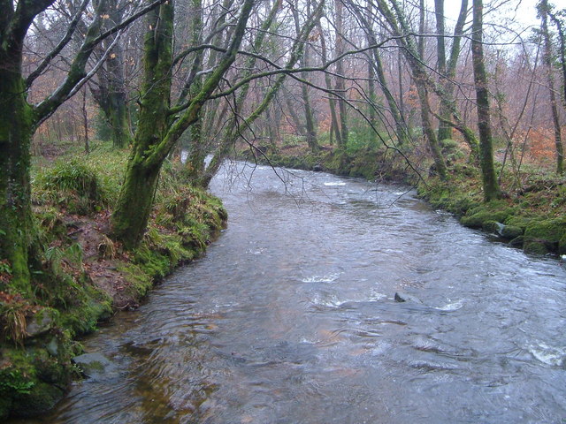
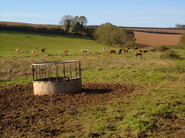
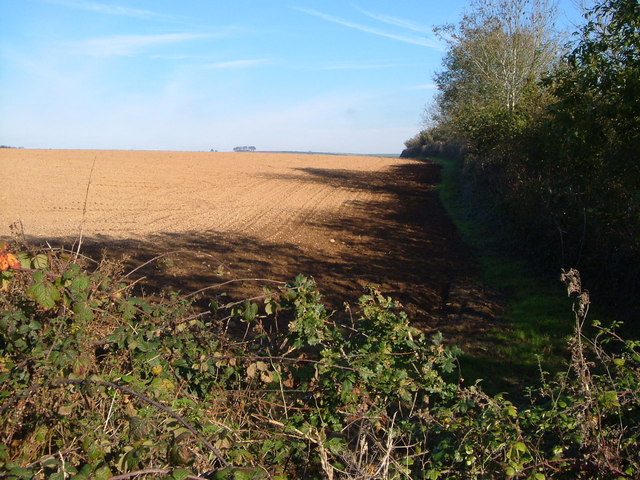
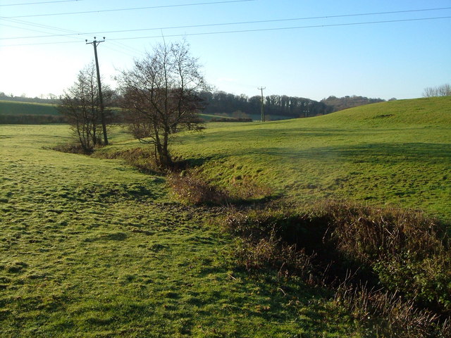
Southwood Wood, located in Devon, England, is a picturesque forest renowned for its natural beauty and diverse flora and fauna. Covering an area of approximately 500 hectares, this ancient woodland is a haven for outdoor enthusiasts, nature lovers, and wildlife enthusiasts.

The forest is predominantly composed of native broadleaf trees such as oak, beech, and ash, creating a dense canopy that provides shade and shelter to a wide range of plant and animal species. The woodland floor is adorned with a rich carpet of wildflowers, including bluebells, primroses, and wood anemones, creating a vibrant and colorful setting during the spring months.

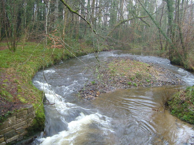
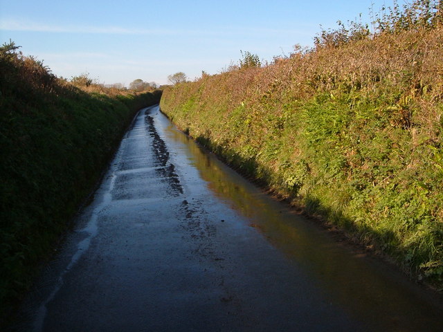
Southwood Wood is crisscrossed by an extensive network of walking trails, offering visitors the opportunity to explore its hidden gems and discover its hidden treasures. These trails lead visitors through ancient woodland, alongside babbling streams, and up gentle slopes, providing stunning views of the surrounding countryside.

The forest is also home to a variety of wildlife, including deer, badgers, foxes, and a multitude of bird species. Nature enthusiasts can observe and appreciate the rich biodiversity of the area, from the elusive tawny owl to the magnificent red deer.

Southwood Wood is not only a natural sanctuary but also an important historical site. It has been used by humans for centuries, with evidence of ancient settlements and historic structures scattered throughout the forest. Archaeological investigations have unearthed artifacts and remains, shedding light on the lives of past inhabitants.

In conclusion, Southwood Wood, Devon, is a captivating woodland, offering a tranquil escape from the hustle and bustle of modern life. With its stunning landscapes, diverse wildlife, and rich history, it is a must-visit destination for anyone seeking a connection with nature and a glimpse into the past.

If you have any feedback on the listing, please let us know in the comments section below.

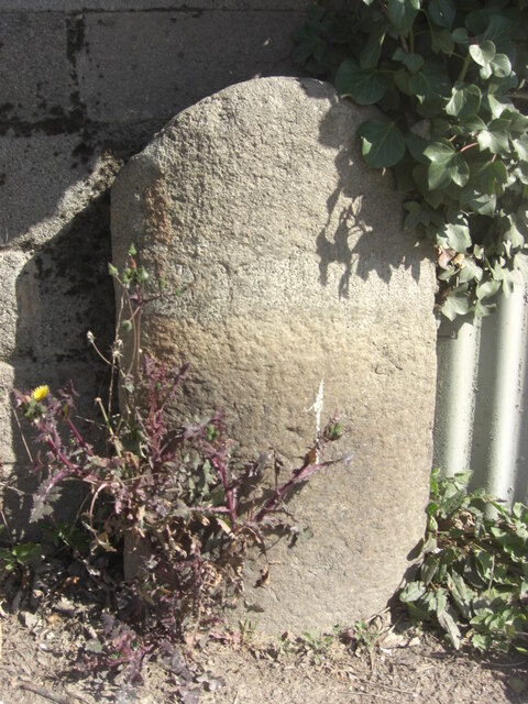
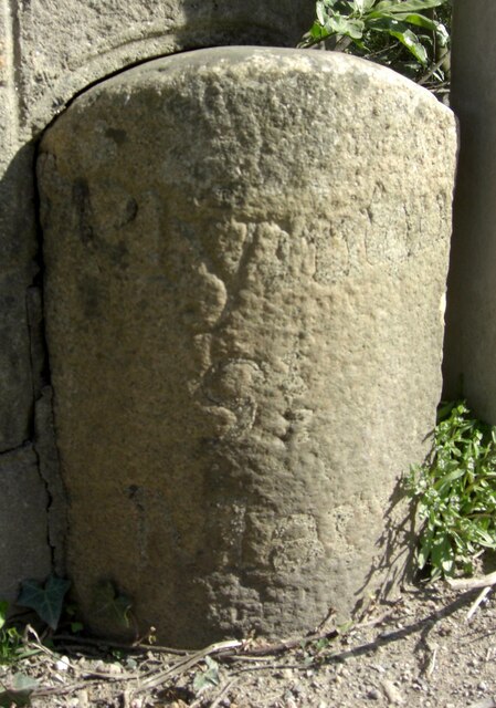
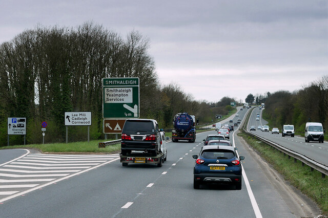
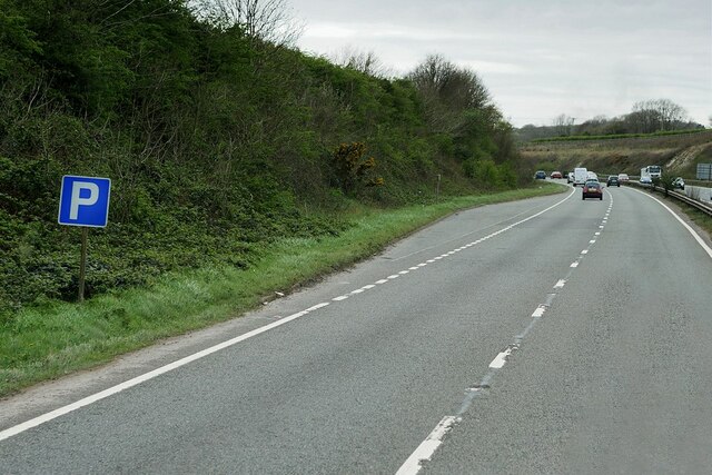
Southwood Wood Images

Images are sourced within 2km of 50.376333/-3.973646 or Grid Reference SX5954. Thanks to Geograph Open Source API. All images are credited.

Old Boundary Marker on the former A38 in Lee Mill, Sparkwell parish Parish Boundary Marker in Lee Mill against the east end of the north parapet of Leemill Bridge, River Yealm. The inscription of ERMINGTON has been filled with concrete, perhaps in World War 2. One of a pair of markers at each end of the bridge. In Ermington parish until 1966 when it became part of Sparkwell parish.

Milestone Society National ID: DV_PLEX08bpb
Old Boundary Marker on the former A38 in Lee Mill, Sparkwell parish
Parish Boundary Marker in Lee Mill against the east end of the north parapet of Leemill Bridge, River Yealm. The inscription of ERMINGTON has been filled with concrete, perhaps in World War 2. One of a pair of markers at each end of the bridge. In Ermington parish until 1966 when it became part of Sparkwell parish. Milestone Society National ID: DV_PLEX08bpb
Old Boundary Marker on the former A38 in Lee Mill, Sparkwell parish Parish Boundary Marker against the west end of the north parapet of Leemill Bridge, River Yealm. The inscription of PLYMPTON / ST / MARY has been filled with concrete, perhaps in World War 2. One of a pair of markers at each end of the bridge. In Plympton St Mary parish until 1966 when it was renamed Sparkwell parish.

Milestone Society National ID: DV_PLEX08apb
Old Boundary Marker on the former A38 in Lee Mill, Sparkwell parish
Parish Boundary Marker against the west end of the north parapet of Leemill Bridge, River Yealm. The inscription of PLYMPTON / ST / MARY has been filled with concrete, perhaps in World War 2. One of a pair of markers at each end of the bridge. In Plympton St Mary parish until 1966 when it was renamed Sparkwell parish. Milestone Society National ID: DV_PLEX08apb
Devon Expressway, Lee Mill The A38 is a major A-class trunk route. When first designated in 1922, it ran from Derby to Plymouth but it was later extended at both ends so that it now runs for 292 miles from Mansfield in Nottinghamshire to Bodmin in Cornwall.

Prior to the opening of the M5 motorway in the 1960s and 1970s, the A38 formed the main "holiday route" from the Midlands to Somerset, Devon and Cornwall and the south-western section was notorious at holiday times for the congestion. Nowadays, for most of the southern section, the A38 is a fairly quiet road shadowing the M5 extremely closely; often running alongside the motorway as a single carriageway road. The section between Exeter and Plymouth is, however, a busy dual carriageway which serves as the southern extension of the M5 and is known as “the Devon Expressway”.

More information at <span class="nowrap"><a title="http://en.wikipedia.org/wiki/A38_road" rel="nofollow ugc noopener" href="http://en.wikipedia.org/wiki/A38_road">Link</a><img style="margin-left:2px;" alt="External link" title="External link - shift click to open in new window" src="https://s1.geograph.org.uk/img/external.png" width="10" height="10"/></span>  (Wikipedia) and <span class="nowrap"><a title="http://www.sabre-roads.org.uk/wiki/index.php?title=A38" rel="nofollow ugc noopener" href="http://www.sabre-roads.org.uk/wiki/index.php?title=A38">Link</a><img style="margin-left:2px;" alt="External link" title="External link - shift click to open in new window" src="https://s1.geograph.org.uk/img/external.png" width="10" height="10"/></span>  (SABRE).
Devon Expressway, Lee Mill
The A38 is a major A-class trunk route. When first designated in 1922, it ran from Derby to Plymouth but it was later extended at both ends so that it now runs for 292 miles from Mansfield in Nottinghamshire to Bodmin in Cornwall. Prior to the opening of the M5 motorway in the 1960s and 1970s, the A38 formed the main "holiday route" from the Midlands to Somerset, Devon and Cornwall and the south-western section was notorious at holiday times for the congestion. Nowadays, for most of the southern section, the A38 is a fairly quiet road shadowing the M5 extremely closely; often running alongside the motorway as a single carriageway road. The section between Exeter and Plymouth is, however, a busy dual carriageway which serves as the southern extension of the M5 and is known as “the Devon Expressway”. More information at LinkExternal link (Wikipedia) and LinkExternal link (SABRE).
A38 Devon Expressway near Lee Mill The A38 is a major A-class trunk route. When first designated in 1922, it ran from Derby to Plymouth but it was later extended at both ends so that it now runs for 292 miles from Mansfield in Nottinghamshire to Bodmin in Cornwall.

Prior to the opening of the M5 motorway in the 1960s and 1970s, the A38 formed the main "holiday route" from the Midlands to Somerset, Devon and Cornwall and the south-western section was notorious at holiday times for the congestion. Nowadays, for most of the southern section, the A38 is a fairly quiet road shadowing the M5 extremely closely; often running alongside the motorway as a single carriageway road. The section between Exeter and Plymouth is, however, a busy dual carriageway which serves as the southern extension of the M5 and is known as “the Devon Expressway”.

More information at <span class="nowrap"><a title="http://en.wikipedia.org/wiki/A38_road" rel="nofollow ugc noopener" href="http://en.wikipedia.org/wiki/A38_road">Link</a><img style="margin-left:2px;" alt="External link" title="External link - shift click to open in new window" src="https://s1.geograph.org.uk/img/external.png" width="10" height="10"/></span>  (Wikipedia) and <span class="nowrap"><a title="http://www.sabre-roads.org.uk/wiki/index.php?title=A38" rel="nofollow ugc noopener" href="http://www.sabre-roads.org.uk/wiki/index.php?title=A38">Link</a><img style="margin-left:2px;" alt="External link" title="External link - shift click to open in new window" src="https://s1.geograph.org.uk/img/external.png" width="10" height="10"/></span>  (SABRE).
A38 Devon Expressway near Lee Mill
The A38 is a major A-class trunk route. When first designated in 1922, it ran from Derby to Plymouth but it was later extended at both ends so that it now runs for 292 miles from Mansfield in Nottinghamshire to Bodmin in Cornwall. Prior to the opening of the M5 motorway in the 1960s and 1970s, the A38 formed the main "holiday route" from the Midlands to Somerset, Devon and Cornwall and the south-western section was notorious at holiday times for the congestion. Nowadays, for most of the southern section, the A38 is a fairly quiet road shadowing the M5 extremely closely; often running alongside the motorway as a single carriageway road. The section between Exeter and Plymouth is, however, a busy dual carriageway which serves as the southern extension of the M5 and is known as “the Devon Expressway”. More information at LinkExternal link (Wikipedia) and LinkExternal link (SABRE).
Layby on the Devon Expressway at Smithaleigh The A38 is a major A-class trunk route. When first designated in 1922, it ran from Derby to Plymouth but it was later extended at both ends so that it now runs for 292 miles from Mansfield in Nottinghamshire to Bodmin in Cornwall.

Prior to the opening of the M5 motorway in the 1960s and 1970s, the A38 formed the main "holiday route" from the Midlands to Somerset, Devon and Cornwall and the south-western section was notorious at holiday times for the congestion. Nowadays, for most of the southern section, the A38 is a fairly quiet road shadowing the M5 extremely closely; often running alongside the motorway as a single carriageway road. The section between Exeter and Plymouth is, however, a busy dual carriageway which serves as the southern extension of the M5 and is known as “the Devon Expressway”.

More information at <span class="nowrap"><a title="http://en.wikipedia.org/wiki/A38_road" rel="nofollow ugc noopener" href="http://en.wikipedia.org/wiki/A38_road">Link</a><img style="margin-left:2px;" alt="External link" title="External link - shift click to open in new window" src="https://s1.geograph.org.uk/img/external.png" width="10" height="10"/></span>  (Wikipedia) and <span class="nowrap"><a title="http://www.sabre-roads.org.uk/wiki/index.php?title=A38" rel="nofollow ugc noopener" href="http://www.sabre-roads.org.uk/wiki/index.php?title=A38">Link</a><img style="margin-left:2px;" alt="External link" title="External link - shift click to open in new window" src="https://s1.geograph.org.uk/img/external.png" width="10" height="10"/></span>  (SABRE).
Layby on the Devon Expressway at Smithaleigh
The A38 is a major A-class trunk route. When first designated in 1922, it ran from Derby to Plymouth but it was later extended at both ends so that it now runs for 292 miles from Mansfield in Nottinghamshire to Bodmin in Cornwall. Prior to the opening of the M5 motorway in the 1960s and 1970s, the A38 formed the main "holiday route" from the Midlands to Somerset, Devon and Cornwall and the south-western section was notorious at holiday times for the congestion. Nowadays, for most of the southern section, the A38 is a fairly quiet road shadowing the M5 extremely closely; often running alongside the motorway as a single carriageway road. The section between Exeter and Plymouth is, however, a busy dual carriageway which serves as the southern extension of the M5 and is known as “the Devon Expressway”. More information at LinkExternal link (Wikipedia) and LinkExternal link (SABRE).
Little Chef, Smithaleigh The Little Chef at Smithaleigh, Devon, just off the A38 Plymouth bound carriageway.
Little Chef, Smithaleigh
The Little Chef at Smithaleigh, Devon, just off the A38 Plymouth bound carriageway.
Challonsleigh Farm Waste Recycling Centre The entrance to Challonsleigh Farm Waste Recycling Centre and Transfer Station at Smithaleigh, Devon. The cars on the left of the picture behind the crash barrier are travelling on the A38 towards Ivybridge.
Challonsleigh Farm Waste Recycling Centre
The entrance to Challonsleigh Farm Waste Recycling Centre and Transfer Station at Smithaleigh, Devon. The cars on the left of the picture behind the crash barrier are travelling on the A38 towards Ivybridge.
The New Country Inn, Smithaleigh The New Country Inn, Smithaleigh, Devon, lies on the route of the old A38. The current A38 now bypasses it to the north.
The New Country Inn, Smithaleigh
The New Country Inn, Smithaleigh, Devon, lies on the route of the old A38. The current A38 now bypasses it to the north.
River Yealm from Popple's Bridge Looking south downstream. The Yealm drops steadily here in its wooded valley between low hills.
River Yealm from Popple's Bridge
Looking south downstream. The Yealm drops steadily here in its wooded valley between low hills.
River Yealm from Lotherton Bridge The Yealm cutting away at both banks as it reaches Lotherton Bridge. Photo taken from the bridge looking upstream (north).
River Yealm from Lotherton Bridge
The Yealm cutting away at both banks as it reaches Lotherton Bridge. Photo taken from the bridge looking upstream (north).
Langage Farm ice cream factory Home of one of the superior ice creams. An interesting comparison: the old thatched farmhouse behind the friendly cow, and the building in the background where, presumably, the ice cream is manufactured. On the other hand, which premises are more likely to produce a reliably hazard-free product?
Langage Farm ice cream factory
Home of one of the superior ice creams. An interesting comparison: the old thatched farmhouse behind the friendly cow, and the building in the background where, presumably, the ice cream is manufactured. On the other hand, which premises are more likely to produce a reliably hazard-free product?
Wet lane to Mount Pleasant Seen from its junction with the lane from Smithaleigh to Yolland Farm.
Wet lane to Mount Pleasant
Seen from its junction with the lane from Smithaleigh to Yolland Farm.
Farm buildings at Hitchcombe Silo and breeze block barns at the end of the public lane near Lee Mill.
Farm buildings at Hitchcombe
Silo and breeze block barns at the end of the public lane near Lee Mill.
Confused bullocks near Hitchcombe The footpath from Hitchcombe to Yolland Farm runs along the edge of their field.
Confused bullocks near Hitchcombe
The footpath from Hitchcombe to Yolland Farm runs along the edge of their field.
Ploughed field north of Lee Mill Shadows encroaching on a field seen across a bramble and oak hedge, from the passing footpath.
Ploughed field north of Lee Mill
Shadows encroaching on a field seen across a bramble and oak hedge, from the passing footpath.
Choakford Farm The farmhouse is on the lane from Yealmpton to Lee Mill.
Choakford Farm
The farmhouse is on the lane from Yealmpton to Lee Mill.
Silverbridge Lake near Collaford The stream is flowing away from the camera on its journey towards the Yealm estuary. Seen from beside the bridge on the lane between Choakford and Voss.
Silverbridge Lake near Collaford
The stream is flowing away from the camera on its journey towards the Yealm estuary. Seen from beside the bridge on the lane between Choakford and Voss.
Sparkwell: the A38 west of Lee Mill The main Exeter-Plymouth road, viewed in the Exeter direction
Sparkwell: the A38 west of Lee Mill
The main Exeter-Plymouth road, viewed in the Exeter direction
Show me another place!

Southwood Wood is located at Grid Ref: SX5954 (Lat: 50.376333, Lng: -3.973646)

Administrative County: Devon

District: South Hams

Police Authority: Devon and Cornwall

What 3 Words

///obtain.outsiders.greyhound. Near Yealmpton, Devon

Related Wikis

Ivybridge Priory

Ivybridge Priory or St. Austin's Priory was a monastic house in Devon, England. From 1932 it was a priory of the Order of Augustinian Recollects. They...

South West Devon (UK Parliament constituency)

South West Devon is a constituency represented in the House of Commons of the UK Parliament since 1997 by Sir Gary Streeter, a Conservative. == Boundaries... ==

Wasteberry Camp

Wasteberry Camp is an Iron Age hill fort situated close to the hamlet of Blackpool, southeast of Plympton, Devon, England. The fort is situated on a hilltop...

Fardel Manor

Fardel is a historic manor in the parish of Cornwood, in the South Hams district of Devon. It was successively the seat of the Raleigh and Hele families...

Nearby Amenities

Located within 500m of 50.376333,-3.973646
Power: tower
Lat/Long: 50.3795847/-3.9713148
Power: tower
Lat/Long: 50.3767864/-3.9787344
Generator Method: wind_turbine
Generator Source: wind
Power: generator
Lat/Long: 50.3741999/-3.9777401
Generator Method: wind_turbine
Generator Source: wind
Power: generator
Lat/Long: 50.3751071/-3.9781713
The data included in this document is from www.openstreetmap.org. The data is made available under ODbL.

Have you been to Southwood Wood?

Leave your review of Southwood Wood below (or comments, questions and feedback).