Merrifield Copse

Wood, Forest in Devon West Devon

England

Merrifield Copse

Old circular AA sign on the former B3217 in Monkokehampton Old AA Sign located on the wall of an old workshop, now a cottage called The Old Forge, on the east side of the former B3217 in Monkokehampton, 8 miles north of Okehampton. Monkokehampton parish.

This is the Circular, village name on black band, no Motor Union symbol or name type, dating from 1923, showing distances Okehampton 7½ Iddesleigh 2¼ London 196. Removed some time between July 2014 and August 2022.

There were five series of AA signs, mostly dating from 1923 and made by Francis & Co / Franco in Deptford, London. The village name and distance to London or Dublin were normally displayed.

See also <span class="nowrap"><a title="https://www.flickr.com/photos/livesurfcams/14394800250" rel="nofollow ugc noopener" href="https://www.flickr.com/photos/livesurfcams/14394800250">Link</a><img style="margin-left:2px;" alt="External link" title="External link - shift click to open in new window" src="https://s1.geograph.org.uk/img/external.png" width="10" height="10"/></span> , <span class="nowrap"><a title="https://www.flickr.com/photos/bumbishop/5656595" rel="nofollow ugc noopener" href="https://www.flickr.com/photos/bumbishop/5656595">Link</a><img style="margin-left:2px;" alt="External link" title="External link - shift click to open in new window" src="https://s1.geograph.org.uk/img/external.png" width="10" height="10"/></span> and <span class="nowrap"><a title="https://www.flickr.com/photos/bridgemarkertim/3966823734" rel="nofollow ugc noopener" href="https://www.flickr.com/photos/bridgemarkertim/3966823734">Link</a><img style="margin-left:2px;" alt="External link" title="External link - shift click to open in new window" src="https://s1.geograph.org.uk/img/external.png" width="10" height="10"/></span>.

Milestone Society National ID: DV-MONKO
Old circular AA sign on the former B3217 in Monkokehampton Credit: A Rosevear

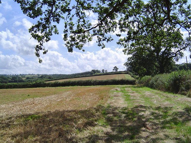
Merrifield Copse is a picturesque woodland located in the county of Devon, England. Covering an area of approximately 50 acres, it is a prominent natural feature in the region and is known for its diverse range of flora and fauna.

The copse is characterized by its dense canopy of trees, which include a mix of deciduous and coniferous species. Oak, beech, and birch are some of the dominant trees found here, providing a rich habitat for numerous wildlife species. The woodland floor is covered with a variety of wildflowers, creating a colorful and vibrant display during the spring and summer months.

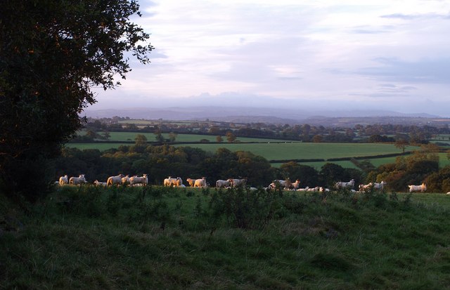
Traversing through Merrifield Copse, one can find several well-maintained walking trails, providing visitors with the opportunity to explore and appreciate the natural beauty of the area. These trails wind through the forest, offering glimpses of tranquil streams, small ponds, and the occasional glimpse of wildlife such as deer, foxes, and various bird species.

Merrifield Copse is also home to a diverse range of woodland creatures, including badgers, squirrels, and hedgehogs. Birdwatchers will be delighted to spot species such as blue tits, woodpeckers, and thrushes, as the copse acts as an important habitat for numerous bird species.

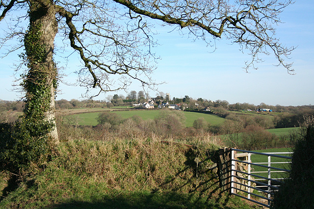
The copse is a popular destination for nature enthusiasts, hikers, and families seeking a peaceful retreat into nature. With its serene atmosphere, stunning scenery, and abundant wildlife, Merrifield Copse is a true gem of Devon and provides a wonderful opportunity to connect with the natural world.

If you have any feedback on the listing, please let us know in the comments section below.

Merrifield Copse Images

Images are sourced within 2km of 50.829234/-3.9981864 or Grid Reference SS5905. Thanks to Geograph Open Source API. All images are credited.

Old circular AA sign on the former B3217 in Monkokehampton Old AA Sign located on the wall of an old workshop, now a cottage called The Old Forge, on the east side of the former B3217 in Monkokehampton, 8 miles north of Okehampton. Monkokehampton parish.

This is the Circular, village name on black band, no Motor Union symbol or name type, dating from 1923, showing distances Okehampton 7½ Iddesleigh 2¼ London 196. Removed some time between July 2014 and August 2022.

There were five series of AA signs, mostly dating from 1923 and made by Francis & Co / Franco in Deptford, London. The village name and distance to London or Dublin were normally displayed.

See also <span class="nowrap"><a title="https://www.flickr.com/photos/livesurfcams/14394800250" rel="nofollow ugc noopener" href="https://www.flickr.com/photos/livesurfcams/14394800250">Link</a><img style="margin-left:2px;" alt="External link" title="External link - shift click to open in new window" src="https://s1.geograph.org.uk/img/external.png" width="10" height="10"/></span> , <span class="nowrap"><a title="https://www.flickr.com/photos/bumbishop/5656595" rel="nofollow ugc noopener" href="https://www.flickr.com/photos/bumbishop/5656595">Link</a><img style="margin-left:2px;" alt="External link" title="External link - shift click to open in new window" src="https://s1.geograph.org.uk/img/external.png" width="10" height="10"/></span> and <span class="nowrap"><a title="https://www.flickr.com/photos/bridgemarkertim/3966823734" rel="nofollow ugc noopener" href="https://www.flickr.com/photos/bridgemarkertim/3966823734">Link</a><img style="margin-left:2px;" alt="External link" title="External link - shift click to open in new window" src="https://s1.geograph.org.uk/img/external.png" width="10" height="10"/></span>.

Milestone Society National ID: DV-MONKO
Old circular AA sign on the former B3217 in Monkokehampton
Old AA Sign located on the wall of an old workshop, now a cottage called The Old Forge, on the east side of the former B3217 in Monkokehampton, 8 miles north of Okehampton. Monkokehampton parish. This is the Circular, village name on black band, no Motor Union symbol or name type, dating from 1923, showing distances Okehampton 7½ Iddesleigh 2¼ London 196. Removed some time between July 2014 and August 2022. There were five series of AA signs, mostly dating from 1923 and made by Francis & Co / Franco in Deptford, London. The village name and distance to London or Dublin were normally displayed. See also LinkExternal link , LinkExternal link and LinkExternal link. Milestone Society National ID: DV-MONKO
Monkokehampton Mill The last working water-powered corn mill in Devon, heritage and preserved mills aside. Built in the late 19th century, it stands by a leat from the Okement and was originally powered by two small overshot waterwheels. One survives in working order today.
Monkokehampton Mill
The last working water-powered corn mill in Devon, heritage and preserved mills aside. Built in the late 19th century, it stands by a leat from the Okement and was originally powered by two small overshot waterwheels. One survives in working order today.
Monkokehampton countryside Fields just south of Monkokehampton
Monkokehampton countryside
Fields just south of Monkokehampton
Broadwoodkelly: south to Dartmoor Farmland and woodland seen from the Monkokehampton-Winkleigh road, near Mount Pleasant. In the distance the Dartmoor range. The rounded height on the left is Cosdon Hill, spot height 550m
Broadwoodkelly: south to Dartmoor
Farmland and woodland seen from the Monkokehampton-Winkleigh road, near Mount Pleasant. In the distance the Dartmoor range. The rounded height on the left is Cosdon Hill, spot height 550m
Field beside the Okement A field of oats occupying the Okement flood plain, seen from New Bridge, Monkokehampton. The river is behind the trees on the right.
Field beside the Okement
A field of oats occupying the Okement flood plain, seen from New Bridge, Monkokehampton. The river is behind the trees on the right.
Lane from New Bridge The parapet of the bridge is in the foreground. The lane climbs away from the Okement floodplain towards Hatherleigh. Evening sun and shadows on the fields.
Lane from New Bridge
The parapet of the bridge is in the foreground. The lane climbs away from the Okement floodplain towards Hatherleigh. Evening sun and shadows on the fields.
Field full of sheep Sheep bask uncertainly in a brief spell of early morning sunlight. On the left on the far side of the field is Froggey Plantation. Beyond, the land slopes away to the valleys of the Hole Brook, and, nearer, one of its tributaries. A very long way beyond is Dartmoor, in a coating of cloud. Seen from the lane between Splatt and Monkokehampton.
Field full of sheep
Sheep bask uncertainly in a brief spell of early morning sunlight. On the left on the far side of the field is Froggey Plantation. Beyond, the land slopes away to the valleys of the Hole Brook, and, nearer, one of its tributaries. A very long way beyond is Dartmoor, in a coating of cloud. Seen from the lane between Splatt and Monkokehampton.
Pony's Moor Plantation Seen across a field from the farm track to Stafford Beer.
Pony's Moor Plantation
Seen across a field from the farm track to Stafford Beer.
Valley north of Monkokehampton The valley carries a tributary of the River Okement. On the right is Ford's Cleave Wood. Seen from the lane between Monkokehampton and Barwick.
Valley north of Monkokehampton
The valley carries a tributary of the River Okement. On the right is Ford's Cleave Wood. Seen from the lane between Monkokehampton and Barwick.
Monkokehampton post office, Devon This could be Ireland, but is in fact deepest Devon.
Monkokehampton post office, Devon
This could be Ireland, but is in fact deepest Devon.
Red barn, Monkokehampton, Devon
Exbourne: copse Looking west
Exbourne: copse
Looking west
Broadwoodkelly: public footpath The path leads to Woodcroft Moor and Broadwoodkelly. Looking north-north-east
Broadwoodkelly: public footpath
The path leads to Woodcroft Moor and Broadwoodkelly. Looking north-north-east
Broadwoodkelly: by Alchey Down The entrance to Alchey Down Farm is on the right. Looking east-south-east towards Corstone
Broadwoodkelly: by Alchey Down
The entrance to Alchey Down Farm is on the right. Looking east-south-east towards Corstone
Broadwoodkelly: Southdown Cross The left turn leads to Coxwell and Exbourne. Looking west-north-west
Broadwoodkelly: Southdown Cross
The left turn leads to Coxwell and Exbourne. Looking west-north-west
Broadwoodkelly: towards the village Looking east near Brixton Barton
Broadwoodkelly: towards the village
Looking east near Brixton Barton
Broadwoodkelly: Methodist church at Splatt Looking north east. Services are held at 11am
Broadwoodkelly: Methodist church at Splatt
Looking north east. Services are held at 11am
Broadwoodkelly: flock of starlings in a tree Near Middlecott. Looking south-south-east
Broadwoodkelly: flock of starlings in a tree
Near Middlecott. Looking south-south-east
Show me another place!

Merrifield Copse is located at Grid Ref: SS5905 (Lat: 50.829234, Lng: -3.9981864)

Administrative County: Devon

District: West Devon

Police Authority: Devon and Cornwall

What 3 Words

///adapt.faster.mops. Near Winkleigh, Devon

Related Wikis

Monkokehampton

Monkokehampton is a village and civil parish in West Devon, England. The village lies on the River Okement, about 3 miles (4.8 km) east-north-east of Hatherleigh...

Broadwoodkelly

Broadwoodkelly is a village and civil parish in the West Devon district of Devon, England. According to the 2001 census it had a population of 218. The...

Exbourne

Exbourne is a village and civil parish in the English county of Devon. The Anglo-Saxon origin of the name is gæces burn - Cuckoo Stream. It occupies a...

Jacobstowe

Jacobstowe is a village and civil parish on the west bank of the River Okement, about 4 miles (6.4 km) north of Okehampton in the West Devon district of...

Iddesleigh

Iddesleigh is a village and civil parish in the county of Devon, England. The settlement has ancient origins and is listed in the Domesday Book. The village...

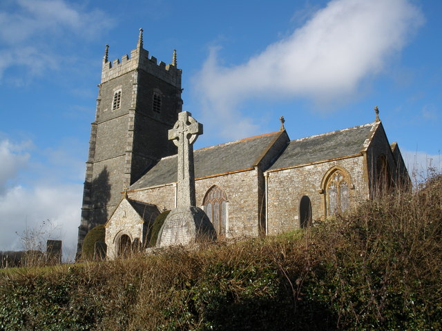
Church of St James, Iddesleigh

St James' Church, Iddesleigh, is a church in the small village of Iddesleigh, Devon, England. It dates back to the 13th century, although most of the...

Winkleigh

Winkleigh is a civil parish and small village in Devon, England. It is part of the local government area of Torridge District Council. The population of...

Honeychurch, Devon

Honeychurch is a village and former civil parish now in the parish of Sampford Courtenay, in the West Devon district of the English county of Devon. It...

Nearby Amenities

Located within 500m of 50.829234,-3.9981864
Generator Method: photovoltaic
Generator Output Electricity: yes
Generator Source: solar
Generator Type: solar_photovoltaic_panel
Location: roof
Power: generator
Lat/Long: 50.830752/-3.9953552
The data included in this document is from www.openstreetmap.org. The data is made available under ODbL.

Have you been to Merrifield Copse?

Leave your review of Merrifield Copse below (or comments, questions and feedback).