Chillesford

Settlement in Suffolk East Suffolk

England

Chillesford

Smoky House
Smoky House Credit: Dave King

Chillesford is a small village located in the eastern county of Suffolk, England. Situated amidst the beautiful countryside, it is part of the Suffolk Coastal district and lies approximately 4 miles southeast of the market town of Wickham Market.

With a population of around 200 residents, Chillesford is a tranquil and picturesque village that offers a peaceful escape from the hustle and bustle of larger towns. The village is characterized by its charming cottages, quaint houses, and verdant landscapes.

One of the notable features of Chillesford is its proximity to the River Ore, which flows just to the east of the village. This river is a prominent waterway in Suffolk, providing opportunities for boating, fishing, and other recreational activities.

Chillesford also boasts a rich history, with evidence of human settlement dating back to the prehistoric period. The village is home to several historical landmarks, including the medieval Church of St. Peter, which is believed to have been built in the 13th century.

While Chillesford is primarily a residential area, it is conveniently located near larger towns and cities. The nearby town of Wickham Market offers various amenities, including shops, schools, and healthcare facilities, ensuring that residents have easy access to essential services.

Overall, Chillesford offers a serene and idyllic setting, making it an attractive place for those seeking a quiet countryside lifestyle while still being within reach of urban amenities.

If you have any feedback on the listing, please let us know in the comments section below.
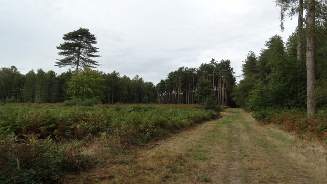
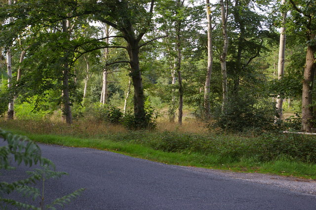
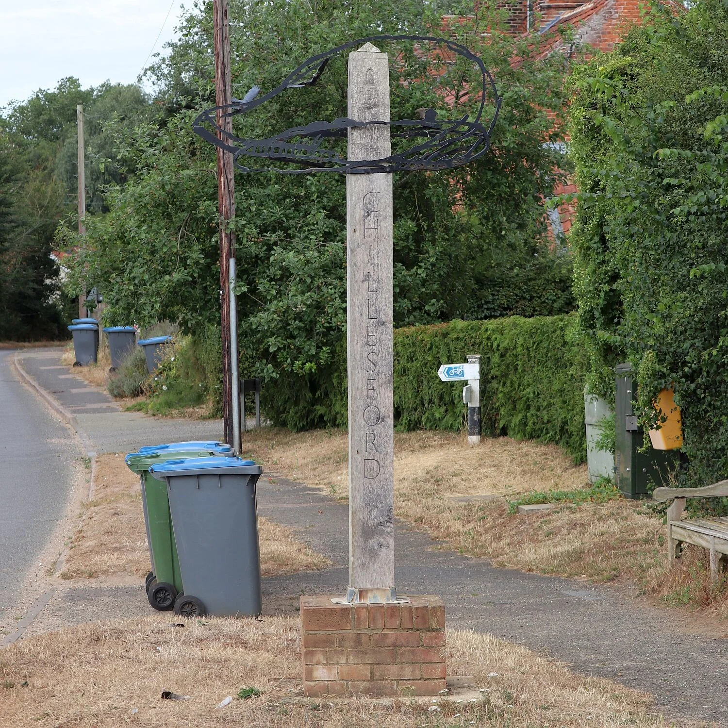
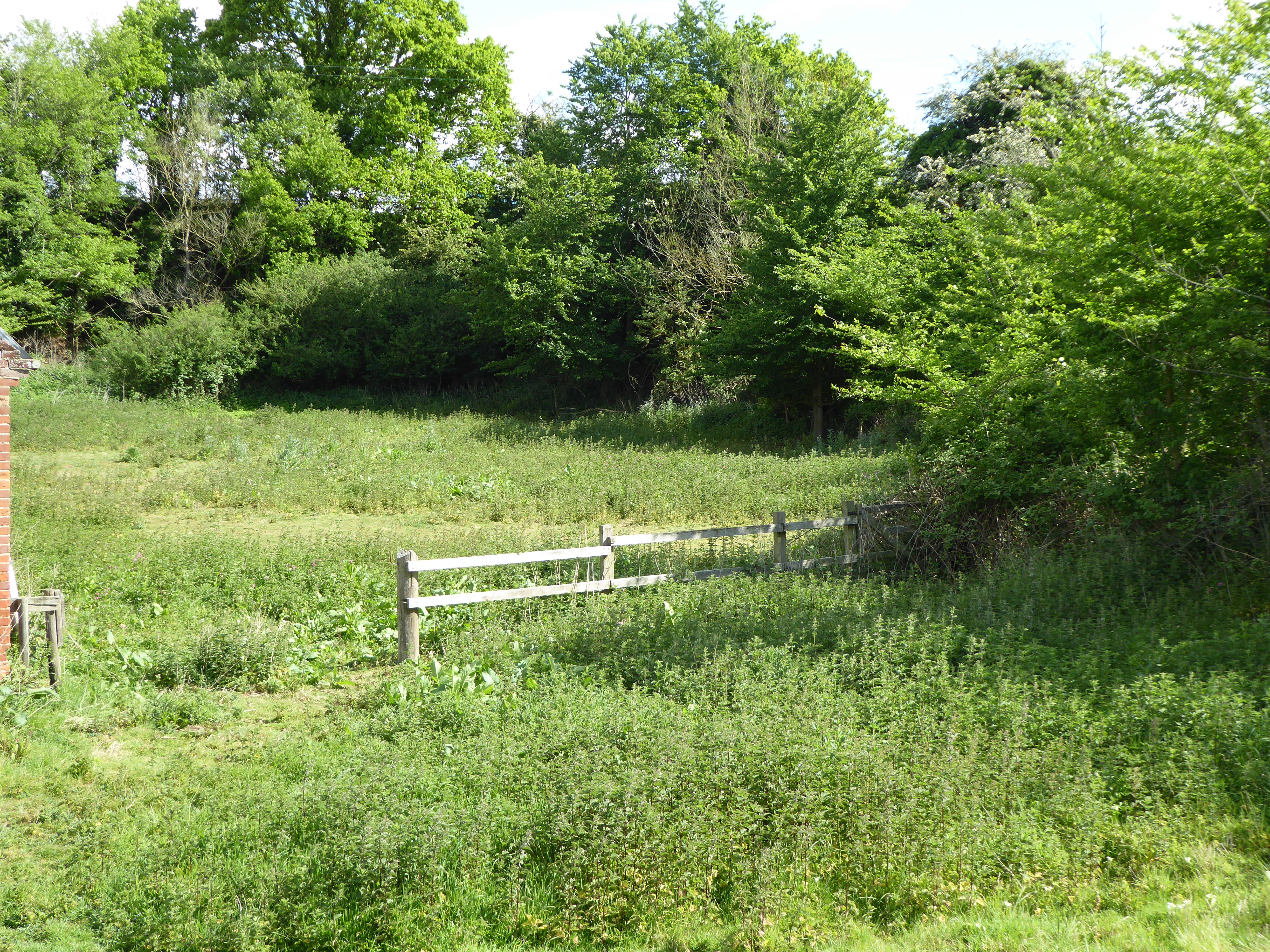
Chillesford Images

Images are sourced within 2km of 52.11665/1.48429 or Grid Reference TM3852. Thanks to Geograph Open Source API. All images are credited.

Smoky House
Smoky House
St Peter's Church The low sun of a winter afternoon brings out the warm colour of the unbuttressed tower, one of only two in England built of coralline crag - the other is at nearby Wantisden in <a href="https://www.geograph.org.uk/gridref/TM3653">TM3653</a>.  The fossiliferous crag, quarried in the pit just north of the church, was laid down in narrow beds when Britain was still joined to the European continent and Chillesford lay on a tributary of the Rhine. <span class="nowrap"><a title="http://www.suffolkchurches.co.uk/chillesford.html" rel="nofollow ugc noopener" href="http://www.suffolkchurches.co.uk/chillesford.html">Link</a><img style="margin-left:2px;" alt="External link" title="External link - shift click to open in new window" src="https://s1.geograph.org.uk/img/external.png" width="10" height="10"/></span>
St Peter's Church
The low sun of a winter afternoon brings out the warm colour of the unbuttressed tower, one of only two in England built of coralline crag - the other is at nearby Wantisden in TM3653. The fossiliferous crag, quarried in the pit just north of the church, was laid down in narrow beds when Britain was still joined to the European continent and Chillesford lay on a tributary of the Rhine. LinkExternal link
Interior of St Peter's Church The very narrow chancel arch, originally Norman but altered in the 15th century and again  by Victorian restorers, is flanked by curious cusped openings and boards with the Lord's Prayer, Creed and Commandments, and surmounted by the miniature royal arms of Victoria in plaster.  The modern east window <a title="https://www.geograph.org.uk/photo/4814054" href="https://www.geograph.org.uk/photo/4814054">Link</a> is the most striking feature of the chancel, with the matching altar frontal by Isobel Clover beneath. <span class="nowrap"><a title="http://www.suffolkchurches.co.uk/chillesford.html" rel="nofollow ugc noopener" href="http://www.suffolkchurches.co.uk/chillesford.html">Link</a><img style="margin-left:2px;" alt="External link" title="External link - shift click to open in new window" src="https://s1.geograph.org.uk/img/external.png" width="10" height="10"/></span>
Interior of St Peter's Church
The very narrow chancel arch, originally Norman but altered in the 15th century and again by Victorian restorers, is flanked by curious cusped openings and boards with the Lord's Prayer, Creed and Commandments, and surmounted by the miniature royal arms of Victoria in plaster. The modern east window Link is the most striking feature of the chancel, with the matching altar frontal by Isobel Clover beneath. LinkExternal link
Christ in Majesty The modern east window of St Peter's Church was designed in 1990 by Surinder Warboys of Mellis to replace its predecessor by Charles Alexander Gibbs dating from 1865,  described by Pevsner as "terrible" and destroyed (apparently by a deranged axeman) in 1987. Some of the tracery from the old window was however reused in the north side of the nave.
Christ in Majesty
The modern east window of St Peter's Church was designed in 1990 by Surinder Warboys of Mellis to replace its predecessor by Charles Alexander Gibbs dating from 1865, described by Pevsner as "terrible" and destroyed (apparently by a deranged axeman) in 1987. Some of the tracery from the old window was however reused in the north side of the nave.
It is I - be not afraid 19th-century stained glass in the west window of St Peter's Church, showing Christ calming the tempest. "AMDG et in memoriam Charles Grayson Pickthall, Ellen Louisa Pickthall".
It is I - be not afraid
19th-century stained glass in the west window of St Peter's Church, showing Christ calming the tempest. "AMDG et in memoriam Charles Grayson Pickthall, Ellen Louisa Pickthall".
Butley Mills next to Minor Road Butley river runs behind the Mill.
Butley Mills next to Minor Road
Butley river runs behind the Mill.
Chillesford -  B1084 Main Road through Village
Chillesford - B1084 Main Road through Village
On the Suffolk Coast Path - track through Tunstall Forest
Sandlings Walk north of Chillesford The long-distance path here heads into Tunstall Forest, passing between mature broad-leaf trees that contrast with the commercial conifers that spread to the right of this viewpoint.
Sandlings Walk north of Chillesford
The long-distance path here heads into Tunstall Forest, passing between mature broad-leaf trees that contrast with the commercial conifers that spread to the right of this viewpoint.
St Peter's church, Chillesford
Reedbeds in the Butley River estuary
Reedbeds looking down the Butley River estuary
Wheat field south of Tunstall Forest Taken from the Suffolk Coast Path as it heads south towards Chillesford.
Wheat field south of Tunstall Forest
Taken from the Suffolk Coast Path as it heads south towards Chillesford.
Tunstall Forest where the Suffolk Coast Path crosses the B1078 Taken from the Coast Path on the south side of the road: the edge of the path heading on into the forest can just be seen on the extreme right.
Tunstall Forest where the Suffolk Coast Path crosses the B1078
Taken from the Coast Path on the south side of the road: the edge of the path heading on into the forest can just be seen on the extreme right.
Path through Tunstall Forest
Field off the Sandlings Walk north of Chillesford
Woodland off the Sandlings Walk, west of Chillesford
View downhill off the Sandlings Walk, west of Chillesford
Show me another place!

Chillesford is located at Grid Ref: TM3852 (Lat: 52.11665, Lng: 1.48429)

Administrative County: Suffolk

District: East Suffolk

Police Authority: Suffolk

What 3 Words

///magma.explained.hears. Near Rendlesham, Suffolk

Related Wikis

Chillesford

Chillesford is a village and civil parish in the East Suffolk district, in the English county of Suffolk. It is located on the B1084 road which runs east...

Chillesford Church Pit

Chillesford Church Pit is a 1.1-hectare (2.7-acre) geological Site of Special Scientific Interest in Chillesford, south of Saxmundham in Suffolk. It is...

Wantisden

Wantisden is a small village and civil parish in the East Suffolk district of Suffolk in eastern England. Largely consisting of a single farm and ancient...

Neutral Farm Pit, Butley

Neutral Farm Pit, Butley is a 1.1-hectare (2.7-acre) geological Site of Special Scientific Interest in Butley, east of Woodbridge in Suffolk. It is a Geological...

Related Videos

Uk holiday

Beautiful beach in.

Walking to Dunwich along the Beach

Beautiful Sunshine in Suffolk takes us out along the Beach to Dunwich.

Walking the beach

We walk the beach looking at the cliff and the debris that comes down as well as the litter.

A Walk around the park

Cliff House Holiday Park it's a nice walk around.

Nearby Amenities

Located within 500m of 52.11665,1.48429
Bus Stop
Mill Lane
Naptan AtcoCode: 390060492
Naptan Bearing: W
Naptan CommonName: Mill Lane
Naptan Indicator: adj
Naptan Landmark: Mill Lane
Naptan NaptanCode: sufgptpj
Naptan Street: B1084
Naptan Verified: no
Source: naptan_import
Lat/Long: 52.1165987/1.483959
Bus Stop
Mill Lane
Naptan AtcoCode: 390060493
Naptan Bearing: E
Naptan BusStopType: CUS
Naptan CommonName: Mill Lane
Naptan Indicator: opp
Naptan Landmark: Mill Lane
Naptan NaptanCode: sufgptpm
Naptan Street: B1084
Naptan Verified: no
Source: naptan_import
Lat/Long: 52.1166902/1.4839077
Post Box
Collection Times: Mo-Fr 16:00; Sa 09:30
Post Box Type: lamp
Ref: IP12 6242
Royal Cypher: EIIR
Royal Cypher Wikidata: Q33102113
Lat/Long: 52.1168588/1.484569
Chillesford
Place: village
Source: NPE
Wikidata: Q3013082
Wikipedia: en:Chillesford
Lat/Long: 52.1171217/1.4845182
Power: pole
Lat/Long: 52.1148534/1.4795896
Power: pole
Lat/Long: 52.1153352/1.4790384
Power: pole
Lat/Long: 52.1159273/1.478392
Parking
Access: private
Lat/Long: 52.1160682/1.4789191
Parking
Access: private
Lat/Long: 52.1164758/1.4803112
Parking
Access: private
Lat/Long: 52.1168587/1.4843144
Parking
Access: private
Lat/Long: 52.1169361/1.4837846
Parking
Access: private
Lat/Long: 52.1166998/1.4833394
Parking
Access: private
Lat/Long: 52.1168307/1.4819755
Parking
Access: private
Lat/Long: 52.1170967/1.4820586
Entrance: yes
Lat/Long: 52.1174084/1.4788111
Man Made: tower
Tower Type: bell_tower
Lat/Long: 52.1174269/1.4787065
Parking
Lat/Long: 52.116881/1.4884825
Parking
Access: private
Lat/Long: 52.1169683/1.4843385
Parking
Access: private
Lat/Long: 52.1163333/1.4822182
Parking
Access: private
Lat/Long: 52.116722/1.4809549
Parking
Access: private
Lat/Long: 52.1167863/1.48011
Parking
Access: private
Lat/Long: 52.117128/1.4878455
Parking
Access: private
Lat/Long: 52.1170621/1.486495
Parking
Access: private
Lat/Long: 52.1169913/1.4861892
Parking
Access: private
Lat/Long: 52.117147/1.4847368
Parking
Access: private
Lat/Long: 52.1170201/1.4855643
Parking
Access: private
Lat/Long: 52.1170308/1.4854422
Parking
Access: private
Lat/Long: 52.1170086/1.4851861
Parking
Access: private
Lat/Long: 52.1169979/1.4849916
Parking
Access: private
Lat/Long: 52.1177325/1.4843452
Parking
Access: private
Lat/Long: 52.1178461/1.4840931
Parking
Access: private
Lat/Long: 52.1179005/1.4839295
Power: pole
Lat/Long: 52.1140727/1.479705
Defibrillator
Defibrillator Location: On the left-hand side of the front wall of the Froize Inn.
Emergency: defibrillator
Indoor: no
Ref GB The Circuit: 9EF5D5CF-37A4-4FEB-A5AF-AD410170D851
Lat/Long: 52.1169166/1.4888831
Public Bookcase
Booth: KX100
Disused Amenity: telephone
Man Made: telephone_box
Public Bookcase Type: phone_box
Lat/Long: 52.1168573/1.4845398
Bench
Lat/Long: 52.1168416/1.4845035
Advertising: board
Lat/Long: 52.1168643/1.484591
Man Made: village_sign
Lat/Long: 52.1168309/1.4845813
The data included in this document is from www.openstreetmap.org. The data is made available under ODbL.

Have you been to Chillesford?

Leave your review of Chillesford below (or comments, questions and feedback).