Badpark Copse
Wood, Forest in Devon West Devon
England
Badpark Copse

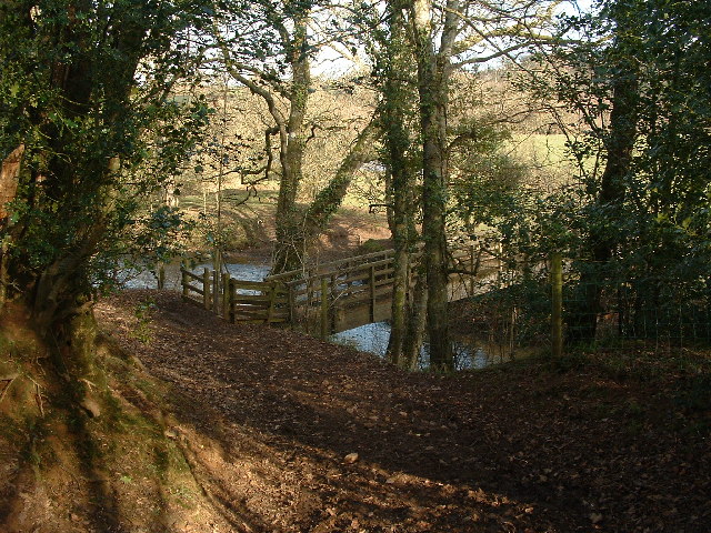
Badpark Copse is a picturesque woodland located in Devon, England. Covering an area of approximately 20 hectares, this stunning forest is nestled in the heart of the county, offering a serene and tranquil escape from the hustle and bustle of everyday life.
The copse is predominantly composed of native broadleaf trees, such as oak, beech, and ash, which create a lush and vibrant canopy overhead. These trees have been allowed to grow undisturbed for decades, resulting in a mature and diverse woodland ecosystem.
Walking through Badpark Copse, visitors are treated to a myriad of natural wonders. Bluebells carpet the forest floor in the spring, creating a breathtaking display of vibrant color. The air is filled with the sweet scent of wildflowers, and the sound of birdsong echoes through the trees.
The copse is crisscrossed with a network of well-maintained footpaths, allowing visitors to explore its beauty at their own pace. These paths wind through the forest, offering glimpses of hidden glades and babbling brooks along the way.
Badpark Copse is not only a haven for nature lovers, but also a vital habitat for a variety of wildlife. The forest provides a home for deer, foxes, and a multitude of bird species, including woodpeckers and owls.
Whether you're seeking a peaceful stroll, a picnic spot, or an opportunity to immerse yourself in nature, Badpark Copse is the perfect destination. Its enchanting beauty and diverse ecosystem make it a must-visit location for anyone exploring the Devon countryside.
If you have any feedback on the listing, please let us know in the comments section below.
Badpark Copse Images
Images are sourced within 2km of 50.842233/-4.0246081 or Grid Reference SS5706. Thanks to Geograph Open Source API. All images are credited.


Badpark Copse is located at Grid Ref: SS5706 (Lat: 50.842233, Lng: -4.0246081)
Administrative County: Devon
District: West Devon
Police Authority: Devon and Cornwall
What 3 Words
///cemented.blacken.froze. Near Hatherleigh, Devon
Nearby Locations
Related Wikis

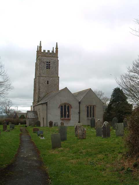
Iddesleigh
Iddesleigh is a village and civil parish in the county of Devon, England. The settlement has ancient origins and is listed in the Domesday Book. The village...

Monkokehampton
Monkokehampton is a village and civil parish in West Devon, England. The village lies on the River Okement, about 3 miles (4.8 km) east-north-east of Hatherleigh...
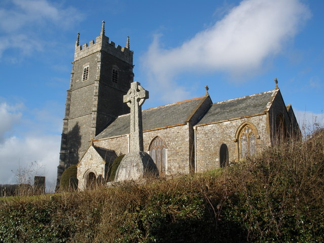
Church of St James, Iddesleigh
St James' Church, Iddesleigh, is a church in the small village of Iddesleigh, Devon, England. It dates back to the 13th century, although most of the...

River Okement
The River Okement is a tributary of the River Torridge in Devon, England. It rises at two places in Dartmoor, as the West Okement and the East Okement...

Meeth
Meeth is a small village roughly 13.5 km (8.4 mi) north-northwest of Okehampton and 40.7 km (25.3 mi) west-northwest of Exeter. It lies to the west of...

River Lew
The River Lew can refer to either of two short rivers that lie close to each other in Devon, England. The more northerly of the two rises just south of...
Meeth Halt railway station
Opened in 1925, Meeth Halt was a small railway station on the North Devon and Cornwall Junction Light Railway, a private line until it became part of the...
Dowland, Devon
Dowland is a civil parish in Devon, situated near Winkleigh. It is also the name of a hamlet in the parish. == References ==
Nearby Amenities
Located within 500m of 50.842233,-4.0246081Have you been to Badpark Copse?
Leave your review of Badpark Copse below (or comments, questions and feedback).