Childswickham

Settlement in Gloucestershire Wychavon

England

Childswickham

A44 at the turning for Murcot
A44 at the turning for Murcot Credit: Peter Whatley

Childswickham is a small village located in the county of Gloucestershire, England. Situated just two miles south-west of Broadway, it is part of the Wychavon district and lies within the Cotswolds Area of Outstanding Natural Beauty.

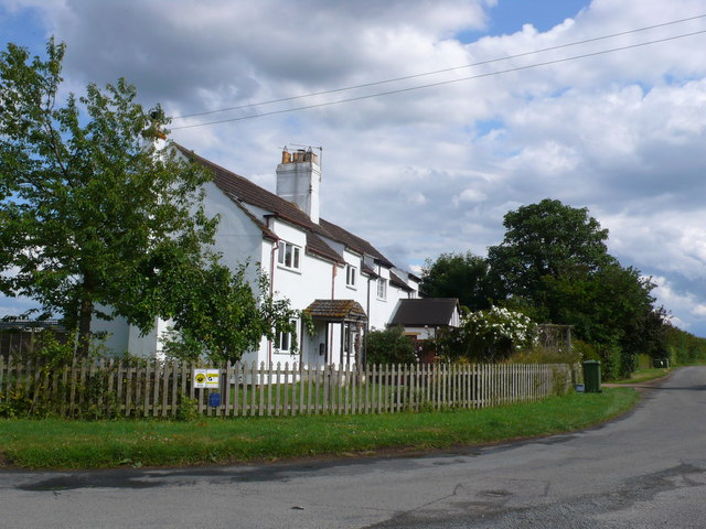
With a population of approximately 300 residents, Childswickham offers a peaceful and picturesque environment. The village is known for its charming cottages, many of which date back to the 17th and 18th centuries, giving it a quintessentially English feel. The local architecture is predominantly characterized by traditional Cotswold stone, adding to the village's aesthetic appeal.

The heart of Childswickham is its historic parish church, St Mary's, which is a Grade I listed building. Constructed in the 12th century, the church boasts stunning architectural features, including a Norman doorway and a medieval font. The church continues to hold regular services and plays an important role in the community.

Despite its small size, Childswickham benefits from a strong sense of community spirit. The village has a primary school, which serves the local children, and a village hall that hosts various social and recreational activities. Additionally, there is a well-utilized playground, providing a safe and enjoyable space for the village's younger residents.

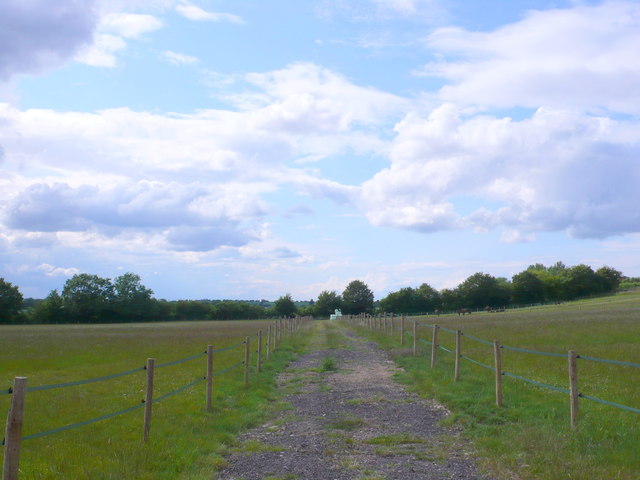
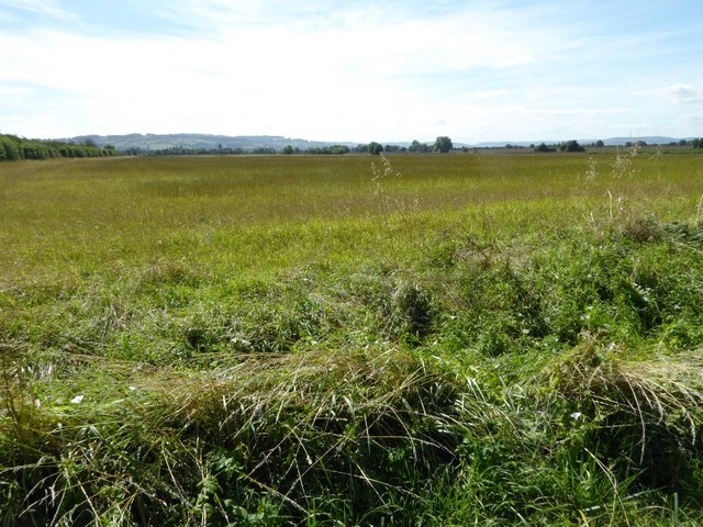
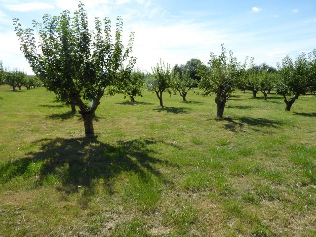
Surrounded by rolling hills and beautiful countryside, Childswickham offers numerous opportunities for outdoor activities such as walking, cycling, and horseback riding. The village is also conveniently located for exploring the wider Cotswolds region, with its charming market towns, historic sites, and stunning landscapes.

In summary, Childswickham is a delightful village in Gloucestershire that offers a tranquil and idyllic setting, rich in history and natural beauty.

If you have any feedback on the listing, please let us know in the comments section below.

Childswickham Images

Images are sourced within 2km of 52.046773/-1.888769 or Grid Reference SP0738. Thanks to Geograph Open Source API. All images are credited.

A44 at the turning for Murcot
Replacement pole in place A well insulated replacement pole for the electrical reticulation system has been raised between the two wires.  Seen from the footpath.
Replacement pole in place
A well insulated replacement pole for the electrical reticulation system has been raised between the two wires. Seen from the footpath.
Never to drive again [2] In the previous image from May 2010 <a href="https://www.geograph.org.uk/photo/1913627">SP0740 : Never to drive again [1]</a> these two vehicles, then 40 and 37 years old, were in a parlous state.  The two intervening years have not improved their condition.
Never to drive again [2]
In the previous image from May 2010 SP0740 : Never to drive again [1] these two vehicles, then 40 and 37 years old, were in a parlous state. The two intervening years have not improved their condition.
Birth of a bale The baling machinery has just created the hay bale.  Seen from the footpath near Gorsehill Abbey Farm.
Birth of a bale
The baling machinery has just created the hay bale. Seen from the footpath near Gorsehill Abbey Farm.
Gorsehill Abbey Farm [2] The silo is in the centre of the farm buildings and is a landmark for some distance around.  Seen from the driveway which is also a public footpath.
Gorsehill Abbey Farm [2]
The silo is in the centre of the farm buildings and is a landmark for some distance around. Seen from the driveway which is also a public footpath.
A44 at Murcot turn
A44 at Murcot turn
Tally Ho Cottages These cottages are located at a sharp bend in the minor road, Murcot Rd that runs from Childswickham to Wickhamford. This bend was once a "t" junction  with the other road going to Murcot Farm.
Tally Ho Cottages
These cottages are located at a sharp bend in the minor road, Murcot Rd that runs from Childswickham to Wickhamford. This bend was once a "t" junction with the other road going to Murcot Farm.
Horse Paddocks near Wickhamford This land was used as arable land until quite recently and it is adjacent to some large orchards.
Horse Paddocks near Wickhamford
This land was used as arable land until quite recently and it is adjacent to some large orchards.
Sewage Pumping Station This small pumping station is on the Murcot road running west out of Wickhamford. The blue sign on the left says Severn Trent Water, Sewage Pumping Station, Wickhamford, Murcot Lane.
Sewage Pumping Station
This small pumping station is on the Murcot road running west out of Wickhamford. The blue sign on the left says Severn Trent Water, Sewage Pumping Station, Wickhamford, Murcot Lane.
Orchard at Wickhamford there are extensive orchards all round the village. This one is on the Murcot road leading south west out of the village.
Orchard at Wickhamford
there are extensive orchards all round the village. This one is on the Murcot road leading south west out of the village.
Road junction on Murcot Road Road junction on Murcot Road near Tally-ho Cottages near Wickhamford.  For the same location in February 2010, see: <a href="https://www.geograph.org.uk/photo/1725224">SP0640 : Tally-ho Cottages, Wickhamford</a>
Road junction on Murcot Road
Road junction on Murcot Road near Tally-ho Cottages near Wickhamford. For the same location in February 2010, see: SP0640 : Tally-ho Cottages, Wickhamford
Flat farmland in the Vale of Evesham The Vale of Evesham is synonymous which market gardening and horticulture but here is a view over arable farmland near Childswickham. The Cotswold Hills can be seen on the horizon.
Flat farmland in the Vale of Evesham
The Vale of Evesham is synonymous which market gardening and horticulture but here is a view over arable farmland near Childswickham. The Cotswold Hills can be seen on the horizon.
Orchard near Wickhamford
A44 Near Wickhamford and Turning For Murcot
Nursery at Pitchers Hill Looking over the nursery beside the Evesham - Oxford road with the Vale of Evesham beyond.
Nursery at Pitchers Hill
Looking over the nursery beside the Evesham - Oxford road with the Vale of Evesham beyond.
Tally-ho Cottages The row of cottages at the junction with the short no through road to Murcot.
Tally-ho Cottages
The row of cottages at the junction with the short no through road to Murcot.
Track to Gorsehill Abbey Farm The buildings and silo at Gorsehill Abbey Farm seen from the footpath from Gallipot Farm House near the southern edge of the square.
Track to Gorsehill Abbey Farm
The buildings and silo at Gorsehill Abbey Farm seen from the footpath from Gallipot Farm House near the southern edge of the square.
Gorsehill Abbey Farm An interesting old brick building in the midst of the collection of farm buildings.  Judging by the stonework ornamentation and the chimney this building may at one time have had grander uses.
This end of the building would have originally housed the farm worker/carter the next part was the stable, and beyond that the barn for storage of hay and corn. Built in 1773 when the farm was enclosed and at the same time as the farm house.
Gorsehill Abbey Farm
An interesting old brick building in the midst of the collection of farm buildings. Judging by the stonework ornamentation and the chimney this building may at one time have had grander uses. This end of the building would have originally housed the farm worker/carter the next part was the stable, and beyond that the barn for storage of hay and corn. Built in 1773 when the farm was enclosed and at the same time as the farm house.
Show me another place!

Childswickham is located at Grid Ref: SP0738 (Lat: 52.046773, Lng: -1.888769)

Administrative County: Worcestershire

District: Wychavon

Police Authority: West Mercia

What 3 Words

///swims.vacancies.noon. Near Broadway, Worcestershire

Nearby Locations

Childswickham

Related Wikis

Childswickham

Childswickham is a village in Worcestershire, England, situated within the flat open landscape of the Vale of Evesham, between the Bredon and Cotswold...

Broadway railway station

Broadway railway station is a railway station on the heritage Gloucestershire Warwickshire Railway in the village of Broadway in Worcestershire, England...

Murcot

Murcot is a hamlet in the English county of Worcestershire. Murcot is located in the west of the Vale of Evesham and is to the west and south of the village...

Broadway, Worcestershire

Broadway is a large village and civil parish in the Cotswolds, England, with a population of 2,540 at the 2011 census. It is in the far southeast of Worcestershire...

Broadway War Memorial

The Broadway War Memorial is located on the village green in the village of Broadway in Worcestershire. The memorial marks the deaths of local individuals...
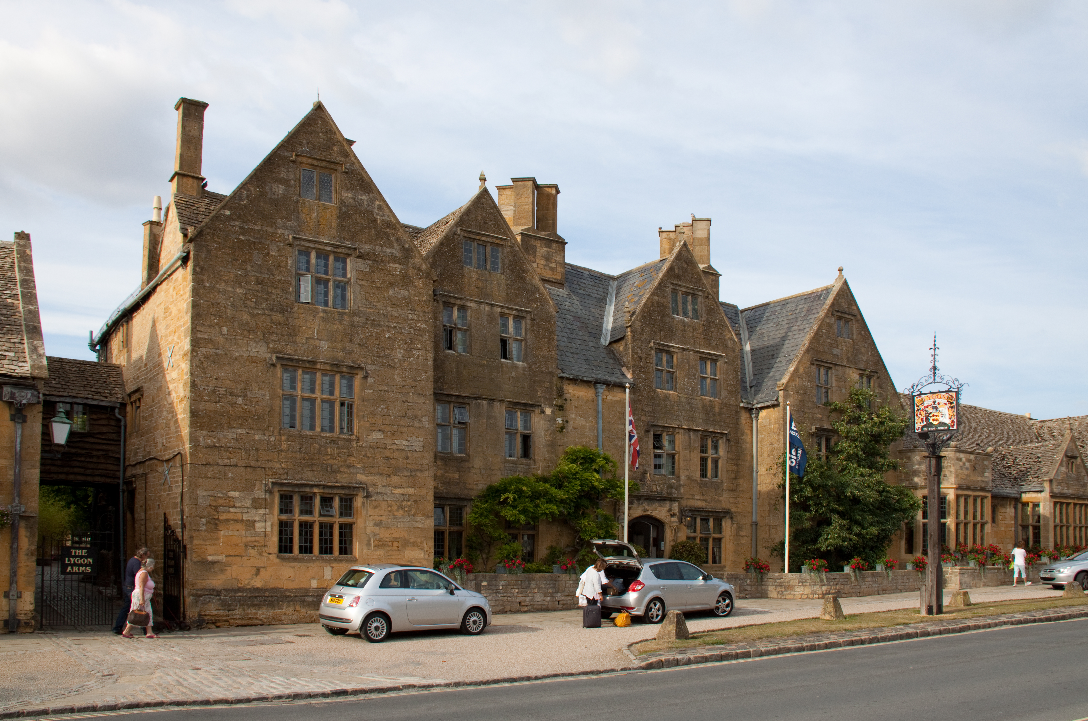
Lygon Arms

The Lygon Arms ( LIG-ən) is a Grade II* listed hotel in Broadway, Worcestershire, originally a coaching inn. The current building dates from the seventeenth...

Buckland, Gloucestershire

Buckland is a village and civil parish in the borough of Tewkesbury, Gloucestershire, England. The parish, which also includes the village of Laverton...

Willersey Halt railway station

Willersey Halt railway station served the village of Willersey, Gloucestershire, England between 1904 and 1960. == History == The halt was opened by the...

Nearby Amenities

Located within 500m of 52.046773,-1.888769
Childswickham
Place: village
Wikidata: Q5098624
Wikipedia: en:Childswickham
Lat/Long: 52.0465987/-1.8936243
Farmers Lane
Naptan AtcoCode: 2000G087901
Naptan Bearing: W
Naptan BusStopType: CUS
Naptan CommonName: Farmers Lane
Naptan Crossing: Farmers Lane
Naptan Indicator: Adj
Naptan NaptanCode: wocdagpd
Naptan Street: New Street
Naptan Verified: no
Source: naptan_import
Lat/Long: 52.0471526/-1.8944719
Caravan Parks
Naptan AtcoCode: 2000G091900
Naptan Bearing: NE
Naptan BusStopType: CUS
Naptan CommonName: Caravan Parks
Naptan Crossing: Broadway Road
Naptan Indicator: opp
Naptan NaptanCode: wocdgpjd
Naptan Street: Pennylands Bank
Naptan Verified: no
Source: naptan_import
Lat/Long: 52.0455382/-1.8845598
Bus Stop
Caravan Parks
Bus: yes
Naptan AtcoCode: 2000G674005
Naptan Bearing: W
Naptan CommonName: Caravan Parks
Naptan Crossing: Broadway Road
Naptan Indicator: adj
Naptan NaptanCode: wocgaptm
Naptan Street: Pennylands Bank
Naptan Verified: no
Public Transport: platform
Source: naptan_import
Lat/Long: 52.0452335/-1.8844882
Village Hall
Addr Locality: Childswickham
Addr Postcode: WR12 7HF
Naptan AtcoCode: 2000G674010
Naptan Bearing: E
Naptan BusStopType: CUS
Naptan CommonName: Village Hall
Naptan Indicator: Adj
Naptan Landmark: Village Hall
Naptan NaptanCode: wocgapwg
Naptan Street: Atkinson Street
Naptan Verified: no
Source: naptan_import
Source Postcode: ONS Open Data
Lat/Long: 52.0465337/-1.8913814
Barrier: stile
Lat/Long: 52.0436144/-1.8921183
Public Bookcase
Booth: K6
Colour: red
Disused Amenity: telephone
Man Made: telephone_box
Public Bookcase Type: phone_box
Lat/Long: 52.0472033/-1.894332
Post Box
Collection Times: Mo-Fr 16:15; Sa 09:00
Historic Operator: Post Office
Post Box Type: wall
Ref: WR12 28
Royal Cypher: EIIR
Royal Cypher Wikidata: Q33102113
Lat/Long: 52.0473647/-1.8947184
Blacksmith Lane
Addr Locality: Childswickham
Addr Postcode: WR12 7HP
Naptan AtcoCode: 2000G674013
Naptan Bearing: W
Naptan BusStopType: CUS
Naptan CommonName: Blacksmith Lane
Naptan Crossing: Blacksmith Lane
Naptan Indicator: Adj
Naptan NaptanCode: wocdajam
Naptan Street: Broadway Road
Naptan Verified: no
Source: naptan_import
Source Postcode: ONS Open Data
Lat/Long: 52.0480645/-1.8923833
Barrier: kissing_gate
Foot: yes
Lat/Long: 52.0430169/-1.8896987
Barrier: stile
Lat/Long: 52.0429152/-1.8921146
Childswickham Cross
HE Ref: 401270
Historic: monument
Listed Status: Grade II
Man Made: cross
Source Listed Status: English Heritage
Lat/Long: 52.0449904/-1.8937894
Defibrillator
Defibrillator Location: Behind the Village Hall, in car park, open white door.
Emergency: defibrillator
Lat/Long: 52.0466287/-1.8915118
Recycling
Recycling Clothes: yes
Recycling Shoes: yes
Lat/Long: 52.0467132/-1.8915433
Generator Method: photovoltaic
Generator Output Electricity: yes
Generator Source: solar
Generator Type: solar_photovoltaic_panel
Location: roof
Power: generator
Lat/Long: 52.0475989/-1.8909694
Generator Method: photovoltaic
Generator Output Electricity: yes
Generator Source: solar
Generator Type: solar_photovoltaic_panel
Location: roof
Power: generator
Lat/Long: 52.0476468/-1.8924822
Generator Method: photovoltaic
Generator Output Electricity: yes
Generator Source: solar
Generator Type: solar_photovoltaic_panel
Location: roof
Power: generator
Lat/Long: 52.0474183/-1.8923534
Childswickham Church
Power: pole
Transformer: distribution
Voltage Primary: 11000
Lat/Long: 52.0451509/-1.8906771
Power: pole
Lat/Long: 52.0446609/-1.890661
Power: pole
Lat/Long: 52.044105/-1.8907991
Power: pole
Lat/Long: 52.0433832/-1.8920302
Power: pole
Lat/Long: 52.0436744/-1.8934143
Manor Farm
Power: pole
Transformer: distribution
Voltage Primary: 11000
Lat/Long: 52.0447104/-1.8946253
Leedons
Power: transformer
Transformer: distribution
Voltage Primary: 11000
Lat/Long: 52.043085/-1.8850585
Power: transformer
Transformer: distribution
Voltage Primary: 11000
Lat/Long: 52.0465729/-1.8931179
Childswickham
Power: pole
Transformer: distribution
Voltage Primary: 11000
Lat/Long: 52.0484402/-1.8929683
Power: pole
Lat/Long: 52.0489161/-1.8941036
Power: pole
Lat/Long: 52.0506134/-1.892385
Robins Pumping Station
Power: pole
Transformer: distribution
Voltage Primary: 11000
Lat/Long: 52.0499792/-1.8915776
Material: wood
Power: pole
Lat/Long: 52.0507656/-1.8881853
Material: wood
Power: pole
Lat/Long: 52.0502724/-1.8893367
Material: wood
Power: pole
Lat/Long: 52.0497318/-1.8900669
Power: pole
Lat/Long: 52.0493087/-1.8906657
Material: wood
Power: pole
Lat/Long: 52.0487429/-1.8898932
Material: wood
Power: pole
Lat/Long: 52.048175/-1.8891489
Material: wood
Power: pole
Lat/Long: 52.0474694/-1.8882094
Childswickham School
Material: wood
Power: pole
Transformer: distribution
Voltage Primary: 11000
Lat/Long: 52.0464096/-1.8875208
Material: wood
Power: pole
Lat/Long: 52.0467139/-1.887395
Material: wood
Power: pole
Lat/Long: 52.0474868/-1.8870755
Material: wood
Power: pole
Lat/Long: 52.0465836/-1.8855936
Childswickham East
Material: wood
Power: pole
Transformer: distribution
Voltage Primary: 11000
Lat/Long: 52.04588/-1.8850451
Material: wood
Power: pole
Lat/Long: 52.0475049/-1.8860335
Material: wood
Power: pole
Lat/Long: 52.0475103/-1.8849351
Material: wood
Power: pole
Lat/Long: 52.0475156/-1.8839487
Material: wood
Power: pole
Lat/Long: 52.047516/-1.8829711
Leedons Camp
Power: pole
Transformer: distribution
Voltage Primary: 11000
Lat/Long: 52.0441763/-1.8832111
The data included in this document is from www.openstreetmap.org. The data is made available under ODbL.

Have you been to Childswickham?

Leave your review of Childswickham below (or comments, questions and feedback).