Grudgeworthy Copse

Wood, Forest in Devon West Devon

England

Grudgeworthy Copse

Old circular AA sign on the former B3217 in Monkokehampton Old AA Sign located on the wall of an old workshop, now a cottage called The Old Forge, on the east side of the former B3217 in Monkokehampton, 8 miles north of Okehampton. Monkokehampton parish.

This is the Circular, village name on black band, no Motor Union symbol or name type, dating from 1923, showing distances Okehampton 7½ Iddesleigh 2¼ London 196. Removed some time between July 2014 and August 2022.

There were five series of AA signs, mostly dating from 1923 and made by Francis & Co / Franco in Deptford, London. The village name and distance to London or Dublin were normally displayed.

See also <span class="nowrap"><a title="https://www.flickr.com/photos/livesurfcams/14394800250" rel="nofollow ugc noopener" href="https://www.flickr.com/photos/livesurfcams/14394800250">Link</a><img style="margin-left:2px;" alt="External link" title="External link - shift click to open in new window" src="https://s1.geograph.org.uk/img/external.png" width="10" height="10"/></span> , <span class="nowrap"><a title="https://www.flickr.com/photos/bumbishop/5656595" rel="nofollow ugc noopener" href="https://www.flickr.com/photos/bumbishop/5656595">Link</a><img style="margin-left:2px;" alt="External link" title="External link - shift click to open in new window" src="https://s1.geograph.org.uk/img/external.png" width="10" height="10"/></span> and <span class="nowrap"><a title="https://www.flickr.com/photos/bridgemarkertim/3966823734" rel="nofollow ugc noopener" href="https://www.flickr.com/photos/bridgemarkertim/3966823734">Link</a><img style="margin-left:2px;" alt="External link" title="External link - shift click to open in new window" src="https://s1.geograph.org.uk/img/external.png" width="10" height="10"/></span>.

Milestone Society National ID: DV-MONKO
Old circular AA sign on the former B3217 in Monkokehampton Credit: A Rosevear

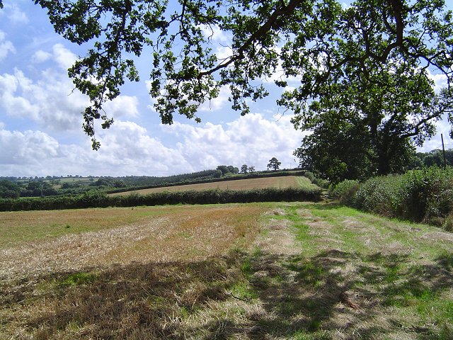
Grudgeworthy Copse is a picturesque woodland located in Devon, England. Nestled in the heart of the county, this charming forest covers an area of approximately 50 acres, providing an enchanting retreat for nature enthusiasts and outdoor adventurers.

The copse boasts a diverse range of flora and fauna, with its dense canopy of ancient oak, beech, and ash trees creating a serene and tranquil atmosphere. The forest floor is adorned with a vibrant carpet of bluebells, wild garlic, and ferns, offering a stunning display of colors during the spring and summer months.

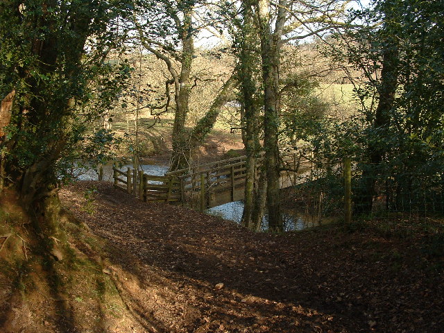
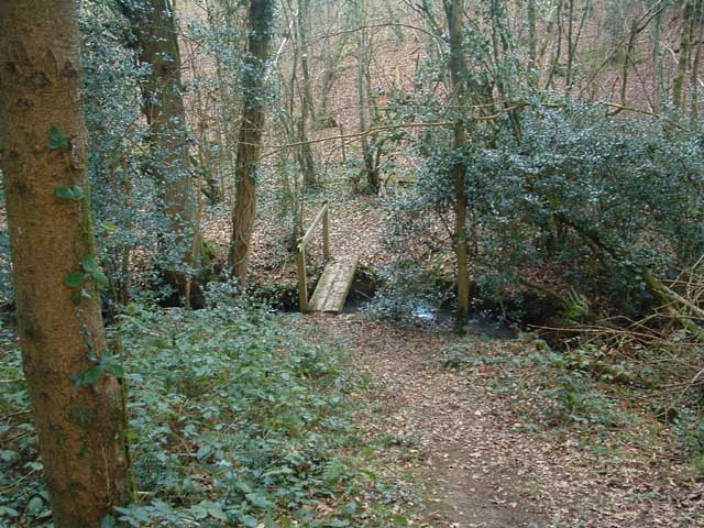
The copse is crisscrossed by a network of well-maintained walking trails, allowing visitors to explore its hidden treasures at their own pace. These trails lead to a small stream that meanders through the woods, providing a peaceful setting for picnics or a moment of quiet reflection.

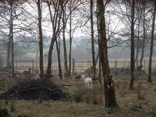
Grudgeworthy Copse is also home to a variety of wildlife. Birdwatchers can spot species such as woodpeckers, owls, and thrushes, while lucky visitors may even catch a glimpse of deer, foxes, and rabbits that call the copse their home.

The copse is managed by local conservation organizations, ensuring that its natural beauty is preserved for future generations to enjoy. Regular clean-up events and educational programs are organized to raise awareness about the importance of environmental conservation.

Whether you are seeking solitude, a family outing, or a chance to reconnect with nature, Grudgeworthy Copse offers an idyllic setting that will leave visitors with a deep appreciation for the natural wonders of Devon.

If you have any feedback on the listing, please let us know in the comments section below.

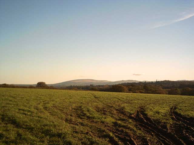
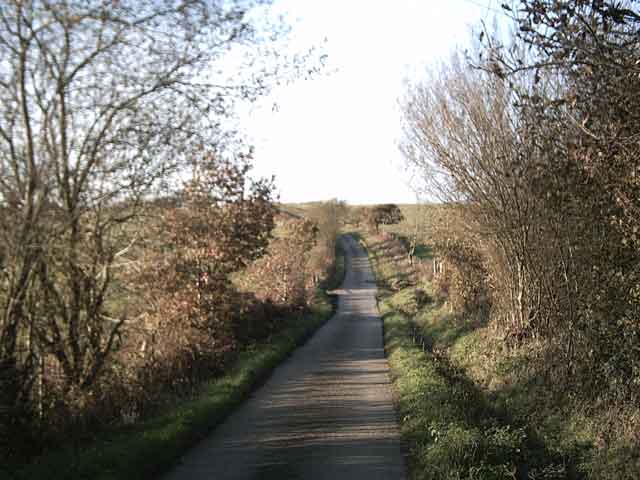
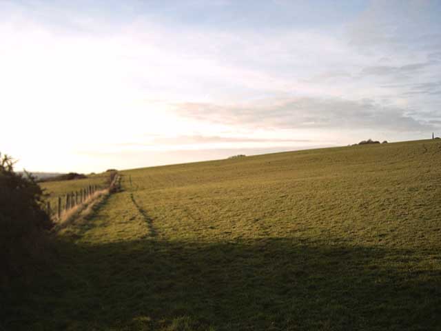
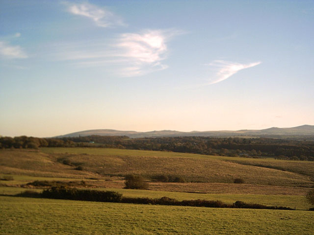
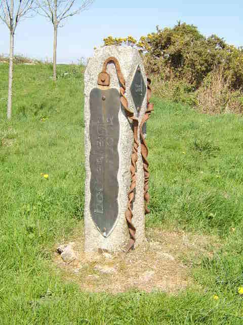
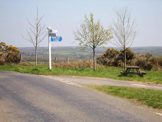
Grudgeworthy Copse Images

Images are sourced within 2km of 50.825022/-4.0368413 or Grid Reference SS5604. Thanks to Geograph Open Source API. All images are credited.

Old circular AA sign on the former B3217 in Monkokehampton Old AA Sign located on the wall of an old workshop, now a cottage called The Old Forge, on the east side of the former B3217 in Monkokehampton, 8 miles north of Okehampton. Monkokehampton parish.

This is the Circular, village name on black band, no Motor Union symbol or name type, dating from 1923, showing distances Okehampton 7½ Iddesleigh 2¼ London 196. Removed some time between July 2014 and August 2022.

There were five series of AA signs, mostly dating from 1923 and made by Francis & Co / Franco in Deptford, London. The village name and distance to London or Dublin were normally displayed.

See also <span class="nowrap"><a title="https://www.flickr.com/photos/livesurfcams/14394800250" rel="nofollow ugc noopener" href="https://www.flickr.com/photos/livesurfcams/14394800250">Link</a><img style="margin-left:2px;" alt="External link" title="External link - shift click to open in new window" src="https://s1.geograph.org.uk/img/external.png" width="10" height="10"/></span> , <span class="nowrap"><a title="https://www.flickr.com/photos/bumbishop/5656595" rel="nofollow ugc noopener" href="https://www.flickr.com/photos/bumbishop/5656595">Link</a><img style="margin-left:2px;" alt="External link" title="External link - shift click to open in new window" src="https://s1.geograph.org.uk/img/external.png" width="10" height="10"/></span> and <span class="nowrap"><a title="https://www.flickr.com/photos/bridgemarkertim/3966823734" rel="nofollow ugc noopener" href="https://www.flickr.com/photos/bridgemarkertim/3966823734">Link</a><img style="margin-left:2px;" alt="External link" title="External link - shift click to open in new window" src="https://s1.geograph.org.uk/img/external.png" width="10" height="10"/></span>.

Milestone Society National ID: DV-MONKO
Old circular AA sign on the former B3217 in Monkokehampton
Old AA Sign located on the wall of an old workshop, now a cottage called The Old Forge, on the east side of the former B3217 in Monkokehampton, 8 miles north of Okehampton. Monkokehampton parish. This is the Circular, village name on black band, no Motor Union symbol or name type, dating from 1923, showing distances Okehampton 7½ Iddesleigh 2¼ London 196. Removed some time between July 2014 and August 2022. There were five series of AA signs, mostly dating from 1923 and made by Francis & Co / Franco in Deptford, London. The village name and distance to London or Dublin were normally displayed. See also LinkExternal link , LinkExternal link and LinkExternal link. Milestone Society National ID: DV-MONKO
Monkokehampton Mill The last working water-powered corn mill in Devon, heritage and preserved mills aside. Built in the late 19th century, it stands by a leat from the Okement and was originally powered by two small overshot waterwheels. One survives in working order today.
Monkokehampton Mill
The last working water-powered corn mill in Devon, heritage and preserved mills aside. Built in the late 19th century, it stands by a leat from the Okement and was originally powered by two small overshot waterwheels. One survives in working order today.
Monkokehampton countryside Fields just south of Monkokehampton
Monkokehampton countryside
Fields just south of Monkokehampton
Tarka Trail: Foot bridge over the Okement There's only one word in this square on the Explorer map. That's the 'Ford' over the River Okement that's just downstream of this foot bridge.
Tarka Trail: Foot bridge over the Okement
There's only one word in this square on the Explorer map. That's the 'Ford' over the River Okement that's just downstream of this foot bridge.
Nethercote House Photo taken from the Tarka Trail between Hatherleigh and Iddesleigh
Nethercote House
Photo taken from the Tarka Trail between Hatherleigh and Iddesleigh
Tarka Trail: Footbridge near Groves Fishleigh There are lots of little footbridges on the Tarka Trail between Hatherleigh and Dolton.
Tarka Trail: Footbridge near Groves Fishleigh
There are lots of little footbridges on the Tarka Trail between Hatherleigh and Dolton.
Deer at Upcott
Deer at Upcott
Farmland near  Upcott Taken from the Tarka Trail. Cosdon Hill in the distance.
Farmland near Upcott
Taken from the Tarka Trail. Cosdon Hill in the distance.
Farmland near Deckport Taken from the Tarka Trail. Cosdon Hill and Belstone Tor in the distance.
Farmland near Deckport
Taken from the Tarka Trail. Cosdon Hill and Belstone Tor in the distance.
Tarka Trail near Hatherleigh Moor
Hatherleigh Moor The Tarka Trail heads across Hatherleigh Moor
Hatherleigh Moor
The Tarka Trail heads across Hatherleigh Moor
View from Hatherleigh Moor towards Dartmoor Taken on the Tarka Trail
View from Hatherleigh Moor towards Dartmoor
Taken on the Tarka Trail
Hatherleigh Moor Marker Stone This roadside marker stands 1 mile from Hatherleigh Town Centre and commands a magnificent view of the moor below.
Hatherleigh Moor Marker Stone
This roadside marker stands 1 mile from Hatherleigh Town Centre and commands a magnificent view of the moor below.
The Upcott turning An ideal place to enjoy a picnic meal overlooking the moors just outside Hatherleigh.
The Upcott turning
An ideal place to enjoy a picnic meal overlooking the moors just outside Hatherleigh.
Field beside the Okement A field of oats occupying the Okement flood plain, seen from New Bridge, Monkokehampton. The river is behind the trees on the right.
Field beside the Okement
A field of oats occupying the Okement flood plain, seen from New Bridge, Monkokehampton. The river is behind the trees on the right.
Lane at Oak Dene The lane from Hatherleigh to Monkokehampton passes under this oak tree immediately after turning a sharp left bend in its brief course across the northwest corner of this square.
Lane at Oak Dene
The lane from Hatherleigh to Monkokehampton passes under this oak tree immediately after turning a sharp left bend in its brief course across the northwest corner of this square.
Pynda A farm at the side of the Okement flood plain, seen from the lane from Hatherleigh to Iddesleigh as it drops to cross the river at Iddesleigh Bridge.
Pynda
A farm at the side of the Okement flood plain, seen from the lane from Hatherleigh to Iddesleigh as it drops to cross the river at Iddesleigh Bridge.
Lane from New Bridge The parapet of the bridge is in the foreground. The lane climbs away from the Okement floodplain towards Hatherleigh. Evening sun and shadows on the fields.
Lane from New Bridge
The parapet of the bridge is in the foreground. The lane climbs away from the Okement floodplain towards Hatherleigh. Evening sun and shadows on the fields.
Show me another place!

Grudgeworthy Copse is located at Grid Ref: SS5604 (Lat: 50.825022, Lng: -4.0368413)

Administrative County: Devon

District: West Devon

Police Authority: Devon and Cornwall

What 3 Words

///positive.conveying.repelled. Near Hatherleigh, Devon

Related Wikis

Monkokehampton

Monkokehampton is a village and civil parish in West Devon, England. The village lies on the River Okement, about 3 miles (4.8 km) east-north-east of Hatherleigh...

River Lew

The River Lew can refer to either of two short rivers that lie close to each other in Devon, England. The more northerly of the two rises just south of...

Hatherleigh

Hatherleigh is a small market town in west Devon, England. It hosts an arts festival in July, and a carnival in November featuring two flaming tar barrel...

Iddesleigh

Iddesleigh is a village and civil parish in the county of Devon, England. The settlement has ancient origins and is listed in the Domesday Book. The village...

Nearby Amenities

Located within 500m of 50.825022,-4.0368413
Generator Method: photovoltaic
Generator Output Electricity: yes
Generator Source: solar
Generator Type: solar_photovoltaic_panel
Location: roof
Power: generator
Lat/Long: 50.8239764/-4.0361318
Generator Method: photovoltaic
Generator Output Electricity: yes
Generator Source: solar
Generator Type: solar_photovoltaic_panel
Location: roof
Power: generator
Lat/Long: 50.8239781/-4.0361613
The data included in this document is from www.openstreetmap.org. The data is made available under ODbL.

Have you been to Grudgeworthy Copse?

Leave your review of Grudgeworthy Copse below (or comments, questions and feedback).