Timbercleave Plantation

Wood, Forest in Devon Torridge

England

Timbercleave Plantation

Steep hill at Langridgeford The deepest of the valleys traversed by the B3227 which runs from Umberleigh to Great Torrington, passing through the hamlet of Langridgeford.
Steep hill at Langridgeford Credit: David Brinicombe

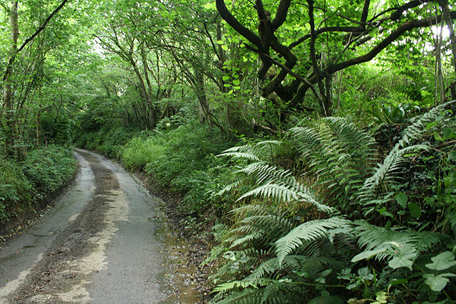
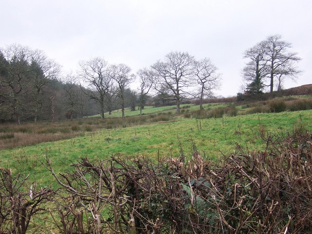
Timbercleave Plantation is a picturesque woodland located in the heart of Devon, England. Covering an expansive area, this enchanting forest is renowned for its ancient trees, diverse wildlife, and tranquil atmosphere.

The plantation is predominantly composed of native species such as oak, beech, and birch trees, which have stood tall for centuries, creating a captivating canopy that provides shade and shelter for a variety of flora and fauna. The vibrant colors of the foliage during autumn make it a popular destination for nature enthusiasts and photographers alike.

Timbercleave Plantation is home to a plethora of wildlife, including deer, foxes, badgers, and numerous bird species. The forest's intricate network of woodland paths offers visitors the opportunity to observe these creatures in their natural habitat. Additionally, the plantation features several bird hides strategically placed throughout the area, allowing birdwatchers to observe the local avian population undisturbed.

For those seeking outdoor activities, Timbercleave Plantation offers a range of recreational opportunities. The well-maintained trails are perfect for walking, jogging, or cycling, allowing visitors to explore the forest at their own pace. The plantation also has designated picnic areas, providing an ideal spot for families and friends to enjoy a leisurely lunch amidst the serene surroundings.

Whether you are an avid nature lover, a wildlife enthusiast, or simply in search of a peaceful retreat, Timbercleave Plantation is a truly captivating destination. Its natural beauty and diverse ecosystem make it a must-visit location for anyone seeking a connection with the great outdoors.

If you have any feedback on the listing, please let us know in the comments section below.

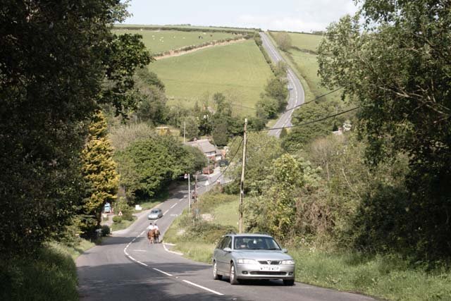
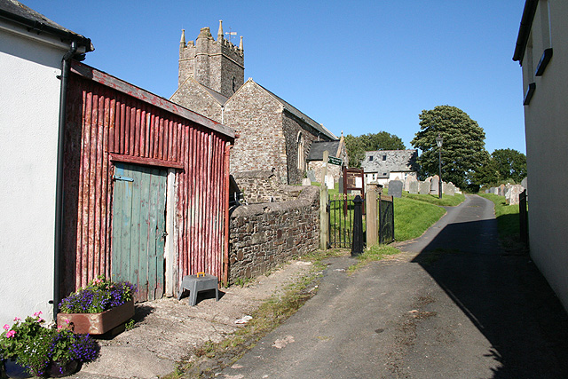
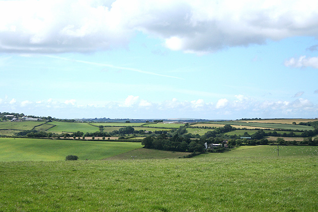
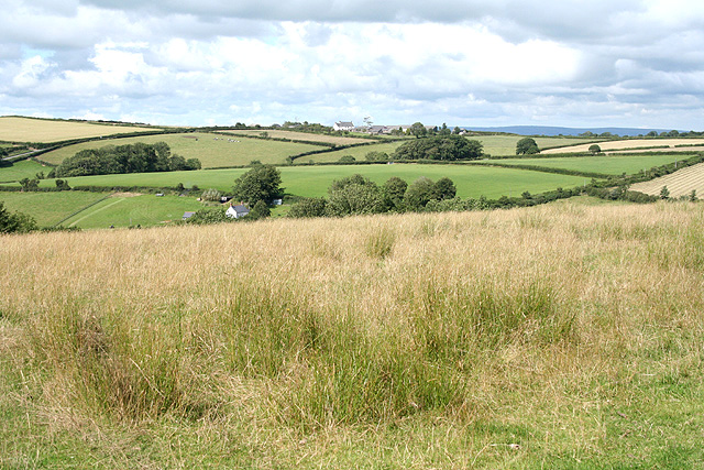
Timbercleave Plantation Images

Images are sourced within 2km of 50.979019/-4.0598442 or Grid Reference SS5521. Thanks to Geograph Open Source API. All images are credited.

Steep hill at Langridgeford The deepest of the valleys traversed by the B3227 which runs from Umberleigh to Great Torrington, passing through the hamlet of Langridgeford.
Steep hill at Langridgeford
The deepest of the valleys traversed by the B3227 which runs from Umberleigh to Great Torrington, passing through the hamlet of Langridgeford.
Yarnscombe: ash tree Near Boode farm, on the lane from Easton Moor. Looking north east
Yarnscombe: ash tree
Near Boode farm, on the lane from Easton Moor. Looking north east
Yarnscombe: by  Easton Moor Cross Looking north, slightly west of Boode, a farm out of shot to the right
Yarnscombe: by Easton Moor Cross
Looking north, slightly west of Boode, a farm out of shot to the right
Yarnscombe: by St Andrew’s church Looking east
Yarnscombe: by St Andrew’s church
Looking east
High Bickington: towards Lower Chapple Lower Chapple stands on the site of St John’s Chapel, within the square and by the Atherington – Torrington road. It can be seen on the horizon on the extreme left. Looking north-north-west
High Bickington: towards Lower Chapple
Lower Chapple stands on the site of St John’s Chapel, within the square and by the Atherington – Torrington road. It can be seen on the horizon on the extreme left. Looking north-north-west
High Bickington: towards Langridge Langridge stands beyond the square on the skyline and by the B3227 Atherington – Torrington road. Looking north east
High Bickington: towards Langridge
Langridge stands beyond the square on the skyline and by the B3227 Atherington – Torrington road. Looking north east
Yarnscombe: near Sherwood Green Looking east-north-east on a bend in the lane, by a field access track
Yarnscombe: near Sherwood Green
Looking east-north-east on a bend in the lane, by a field access track
Yarnscombe: near Sherwood Green Looking north-north-west
Yarnscombe: near Sherwood Green
Looking north-north-west
St Giles in the Wood: Cranford Cross On Cranford Moor. The main road is the B3227 from Atherington to Torrington. Ahead the lane runs to Sherwood Green
St Giles in the Wood: Cranford Cross
On Cranford Moor. The main road is the B3227 from Atherington to Torrington. Ahead the lane runs to Sherwood Green
St Giles in the Wood: the B3227 The road to Atherington at Cranford Cross. Looking east-north-east
St Giles in the Wood: the B3227
The road to Atherington at Cranford Cross. Looking east-north-east
Yarnscombe: Churchcombe Farm The modern barns dwarf the earlier buildings
Yarnscombe: Churchcombe Farm
The modern barns dwarf the earlier buildings
Yarnscombe: on Easton Moor Looking east-north-east in the direction of Easton Moor Cross. The sky has begun to cloud up
Yarnscombe: on Easton Moor
Looking east-north-east in the direction of Easton Moor Cross. The sky has begun to cloud up
Yarnscombe: near Oakenhill Bridge On the edge of Tunnel Wood, on the lane to Three Gates Cross and Yarnscombe Cross from the main Atherington – Torrington road
Yarnscombe: near Oakenhill Bridge
On the edge of Tunnel Wood, on the lane to Three Gates Cross and Yarnscombe Cross from the main Atherington – Torrington road
Valley beside Dodscott Wood The stream in the valley (draining away from the camera) eventually reaches the Woolleigh Brook. Dodscott Woods form a long narrow strip of access woodland running along the right bank of the valley system for well over two miles. The lane is between High Bullen and Sherwood Green.
Valley beside Dodscott Wood
The stream in the valley (draining away from the camera) eventually reaches the Woolleigh Brook. Dodscott Woods form a long narrow strip of access woodland running along the right bank of the valley system for well over two miles. The lane is between High Bullen and Sherwood Green.
Lane near Dodscott Wood The lane shown in <a href="https://www.geograph.org.uk/photo/649088">SS5420 : Valley beside Dodscott Wood</a> drops to cross the Dodscott Brook. Dodscott Wood is on the right; the track shown in <a href="https://www.geograph.org.uk/photo/656904">SS5420 : Dodscott Wood</a> can be seen running through it.
Lane near Dodscott Wood
The lane shown in SS5420 : Valley beside Dodscott Wood drops to cross the Dodscott Brook. Dodscott Wood is on the right; the track shown in SS5420 : Dodscott Wood can be seen running through it.
Lane near Dodscott Wood The lane shown in <a href="https://www.geograph.org.uk/photo/656975">SS5420 : Lane near Dodscott Wood</a> performing a sinuous course as it crosses Dodscott  Brook. The land bordering the lane on the right immediately after the bridge is access land which adjoins Dodscott Wood.
Lane near Dodscott Wood
The lane shown in SS5420 : Lane near Dodscott Wood performing a sinuous course as it crosses Dodscott Brook. The land bordering the lane on the right immediately after the bridge is access land which adjoins Dodscott Wood.
Fields near Dodscott A reverse view along the valley shown in <a href="https://www.geograph.org.uk/photo/649088">SS5420 : Valley beside Dodscott Wood</a>, taken from the section of lane in <a href="https://www.geograph.org.uk/photo/656975">SS5420 : Lane near Dodscott Wood</a>. The lane runs behind the hedge on the right; Dodscott Wood is on the left, over the stream. Two field boundaries are provided by lines of trees.
Fields near Dodscott
A reverse view along the valley shown in SS5420 : Valley beside Dodscott Wood, taken from the section of lane in SS5420 : Lane near Dodscott Wood. The lane runs behind the hedge on the right; Dodscott Wood is on the left, over the stream. Two field boundaries are provided by lines of trees.
Dodscott Brook Looking upstream from the stream crossing in <a href="https://www.geograph.org.uk/photo/656987">SS5420 : Lane near Dodscott Wood</a>. The small brook makes its way through woodland.
Dodscott Brook
Looking upstream from the stream crossing in SS5420 : Lane near Dodscott Wood. The small brook makes its way through woodland.
Show me another place!

Timbercleave Plantation is located at Grid Ref: SS5521 (Lat: 50.979019, Lng: -4.0598442)

Administrative County: Devon

District: Torridge

Police Authority: Devon and Cornwall

What 3 Words

///stockpile.handbook.thinnest. Near Great Torrington, Devon

Related Wikis

Yarnscombe

Yarnscombe is a small village and parish in the Torridge area of Devon, England. It is situated approximately 5 miles (8 km) from Great Torrington and...

Belle Vue Airfield

Belle Vue Airfield (often classed as airport or heliport) is a single runway airfield about 2.5 miles (4.0 km) north east of Great Torrington in North...

Huntshaw Cross transmitting station

Huntshaw Cross transmitting station is a telecommunications facility serving North Devon including the towns of Barnstaple and South Molton. It broadcasts...

St Giles in the Wood

St Giles in the Wood is a village and civil parish in the Torridge district of Devon, England. The village lies about 2.5 miles east of the town of Great...

Nearby Amenities

Located within 500m of 50.979019,-4.0598442
Direction: S
Generator Method: photovoltaic
Generator Output Electricity: yes
Generator Solar Modules: 24
Generator Source: solar
Generator Type: solar_photovoltaic_panel
Location: roof
Power: generator
Lat/Long: 50.9769617/-4.0625791
The data included in this document is from www.openstreetmap.org. The data is made available under ODbL.

Have you been to Timbercleave Plantation?

Leave your review of Timbercleave Plantation below (or comments, questions and feedback).