Chiddingstone

Settlement in Kent Sevenoaks

England

Chiddingstone

Tudor Village at Hever Castle 1968 Viewed from Hever Castle this mock Tudor village was added between 1900-1910 along with the lakes and gardens by William Waldof Astor.
Tudor Village at Hever Castle 1968 Credit: Gordon Spicer

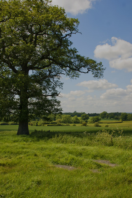
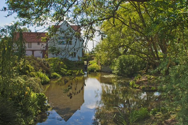
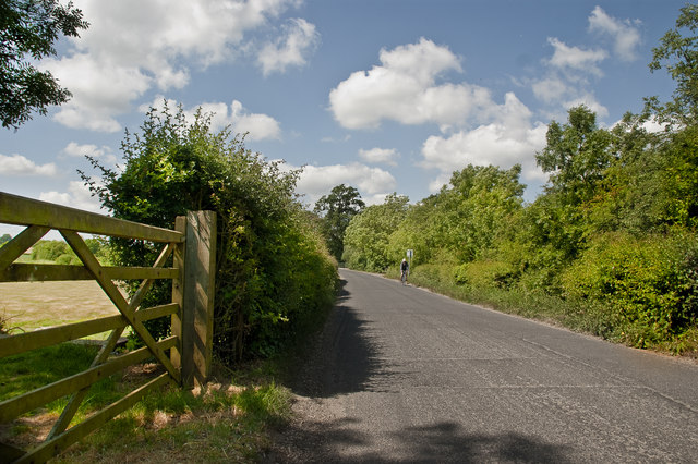
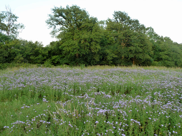
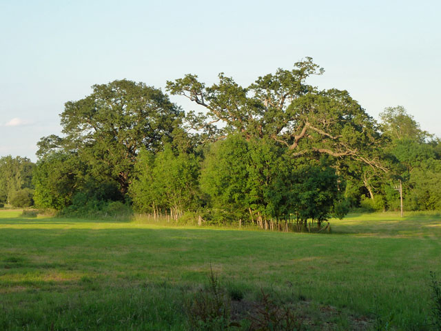
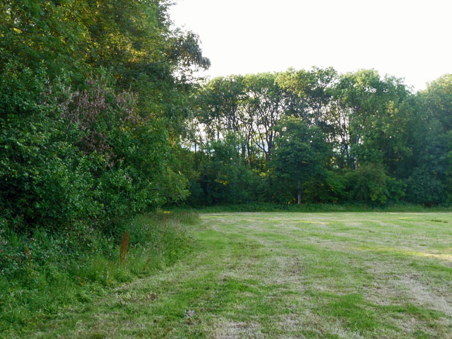
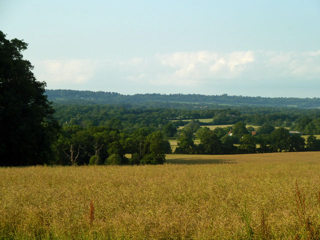
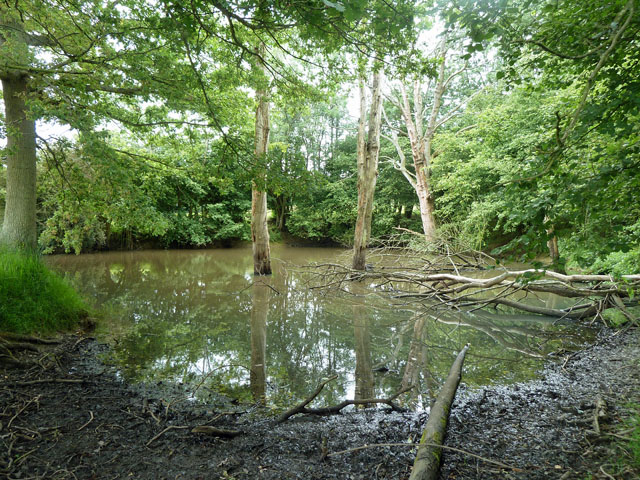
Chiddingstone is a picturesque village located in the county of Kent, in Southeast England. Situated on the edge of the High Weald Area of Outstanding Natural Beauty, it is renowned for its unspoiled charm and historic character. The village is nestled on the banks of the River Eden, surrounded by rolling hills and lush countryside.

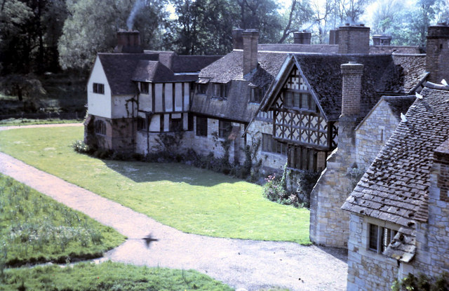
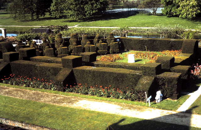
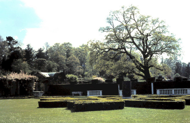
Chiddingstone is best known for its well-preserved medieval architecture, with many buildings dating back to the 16th and 17th centuries. The village is a designated conservation area, ensuring the preservation of its unique heritage. One of the notable landmarks is Chiddingstone Castle, a magnificent country house built in the 19th century, which now serves as a museum showcasing a vast collection of antiquities and art.

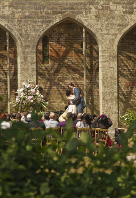
The village exudes a traditional English village atmosphere, with its quaint cottages, charming tea rooms, and a village green that hosts various community events throughout the year. The High Street is lined with historic timber-framed buildings, housing a variety of independent shops, including an antique store and a traditional village pub.

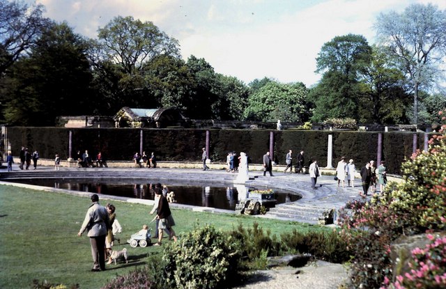
Chiddingstone offers a range of outdoor activities for nature enthusiasts, including beautiful walking trails through the surrounding countryside and along the river. The village is also home to a cricket club and a local football team, promoting a strong sense of community spirit.

Overall, Chiddingstone is a hidden gem in the heart of Kent, attracting visitors with its idyllic setting, rich history, and warm village atmosphere. It offers a peaceful retreat for those seeking a taste of traditional English village life.

If you have any feedback on the listing, please let us know in the comments section below.

Chiddingstone Images

Images are sourced within 2km of 51.188185/0.141211 or Grid Reference TQ4945. Thanks to Geograph Open Source API. All images are credited.

Tudor Village at Hever Castle 1968 Viewed from Hever Castle this mock Tudor village was added between 1900-1910 along with the lakes and gardens by William Waldof Astor.
Tudor Village at Hever Castle 1968
Viewed from Hever Castle this mock Tudor village was added between 1900-1910 along with the lakes and gardens by William Waldof Astor.
Topiary garden Hever Castle 1968 Created in the early 1900's by William Waldof Astor.
Topiary garden Hever Castle 1968
Created in the early 1900's by William Waldof Astor.
Ornamental semi circular pond 1968 In the grounds of Hever Castle.
Ornamental semi circular pond 1968
In the grounds of Hever Castle.
Topiary on entrance path to Hever Castle 1968 Viewed from outside the outer moat.
Topiary on entrance path to Hever Castle 1968
Viewed from outside the outer moat.
Ornamental gardens Hever Castle 1968 A series of gardens ending at the western edge of lake.
Ornamental gardens Hever Castle 1968
A series of gardens ending at the western edge of lake.
Wedding at Chiddingstone Wedding at Chiddingstone Castle
Wedding at Chiddingstone
Wedding at Chiddingstone Castle
Chiddingstone Countryside View northwest from Mill Lane
Chiddingstone Countryside
View northwest from Mill Lane
House in Mill Lane House off Mile Lane north of Chiddlestone
House in Mill Lane
House off Mile Lane north of Chiddlestone
Cyclist Cycling south along Mill Lane north of Chiddlestone
Cyclist
Cycling south along Mill Lane north of Chiddlestone
A large patch of thistles These Creeping Thistles formed a large patch in one particular part of this field of rough grass.
A large patch of thistles
These Creeping Thistles formed a large patch in one particular part of this field of rough grass.
Trees in the evening sun A small wooded island in a field. The country hereabouts is managed almost as parkland, and is probably part of the Hever estate.
Trees in the evening sun
A small wooded island in a field. The country hereabouts is managed almost as parkland, and is probably part of the Hever estate.
Field corner near Hever Castle gardens This is actually in Chiddingstone parish, as is a significant fraction of the Hever Castle grounds.
Field corner near Hever Castle gardens
This is actually in Chiddingstone parish, as is a significant fraction of the Hever Castle grounds.
View over the Eden valley The very many large hedgerow trees make the landscape appear more wooded than it really is.
View over the Eden valley
The very many large hedgerow trees make the landscape appear more wooded than it really is.
Limited visibility rail foot crossing, Bough Beech This crossing is fine for those crossing left to right. Crossing the other way, the bridge and curve in the track means there is only about five seconds visible warning from a position of safety for a train approaching at 60 mph. This is surely sub-standard.
Limited visibility rail foot crossing, Bough Beech
This crossing is fine for those crossing left to right. Crossing the other way, the bridge and curve in the track means there is only about five seconds visible warning from a position of safety for a train approaching at 60 mph. This is surely sub-standard.
An oak in a field With no competition, oaks are often quite shapely trees.
An oak in a field
With no competition, oaks are often quite shapely trees.
Trees below the dam Beyond looms the Bough Beech reservoir dam.
Trees below the dam
Beyond looms the Bough Beech reservoir dam.
Pond by road north of Hoath Corner This is one of several in this area, excavated in the Wadhurst Clay either to extract marl for use on more acid soils, or to extract ironstone.
Pond by road north of Hoath Corner
This is one of several in this area, excavated in the Wadhurst Clay either to extract marl for use on more acid soils, or to extract ironstone.
Hever Castle (1)
Hever Castle (1)
Show me another place!

Chiddingstone is located at Grid Ref: TQ4945 (Lat: 51.188185, Lng: 0.141211)

Administrative County: Kent

District: Sevenoaks

Police Authority: Kent

What 3 Words

///jumped.fleet.inner. Near Edenbridge, Kent

Nearby Locations

Chiddingstone Mill Shaw

Related Wikis

Chiddingstone Castle

Chiddingstone Castle is situated in the village of Chiddingstone, near Edenbridge, Kent, England, 35 miles (56 kilometres) south-southeast of London and...

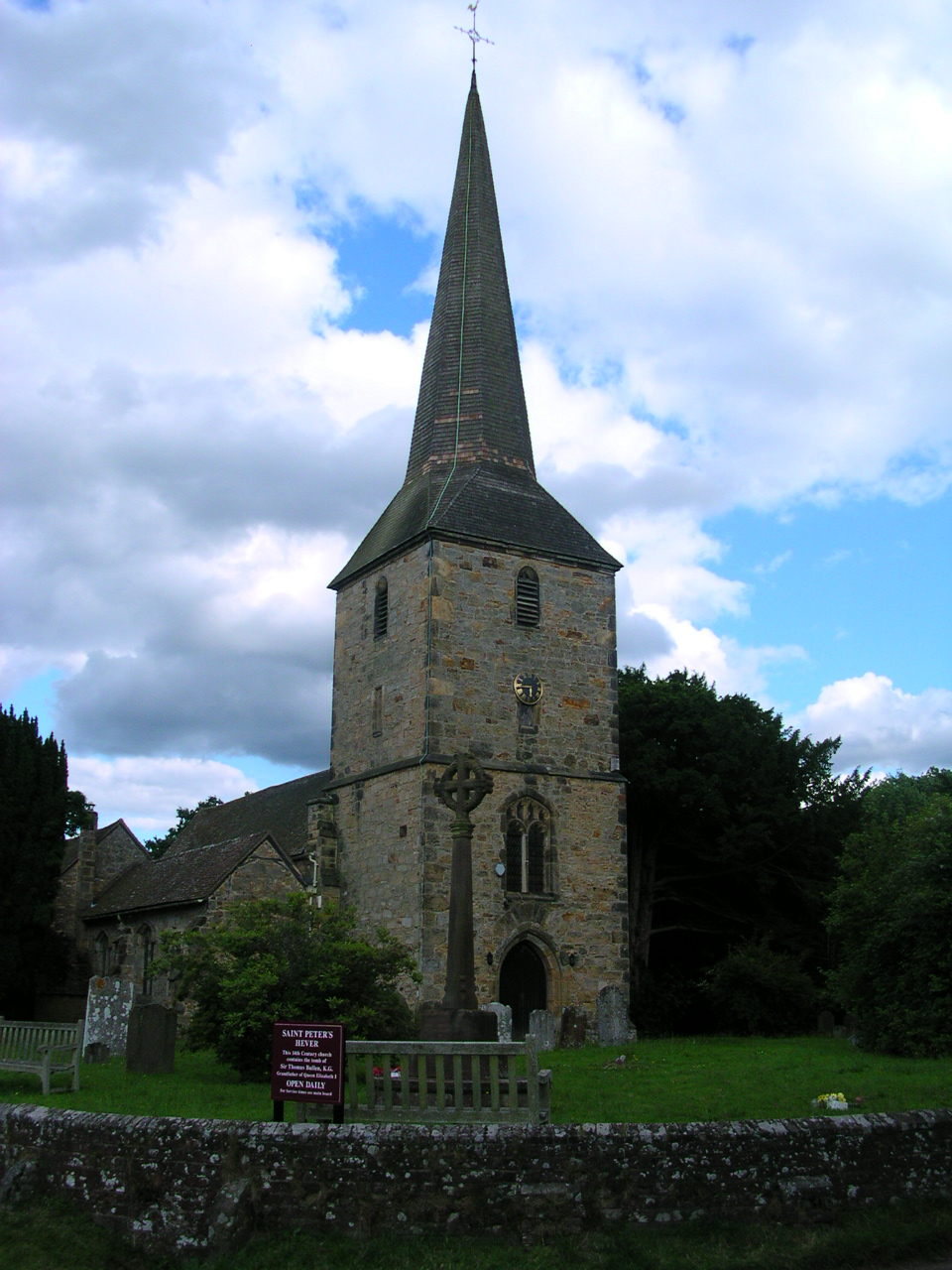
St. Mary the Virgin, Chiddingstone

St. Mary the Virgin is a parish church in the united benefice of Chiddingstone, Penshurst, Chiddingstone Causeway and Fordcombe in the episcopal Diocese...

Chiddingstone

Chiddingstone is a village and civil parish in the Sevenoaks District of Kent, England. The parish is located on the River Eden between Tonbridge and Edenbridge...

Bough Beech

Bough Beech is a hamlet in the county of Kent, England, and is south of the Bough Beech Reservoir. It is located approximately three miles east of Edenbridge...
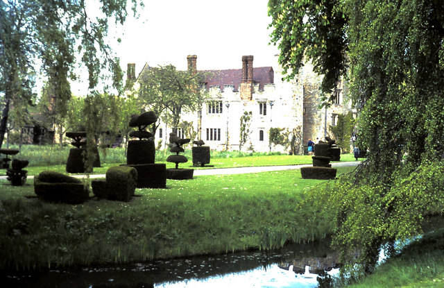
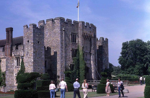
Hever Castle

Hever Castle ( HEE-vər) is located in the village of Hever, Kent, near Edenbridge, 30 miles (48 km) south-east of London, England. It began as a country...

Somerden Hundred

Somerden was a hundred, a historical land division, in the county of Kent, England. It occupied the southwest corner of Kent, in the southern part of the...

Hever, Kent

Hever village is a village and civil parish in the Sevenoaks District of Kent, England. The parish is located on the River Eden, a tributary of the River...

Polebrook Farm

Polebrook Farm is a 13-hectare (32-acre) biological Site of Special Scientific Interest south of Sevenoaks in Kent, England.The field layout of this farm...

Nearby Amenities

Located within 500m of 51.188185,0.141211
Chiddingstone
Addr Postcode: TN8 7AH
Place: hamlet
Source: npe
Lat/Long: 51.1858536/0.1459325
Bus Stop
Church
Flag: no
Naptan AtcoCode: 2400A035010A
Naptan Bearing: W
Naptan BusStopType: CUS
Naptan CommonName: Church
Naptan Indicator: opp
Naptan Landmark: Church
Naptan NaptanCode: kntdmgma
Naptan Street: Chiddingstone Road
Naptan Verified: no
Public Transport: platform
Ref: kntdmgma
Shelter: no
Source: naptan_import
Source Date: 2018-06-13
Lat/Long: 51.1859726/0.1465495
Defibrillator
Booth: K6
Covered: booth
Defibrillator Location: inside old red phone box in Chiddingstone - near churchyard
Emergency: defibrillator
Indoor: yes
Man Made: telephone_box
Opening Hours: 24/7
Lat/Long: 51.1864719/0.1454962
Gilwyns Corner
Junction: yes
Source Name: Implied from NAPTAN data
Lat/Long: 51.1879239/0.1446026
Barrier: kissing_gate
Lat/Long: 51.1874144/0.1449062
Pub
Castle Inn
Opening Hours: Mo-We 12:00-21:00; Fr,Sa 12:00-23:00; Su 12:00-19:00
Outdoor Seating: yes
Wikidata: Q17545679
Lat/Long: 51.1859389/0.1456115
Post Office
Chiddingstone Stores and Post Office
Addr Postcode: TN8 7AH
Ref Pol Id: 3021
Lat/Long: 51.1859585/0.1461679
Post Box
Ref: TN8 213
Lat/Long: 51.1859918/0.1461438
Entrance: main
Lat/Long: 51.1861945/0.1461534
The Chiding Stone
Historic: archaeological_site
Source: Survey
Lat/Long: 51.1853518/0.1458905
Post Box
Collection Times: Mo-Fr 09:00; Sa 07:00
Post Box Design: penfold
Post Box Type: pillar
Ref: TN8 356
Royal Cypher: VR
Royal Cypher Wikidata: Q33102356
Source: bing
Lat/Long: 51.1859922/0.1422187
Cafe
Lat/Long: 51.1856295/0.1420925
Toilets
Lat/Long: 51.1855948/0.1420056
Entrance: yes
Lat/Long: 51.1855055/0.1420436
Chiddingstone Castle Gift Shop
Shop: gift
Lat/Long: 51.1855227/0.1420673
Entrance: yes
Lat/Long: 51.1855524/0.1420636
Entrance: main
Lat/Long: 51.1859745/0.1424657
Entrance: yes
Lat/Long: 51.1855831/0.1423053
Entrance: yes
Lat/Long: 51.1856918/0.1423579
Man Made: silo
Lat/Long: 51.1881562/0.145214
Bus Stop
Church
Flag: no
Naptan AtcoCode: 2400102563
Naptan Bearing: E
Naptan BusStopType: CUS
Naptan CommonName: Church
Naptan Indicator: adj
Naptan Landmark: Church
Naptan NaptanCode: kntjamjt
Naptan Street: Chiddingstone Road
Naptan Verified: no
Public Transport: platform
Ref: kntjamjt
Shelter: no
Source: naptan_import
Source Date: 2014-01-06
Lat/Long: 51.1861108/0.1463699
Waste Basket
Waste: trash
Lat/Long: 51.1866003/0.1452993
Barrier: entrance
Lat/Long: 51.1860521/0.1472418
Waste Basket
Source: gps
Lat/Long: 51.186006/0.1462307
Waste Basket
Source: gps
Lat/Long: 51.1860329/0.147439
The data included in this document is from www.openstreetmap.org. The data is made available under ODbL.

Have you been to Chiddingstone?

Leave your review of Chiddingstone below (or comments, questions and feedback).