Long Acre Wood

Wood, Forest in Devon West Devon

England

Long Acre Wood

Tarka Trail shared path near Meeth
Tarka Trail shared path near Meeth Credit: David Smith

Long Acre Wood is a picturesque forest located in the county of Devon, England. Covering an area of approximately 100 acres, this woodland is a haven of natural beauty and tranquility. It is situated near the town of Newton Abbot, making it easily accessible for both locals and tourists.

The forest is predominantly composed of native tree species, such as oak, beech, and ash, creating a diverse and thriving ecosystem. The dense canopy of the trees provides a cool and shaded environment, perfect for a leisurely stroll on a hot summer's day. The forest floor is adorned with a variety of wildflowers and ferns, adding to its enchanting atmosphere.

Long Acre Wood is also home to a myriad of wildlife, making it a popular destination for nature enthusiasts. Visitors may spot a range of bird species, including woodpeckers, owls, and warblers, as well as small mammals like squirrels and rabbits. The forest is also known to have a population of deer, which can occasionally be seen grazing in the early morning or at dusk.

The wood offers several well-marked walking trails, allowing visitors to explore its beauty at their own pace. These trails wind through the forest, leading to secluded clearings and picturesque viewpoints. The peaceful ambiance of the wood, combined with its natural beauty, makes it an ideal place for a picnic or a day of relaxation in the heart of nature.

Overall, Long Acre Wood in Devon is a captivating destination for those seeking solace in nature. With its diverse flora and fauna, tranquil atmosphere, and well-maintained walking trails, it is an idyllic spot for a day of exploration and rejuvenation.

If you have any feedback on the listing, please let us know in the comments section below.

Long Acre Wood Images

Images are sourced within 2km of 50.845839/-4.0853653 or Grid Reference SS5307. Thanks to Geograph Open Source API. All images are credited.

Tarka Trail shared path near Meeth
Ford and footbridge on Tarka Trail The ford is for cyclists
Ford and footbridge on Tarka Trail
The ford is for cyclists
Iddesleigh: The Torridge Seen just below its confluence with the Okement, near Bridge Town. If there was a bridge here, and the indications are that there was, there is no evidence on the ground today. Looking roughly north west
Iddesleigh: The Torridge
Seen just below its confluence with the Okement, near Bridge Town. If there was a bridge here, and the indications are that there was, there is no evidence on the ground today. Looking roughly north west
River Torridge at Hele Bridge, Devon
River Torridge. View E.N.East from Hele Bridge
Bales near Lewer A field of hay bales, seen from beside the long lane linking Hatherleigh and Sheepwash. On the far side is Bremridge Wood.
Bales near Lewer
A field of hay bales, seen from beside the long lane linking Hatherleigh and Sheepwash. On the far side is Bremridge Wood.
Lewer Bottom Wood So good to see completely unfenced woodland by the roadside. This attractive mixed woodland, here featuring larches, is to the left of the lane, which leads from Hatherleigh to Sheepwash. A belt of trees to the right separates the lane from farmland around Lewer.
Lewer Bottom Wood
So good to see completely unfenced woodland by the roadside. This attractive mixed woodland, here featuring larches, is to the left of the lane, which leads from Hatherleigh to Sheepwash. A belt of trees to the right separates the lane from farmland around Lewer.
Lane near Lewer Trees (principally oak) border both sides of this attractive stretch of lane between Sheepwash and Hatherleigh, as it approaches <a href="https://www.geograph.org.uk/photo/536366">SS5205 : Lewer Bottom Wood</a>.
Lane near Lewer
Trees (principally oak) border both sides of this attractive stretch of lane between Sheepwash and Hatherleigh, as it approaches SS5205 : Lewer Bottom Wood.
Golden rod A sure sign of late summer, Solidago virgaurea - here growing by the lane from Hatherleigh to Sheepwash.
Golden rod
A sure sign of late summer, Solidago virgaurea - here growing by the lane from Hatherleigh to Sheepwash.
View from Friar's Hele Cross A view NNE from the ridge north of the Torridge. Fields slope towards an unnamed wood.
View from Friar's Hele Cross
A view NNE from the ridge north of the Torridge. Fields slope towards an unnamed wood.
St Michael's church, Meeth Plenty of Norman work is evident. "This is a very simple church but it has some good quality detail and the C19 restoration has added to rather than detracted from the building" <span class="nowrap"><a title="http://www.britishlistedbuildings.co.uk/en-93295-church-of-st-michael-meeth" rel="nofollow ugc noopener" href="http://www.britishlistedbuildings.co.uk/en-93295-church-of-st-michael-meeth">Link</a><img style="margin-left:2px;" alt="External link" title="External link - shift click to open in new window" src="https://s1.geograph.org.uk/img/external.png" width="10" height="10"/></span> . Seen from the edge of the churchyard, which is set up above the main road.
St Michael's church, Meeth
Plenty of Norman work is evident. "This is a very simple church but it has some good quality detail and the C19 restoration has added to rather than detracted from the building" LinkExternal link . Seen from the edge of the churchyard, which is set up above the main road.
Field beside Round Pole Plantation The plantation is to the right across the field. The mound on the extreme left is part of Meeth Clay Tip. Seen in torrential rain from Meeth Footpath 2, here followed by the cycle track version of the Tarka Trail.
Field beside Round Pole Plantation
The plantation is to the right across the field. The mound on the extreme left is part of Meeth Clay Tip. Seen in torrential rain from Meeth Footpath 2, here followed by the cycle track version of the Tarka Trail.
Meeth Halt (disused) The North Devon and Cornwall Junction Light Railway (<span class="nowrap"><a title="http://en.wikipedia.org/wiki/North_Devon_and_Cornwall_Junction_Light_Railway" rel="nofollow ugc noopener" href="http://en.wikipedia.org/wiki/North_Devon_and_Cornwall_Junction_Light_Railway">Link</a><img style="margin-left:2px;" alt="External link" title="External link - shift click to open in new window" src="https://s1.geograph.org.uk/img/external.png" width="10" height="10"/></span> ) closed in 1965. This must always have been a tiny station. It now serves as a starting point for a cyclepath along the former line as a branch of the Tarka Trail.
Meeth Halt (disused)
The North Devon and Cornwall Junction Light Railway (LinkExternal link ) closed in 1965. This must always have been a tiny station. It now serves as a starting point for a cyclepath along the former line as a branch of the Tarka Trail.
Path to church, Meeth "A cobbled path, made in 1818 from Torridge river pebbles by the French prisoners from Dartmoor prison at the time of the Napoleonic wars, leads past old lime trees to the early Norman porch" (<span class="nowrap"><a title="http://www.hatherleigh.net/meeth.asp" rel="nofollow ugc noopener" href="http://www.hatherleigh.net/meeth.asp">Link</a><img style="margin-left:2px;" alt="External link" title="External link - shift click to open in new window" src="https://s1.geograph.org.uk/img/external.png" width="10" height="10"/></span> ). A similar path exists at <a href="https://www.geograph.org.uk/photo/567493">SS5311 : St James the Less church, Huish</a>, presumably of the same origin.
Path to church, Meeth
"A cobbled path, made in 1818 from Torridge river pebbles by the French prisoners from Dartmoor prison at the time of the Napoleonic wars, leads past old lime trees to the early Norman porch" (LinkExternal link ). A similar path exists at SS5311 : St James the Less church, Huish, presumably of the same origin.
Path from church, Meeth Clearly not of the some vintage as <a href="https://www.geograph.org.uk/photo/569349">SS5408 : Path to church, Meeth</a>, at least not in its present tarmaced state, this path leads across the northern churchyard.
Path from church, Meeth
Clearly not of the some vintage as SS5408 : Path to church, Meeth, at least not in its present tarmaced state, this path leads across the northern churchyard.
St Michael's church, Meeth The east end of <a href="https://www.geograph.org.uk/photo/567325">SS5408 : St Michael's church, Meeth</a> seen from <a href="https://www.geograph.org.uk/photo/569371">SS5408 : Path from church, Meeth</a>.
St Michael's church, Meeth
Gravestones, Meeth Inscribed slate stones, leaning against the wall of <a href="https://www.geograph.org.uk/photo/567325">SS5408 : St Michael's church, Meeth</a>.
Gravestones, Meeth
Inscribed slate stones, leaning against the wall of SS5408 : St Michael's church, Meeth.
Broken gravestone, Meeth This looks like the top and bottom of the same stone, against the church wall at <a href="https://www.geograph.org.uk/photo/567325">SS5408 : St Michael's church, Meeth</a>.
Broken gravestone, Meeth
This looks like the top and bottom of the same stone, against the church wall at SS5408 : St Michael's church, Meeth.
Show me another place!

Long Acre Wood is located at Grid Ref: SS5307 (Lat: 50.845839, Lng: -4.0853653)

Administrative County: Devon

District: West Devon

Police Authority: Devon and Cornwall

What 3 Words

///parkland.posts.busy. Near Hatherleigh, Devon

Nearby Locations

Long Acre Wood

Related Wikis

Meeth

Meeth is a small village roughly 13.5 km (8.4 mi) north-northwest of Okehampton and 40.7 km (25.3 mi) west-northwest of Exeter. It lies to the west of...

Meeth Halt railway station

Opened in 1925, Meeth Halt was a small railway station on the North Devon and Cornwall Junction Light Railway, a private line until it became part of the...

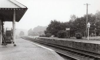
Hatherleigh railway station

Hatherleigh Railway Station was a station on the North Devon and Cornwall Junction Light Railway between Torrington and Halwill Junction, serving the town...

River Lew

The River Lew can refer to either of two short rivers that lie close to each other in Devon, England. The more northerly of the two rises just south of...

Nearby Amenities

Located within 500m of 50.845839,-4.0853653
Friar's Hele Cross
Junction: yes
Lat/Long: 50.8439534/-4.0802244
The data included in this document is from www.openstreetmap.org. The data is made available under ODbL.

Have you been to Long Acre Wood?

Leave your review of Long Acre Wood below (or comments, questions and feedback).