Common Wood

Wood, Forest in Devon

England

Common Wood

Old Boundary Markers on Tavistock Road, Plymouth Two Parish Boundary Markers on the west side of the A386 Tavistock Road, Plymouth, set in a recess in the front garden wall of No.451. Until 1951 these marked the boundary of Tamerton Foliot and Bickleigh parishes but thereafter were entirely in Plymouth. Google Earth shows that the timber frame has now been removed.

On the left is DV_PLPB01pb inscribed Tamerton / (Foliott).

On the right is DV_PLPB03pb inscribed Bickleigh
Old Boundary Markers on Tavistock Road, Plymouth Credit: T Jenkinson

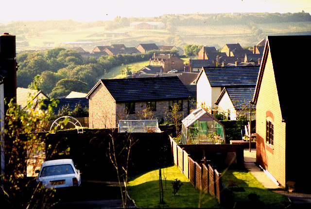
Common Wood is a picturesque forest located in the county of Devon, England. Spanning an area of approximately 300 acres, it is a popular destination for nature lovers and outdoor enthusiasts. The wood is situated near the village of Wood and is easily accessible, making it an ideal spot for both locals and tourists to explore.

The woodland is characterized by its diverse range of tree species, including oak, beech, ash, and birch. These trees create a dense canopy, providing a tranquil and shaded environment for visitors to enjoy. The forest floor is covered in a carpet of ferns, bluebells, and wildflowers, adding to the enchanting atmosphere.

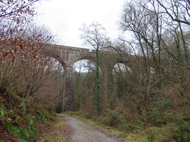
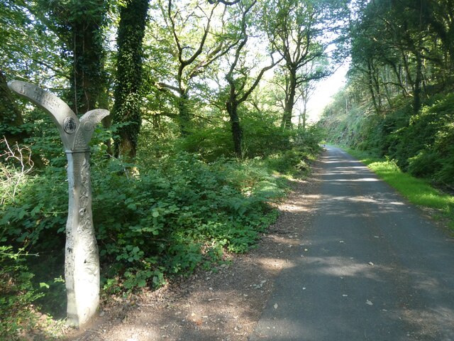
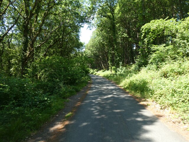
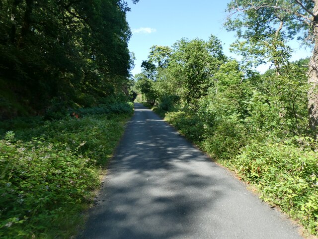
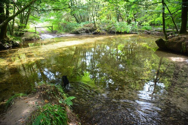
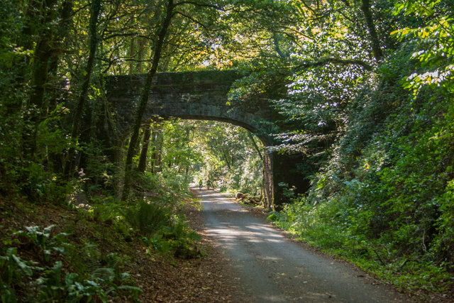
Common Wood is crisscrossed by a network of well-maintained footpaths and trails, allowing visitors to navigate and discover the forest at their own pace. Along these paths, one can stumble upon hidden clearings, babbling brooks, and even a small pond, providing plenty of opportunities for quiet reflection and wildlife observation.

The wood is home to a diverse array of fauna, including deer, foxes, badgers, and a variety of bird species. Birdwatchers will be delighted by the chance to spot woodpeckers, owls, and many other feathered inhabitants.

Throughout the year, Common Wood offers different seasonal delights. In the spring, the forest comes alive with the vibrant colors of blooming flowers and the melodious songs of birds. In autumn, the trees shed their leaves, creating a stunning display of reds, oranges, and yellows.

Common Wood is a true gem of Devon, offering visitors a chance to immerse themselves in the natural beauty and tranquility of the English countryside.

If you have any feedback on the listing, please let us know in the comments section below.
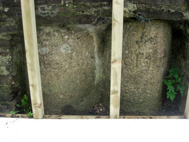
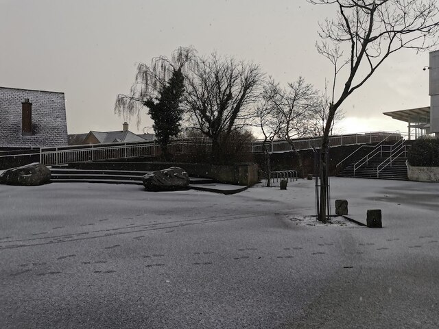
Common Wood Images

Images are sourced within 2km of 50.426038/-4.0888126 or Grid Reference SX5160. Thanks to Geograph Open Source API. All images are credited.

Old Boundary Markers on Tavistock Road, Plymouth Two Parish Boundary Markers on the west side of the A386 Tavistock Road, Plymouth, set in a recess in the front garden wall of No.451. Until 1951 these marked the boundary of Tamerton Foliot and Bickleigh parishes but thereafter were entirely in Plymouth. Google Earth shows that the timber frame has now been removed.

On the left is DV_PLPB01pb inscribed Tamerton / (Foliott).

On the right is DV_PLPB03pb inscribed Bickleigh
Old Boundary Markers on Tavistock Road, Plymouth
Two Parish Boundary Markers on the west side of the A386 Tavistock Road, Plymouth, set in a recess in the front garden wall of No.451. Until 1951 these marked the boundary of Tamerton Foliot and Bickleigh parishes but thereafter were entirely in Plymouth. Google Earth shows that the timber frame has now been removed. On the left is DV_PLPB01pb inscribed Tamerton / (Foliott). On the right is DV_PLPB03pb inscribed Bickleigh
Old Boundary Marker on Tavistock Road, Plymouth Parish Boundary Marker on the west side of the A386 Tavistock Road in the front garden wall of No.451 but visible from the road. Inscribed T and B on opposite faces. Until 1951 this marked the boundary of Tamerton Foliot and Bickleigh parishes but thereafter was entirely in Plymouth.

Milestone Society National ID: DV_PLPB02pb
Old Boundary Marker on Tavistock Road, Plymouth
Parish Boundary Marker on the west side of the A386 Tavistock Road in the front garden wall of No.451 but visible from the road. Inscribed T and B on opposite faces. Until 1951 this marked the boundary of Tamerton Foliot and Bickleigh parishes but thereafter was entirely in Plymouth. Milestone Society National ID: DV_PLPB02pb
West Devon Way viaduct
Wooded Plym valley
Wooded Plym valley
Sustrans millennium milepost by NCN27, Colwill Wood National Cycle Network Route 27 is a 99 miles long route between Ilfracombe and Plymouth, of which 71 miles are traffic-free. The route combines the beaches and estuaries of North Devon with the lush green valleys of the Torridge, the Tavy, the Walkham and other evocative West Country rivers. The route also skirts round the western flank of Dartmoor offering superb views of Cornwall and the surrounding area. There is also many local links and spurs to explore. Largely tracing the course of former railway lines, the route takes you through tunnels and across the breathtaking viaducts and bridges bequeathed by Victorian railway engineers.
Sustrans millennium milepost by NCN27, Colwill Wood
National Cycle Network Route 27 is a 99 miles long route between Ilfracombe and Plymouth, of which 71 miles are traffic-free. The route combines the beaches and estuaries of North Devon with the lush green valleys of the Torridge, the Tavy, the Walkham and other evocative West Country rivers. The route also skirts round the western flank of Dartmoor offering superb views of Cornwall and the surrounding area. There is also many local links and spurs to explore. Largely tracing the course of former railway lines, the route takes you through tunnels and across the breathtaking viaducts and bridges bequeathed by Victorian railway engineers.
Wintery showers near Asda Wintery weather in the courtyard near Asda
Wintery showers near Asda
Wintery weather in the courtyard near Asda
Plym Valley Trail (NCN27) National Cycle Network Route 27 is a 99 miles long route between Ilfracombe and Plymouth, of which 71 miles are traffic-free. The route combines the beaches and estuaries of North Devon with the lush green valleys of the Torridge, the Tavy, the Walkham and other evocative West Country rivers. The route also skirts round the western flank of Dartmoor offering superb views of Cornwall and the surrounding area. There is also many local links and spurs to explore. Largely tracing the course of former railway lines, the route takes you through tunnels and across the breathtaking viaducts and bridges bequeathed by Victorian railway engineers.
Plym Valley Trail (NCN27)
National Cycle Network Route 27 is a 99 miles long route between Ilfracombe and Plymouth, of which 71 miles are traffic-free. The route combines the beaches and estuaries of North Devon with the lush green valleys of the Torridge, the Tavy, the Walkham and other evocative West Country rivers. The route also skirts round the western flank of Dartmoor offering superb views of Cornwall and the surrounding area. There is also many local links and spurs to explore. Largely tracing the course of former railway lines, the route takes you through tunnels and across the breathtaking viaducts and bridges bequeathed by Victorian railway engineers.
Plym Valley Trail (NCN27) in Colwill Wood National Cycle Network Route 27 is a 99 miles long route between Ilfracombe and Plymouth, of which 71 miles are traffic-free. The route combines the beaches and estuaries of North Devon with the lush green valleys of the Torridge, the Tavy, the Walkham and other evocative West Country rivers. The route also skirts round the western flank of Dartmoor offering superb views of Cornwall and the surrounding area. There is also many local links and spurs to explore. Largely tracing the course of former railway lines, the route takes you through tunnels and across the breathtaking viaducts and bridges bequeathed by Victorian railway engineers.
Plym Valley Trail (NCN27) in Colwill Wood
National Cycle Network Route 27 is a 99 miles long route between Ilfracombe and Plymouth, of which 71 miles are traffic-free. The route combines the beaches and estuaries of North Devon with the lush green valleys of the Torridge, the Tavy, the Walkham and other evocative West Country rivers. The route also skirts round the western flank of Dartmoor offering superb views of Cornwall and the surrounding area. There is also many local links and spurs to explore. Largely tracing the course of former railway lines, the route takes you through tunnels and across the breathtaking viaducts and bridges bequeathed by Victorian railway engineers.
Ordnance Survey Cut Mark This OS cut mark can be found on the west face of St Mary's Church. It marks a point 102.020m above mean sea level.
Ordnance Survey Cut Mark
This OS cut mark can be found on the west face of St Mary's Church. It marks a point 102.020m above mean sea level.
Warning sign about Bickleigh Bridge Advance warning of the narrow bridge, at a place where it would be possible to turn round
Warning sign about Bickleigh Bridge
Advance warning of the narrow bridge, at a place where it would be possible to turn round
Woodland south of Bickleigh Bridge
Bickleigh Bridge over the River Plym
River Plym at Bickleigh Bridge
Bus stop in New Road near Bickleigh Camp The security camera on the left is part of the surveillance of the military camp
Bus stop in New Road near Bickleigh Camp
The security camera on the left is part of the surveillance of the military camp
Bus stop and phone box, New Road, Bickleigh
Ford on the West Devon Way This ford is found on the River Plym beside the West Devon Way close to Bickleigh Bridge.
Ford on the West Devon Way
This ford is found on the River Plym beside the West Devon Way close to Bickleigh Bridge.
Bickleigh Ford This ford on the River Plym is found below Riverford Viaduct on the West Devon Way.
<span class="nowrap"><a title="https://youtu.be/tP4qnXBRzpM" rel="nofollow ugc noopener" href="https://youtu.be/tP4qnXBRzpM">Link</a><img style="margin-left:2px;" alt="External link" title="External link - shift click to open in new window" src="https://s1.geograph.org.uk/img/external.png" width="10" height="10"/></span>
Bickleigh Ford
This ford on the River Plym is found below Riverford Viaduct on the West Devon Way. LinkExternal link
Drake's Trail On the path of the disused Tavistock and Launceston Branch railway.
Drake's Trail
On the path of the disused Tavistock and Launceston Branch railway.
Show me another place!

Common Wood is located at Grid Ref: SX5160 (Lat: 50.426038, Lng: -4.0888126)

Unitary Authority: Plymouth

Police Authority: Devon and Cornwall

What 3 Words

///wide.putty.loving. Near Plympton, Devon

Related Wikis

Woolwell

Woolwell is a suburb on the north-east fringe of the city of Plymouth, England, located just outside the city's boundaries in the district of the South...

Plymouth City Airport

Plymouth City Airport (IATA: PLH, ICAO: EGHD) was an airport located within the City of Plymouth 3.5 NM (6.5 km; 4.0 mi) north northeast of the city centre...

RAF Roborough

Royal Air Force Roborough or more simply RAF Roborough is a former Royal Air Force station in Roborough located 3.8 miles (6.1 km) north of Plymouth, Devon...

RM Bickleigh

RM Bickleigh, or Bickleigh Barracks, is a military installation at Bickleigh, South Hams which is currently used by 42 Commando. == History == The barracks...

Plymouth Marjon University

Plymouth Marjon University, commonly referred to as Marjon, is the trading name of the University of St Mark and St John, a university based primarily...

Plymouth Science Park

Plymouth Science Park, previously known as Tamar Science Park, is a science and technology park located in Plymouth, Devon, in southern England. The park...

Tor Bridge High

Tor Bridge High (formerly Estover Community College) is a mixed secondary school and sixth form located in the Estover area of Plymouth in the English...

Plymouth Marjon F.C.

Plymouth Marjon Football Club is a football club based in Plymouth, Devon. They are currently members of the Devon League and play at The Campus on Derriford...

Nearby Amenities

Located within 500m of 50.426038,-4.0888126
AS
Shop: doityourself
Lat/Long: 50.4225306/-4.0930983
Darklake Wood
Natural: wood
Lat/Long: 50.4282368/-4.0925831
Common Wood
Natural: wood
Lat/Long: 50.4260031/-4.0903375
Henroost Wood
Natural: wood
Lat/Long: 50.4274047/-4.0861801
Ncn Milepost: mills
Sustrans Ref: MP877
Lat/Long: 50.4234755/-4.0841728
Alliance Pioneer Ltd
Ambulance Station
Addr City: Plymouth
Addr Housename: Office Suite, Hawthorne House
Addr Postcode: PL6 7TL
Addr Street: Darklake View
Air Conditioning: yes
Emergency: ambulance_station
Phone: +44845 539 5309
Website: https://alliance-pioneer.co.uk/
Lat/Long: 50.4236917/-4.090822
The data included in this document is from www.openstreetmap.org. The data is made available under ODbL.

Have you been to Common Wood?

Leave your review of Common Wood below (or comments, questions and feedback).