West Wood

Wood, Forest in Devon South Hams

England

West Wood

Old Boundary Markers on Tavistock Road, Plymouth Two Parish Boundary Markers on the west side of the A386 Tavistock Road, Plymouth, set in a recess in the front garden wall of No.451. Until 1951 these marked the boundary of Tamerton Foliot and Bickleigh parishes but thereafter were entirely in Plymouth. Google Earth shows that the timber frame has now been removed.

On the left is DV_PLPB01pb inscribed Tamerton / (Foliott).

On the right is DV_PLPB03pb inscribed Bickleigh
Old Boundary Markers on Tavistock Road, Plymouth Credit: T Jenkinson

West Wood is a picturesque woodland located in the county of Devon, England. Spanning over an area of approximately 50 acres, it is known for its natural beauty and diverse ecosystem. The woodland is part of a larger forested area, adding to its appeal for nature enthusiasts and outdoor adventurers.

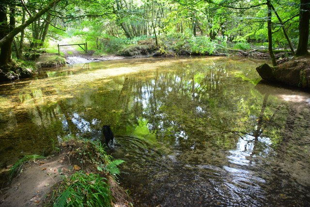
West Wood is characterized by its dense and ancient trees, creating a serene and peaceful atmosphere. The tree species found in the wood include oak, ash, beech, and birch, among others. The canopy formed by these towering trees provides shelter to a wide variety of wildlife, making it a haven for birdwatchers and animal lovers.

The woodland floor is covered in a thick carpet of ferns, mosses, and wildflowers, adding to the enchanting ambiance. It is not uncommon to spot deer, squirrels, badgers, and various species of birds while exploring the wood.

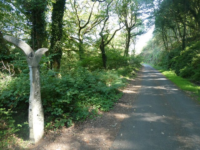
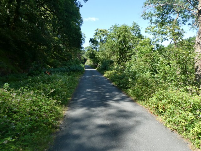
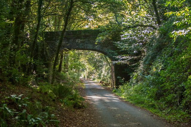
A network of well-maintained footpaths meanders through West Wood, offering visitors the chance to explore its wonders. These paths are suitable for both leisurely strolls and more challenging hikes, catering to different levels of fitness and interests.

West Wood is also a popular destination for families and picnickers, with several designated areas for outdoor gatherings. The tranquil surroundings and ample space provide an ideal setting for relaxation and recreation.

Overall, West Wood in Devon is a captivating woodland that showcases the natural beauty and biodiversity of the region. Its ancient trees, diverse wildlife, and charming paths make it a must-visit destination for nature lovers and those seeking a peaceful retreat in the heart of Devon.

If you have any feedback on the listing, please let us know in the comments section below.
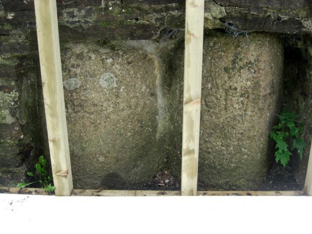
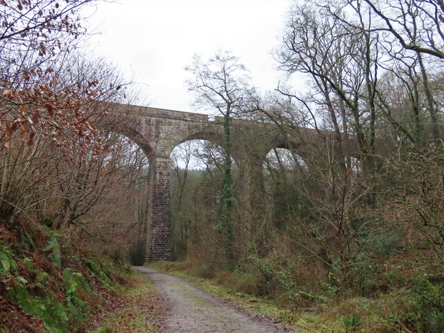
West Wood Images

Images are sourced within 2km of 50.429735/-4.0977757 or Grid Reference SX5160. Thanks to Geograph Open Source API. All images are credited.

Old Boundary Markers on Tavistock Road, Plymouth Two Parish Boundary Markers on the west side of the A386 Tavistock Road, Plymouth, set in a recess in the front garden wall of No.451. Until 1951 these marked the boundary of Tamerton Foliot and Bickleigh parishes but thereafter were entirely in Plymouth. Google Earth shows that the timber frame has now been removed.

On the left is DV_PLPB01pb inscribed Tamerton / (Foliott).

On the right is DV_PLPB03pb inscribed Bickleigh
Old Boundary Markers on Tavistock Road, Plymouth
Two Parish Boundary Markers on the west side of the A386 Tavistock Road, Plymouth, set in a recess in the front garden wall of No.451. Until 1951 these marked the boundary of Tamerton Foliot and Bickleigh parishes but thereafter were entirely in Plymouth. Google Earth shows that the timber frame has now been removed. On the left is DV_PLPB01pb inscribed Tamerton / (Foliott). On the right is DV_PLPB03pb inscribed Bickleigh
Old Boundary Marker on Tavistock Road, Plymouth Parish Boundary Marker on the west side of the A386 Tavistock Road in the front garden wall of No.451 but visible from the road. Inscribed T and B on opposite faces. Until 1951 this marked the boundary of Tamerton Foliot and Bickleigh parishes but thereafter was entirely in Plymouth.

Milestone Society National ID: DV_PLPB02pb
Old Boundary Marker on Tavistock Road, Plymouth
Parish Boundary Marker on the west side of the A386 Tavistock Road in the front garden wall of No.451 but visible from the road. Inscribed T and B on opposite faces. Until 1951 this marked the boundary of Tamerton Foliot and Bickleigh parishes but thereafter was entirely in Plymouth. Milestone Society National ID: DV_PLPB02pb
West Devon Way viaduct
Wooded Plym valley
Wooded Plym valley
Sustrans millennium milepost by NCN27, Colwill Wood National Cycle Network Route 27 is a 99 miles long route between Ilfracombe and Plymouth, of which 71 miles are traffic-free. The route combines the beaches and estuaries of North Devon with the lush green valleys of the Torridge, the Tavy, the Walkham and other evocative West Country rivers. The route also skirts round the western flank of Dartmoor offering superb views of Cornwall and the surrounding area. There is also many local links and spurs to explore. Largely tracing the course of former railway lines, the route takes you through tunnels and across the breathtaking viaducts and bridges bequeathed by Victorian railway engineers.
Sustrans millennium milepost by NCN27, Colwill Wood
National Cycle Network Route 27 is a 99 miles long route between Ilfracombe and Plymouth, of which 71 miles are traffic-free. The route combines the beaches and estuaries of North Devon with the lush green valleys of the Torridge, the Tavy, the Walkham and other evocative West Country rivers. The route also skirts round the western flank of Dartmoor offering superb views of Cornwall and the surrounding area. There is also many local links and spurs to explore. Largely tracing the course of former railway lines, the route takes you through tunnels and across the breathtaking viaducts and bridges bequeathed by Victorian railway engineers.
Plym Valley Trail (NCN27) in Colwill Wood National Cycle Network Route 27 is a 99 miles long route between Ilfracombe and Plymouth, of which 71 miles are traffic-free. The route combines the beaches and estuaries of North Devon with the lush green valleys of the Torridge, the Tavy, the Walkham and other evocative West Country rivers. The route also skirts round the western flank of Dartmoor offering superb views of Cornwall and the surrounding area. There is also many local links and spurs to explore. Largely tracing the course of former railway lines, the route takes you through tunnels and across the breathtaking viaducts and bridges bequeathed by Victorian railway engineers.
Plym Valley Trail (NCN27) in Colwill Wood
National Cycle Network Route 27 is a 99 miles long route between Ilfracombe and Plymouth, of which 71 miles are traffic-free. The route combines the beaches and estuaries of North Devon with the lush green valleys of the Torridge, the Tavy, the Walkham and other evocative West Country rivers. The route also skirts round the western flank of Dartmoor offering superb views of Cornwall and the surrounding area. There is also many local links and spurs to explore. Largely tracing the course of former railway lines, the route takes you through tunnels and across the breathtaking viaducts and bridges bequeathed by Victorian railway engineers.
Ordnance Survey Cut Mark This OS cut mark can be found on the west face of St Mary's Church. It marks a point 102.020m above mean sea level.
Ordnance Survey Cut Mark
This OS cut mark can be found on the west face of St Mary's Church. It marks a point 102.020m above mean sea level.
Woodland south of Bickleigh Bridge
Bickleigh Bridge over the River Plym
River Plym at Bickleigh Bridge
Bus stop in New Road near Bickleigh Camp The security camera on the left is part of the surveillance of the military camp
Bus stop in New Road near Bickleigh Camp
The security camera on the left is part of the surveillance of the military camp
Bus stop and phone box, New Road, Bickleigh
Ford on the West Devon Way This ford is found on the River Plym beside the West Devon Way close to Bickleigh Bridge.
Ford on the West Devon Way
This ford is found on the River Plym beside the West Devon Way close to Bickleigh Bridge.
Bickleigh Ford This ford on the River Plym is found below Riverford Viaduct on the West Devon Way.
<span class="nowrap"><a title="https://youtu.be/tP4qnXBRzpM" rel="nofollow ugc noopener" href="https://youtu.be/tP4qnXBRzpM">Link</a><img style="margin-left:2px;" alt="External link" title="External link - shift click to open in new window" src="https://s1.geograph.org.uk/img/external.png" width="10" height="10"/></span>
Bickleigh Ford
This ford on the River Plym is found below Riverford Viaduct on the West Devon Way. LinkExternal link
Drake's Trail On the path of the disused Tavistock and Launceston Branch railway.
Drake's Trail
On the path of the disused Tavistock and Launceston Branch railway.
Drake's Trail
Drake's Trail
A386 near Roborough The A386 is a 60 mile long road across Devon. It runs from Plymouth to Appledore.
<span class="nowrap"><a title="http://www.sabre-roads.org.uk/wiki/index.php?title=A386" rel="nofollow ugc noopener" href="http://www.sabre-roads.org.uk/wiki/index.php?title=A386">Link</a><img style="margin-left:2px;" alt="External link" title="External link - shift click to open in new window" src="https://s1.geograph.org.uk/img/external.png" width="10" height="10"/></span>
A386 near Roborough
The A386 is a 60 mile long road across Devon. It runs from Plymouth to Appledore. LinkExternal link
A386 entering Plymouth The A386 is a 60 mile long road across Devon. It runs from Plymouth to Appledore.
<span class="nowrap"><a title="http://www.sabre-roads.org.uk/wiki/index.php?title=A386" rel="nofollow ugc noopener" href="http://www.sabre-roads.org.uk/wiki/index.php?title=A386">Link</a><img style="margin-left:2px;" alt="External link" title="External link - shift click to open in new window" src="https://s1.geograph.org.uk/img/external.png" width="10" height="10"/></span>
A386 entering Plymouth
The A386 is a 60 mile long road across Devon. It runs from Plymouth to Appledore. LinkExternal link
Show me another place!

West Wood is located at Grid Ref: SX5160 (Lat: 50.429735, Lng: -4.0977757)

Administrative County: Devon

District: South Hams

Police Authority: Devon and Cornwall

What 3 Words

///flat.engage.rounds. Near Plympton, Devon

Related Wikis

Woolwell

Woolwell is a suburb on the north-east fringe of the city of Plymouth, England, located just outside the city's boundaries in the district of the South...

Plymouth City Airport

Plymouth City Airport (IATA: PLH, ICAO: EGHD) was an airport located within the City of Plymouth 3.5 NM (6.5 km; 4.0 mi) north northeast of the city centre...

RAF Roborough

Royal Air Force Roborough or more simply RAF Roborough is a former Royal Air Force station in Roborough located 3.8 miles (6.1 km) north of Plymouth, Devon...

Plymouth Marjon University

Plymouth Marjon University, commonly referred to as Marjon, is the trading name of the University of St Mark and St John, a university based primarily...

Nearby Amenities

Located within 500m of 50.429735,-4.0977757
Woolwell
Is In: South Hams
Place: suburb
Lat/Long: 50.4337681/-4.099104
Bus Stop
Bickleigh Down School
Bench: yes
Bin: no
Bus: yes
Departures Board: no
Mapillary: 169829868670908
Public Transport: platform
Shelter: yes
Survey Date: 2021-10-17
Lat/Long: 50.4338222/-4.1005738
Bus Stop
Bickleigh Down School
Bench: yes
Bin: no
Bus: yes
Mapillary: 585851319321865
Naptan AtcoCode: 1100PLX00055
Naptan NaptanCode: dvnajmtg
Public Transport: platform
Shelter: yes
Survey Date: 2021-10-17
Lat/Long: 50.4337038/-4.1006252
Post Box
Collection Times: Mo-Fr 09:00; Sa 07:00
Ref: PL6 145D
Royal Cypher: EIIR
Royal Cypher Wikidata: Q33102113
Lat/Long: 50.4315772/-4.0962984
West Wood
Natural: wood
Lat/Long: 50.4291446/-4.0968922
Darklake Wood
Natural: wood
Lat/Long: 50.4282368/-4.0925831
Holt Wood
Natural: wood
Lat/Long: 50.427946/-4.097666
Glenholt Park
Natural: wood
Lat/Long: 50.4263801/-4.1016109
Leisure: park
Lat/Long: 50.4321655/-4.0962224
Generator Method: photovoltaic
Generator Output Electricity: yes
Generator Source: solar
Generator Type: solar_photovoltaic_panel
Location: roof
Power: generator
Lat/Long: 50.4287952/-4.1020149
Generator Method: photovoltaic
Generator Output Electricity: yes
Generator Source: solar
Generator Type: solar_photovoltaic_panel
Location: roof
Power: generator
Lat/Long: 50.4282279/-4.1001132
Generator Method: photovoltaic
Generator Output Electricity: yes
Generator Source: solar
Generator Type: solar_photovoltaic_panel
Location: roof
Power: generator
Lat/Long: 50.425863/-4.1007087
Generator Method: photovoltaic
Generator Output Electricity: yes
Generator Source: solar
Generator Type: solar_photovoltaic_panel
Location: roof
Power: generator
Lat/Long: 50.4256614/-4.0998048
Generator Method: photovoltaic
Generator Output Electricity: yes
Generator Source: solar
Generator Type: solar_photovoltaic_panel
Location: roof
Power: generator
Lat/Long: 50.4337398/-4.0978146
Generator Method: photovoltaic
Generator Output Electricity: yes
Generator Source: solar
Generator Type: solar_photovoltaic_panel
Location: roof
Power: generator
Lat/Long: 50.4340012/-4.0964359
Generator Method: photovoltaic
Generator Output Electricity: yes
Generator Source: solar
Generator Type: solar_photovoltaic_panel
Location: roof
Power: generator
Lat/Long: 50.4312402/-4.095009
Generator Method: photovoltaic
Generator Output Electricity: yes
Generator Source: solar
Generator Type: solar_photovoltaic_panel
Location: roof
Power: generator
Lat/Long: 50.4310241/-4.0951458
Generator Method: photovoltaic
Generator Output Electricity: yes
Generator Source: solar
Generator Type: solar_photovoltaic_panel
Location: roof
Power: generator
Lat/Long: 50.4304585/-4.0945758
Generator Method: photovoltaic
Generator Output Electricity: yes
Generator Source: solar
Generator Type: solar_photovoltaic_panel
Location: roof
Power: generator
Lat/Long: 50.4306525/-4.0942311
Generator Method: photovoltaic
Generator Output Electricity: yes
Generator Source: solar
Generator Type: solar_photovoltaic_panel
Location: roof
Power: generator
Lat/Long: 50.4301741/-4.0961972
Generator Method: photovoltaic
Generator Output Electricity: yes
Generator Source: solar
Generator Type: solar_photovoltaic_panel
Location: roof
Power: generator
Lat/Long: 50.431382/-4.0977073
Generator Method: photovoltaic
Generator Output Electricity: yes
Generator Source: solar
Generator Type: solar_photovoltaic_panel
Location: roof
Power: generator
Lat/Long: 50.4316349/-4.0981177
Generator Method: photovoltaic
Generator Output Electricity: yes
Generator Source: solar
Generator Type: solar_photovoltaic_panel
Location: roof
Power: generator
Lat/Long: 50.4319869/-4.0982437
Generator Method: photovoltaic
Generator Output Electricity: yes
Generator Source: solar
Generator Type: solar_photovoltaic_panel
Location: roof
Power: generator
Lat/Long: 50.43157/-4.0988794
Generator Method: photovoltaic
Generator Output Electricity: yes
Generator Source: solar
Generator Type: solar_photovoltaic_panel
Location: roof
Power: generator
Lat/Long: 50.431599/-4.0990725
Generator Method: photovoltaic
Generator Output Electricity: yes
Generator Source: solar
Generator Type: solar_photovoltaic_panel
Location: roof
Power: generator
Lat/Long: 50.431763/-4.0997672
Generator Method: photovoltaic
Generator Output Electricity: yes
Generator Source: solar
Generator Type: solar_photovoltaic_panel
Location: roof
Power: generator
Lat/Long: 50.4316366/-4.0994802
Generator Method: photovoltaic
Generator Output Electricity: yes
Generator Source: solar
Generator Type: solar_photovoltaic_panel
Location: roof
Power: generator
Lat/Long: 50.4318519/-4.0989545
Generator Method: photovoltaic
Generator Output Electricity: yes
Generator Source: solar
Generator Type: solar_photovoltaic_panel
Location: roof
Power: generator
Lat/Long: 50.4323081/-4.0991315
Generator Method: photovoltaic
Generator Output Electricity: yes
Generator Source: solar
Generator Type: solar_photovoltaic_panel
Location: roof
Power: generator
Lat/Long: 50.432344/-4.0990832
Generator Method: photovoltaic
Generator Output Electricity: yes
Generator Source: solar
Generator Type: solar_photovoltaic_panel
Location: roof
Power: generator
Lat/Long: 50.4330103/-4.1005182
Generator Method: photovoltaic
Generator Output Electricity: yes
Generator Source: solar
Generator Type: solar_photovoltaic_panel
Location: roof
Power: generator
Lat/Long: 50.4320996/-4.1004002
Generator Method: photovoltaic
Generator Output Electricity: yes
Generator Source: solar
Generator Type: solar_photovoltaic_panel
Location: roof
Power: generator
Lat/Long: 50.432021/-4.1014838
Generator Method: photovoltaic
Generator Output Electricity: yes
Generator Source: solar
Generator Type: solar_photovoltaic_panel
Location: roof
Power: generator
Lat/Long: 50.4316998/-4.1018969
Generator Method: photovoltaic
Generator Output Electricity: yes
Generator Source: solar
Generator Type: solar_photovoltaic_panel
Location: roof
Power: generator
Lat/Long: 50.4316195/-4.1034767
Generator Method: photovoltaic
Generator Output Electricity: yes
Generator Source: solar
Generator Type: solar_photovoltaic_panel
Location: roof
Power: generator
Lat/Long: 50.4316144/-4.1035652
Waste Basket
Survey Date: 2022-01-25
Waste: dog_excrement
Lat/Long: 50.4318578/-4.096411
Post Box
Brand: Royal Mail
Brand Wikidata: Q638098
Collection Times: Mo-Fr 17:00; Sa 12:45; Su off
Drive Through: no
Mapillary: 169829868670908
Operator: Royal Mail
Operator Wikidata: Q638098
Post Box Mounting: pier
Post Box Type: lamp
Ref: PL6 8
Royal Cypher: EIIR
Royal Cypher Wikidata: Q33102113
Survey Date: 2022-01-25
Lat/Long: 50.4338203/-4.1005166
Grit Bin
Survey Date: 2022-01-25
Lat/Long: 50.4335142/-4.0984202
Street Lamp
Survey Date: 2022-01-25
Lat/Long: 50.4335702/-4.099256
Fire Hydrant
Emergency: fire_hydrant
Fire Hydrant Type: underground
Survey Date: 2022-01-25
Lat/Long: 50.4319108/-4.0969583
Noexit: yes
Lat/Long: 50.4317071/-4.1035337
Noexit: yes
Lat/Long: 50.4317092/-4.1040963
The data included in this document is from www.openstreetmap.org. The data is made available under ODbL.

Have you been to West Wood?

Leave your review of West Wood below (or comments, questions and feedback).